Grettisbæli - the Lair of the Viking Grettir the Strong in Öxarnúpur in North-East Iceland
On our trip to Melrakkaslétta plain in North-East Iceland, we drove down to Axarfjörður fjord - also called Öxarfjörður, where one can find a lair of the outlaw, Grettir the Strong Ásmundarson (born around 996).
Grettir was one of the best-known Vikings in Iceland and his story is told in the Grettis Saga, which was written in the 14th century.
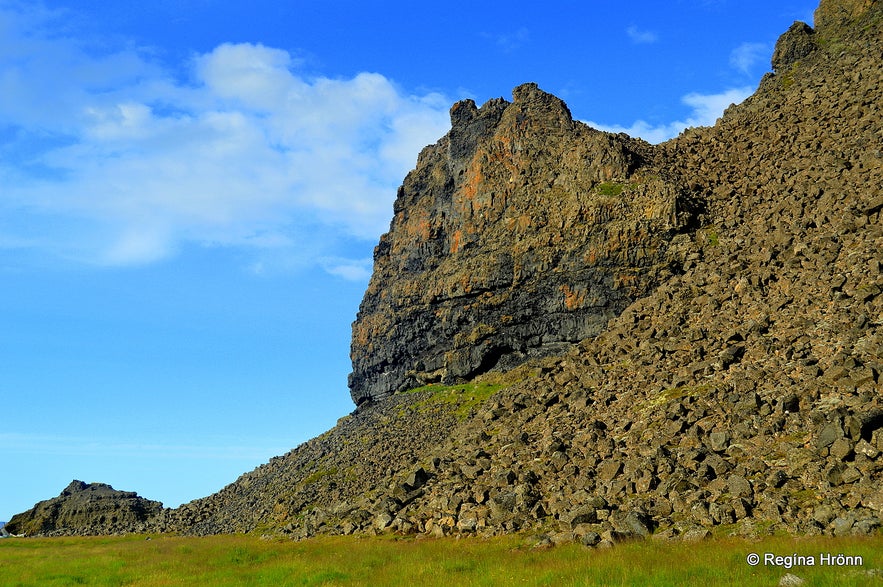
See these huge basalt columns on top of the lair!
Grettir is known for being the longest surviving outlaw in the Viking history of my country - he was an outlaw for almost 20 years!
In Iceland, outlaws could gain their freedom after having been outlaws for 20 years, and when Grettir was killed on Drangey island, he only had a couple of months left to have fulfilled his duty of staying an outlaw for 20 years!
Grettir was 44 years old when he was slain on the island.
See also: Drangey Bird Cliff in North Iceland and the Viking Grettir the Strong
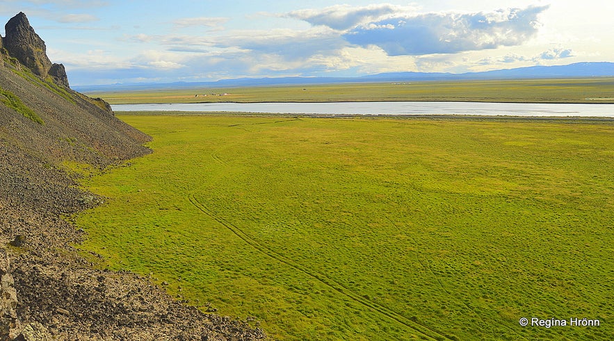
The view from Grettisbæli lair
Grettir the Strong became an outlaw after having been accused of starting a fire where 12 men died, including 2 Icelandic brothers.
Grettir visited the hut where these men were staying in Norway to ask them to give him some fire.
They mistook him for a troll and attacked him, some of them hit him with firebrands. In the panic, the fire spread. So he was innocent of this crime, but he wasn't believed and he became an outcast.
My husband on top of the Grettisbæli lair
After returning back to Iceland from Norway, Grettir was greeted with the news that his father had died, he himself had been sentenced to outlawry in the whole of Iceland, and that Þorbjörn öxnamegin had killed his brother Atli!!
Grettir killed Þorbjörn öxnamegin and his son to revenge for the slaying of his brother Atli, and for almost 20 years Grettir hid in lairs, which are called Grettisbæli in Iceland, or the Lairs of Grettir; sometimes good people took him in.
See also: Grettir the Strong and the Troll in the Waterfall - a Viking Saga from North-Iceland
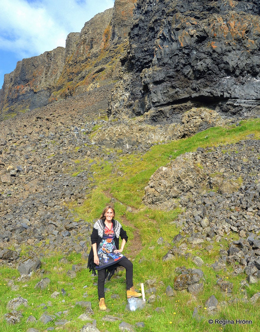
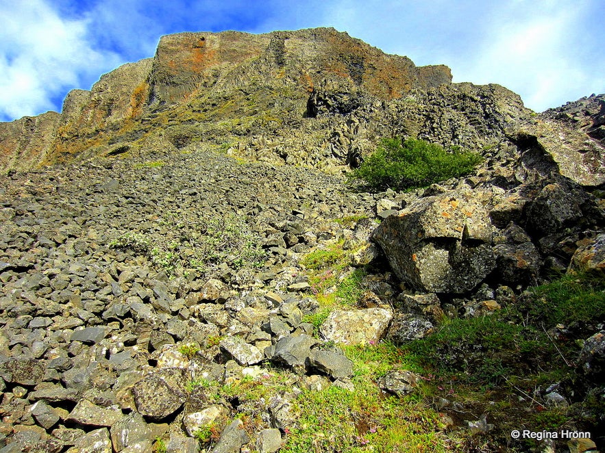 Grettisbæli as seen from below
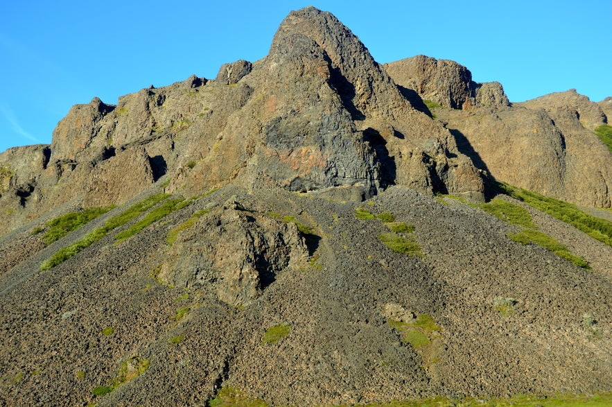
One of these lairs is located in the mountain Öxarnúpur, a 146 m mountain, made of basalt columns. It is a massive rock with a lot of scree, making it difficult to mount.
There is a path leading from the parking lot through the land of the farmer and up to the Grettisbæli lair. It takes some 25 minutes to get to the lair and it is a bit steep hike up the mountain.
The lair cannot be seen from below and it isn't until one actually stands on the protruding cliff that it is obvious that this was the lair of Grettir the Strong, his hiding place.
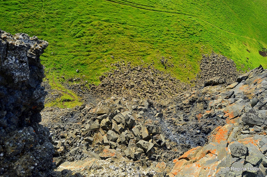
Grettisbæli lair is high up
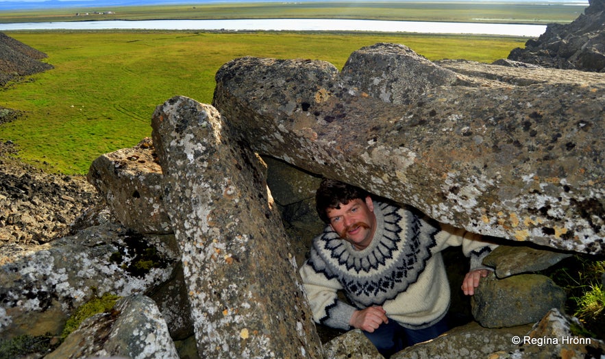
When we got up on top of the protruding rock there was a small lawn, about the size of a small room. By the end of it, the lair is located. It isn't big, only some 3 meters long with a width and height of 1 meter.
One can crawl into it and peek out from the basalt columns, which create a roof over this stronghold of Grettir the Strong. It must have been well insulated back when it was in use - with moss, hide, and turf.
One can only imagine how strong Grettir really was, seeing that the basalt columns are extremely heavy. Some of the basalt columns are now missing.
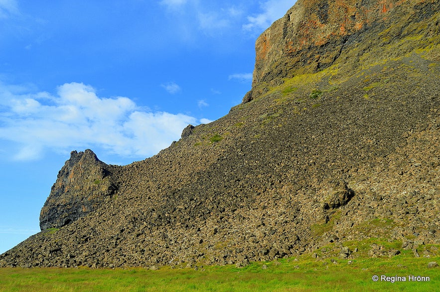
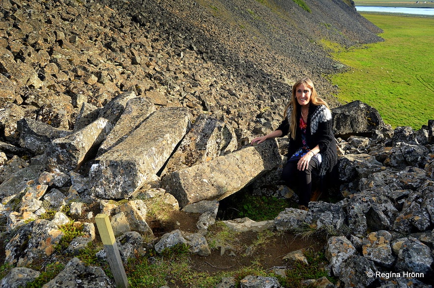
On the way to Grettisbæli lair
Here Grettir was able to hide out and protect himself from his enemies. Looking down from the lair, as can be seen in my photo above, one can see how steep and difficult the climb up to the lair was.
From his hiding place, Grettir would have had plenty of rocks to throw at his enemies.
The view from the lair is excellent, but the lair cannot be seen from below, so that would have put Grettir at an advantage point as well. Now a path has been made to the lair from the other side.
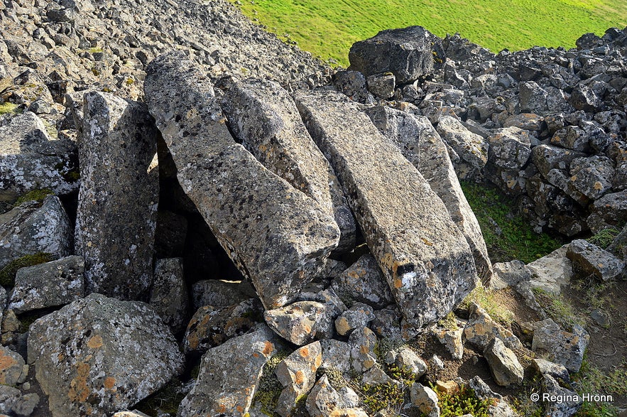 The huge basalt columns in Grettir's lair
We don't know for how long Grettir stayed in Grettisbæli, but it must have been very lonely, cold, and tiresome. And Glaumur's eyes must have haunted him in the darkness.
Mt. Öxarnúpur is not mentioned in Grettissaga, but it is said that passers-by shun passing Grettisbæli out of fear of Grettir and choose the route behind the mountain.
We walked twice up to Grettisbæli, as on our first visit we turned to the right from the parking lot and hiked up a mountain that was really difficult to climb, thinking that up there must be the lair of Grettir.
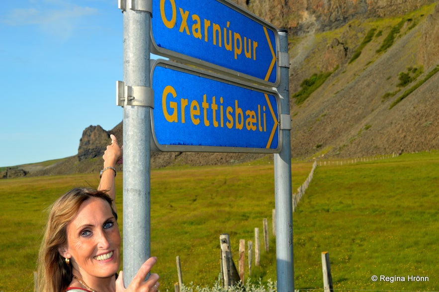
Pointing towards Grettisbæli lair
After having looked for it for quite a while and crawled up and down the scree and further and further up, we decided on this being way too dangerous and headed down again.
This part of the mountain is right in front of the parking lot. There is a protruding rock there as well.
If you are looking for the Grettisbæli walk to the left of this part of the mountain, not straight towards it as we did, and take the path that leads you through the grassy land of the farmer until you find another protruding rock from the mountain. There Grettisbæli is located.
This is not the lair
I don't know how happy the farmer is though that we are walking on his land. It must be difficult having a historic spot on the land you own.
I think it is awesome being able to visit such an old lair of one of our most notorious Vikings!
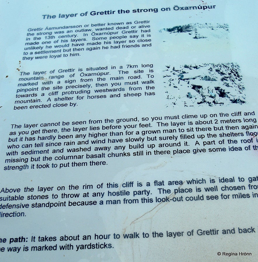 The information sign - this happened in the 11th century though not the 13th (maybe there is a new sign now)
I have written another travel-blog about Viking Ruins and Burial Mounds I have visited on my Travels in Iceland - which is a list of all the archaeological sites and burial mounds, I have visited in Iceland.
Now a full day of exploring Melrakkaslétta plain had come to an end and we headed back to Raufarhöfn village on the other side of the Melrakkaslétta peninsula, where we were staying: Raufarhöfn village and the mystical Arctic Henge.
 The path is marked
If you continue driving you will reach Ásbyrgi and Jökulsárgljúfur: Ásbyrgi and Botnstjörn in Jökulsárgljúfur in North Iceland - the Capital City of the Elves - my favourite spot in Iceland :)
I have written another travel-blog about another Grettisbæli in Mt. Fagraskógarfjall in Hítardalur valley.
Here is the location of Öxarfjörður fjord on Google maps.
Have a lovely time in northeast Iceland :)
Source: Grettir's Saga
기타 흥미로운 블로그
요쿨살론부터 비크까지, 꽃보다 청춘 5화
드디어 하늘씨과 쓰리스톤즈가 합류했는데요! 설원을 달리는 모습에 저도 아이슬란드가 엄청 그리워졌답니다. 빙하와 빛나는 요쿨살론 첫번째로 향한 요쿨살론(Jokulsarlon)은 아이슬란드의 대표적인 명소 중 하나랍니다. 영어로 Glacier lagoon 이라고도 하는데요. 방송에 나온 것처럼 눈 앞에 보이는 빙하는 빙하수가 흘러서 녹았다 얼었다를더 보기스코가포스 폭포부터 오로라까지, 꽃보다청춘 4화를 따라서
여행 5일째, 포스톤즈가 처음으로 향한 곳은 아이슬란드 남부에 있는 스코가포스 폭포(skogasfoss)입니다. 아이슬란드 남부의 대표적인 폭포 중 하나에요. 방송에서는 들르지 않았지만 스코가포스 거의 바로 옆에 위치한 셀리야란드스포스(seljalandsfoss) 폭포와 함께 같이 들르곤 한답니다. 스코가포스 폭포는 폭포의 물줄기 끝까지 올라갈 수 있단더 보기꽃청춘을 따라서
요즘 인기리에 방영되고 있는 꽃보다 청춘 아이슬란드편! 저도 매주 빼놓지 않고 시청하고 있습니다. 많은 분들께서 포스톤즈의 발랄한 매력과 아이슬란드의 놀라운 경치에 빠져드셨을 것 같습니다! 이번에는 꽃보다 청춘을 따라서 아이슬란드를 한번 가보도록 해요! 사실 아이슬란드가 한국에서 그렇게 가기 쉬운 나라는 아닙니다. 거리도 멀고 항공권도 비싸고! 우더 보기

아이슬란드 최대의 여행 마켓플레이스를 전화에 다운로드하여 전체 여행을 한 곳에서 관리하세요
전화 카메라로 이 QR 코드를 스캔하고 표시되는 링크를 누르면 아이슬란드 최대의 여행 마켓플레이스를 주머니에 넣을 수 있답니다. 다운로드 링크가 포함된 SMS 또는 이메일을 받으려면 전화번호 또는 이메일 주소를 추가하세요.

