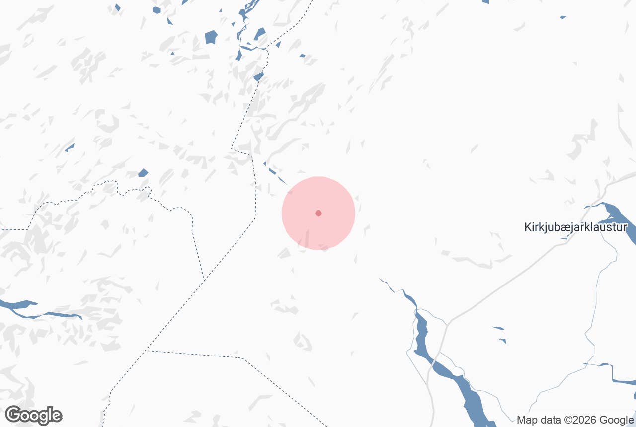
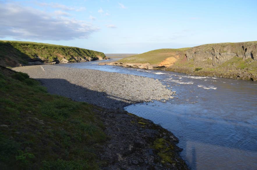
Lower Hólmsá from a road bridge. Photo: Eysteinn Guðni Guðnason, CC BY 4.0
The Hólmsá river is a highland river in South Iceland that rises in Hólmsárbotnar south-east of Torfajökull, flows through the lake Hólmsárlón and down through Skaftártunga to join the great glacial river Kúðafljót. It is a spring-fed river (lindá) that also takes glacial streams from the north-east side of Mýrdalsjökull.
The name means "islet river" (hólmi, an islet in a river), and the river has many islets.
For most of its length it flows through the raw volcanic country of the Fjallabak region, cutting small gorges in lava and tuff and dropping over several waterfalls: the Hólmsárfossar below the lake Hólmsárlón, Axlafoss (also written Axlarfoss) beside the F210 track, and Hólmsárfoss further down at the F232.
It is a favourite with highland photographers, usually as the foreground to the green cone of Mælifell or the red crater Rauðibotn, and it is a river you will drive beside, and may have to ford, if you take the Fjallabaksleið syðri (F210) between Hvolsvöllur and Skaftártunga.
Key Takeaways About Hólmsá
- Spring- and glacier-fed river from Hólmsárbotnar and Hólmsárlón, between Torfajökull and Mýrdalsjökull, to Kúðafljót in Skaftártunga; catchment about 360 km2 down to Atley
- Three waterfall groups: Hólmsárfossar below the lake, Axlafoss (8-12 m, sources differ) by the F210, Hólmsárfoss at the F232
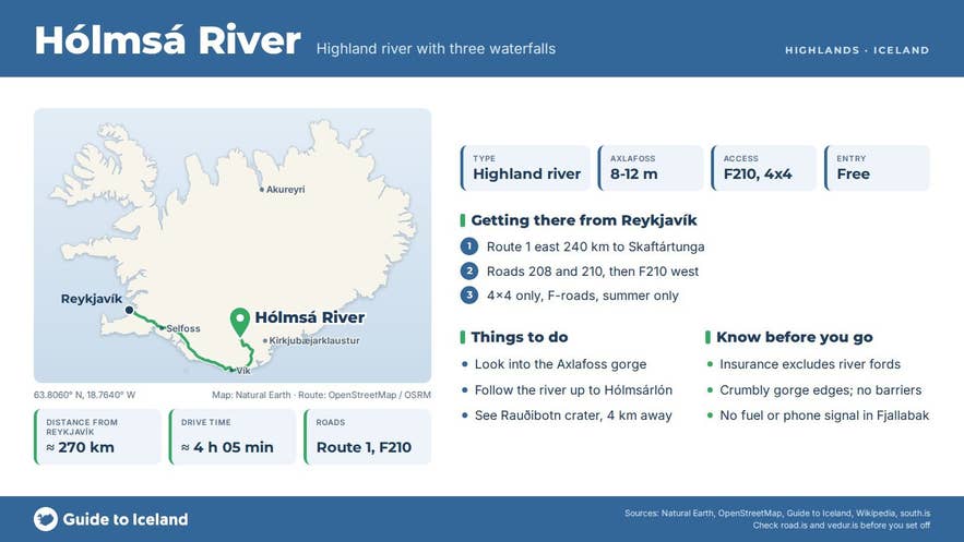
- Lower river beside Route 1 in Skaftártunga (about 240 km / 3.5 h from Reykjavík); the falls need a 4x4 on F-roads, open roughly late June to September
- Upper catchment (196 km2) protected against hydropower in 2021; the islets hold one of Iceland's two barnacle goose colonies
- Not to be confused with the small Hólmsá near Reykjavík or the Hólmsá by Fláajökull
Why visit the Hólmsá river
The Hólmsá drains a catchment of about 360 square kilometres down to Atley, between Torfajökull and the north-east side of Mýrdalsjökull, with a mean flow of about 66 cubic metres a second.
It is mainly a spring-fed river: large springs such as Brytalækir feed it from the west, while glacial streams from Mýrdalsjökull (Jökulkvísl and the Bláfjallakvíslar) join lower down, so its colour changes with the weather: milky grey after warm days on the ice cap, clearer and bluer in cold spells.
It rises in Hólmsárbotnar south-east of Torfajökull, flows through Hólmsárlón, a lake sometimes called "little Langisjór", and leaves the lake over a series of falls, the Hólmsárfossar, which spill across lava shelves and black sand with Rauðibotn, a red-and-green explosion crater on the Eldgjá fissure system, close by.
Downstream, where a side track off the F210 meets the river, the Hólmsá drops roughly 8 to 12 metres (sources differ) into a tight dark gorge at Axlafoss, also written Axlarfoss.
The fall is invisible until you reach the rim, which is what makes it memorable: a car park sits a few metres from the edge, and the whole river folds into a slot in the rock.
Further down, below the F232 crossing on the boundary between the Skaftártunga and Álftaver common pastures, is Hólmsárfoss, a broad white cascade over a lava step.
Opposite it stands the Álftaver shepherds' hut, a two-storey building with a stable below and sleeping room for 20 to 30 people above, used in the autumn sheep round-ups.
The river is a tributary of Kúðafljót, one of the largest glacial rivers in Iceland, which it joins in Skaftártunga near the Ring Road before the combined river crosses Mýrdalssandur to the sea.
The river's many islets are a nesting place for barnacle geese, which have bred here since 1999; about 80 pairs, one of only two known colonies in Iceland.
Several hydropower schemes were proposed for the Hólmsá, but in 2013 Alþingi placed the upper river in the protection category of the Master Plan, and in 2021 the upper 196 square kilometres of the catchment, including Hólmsárlón, Brytalækir and Axlafoss, were formally protected against energy development.
How to get to the Hólmsá river
The lower Hólmsá is easy to reach. From Reykjavík take the Ring Road (Route 1) east for about 240 km to Skaftártunga, about 3 and a half hours' driving.
The Hólmsá meets Kúðafljót here, just south of the Road 208 (Skaftártunguvegur) junction, and Route 1 crosses the combined river on the long Kúðafljót bridge. Kirkjubæjarklaustur, the nearest service town, is about 30 km further east on Route 1, and Vík is about 50 km west.
The highland sections need a proper 4x4 and only open in summer, typically late June to September.
For Axlafoss and the Hólmsárlón area, take Road 208 (Skaftártunguvegur) north from Route 1 for about 5 km, then Road 210 (Ljótarstaðavegur) past Snæbýli, where it becomes the F210 (Fjallabaksleið syðri), and continue west for about 23 km to the signed Axlafoss turn-off; the side track to the car park is just over 1 km.
The whole stretch from Route 1 is about 31 km. The F210 involves unbridged river crossings whose depth changes daily; the Hólmsá itself is forded on some routes. Hólmsárfoss at the F232 is reached from Road 209 (Hrífunesvegur), off Route 1 in Skaftártunga, via the F232 (Öldufellsleið), also 4x4 only.
Nothing on the F-roads is passable in a normal rental car, and insurance does not cover river crossings.
Best time to visit
July and August are the only months when every part of the river is reliably reachable.
Early in the season (late June) the tracks may still be closed and rivers high with snowmelt; by September the colours are at their best but the first snow can close the F210 without warning.
The lower river in Skaftártunga can be seen year-round when Route 1 is open. Check road.is for F-road openings and umferdin.is for conditions before setting out.
Safety and practical tips
- Never cross a river you have not walked into or watched another vehicle cross first; glacial rivers rise during warm afternoons and after rain.
- There are no barriers at Axlafoss or the Hólmsárfossar. The gorge edges are crumbly tuff and wet moss.
- There are no facilities on the F210 or F232. The nearest fuel and food are at Kirkjubæjarklaustur and Vík; Hólaskjól highland centre on the F208 has huts, a campsite, toilets and showers (open June to September).
- Mobile coverage is poor to absent in Fjallabak. Leave a travel plan at safetravel.is.
- The water is glacial: do not swim. Strútslaug hot spring, about 12 km north-west of Axlafoss, is the natural bath in this area.
- Drive only on marked tracks; the moss and sand here take decades to recover.
Nearby attractions
- Axlafoss waterfall - the 8-12 m gorge fall in the Hólmsá by the F210
- Rauðibotn crater - red explosion crater beside the river, 4 km from Axlafoss
- Hólmsárfossar waterfalls - the chain of falls where the river leaves Hólmsárlón, 5 km
- Hólmsárlón lake - the source lake, 8 km
- Mælifell - the moss-green cone on Mælifellssandur, 9 km
- Strútslaug hot spring - natural hot spring, 12 km
- Hólaskjól highland centre - huts and campsite on the F208, 14 km
Tours that visit the Hólmsá river
- Extreme 13 Day Photography Workshop in the Highlands of Iceland - the itinerary includes Axlafoss in the Hólmsá, framed by basalt columns, on its Fjallabak days after Mælifell.
