
Beschreibung
Zusammenfassung
Beschreibung
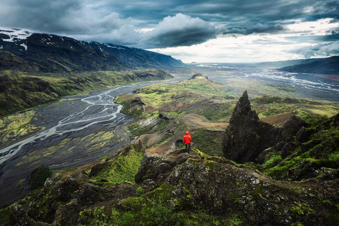
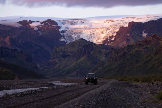
Begib dich auf eine aufregende Superjeep-Tour ins legendäre Thorsmörk, auch „Tal des Thor“ genannt. Es ist so atemberaubend, dass viele Isländer es als das Kronjuwel des Hochlands betrachten. Dieses ganzjährig buchbare Abenteuer ist familienfreundlich und perfekt für alle, die Islands wilde Schönheit hautnah erleben möchten.
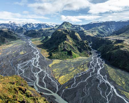
Thorsmörk ist eine beeindruckende Oase im Süden Islands. Das Tal ist eingerahmt von dramatischen Bergrücken, leuchtenden Birkenwäldern, uralten Lavafeldern und drei berühmten Gletschern: Eyjafjallajökull, Myrdalsjökull und Tindfjallajökull.
Schon die Anreise ist ein Abenteuer für sich. Dein erfahrener Guide steuert den Superjeep über raue Hochlandpisten und durchquert kraftvolle, ungebändigte Gletscherflüsse. Dieses Erlebnis ist nur mit einem voll ausgestatteten 4x4-Superjeep möglich.
Unterwegs hältst du am Gígjökull, wo der gewaltige Ausbruch des Eyjafjallajökull im Jahr 2010 die Landschaft für immer verändert hat. Am Fuß dieses Gletschers zu stehen, ist eine seltene Gelegenheit, die rohe Kraft der isländischen Natur hautnah zu spüren.
Deine lokalen Guides sind leidenschaftlich bei der Sache: Unterwegs teilen sie spannende Geschichten, geologische Hintergründe und versteckte Highlights. Sie sorgen dafür, dass dein Tag von Anfang bis Ende voller unvergesslicher Momente ist.
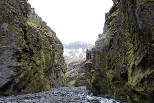
In Thorsmörk angekommen, spürst du sofort die Magie dieses Ortes. Die Landschaft wirkt wie aus Tolkiens Welt: verwinkelte Schluchten, moosbedeckte Hänge, Gletscherblicke und Täler, die wie aus der Zeit gefallen scheinen.
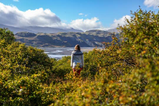
Während der Tour erwarten dich zahlreiche Fotostopps und kurze Wanderungen. Die längste Wanderung dauert etwa 60 Minuten, aber jede Tour wird individuell auf die Wünsche der Gäste abgestimmt. Du möchtest es lieber gemütlich angehen? Dann spaziere auf dem wunderschönen Weg von Langidalur nach Husadalur, wo du deinen Guide in den gemütlichen Volcano Huts triffst.
Dort kannst du entspannen, die Aussicht genießen und dich auf ein leckeres Essen freuen, das im Preis inbegriffen ist, bevor es auf einer landschaftlich eindrucksvollen Route zurückgeht.
Mach dein Island-Abenteuer unvergesslich und erlebe die Kraft, Schönheit und das Geheimnis von Thorsmörk im Superjeep! Prüfe jetzt die Verfügbarkeit, indem du ein Datum auswählst.


