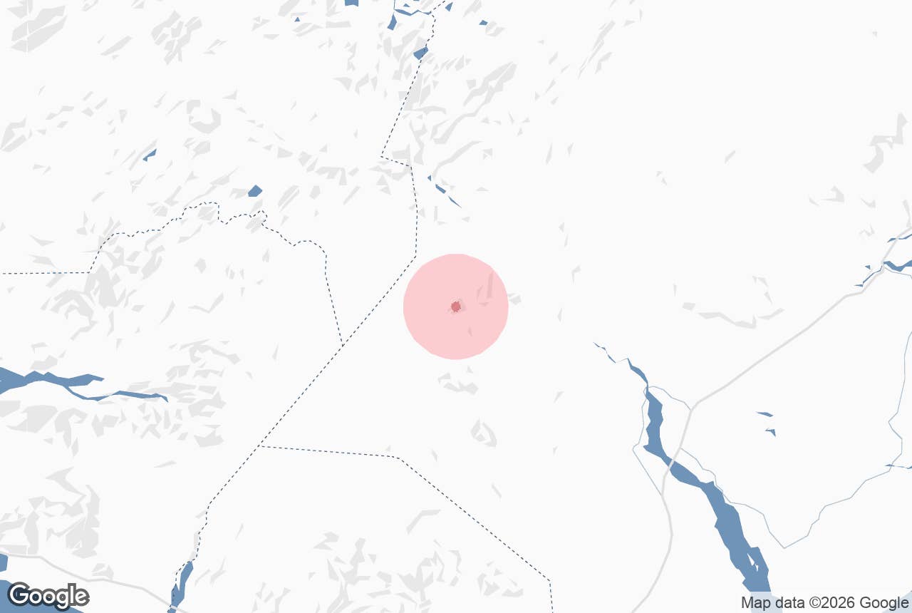
Öldufell mountain is an 810-metre (2,657 ft) peak on the north-eastern edge of Mýrdalsjökull in the southern highlands of Iceland, on the margin of the black-sand desert of Mælifellssandur.
The name means "wave mountain" (*alda* is a wave or a long ridge, *fell* a mountain), and the outlet glacier that pushes down from Mýrdalsjökull beside it is called Öldufellsjökull after it. The mountain gives its name to the F232 highland road, Öldufellsleið, which climbs past it from the Skaftártunga farmland to the Fjallabak south route.
Öldufell is in the municipality of Skaftárhreppur and inside the Katla UNESCO Global Geopark.
Key Takeaways About Öldufell
- 810 m moss-covered mountain on the north-eastern edge of Mýrdalsjökull, beside Mælifellssandur, in Skaftárhreppur and Katla Geopark
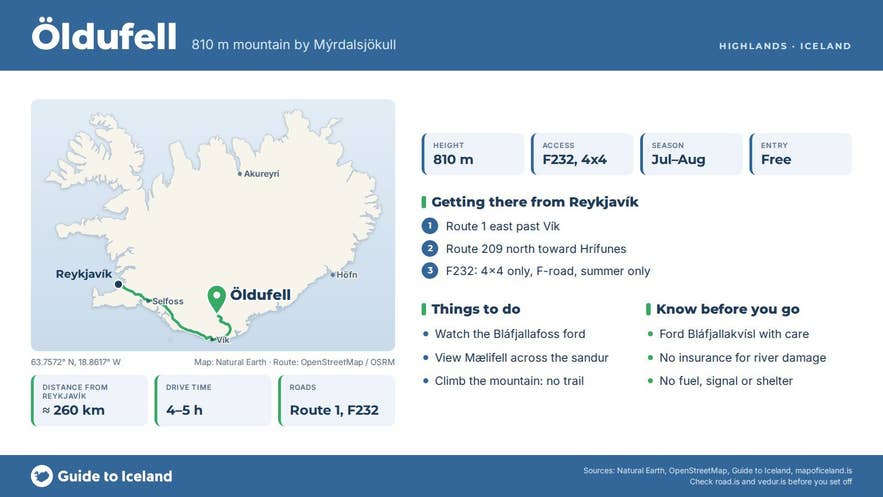
- Reached only via F232 Öldufellsleið (4x4, medium difficulty), which fords the Bláfjallakvísl river beside Bláfjallafoss right beneath the mountain
- F232 opens late June–late July and closes in early September; check road.is
- Vík is about 38 km away in a straight line, roughly 75 km by road; 4–5 hours from Reykjavík
- No facilities, fee or marked trail; Mælifell is 6 km to the north-west
Why visit Öldufell
Öldufell is a broad, moss-covered mountain with a flat-topped crown and a skirt of long green ridges running down to the river flats, and it stands almost alone where the farmland of Skaftártunga gives way to the sand, ash and glacier ice of the interior.
Its prominence is about 250 metres, and its nearest higher neighbour is Strútur mountain, about 10 kilometres to the north-north-west.
The glacier beside it has retreated a long way. Photographers who know the mountain point out a dark band on its flank that they read as a former, higher margin of Öldufellsjökull.
Today the glacier snout ends well back and the melt runs out across the sand in the river Bláfjallakvísl, which the F232 crosses right beneath the mountain at Bláfjallafoss.
The ford runs directly beside the waterfall, so vehicles drive through moving water with the fall breaking next to them, a crossing that has made this road well known among highland drivers.
From the slopes and from the road there are wide views west over Mælifellssandur to the cone of Mælifell, the green pyramid that stands on the sandur about 6 kilometres to the north-west of Öldufell, and north to the rhyolite ridges of the Torfajökull area.
Mælifellssandur itself lies at roughly 600 metres above sea level and is bare sand and gravel for most of the year, flooded by meltwater in early summer.
There is no marked trail to the summit. Experienced walkers do climb the mountain from the F232 side on firm moss and gravel; allow several hours and expect no path, no signs and no shelter.
How to get to Öldufell
Öldufell mountain is reached only by the F232 Öldufellsleið mountain road. From the Ring Road east of Vík, turn north onto Route 209 towards Hrífunes, then onto F232 near Hrífunes, which climbs north to join F210 (Fjallabaksleið syðri) near the river Hólmsá.
The mountain and the Bláfjallakvísl ford are in the upper part of the road. Vík í Mýrdal, the nearest town with fuel and services, is about 38 kilometres away in a straight line and roughly 75 kilometres by road via the Ring Road, Route 209 and the F232; allow around two hours for that drive.
From Reykjavík allow 4 to 5 hours of driving each way with the highland section included, which is why most visitors come on a super jeep day tour from Vík or as part of a multi-day highlands photography trip.
F232 is rated medium difficulty by Icelandic F-road guides. It has one real river crossing, Bláfjallakvísl at the waterfall, plus smaller fords and puddles; the Bláfjallakvísl ford varies with glacier melt and rain and the right-hand side has usually been the shallower line. A proper 4x4 with high clearance is the minimum.
Check your rental contract to see whether the vehicle may be driven on F232 and on F210. There is no parking area or signage at the mountain; drivers pull off the track on firm ground.
The alternative approach is along F210 from Hvanngil and Mælifellssandur in the west, which involves many fords, including the deep Kaldaklofskvísl and Hólmsá crossings, and is for modified super jeeps only.
Best time to visit
The F232 normally opens between late June and late July, depending on snow, and closes in early September, a short season even by highland standards. July and August give the most reliable conditions and the greenest moss. In early summer the sandur rivers run high with meltwater, and in September the first snow can close the road overnight.
Safety and practical tips
- There are no services of any kind: no fuel, no toilets, no shelter and no mobile signal for much of the route. Fill up in Vík or Kirkjubæjarklaustur and carry food, water and warm clothing.
- Always check road.is for F232 and F210 status and safetravel.is for weather before leaving the Ring Road. Highland weather changes fast, and fog on the sandur makes navigation hard.
- Wade a ford on foot before driving it if you are unsure, and never cross Bláfjallakvísl when it is discoloured or running fast after rain. Rental insurance does not cover water damage.
- Keep to the track. Driving off-road on moss and sand is illegal in Iceland and the damage lasts for decades.
- There is no fee. Camp only at designated sites, such as the Hólaskjól highland centre or the Strútur hut.
Nearby attractions
- Bláfjallafoss – 1 km, the waterfall the F232 fords directly beneath Öldufell.
- Mælifell – 6 km, the moss-green cone on Mælifellssandur.
- Brytalækir – 6.5 km, spring-fed streams on the edge of the sandur.
- Axlafoss – 8 km, waterfall on the Hólmsá river.
- Rauðibotn Crater – 8 km, red crater at the head of Hólmsá.
- Hólmsárfossar – 9 km, the Hólmsá waterfalls below Hólmsárlón.
- Strútslaug – 14 km, natural hot spring reached on foot from Strútur hut.
Tours that visit Öldufell
- Maelifell Volcano & Southern Highlands Super Jeep Tour from Vik – a day tour whose route descends Öldufell mountain on its way to Mælifell.
- Extreme 13 Day Photography Workshop in the Highlands of Iceland – the itinerary includes Öldufell and Mælifell on its Mýrdalsjökull highland days.
- Photography Workshop in the Highlands & South Coast of Iceland for 10 Days – the itinerary visits Öldufell, described on the tour as a conical, imposing mountain.
