")
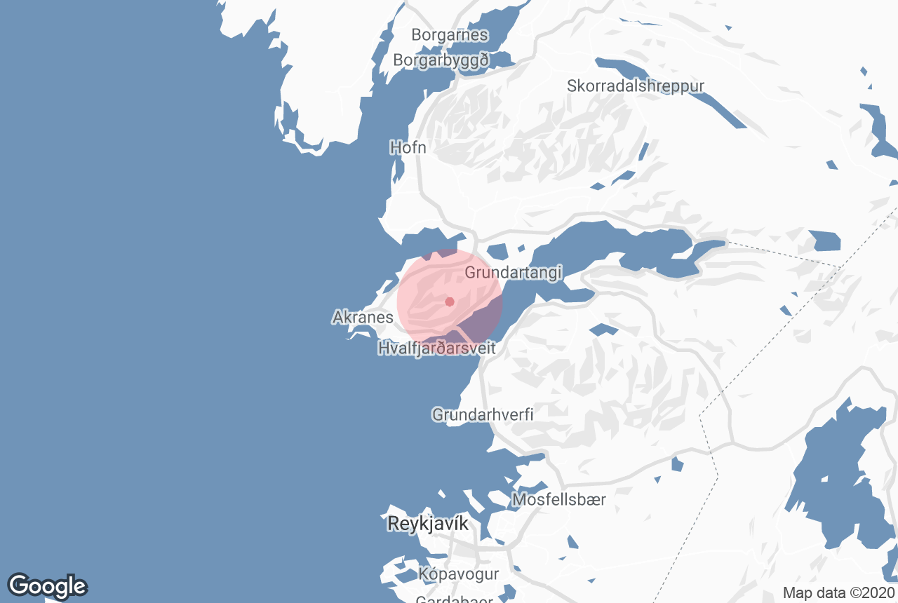
Akrafjall is a mountain located on the Akranes Peninsula on the west coast of Iceland.
Mount Akrafjall is a lone and eye-catching mountain that rises between the coastlines of Hvalfjörður Fjord and Leirárvogur Bay. The mountain covers most of its hosting peninsula’s landmass, as it rises close to the coastlines on each side. Its highest summit is Geirmundartindur with a peak of 643 metres.
저희의 콘텐츠를 신뢰할 수 있는 이유
가이드투아이슬란드는 아이슬란드에서 가장 믿을 수 있는 여행 플랫폼으로, 매년 수백만 명의 여행객이 저희와 함께 아이슬란드를 방문합니다. 저희의 모든 콘텐츠는 아이슬란드를 누구보다 잘 아는 현지 전문가들이 작성하고 검토하므로, 정확하고 신뢰할 수 있는 최신 여행 정보만 제공합니다.
Geology and History
The distinctive shape of Akrafjall is due to periods of formation during the last Ice Age, where what is now the top of the mountain used to host a glacier. As the glacier melted, it left a noticeable dent in the middle of the mountain, while its slopes remained steep.
The south side of the mountain, as seen from the perspective of Fjord Hvalfjörður, consists of a single, steep slope. The north side, however, as seen from the town of Akranes, displays two peaks or shoulders on each side, that are divided by a valley in the middle called Berjadalur.
Geologists have discovered a history of strandflat in the mountain's sedimentary rock layers, suggesting that it was an island surrounded by water before the glacial retreat. The lava that formed Akrafjall dates back to 4,5-3 million years, with its main rock type being basalt.
Hiking Mt. Akrafjall
The mountain is relatively easy to ascend, and the top provides for one of the best views in western Iceland. Starting out from the Akranes Water Works car park, signs indicate the different paths up the mountain.
There are two separate places to park and start the trek, so visitors should make sure to choose the correct side of the Berjadalsá River before starting their ascent, which takes between 2 and 5 hours.
The shoulder to the right of the mountain, as seen from Akranes, is called Háihnúkur and has a peak of 555 metres. This south summit is the more popular destination for hikers and hosts a guestbook for visitors to sign.
A slightly longer hike leads to the opposite summit of Geirmundartindur, the mountain’s highest peak at 643 metres. There is also an existing loop route that combines the two main summits along with other minor high points. The route is roughly 10 kilometres and has a change in elevation of 600 metres.
Sights
From the top, one can see the vastness of the greater Faxaflói Bay, with a panoramic view that stretches from the Reykjanes Peninsula to the Snæfellsnes Peninsula, and its resident glacial volcano Snæfellsjökull.
The capital of Reykjavík can also be spotted, as well as an abundance of fjords, valleys and neighbouring mountains.
Along the base of the western side of Geirmundartindur, one can find the remains of a military aircraft that crashed there back in 1955.
The Icelandic seabirds fulmars and great black-backed gulls also nest in the cliffs of Akrafjall.