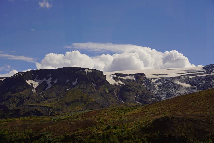
Outlet glacier above the Þórsmörk road. Photo: Ray Swi-hymn, CC BY-SA 2.0
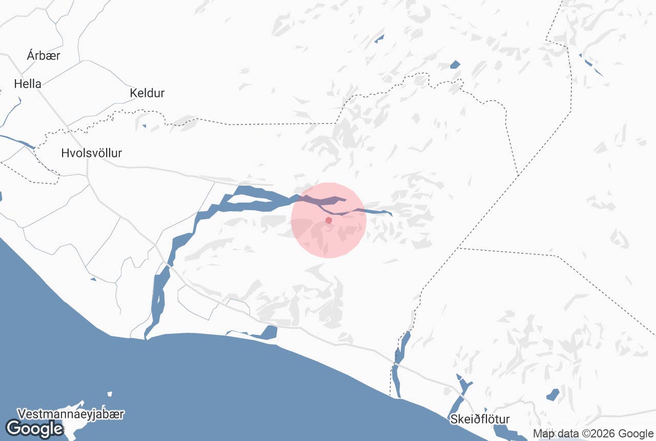
Steinsholt (from steinn, "stone", and holt, a rocky hillock) is a valley and old summer pasture on the north side of Eyjafjallajökull in South Iceland, on the F249 road into Þórsmörk.
The valley, Steinsholtsdalur, runs south from the Markarfljót plain up to Steinsholtsjökull, an outlet glacier of Eyjafjallajökull that ends in a small lagoon.
It lies just east of the better-known Gígjökull and is known for one of the best-documented rockslide floods in Iceland's recorded history, in January 1967, whose debris still covers the valley floor.
Key Takeaways About Steinsholtsdalur
- Valley and old summer pasture on the north side of Eyjafjallajökull, just east of Gígjökull on F249
- On 15 January 1967 part of the Innstihaus cliff fell onto Steinsholtsjökull, sending a flood down Steinsholtsá and Markarfljót to the Ring Road bridge (peak flow estimated at 2,100–2,700 m³/s)
- F249 has unbridged glacial rivers, including Steinsholtsá: high-clearance 4x4 with river experience, super jeep tour or highland bus only
- Short walk up the boulder-strewn valley towards the glacier lagoon; no facilities
- Road usually open from about June to September; part of Katla UNESCO Global Geopark
Why visit Steinsholt
Most traffic on the Þórsmörk road drives straight past Steinsholt after stopping at Gígjökull, so Steinsholtsdalur is one of the quieter places to stretch your legs on the route.
The valley is a few kilometres long, hemmed in by steep hillsides and cut by deep gullies, which is why gathering sheep here in autumn was always hard work, sometimes needing ropes.
The landscape of Steinsholt is a direct record of 15 January 1967. On that day a large section of Innstihaus, a cliff some 300–400 m high on the mountain's north face above Steinsholtsjökull, broke away and fell onto the glacier. The impact crushed the ice and drove the glacier lagoon out of its basin in a single wave.
The flood ran down the Steinsholtsá river into Markarfljót, reaching the Markarfljót bridge on the Ring Road roughly 20–25 km downstream, where the peak flow was estimated at 2,100 to 2,700 cubic metres per second.
The rockslide itself is estimated at 15 to 20 million cubic metres of rock, and boulders of up to 80 cubic metres were carried about 5 km down the valley. The valley is uninhabited, and the flood carried huge blocks of rock and ice down the valley, and the boulder field it left is what you walk through today.
Geologists study the Steinsholt event as a type example of a rock avalanche triggering a glacier outburst flood, and recent research treats it as the kind of event that may become more common as Icelandic glaciers thin and the slopes above them lose support. The area is part of Katla UNESCO Global Geopark.
At the head of the valley, Steinsholtsjökull descends in a steep icefall from the Eyjafjallajökull ice cap to the lagoon. Like Iceland's other outlet glaciers, it has retreated in recent decades.
How to get to Steinsholt
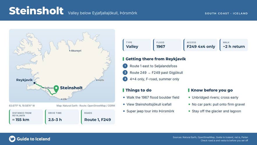
Steinsholt is reached from the Þórsmörk road, F249 (Þórsmerkurvegur). From Reykjavík, drive the Ring Road (Route 1) east for about 125 km to the Markarfljót bridge by Seljalandsfoss (about 2 hours), then turn onto Route 249, which becomes F249 a few kilometres east of the waterfall.
Follow the track east along the foot of Eyjafjallajökull past Gígjökull; the mouth of Steinsholtsdalur is the next valley east, about 20 km from Seljalandsfoss as the crow flies and roughly 25 km by track, where the Steinsholtsá river is forded. The nearest town is Hvolsvöllur, about 20 km west of the Markarfljót bridge on Route 1.
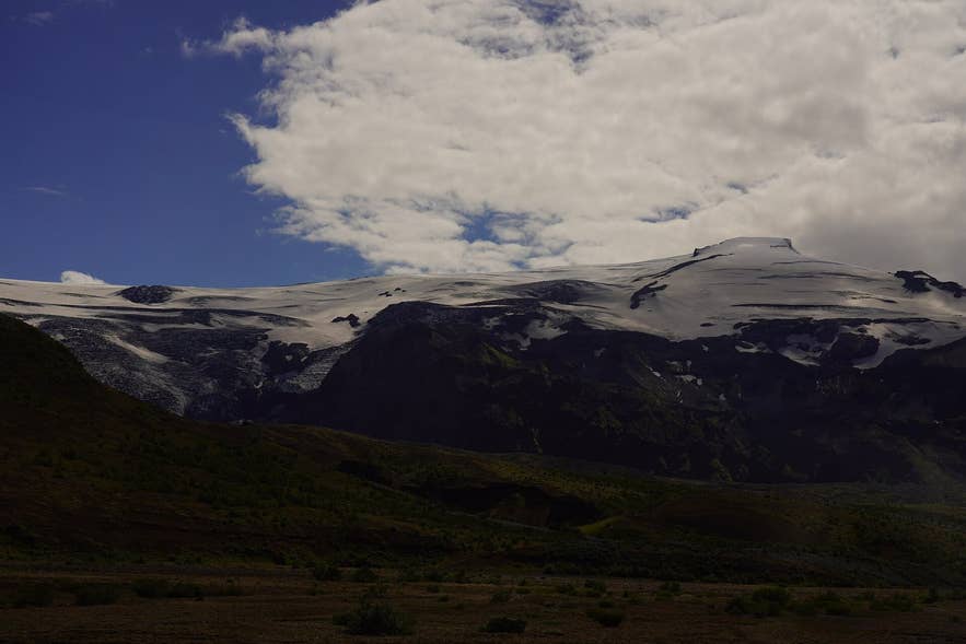
Steinsholtsjökull icefall on Eyjafjallajökull. Photo: Ray Swi-hymn, CC BY-SA 2.0
F249 is a highland track with several unbridged glacial rivers, including Steinsholtsá itself, and river crossings here regularly go wrong for unprepared drivers. Only drive it in a high-clearance 4x4 with experience of fording rivers, and check your rental agreement, which often excludes F249 and its river crossings.
The practical options are a super jeep tour or the scheduled highland buses to Þórsmörk. The road usually opens between late May and late June and closes in September or October, depending on snow and river levels; check road.is before setting out.
There is no formal car park; drivers pull off the track onto firm gravel at the mouth of Steinsholtsdalur and walk up the valley.
The walk towards the glacier lagoon follows the river through the boulder field left by the 1967 flood; the GTI super jeep tour describes its stop as a short hike, and a return walk of around two hours is a reasonable allowance at an easy pace.
Best time to visit
July and August are the most reliable months: the road is open, rivers are usually at their most predictable in the morning, and the valley is green.
June can have snow patches and high meltwater; September has autumn colours in the birch scrub of Þórsmörk and fewer people, but short days and the first storms. The road is closed in winter.
Safety and practical tips
- Glacial rivers rise through the day as the glacier melts, and sharply after rain. Cross early and never attempt a crossing you cannot see the bottom of.
- Do not walk on Steinsholtsjökull or close under its snout. Ice falls from the icefall without warning, and the lagoon edge is unstable.
- The boulder field is uneven and the rocks can be loose; wear boots with ankle support.
- There are no facilities at Steinsholt. The nearest toilets and shelter are at the Þórsmörk huts (Húsadalur, Langidalur and Básar) further along the track, and at Seljalandsfoss.
- Weather in Þórsmörk changes fast; bring waterproofs and warm layers in every month.
Nearby attractions
- Gígjökull – about 4.1 km, the neighbouring outlet glacier to the west
- Stakkholtsgjá – about 1.5 km, the canyon further along F249
- Valahnúkur – about 3.2 km
- Thorsmork (þórsmörk) – about 5.1 km
- Nauthúsagil – about 13.4 km
- Seljalandsfoss Waterfall – about 20.9 km
Tours that visit Steinsholt
- Scenic 2 Day Super Jeep Tour of Thorsmork with Hiking & BBQ – stops first at Gígjökull, then at Steinsholt for a short hike on the way into Þórsmörk, before continuing to the Volcano Huts in Húsadalur.
