


Description
Summary
Description
Jump aboard this incredible bus tour to marvel over the beautiful South Coast of Iceland, while receiving commentary in your native language. This unique, personal and modern bus tour is sure to inform, entertain, and stay with you for life.
When leaving Reykjavík nice and early, the first thing you will notice is the features on the bus. Each guest has a tablet with free-wifi, USB plug-ins, and, most importantly, a ‘Smart In-Bus Audio Guide’. This will allow you to listen to commentary about your surroundings in English, Spanish, Mandarin, German, Dutch, Finnish, French, Italian, Japanese and Korean.
Of course, your audio guide cannot answer questions, so you will also have a host on board who can help with any additional queries that you have. Therefore, by the end of the tour, you will know everything you want to about each of the many features that you will pass.
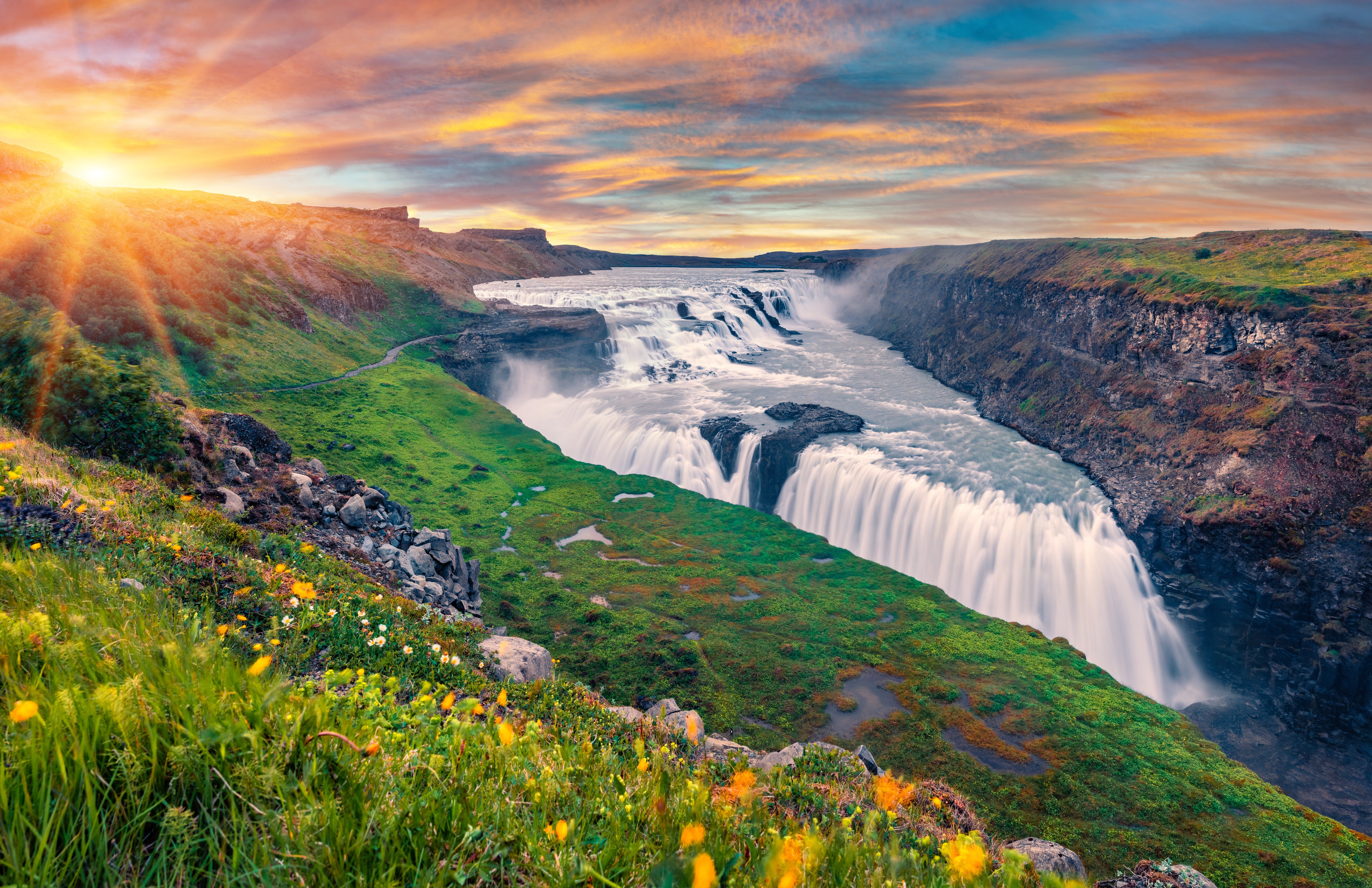
The South Coast tour takes you through a wealth of incredible landscapes. The first you will come across after leaving Reykjavík is the Hengill area, best known for its volcanic peaks, otherworldly lava fields, and hot springs. On clear days, you can see Hekla volcano, and sometimes even Eyjafjallajökull, the notorious glacial volcano that erupted in 2010.
As you travel from here, just a few kilometres off the coastline, you may also be able to see the Vestmannaeyjar Islands, also called the Westman Islands, rising dramatically from the surface of the ocean.
Sólheimajökull glacier is the first stop on the way; you will be able to walk right up to the edge of the glacier and marvel over its striations of black ash and vivid blue ice. Its diverse colouration and the contrast of the snow against the surrounding black lava make this a very popular site for photographers.
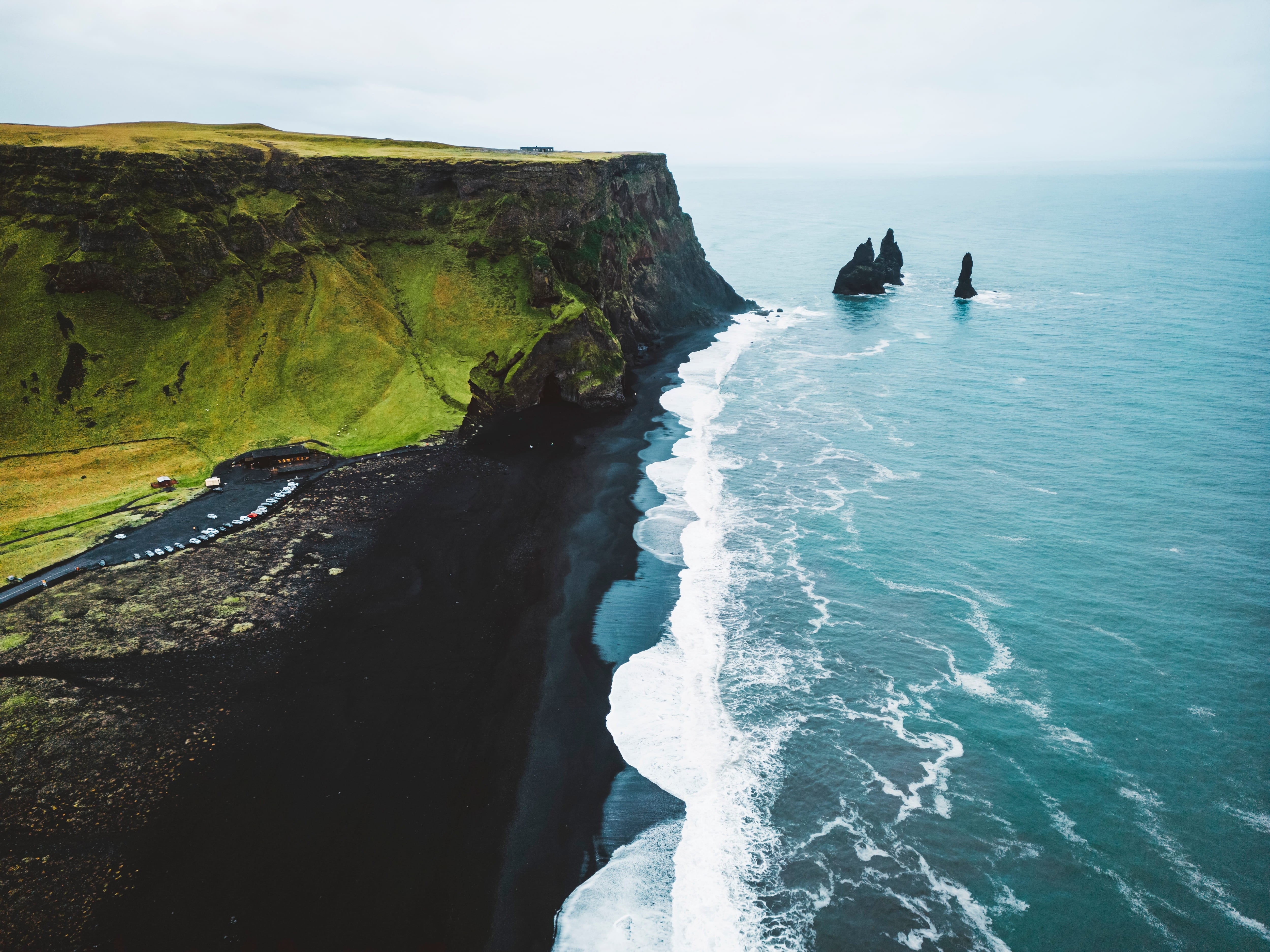
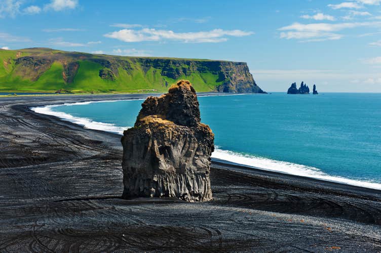
The next stops is at Reynisfjara black sand beach. This is considered one of Iceland’s most beautiful coastal stretches. It’s mighty rock arch, Dyrhólaey, has rare hexagonal black columns, and is home to many puffins during the summer.
Offshore, you will see two magnificent sea stacks rising tall from the ocean surface. These are called Reynisdrangar and are believed to be wading trolls that were petrified to stone in the light of the morning sun.
After being amazed by the power of the sea in Reynisfjara Beach we will head on to Vík. The village of Vík is the southernmost village in Iceland, located on the main ring road around the island. Despite its small size (291 inhabitants) it is the largest settlement for 70 km.
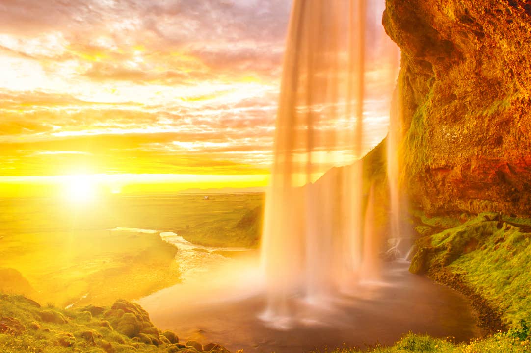
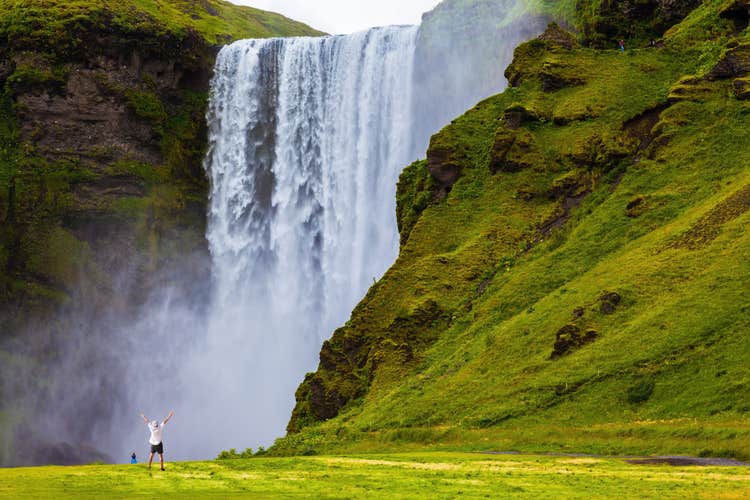
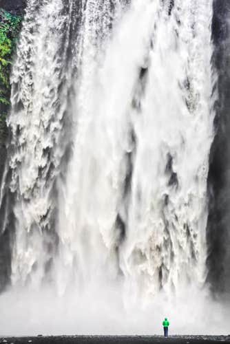
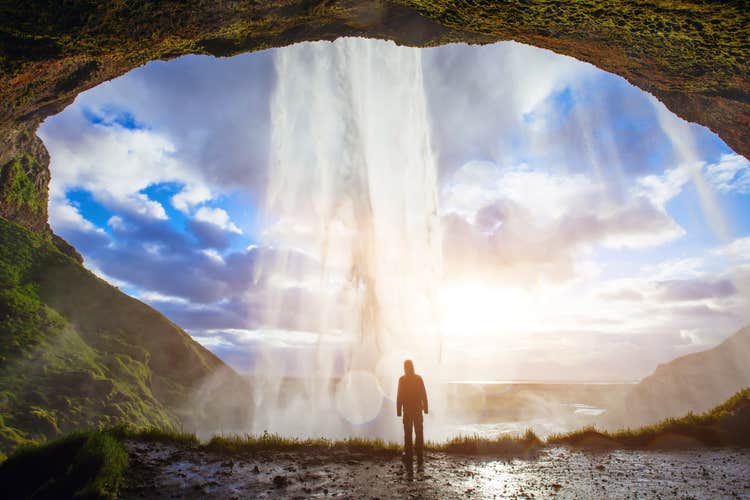
Your final stops will be at two waterfalls, each as unique and as they are beautiful. You’ll have a chance to stroll through the verdant fields at Seljalandsfoss waterfall, and even take a path behind the plunging water. At Skógarfoss, you can walk right up to where the water is crashing down, and take a flight of stairs to the very top. The views from up here are magnificent.
The South Coast is absolutely magnificent, and to hear all about it in your native tongue is not an opportunity many are lucky enough to get. Don’t miss your chance to experience it. Check availability by choosing a date