
Description
Summary
Description
Experience the trip of a lifetime with this 9-day self-drive tour of Iceland. Drive along the famous Ring Road and take a detour to explore the beautiful Snaefellsnes Peninsula along the way.
Travelers eager to witness the midnight sun and discover Iceland’s rare ice caves, mighty waterfalls, and awe-inspiring wildlife will enjoy an unforgettable journey
This 9-day Iceland tour gives you the freedom and flexibility to explore the country’s wonders without the stress of planning an itinerary. Upon booking this tour, you'll receive a detailed and customizable itinerary covering Iceland’s top attractions, best-hidden gems, and worthwhile detours
With a reliable rental car and eight nights of accommodations included, you’ll enjoy a seamless journey that eliminates the hassle of research, booking, and logistics.
By letting the experts handle the details, you’ll maximize your time in Iceland and avoid costly mistakes. All you have to do is show up and enjoy your Iceland road trip.
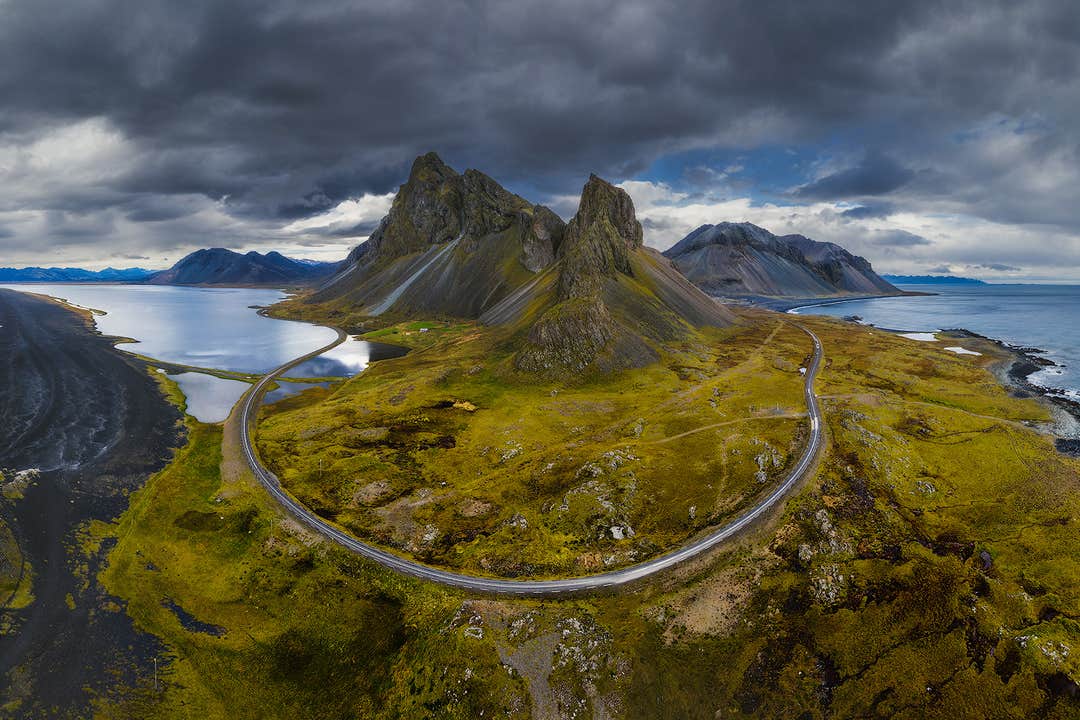
Over nine days in Iceland, you’ll visit famous destinations, including the Blue Lagoon, Golden Circle, South Coast, Eastfjords, Northern Region, and Snaefellsnes Peninsula.
The journey begins with a scenic loop around the Golden Circle, where you’ll encounter Thingvellir National Park, the erupting Strokkur Geyser, and the powerful Gullfoss Waterfall.
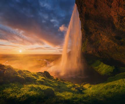
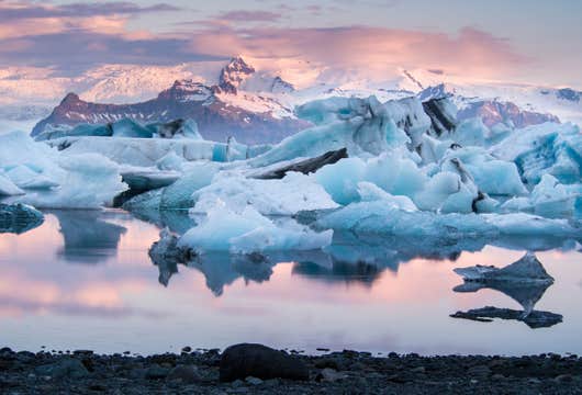
From there, the route continues along the South Coast. This stretch features dramatic sights like Skogafoss Waterfall, the black sands of Reynisfjara Beach, and the dreamlike Jokulsarlon Glacier Lagoon, where floating icebergs drift toward the nearby Diamond Beach.
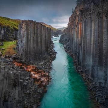
Eastern Iceland brings a quieter atmosphere, with winding coastal roads, peaceful fjord views, and small fishing villages that feel far removed from the typical tourist trail. This region is perfect for travelers looking to slow down and soak in the scenery.
In the north, volcanic terrain surrounds Lake Myvatn, with stops like Godafoss Waterfall, Asbyrgi Canyon, and Akureyri offering a mix of natural wonders and local culture. Picturesque Husavik is also worth a visit, especially during the whale-watching season.
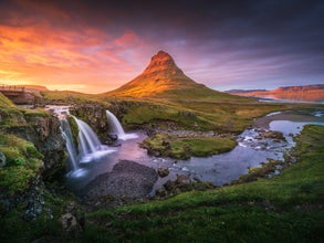
The final stretch leads through the Snaefellsnes Peninsula, a region known for its diverse landscapes and dramatic coastlines. Highlights include Kirkjufell Mountain, Ytri Tunga Beach, Stykkisholmur village, and the glacier-capped Snaefellsjokull Volcano.
With no tour guides, strict schedules, or large groups, you have complete control over your journey. Decide when to arrive, how long to stay, and where to go next.
What makes this top-rated tour truly special is that it allows you to add exciting adventures at a discounted price when booking. With nearly 24 hours of daylight, you can make the most of your summer self-drive tour in Iceland. Ride a snowmobile on the Langjokull Glacier, go glacier hiking on the South Coast, descend into an ice cave, or take a boat trip on the Jokulsarlon Glacier Lagoon.
You can also go whale watching in Husavik Town or horse riding in multiple locations along the Ring Road. The endless opportunities allow for a perfect balance between sightseeing and activities.
You can travel around Iceland with peace of mind, knowing that a personal travel agent is available 24/7 to assist you. In the case of unexpected changes to your travel plans, rest assured, you can cancel your booking up to 24 hours before departure and still receive a full refund.
Chase waterfalls, walk on glaciers, and watch the midnight sun paint the sky on this 9-day self-drive tour of Iceland. Check availability now by choosing a date.


