


Description
Summary
Description
Explore two unforgettable Icelandic regions in one day with this private tour in a 4x4 super SUV with a local guide. Travelers seeking to witness the Golden Circle and South Coast in a private setting should not hesitate to book this fantastic tour.
On the morning of this amazing experience, a private guide will pick you up from Reykjavik and escort you around Iceland's most famous sightseeing route, the Golden Circle.
The spacious vehicle you're traveling in can seat up to six, so you'll have plenty of opportunities to ask your guide about the surrounding nature and local folklore.
Thingvellir National Park is the first site of the Golden Circle, renowned for its dramatic geology, with two tectonic plates framing its beautiful forests and rivers. This UNESCO World Heritage Site is also famous for its fascinating history of clan gatherings, Viking clashes, and witch trials.
Next, you'll find the Geysir Geothermal Area, where the geyser Strokkur erupts every five to ten minutes. Around this feature are plenty of other hot springs and steam vents to admire.
Gullfoss waterfall, a two-tiered feature that originates at a glacier and pours into an ancient valley, is the final site of this region. Its nickname, the Golden Waterfall, led to the name of the Golden Circle tourist trail.
While most tours would end here, your private guide will take you and your SUV on Iceland's second most popular sightseeing route, the South Coast. The first attraction of this beautiful area is the Seljalandsfoss waterfall, a feature 197 feet (60 meters) tall with a vast cavern behind it. You can thus photograph the water from a path that runs around it in clear weather.
Skogafoss waterfall is the next attraction, just as tall as its neighbor but far more powerful.
As you continue to the next site of this region, you can marvel over the glistening ice caps of Myrdalsjokull and the more infamous Eyjafjallajokull. Finally, you'll come to the black sand shore of Reynisfjara, which is renowned for its incredible geology and powerful waves.
The Reynisfjara sea stacks are also a dramatic feature here, said in folklore to be trolls frozen by sunlight.
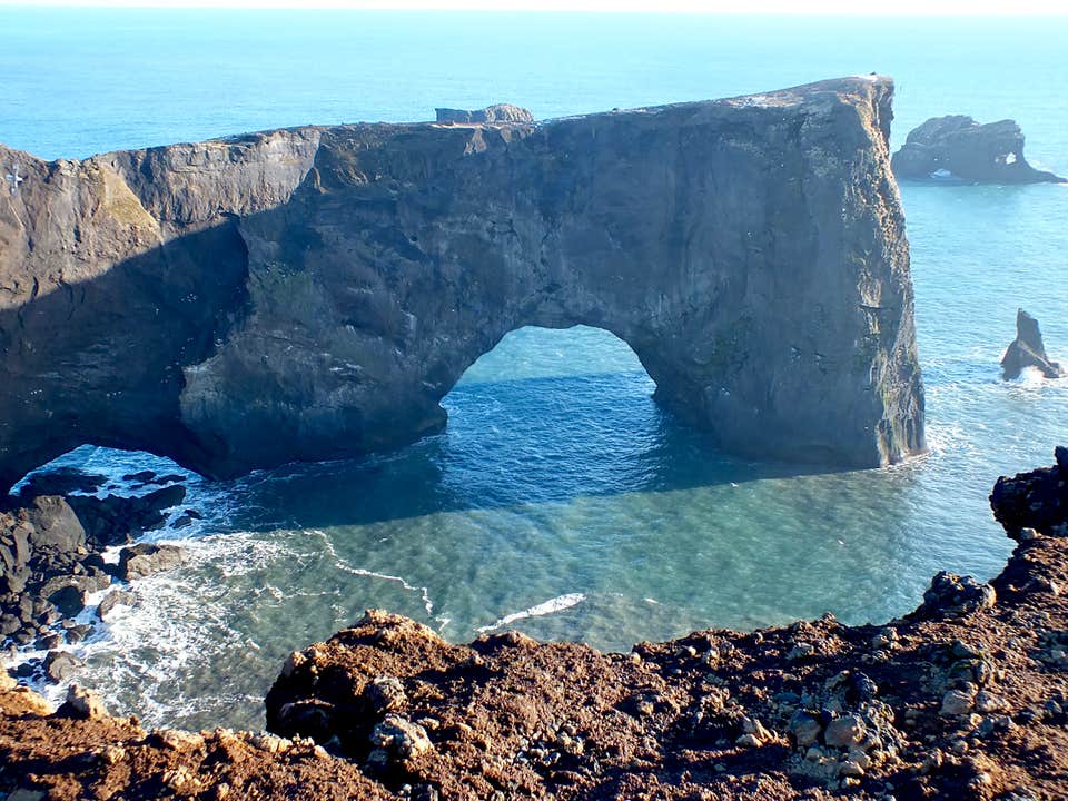
You will also make a visit to Dyrholaey, a magnificent rock arch that comes alive with nesting puffins in summer.
This is a private tour only. The price is the same for one to 6 passengers.
Winter travelers have a chance to see the aurora borealis on their return drive to Reykjavik.
Immerse yourself in the magical landscapes of Iceland by packing your day with adventure on this exciting SUV private tour of the Golden Circle and South Coast. Check availability now by choosing a date.


