
Description
Summary
Description
Experience the magic of Iceland! The Katla Ice Cave Tour takes you on an excursion through ice caves, blue glaciers, black sand beaches, world-famous sights, and so much more. Explore Iceland’s landscape by jeep and by foot on this unforgettable guided tour.
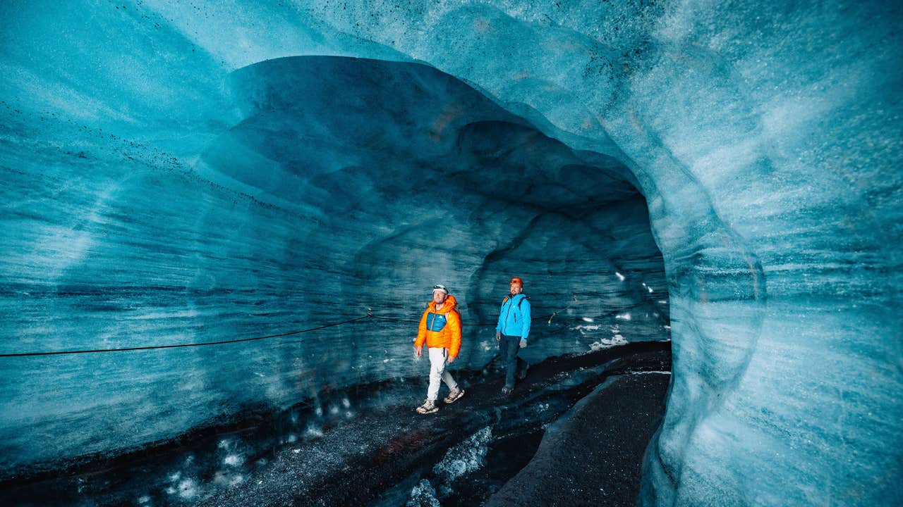
You’ll experience many natural wonders on our ice cave tour, including an ice cave in the 800-year-old Katla glacier with black, white, and blue ice, a visit to a private black sand beach where you can enjoy the scenery without crowds, and a super jeep ride through iconic film set locations. There’s never a dull moment, so expect to see many more exciting highlights along the way!
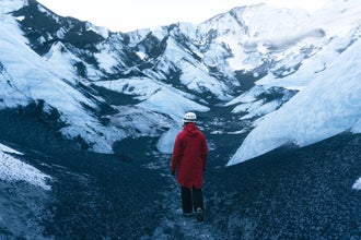
Your adventure begins in Vík. You will leave the black sand coastline behind and start to ascend the volcano Katla, towards the Mýrdalsjökull glacier. Katla is a beautiful volcano, and it's easy to immerse yourself in the spectacular views unfolding outside your window. Keep your camera close for some great snaps of the incredible terrain on the way up.
Once you reach Mýrdalsjökull, the glacier that caps Katla, you will hop out of the vehicle and put on the safety gear provided for you. This consists of a helmet, headlamps, and crampons to give you stable footing on the ice.
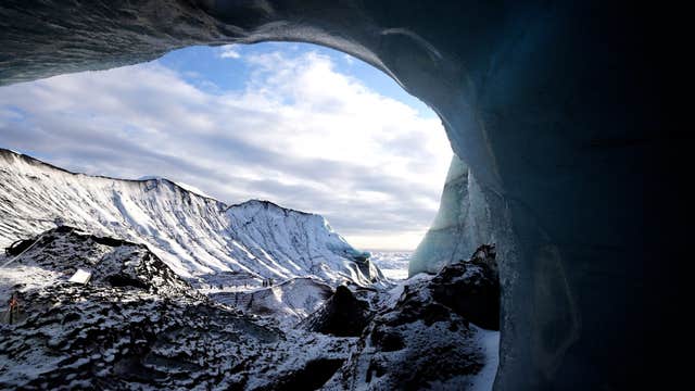
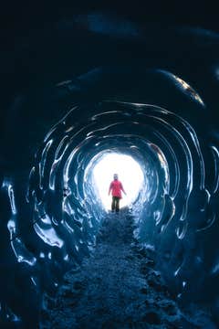
When your group is ready, you will head to the ice cave. Here, dazzling white snow, electric blue ice, and veins of ash swirl together, creating scenes of otherworldly beauty.
Your guide will show you around the cave, tell you about its formation, and teach you about both the glacier and the volcano it covers. Use the time to ask questions, take pictures, or simply marvel at your surroundings. Depending on your preference, we will spend 1–1.5 hours in the glacier area. Our goal is always to explore the glacier and two ice caves on this tour for the best experience possible.
Glaciers and ice caves change naturally over time, so the route may vary. If necessary, we will use wooden bridges to cross a small stream so that we can hike on the widest and safest side. All of the bridges, ropes, and ice screws we use are inspected daily to ensure we are always operating under the most secure conditions.
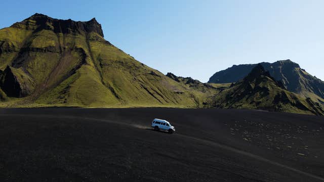
Once your group is ready to leave, you will return to the super jeep for a fun drive to a private black sand beach that few travelers get the pleasure of visiting. We prefer to stay away from the crowds and head off-the-beaten-path, so you're sure to have a unique experience here. Make sure to take some photos because these are memories that you'll treasure for a lifetime.
Don’t miss the chance to explore the stunning Katla Ice Cave under the mighty Myrdalsjokull Glacier on this unique adventure from Vik. Check availability now by choosing a date.


