


Beschreibung
Zusammenfassung
Beschreibung
Entscheide dich für diesen aufregenden Gletscherspaziergang mit einer Einführung in das Eisklettern auf der atemberaubenden Sólheimajökull-Eiskappe, einem Auslassgletscher des Mýrdalsjökull. Wenn du etwas mehr als nur eine Gletscherwanderung erleben möchtest, dann ist dies die perfekte Aktivität für dich.
Du wirst den Guide auf dem Parkplatz am Gletscher treffen, wo du auf den Ausflug vorbereitet wirst. Sicherheitsausrüstung wie Steigeisen, Gurte, Eispickel und Helm werden vom Anbieter gestellt, ebenso erhältst du vor Beginn des Abenteuers natürlich eine informative Sicherheitseinweisung.
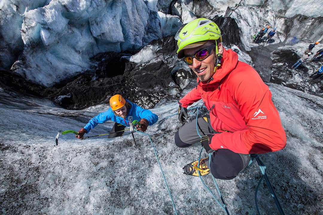
Wenn alle bereit sind wird die Gruppe eine kurze Wanderung zu den Gletscherwurzeln unternehmen. Dort angekommen legst du die Steigeisen an und begibst dich auf die Gletscherzunge, wo dich ein aufregendes Wunderland aus tiefen Spalten, schmalen Graten und glitzernden Eisskulpturen erwartet.
Dein sachkundiger Guide wird dich durch die beeindruckende Gletscherlandschaft führen und dir alles über die Geschichte und Geologie dieser verschwindenden Riesen erzählen. Die Wanderung führt dich zu einer Eiswand oder einer zum Eisklettern geeigneten Doline. Da dies eine Einführung in das Eisklettern ist und keine technischen Fähigkeiten erforderlich sind, wird der Guide sicherstellen, dass jeder einen für sein Können geeigneten Aufstieg ausprobieren kann.
Die Tour erfolgt in kleinen Gruppen von nicht mehr als sechs Teilnehmern pro Guide, daher hat wirklich jeder genügend Zeit und Gelegenheit, sich im Klettern zu versuchen. Vergiss nicht deine Kamera, um deinen Mut für die Nachwelt festzuhalten!
Nach etwa drei Stunden auf dem Eis; in denen du wanderst, kletterst und die herrliche Landschaft genießt, kehrst du vom Gletscher zurück, legst die Steigeisen ab und marschierst zurück zum Parkplatz, wo die Tour endet.
Verpasse nicht diese unglaubliche Erfahrung im Land aus Eis und Feuer und erklimme einen majestätischen Gletscher! Überprüfe die Verfügbarkeit, indem du ein Datum auswählst.


