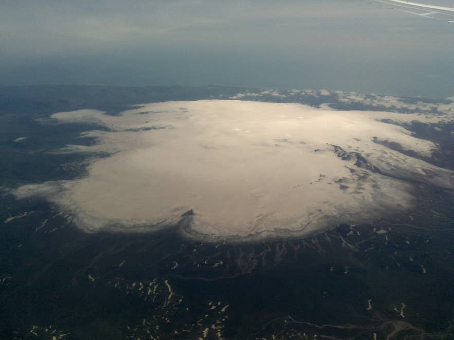
Mýrdalsjökull ice cap from the air. Photo: Bjoertvedt, CC BY-SA 3.0
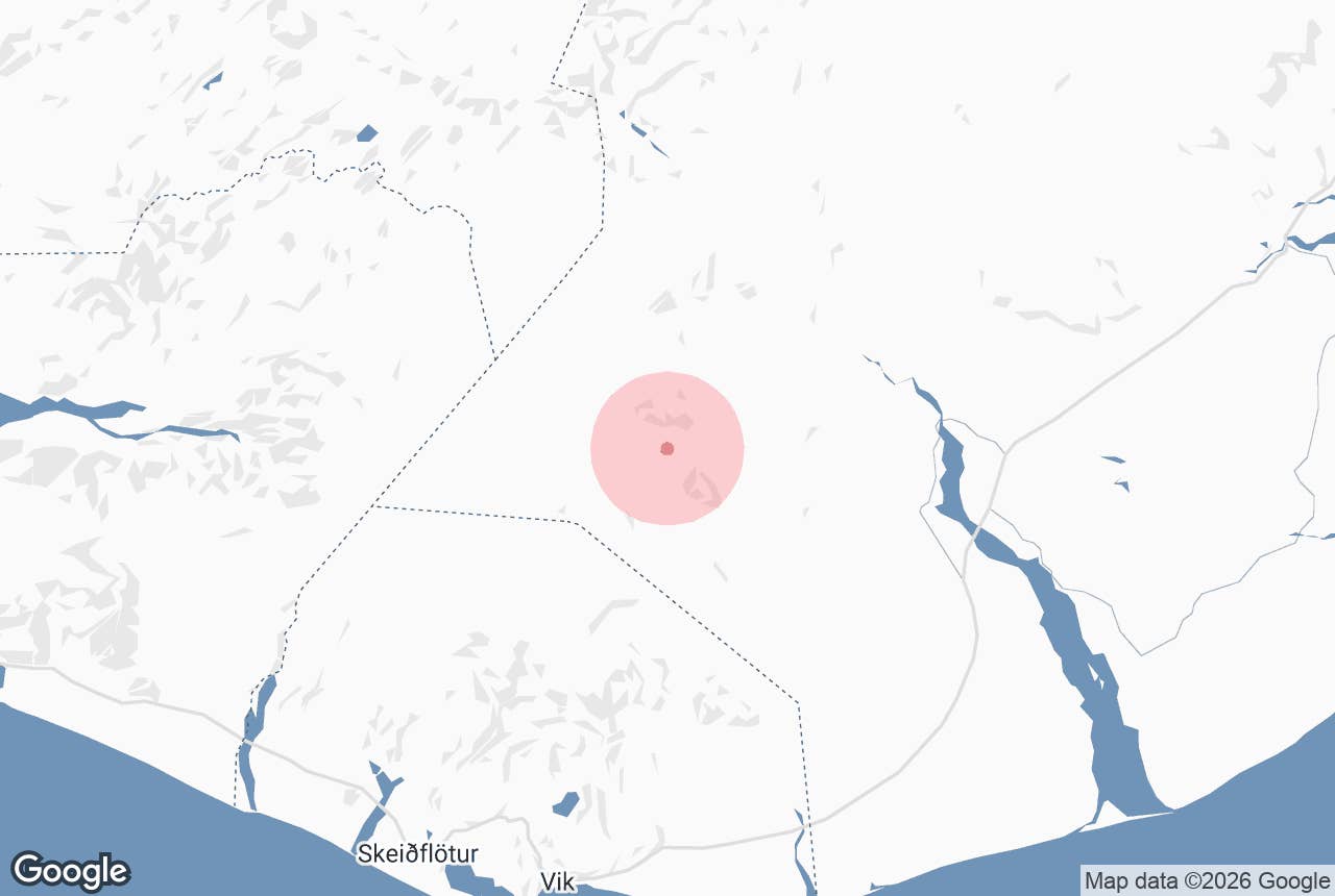
Sandfellsjökull glacier is an outlet glacier on the eastern margin of Mýrdalsjökull, the ice cap that covers the Katla volcano in South Iceland. It is named for Sandfell, the mountain beside its snout, and lies in the uninhabited highland between Mýrdalsjökull and the Hólmsá river, roughly 30 km north-east of the village of Vík í Mýrdal.
Unlike Sólheimajökull on the ice cap's southern side, Sandfellsjökull has no road, no car park and no crowds; it is reached on guided 4x4 trips that end with a short hike to the ice edge. The name means "Sandfell glacier", and Sandfell means "sand mountain".
Key Takeaways About Sandfellsjökull
- Outlet glacier on the east side of Mýrdalsjökull (Katla), about 29 km north-east of Vík, named after the mountain Sandfell
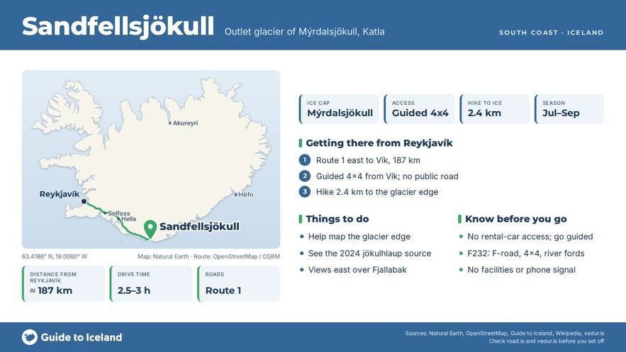
- No road or car park: the way in is a guided 4x4 trip from Vík with a 2.4 km hike to the ice edge, July to September
- Source of the 27 July 2024 jökulhlaup that flooded the Ring Road at the Skálm river on Mýrdalssandur
- The one GTI tour doubles as fieldwork: you help Katla Geopark map the glacier edge and outlet rivers
- Nearest F-roads (F232, F210) need a 4x4 and involve river crossings; do not attempt them in a two-wheel-drive rental car
Why visit Sandfellsjökull
Mýrdalsjökull is Iceland's fourth-largest ice cap, roughly 520 to 590 square kilometres of ice (surveys differ) reaching almost 1,500 m, with an average thickness of around 230 m.
Beneath it sits the 10 km-wide caldera of Katla, one of the country's most active volcanoes, which has erupted roughly every 40 to 80 years and last broke through the ice in 1918. The ice drains outwards through more than a dozen named outlet glaciers.
Sandfellsjökull is one of the eastern ones, between Öldufellsjökull to the north and Kötlujökull to the south, and it first appears under that name on the Icelandic 1:250,000 map sheet of 1969, having been described in the Ferðafélag Íslands yearbook of 1960.
What makes it worth the effort is that it is a glacier in retreat that almost nobody sees. Like the rest of Mýrdalsjökull, Sandfellsjökull has thinned and pulled back over recent decades.
It is also a glacier that makes news: on 27 July 2024 a glacial outburst flood (jökulhlaup) burst from beneath Sandfellsjökull into the river Skálm, washed over the Ring Road at the Skálm bridge on Mýrdalssandur and closed it between Vík and Kirkjubæjarklaustur while the damaged road was repaired, with a smaller flood following in September 2024.
That is one reason the ice edge here is now being measured. Because the ice sits on tephra and old lava from Katla, the terrain in front of it is a mix of black sand, moss-covered lava, rust-coloured streams and small waterfalls, with views back across the ice cap and east over the Fjallabak highlands.
The one tour that goes there turns the visit into fieldwork. With a specialist from Katla UNESCO Global Geopark you help record the position of the glacier edge and the flow of its outlet rivers, simple measurements that feed into an ongoing study of how the ice is changing, and you get a digital report afterwards.
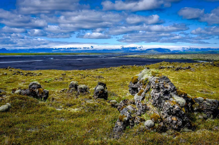
Mýrdalsjökull from Meðalland. Photo: Gretar Skulason, CC BY-SA 3.0
How to get to Sandfellsjökull
There is no public road to the glacier. The highland tracks that come closest are F-roads in the Fjallabak region, principally F232 (Öldufellsleið), which leaves Route 209 in Skaftártunga, follows the Hólmsá river valley past the mountain Öldufell and joins F210 (Fjallabaksleið syðri) on Mælifellssandur.
These are F-roads, legally closed to two-wheel-drive cars, with unbridged river crossings (including the Bláfjallakvísl river on F210), and Vegagerðin has opened the eastern part of F210 between 23 June and 6 July in recent years, closing it again in early autumn. From the tracks it is still a cross-country walk to the ice.
For most people the practical way in is the guided tour from Vík, which uses a modified 4x4 to cover the off-road section and then a hike of about 2.4 km over rocky hills, streams and lava to the glacier edge.
Vík is 187 km from Reykjavík on Route 1, about 2 hours 30 minutes to 3 hours. The glacier edge lies roughly 29 km north-east of Vík in a straight line, but the drive in takes considerably longer because of the terrain.
Best time to visit
Access is realistic only in summer and early autumn, roughly July to September, when the highland tracks are open and the river levels are manageable. Clear days in July and August give the longest daylight.
Rain raises the rivers quickly and can make the approach impossible, so tours depend on conditions on the day. In winter the whole area is snowbound and the tracks are closed.
Safety and practical tips
- Do not attempt to reach the glacier on your own in a rental car. F-roads require a 4x4, insurance rarely covers river crossings, and there is no mobile coverage or help nearby. Go with a guide.
- Never walk onto glacier ice without a qualified guide and equipment. Keep off the snout even when it looks solid; ice can collapse and meltwater channels run beneath it.
- The hike is about 2.4 km each way over uneven ground with stream crossings. Wear waterproof hiking boots and bring waterproof layers, a hat and gloves even in August, plus water and a packed lunch; there are no facilities of any kind.
- Katla is monitored around the clock by the Icelandic Met Office, and the 2024 floods show that meltwater can burst from this side of the ice cap without an eruption. Follow your guide's instructions on evacuation routes and check the Met Office (vedur.is) for the current status of Katla before you travel.
Nearby attractions
- Katla Volcano – 11 km, the volcano under the ice cap
- Þakgil Canyon – 15 km, green campsite valley south-east of the ice cap
- Mælifell – 15 km, the moss-green cone on Mælifellssandur
- Axlafoss – 16 km, waterfall on the F232 route
- Mýrdalsjökull Glacier – 16 km to the ice cap's centre
- Katla Geopark – 20 km to the geopark centre
- Vík í Mýrdal – 29 km, the tour's starting point
Tours that visit Sandfellsjökull
- Private Sandfellsjokull Glacier Mapping Tour with 4x4 Highlands Access from Vik – a 10-hour private day from Vík (up to four people, minimum age 10, July to September) with 4x4 highland driving, a 2.4 km hike to the glacier edge and glacier-mapping fieldwork with a Katla Geopark specialist, followed by a digital report.
