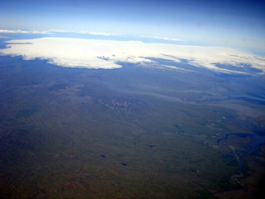
Western Vatnajökull above Þórðarhyrna. Photo: TommyBee, public domain
Þórðarhyrna volcano is a central volcano buried under the ice of western Vatnajökull, in the Highlands of southeast Iceland. It is the quieter twin of Grímsvötn, the country's most active volcano, and sits about 19 kilometres to its southwest beneath 100 to 600 metres of glacier ice.
The name combines the Icelandic man's name Þórður with hyrna, a word for a horn-shaped peak, so it means roughly "Þórður's peak".
You cannot drive to it or stand on it, but you can see it from the air on sightseeing flights out of Skaftafell, and the nunatak Pálsfjall, about 8 kilometres to its north-west, is one of the few rock outcrops in this part of the ice cap.
Key Takeaways About Þórðarhyrna
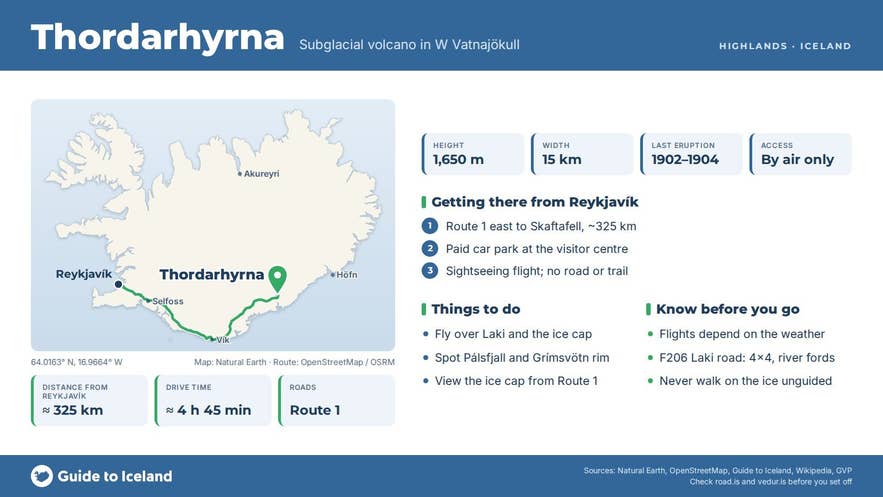
- Subglacial central volcano about 15 km across and 1,650 m high, 19 km south-west of Grímsvötn in the Grímsvötn–Laki system
- Last erupted 1902–1904 (VEI 4 in May 1903); earlier eruptions in 1823 and 1887–89 attributed but unconfirmed
- No road or trail: the realistic way to see it is a sightseeing flight from the Skaftafell airstrip
- Skaftafell is about 325 km from Reykjavík on Route 1, with a paid car park and visitor centre
- Flights depend on weather; June to August gives the best odds of clear skies over the ice cap
Why visit Þórðarhyrna
Þórðarhyrna is a central volcano about 15 kilometres across, rising to roughly 1,650 metres above sea level.
Almost all of it is buried under the ice; the nearby nunatak Pálsfjall (1,355 metres) is one of the few rock outcrops in the area, which is why the mountain is better known to geologists than to travellers.
Together with Grímsvötn it forms the Grímsvötn–Laki volcanic system, the system responsible for the Laki fissure eruption of 1783–1784, one of the largest and most damaging eruptions in recorded history.
The two volcanoes are joined by a subglacial ridge and share fissure swarms, although Þórðarhyrna is treated as a volcano in its own right; its rocks are mostly basalt, but rhyolite is found on its nunataks.
Its eruptions are explosive because magma meets meltwater under the ice. Tephra volumes of 0.01 to 1 cubic kilometres are typical, and eruptions are accompanied by jökulhlaups, glacial outburst floods that run south across the sands toward the coast.
Only the eruption of 1902–1904 can be assigned to Þórðarhyrna with certainty: its main phase in May 1903 was a VEI 4 event that took place while Grímsvötn was also active.
Earlier eruptions in 1823 and 1887–1889, and possibly one in 1753, are attributed to it, and a much older eruption around 3,500 BC poured lava out south of the volcano. Nothing has been recorded since 1904.
For visitors the appeal is the setting. From a small aircraft you look across the broad white plateau of western Vatnajökull, with the outlet glaciers Síðujökull and Skeiðarárjökull spilling off its southern edge, the Lakagígar crater row to the south-west and the dark rock of Pálsfjall and the Grímsvötn rim poking through.
How to get to Þórðarhyrna
There is no road, trail or marked route to Þórðarhyrna, and the volcano lies deep inside Vatnajökull National Park on the ice cap itself. Travel on the glacier requires full expedition equipment and experience with crevasses and whiteout navigation, so for almost everyone the only practical way to see it is by air.
Sightseeing flights leave from the airstrip at Skaftafell, on the Ring Road (Route 1) in the national park. Skaftafell is roughly 325 kilometres east of Reykjavík, around four and a half to five hours' drive in good conditions, and about 70 kilometres east of Kirkjubæjarklaustur, the nearest village.
From Skaftafell the flight path over the Lakagígar craters and western Vatnajökull passes Þórðarhyrna in a matter of minutes. There is a large paid car park at the Skaftafell visitor centre, which also has toilets, a café and the national park information desk.
On the ground, the nearest places you can reach by car with a view toward this part of the ice cap are along Route 1 between Núpsstaður and Skaftafell, and, in summer, the F206 track to Lakagígar, a 4x4-only F-road that crosses unbridged rivers.
Best time to visit
Flights operate from spring to autumn (the tour listed below runs from April to October) and depend entirely on the weather, which changes quickly around Vatnajökull.
June to August gives the longest daylight and the best odds of clear skies over the ice cap, and the glacier surface is at its brightest. Autumn can bring sharp, clear days with fresh snow on the nunataks, but cancellations are more common. In winter the airstrip and roads can close at short notice.
Safety and practical tips
- Flights are weather dependent. Book early in your stay so there is room to reschedule if the first attempt is cancelled.
- Þórðarhyrna is a monitored volcano. The Icelandic Meteorological Office (vedur.is) publishes alerts; any unrest in the Grímsvötn system would be announced there well before it affected visitors.
- Jökulhlaups from this part of Vatnajökull run down onto Skeiðarársandur and can close the Ring Road. If a flood warning is issued, follow instructions from safetravel.is and the park.
- Do not attempt to walk onto Vatnajökull without a certified guide. Crevasses near the glacier edges are often hidden under snow.
- Skaftafell has a café, campsite and accommodation nearby; the nearest village with a full range of services is Kirkjubæjarklaustur, about 70 km to the west.
Nearby attractions
- Grímsvötn – the paired, far more active volcano under the ice, 19 km northeast
- Grænalón – ice-dammed lake at the edge of Skeiðarárjökull, 13 km south-east
- Síðujökull – outlet glacier flowing off western Vatnajökull below Þórðarhyrna, 23 km southwest
- Langisjór Lake – long highland lake west of the ice cap, 34 km west
- Lómagnúpur Mountain – the sheer headland on the Ring Road, 34 km south
- Lakagígar – the 1783 Laki crater row, part of the same volcanic system, 43 km southwest
Tours that visit Þórðarhyrna
- Exciting 1-Hour Airplane Tour Over Vatnajokull National Park from Skaftafell – a sightseeing flight of about 75 minutes from Skaftafell over Vatnajökull, Grímsvötn, the Lakagígar crater chain and the Þórðarhyrna volcano, continuing to Landmannalaugar.
