


Description
Summary
Description
Discover the beauty of Iceland's Vatnajokull National Park and the Landmannalaugar geothermal area with this fantastic 75-minute airplane sightseeing tour. If you want to enjoy spectacular views of volcanic terrain, glaciers, and rivers from above, this is the perfect airplane adventure for you.
Your tour departs from Skaftafell Airport. Make your way here to meet your experienced pilot, who'll guide your group on the day's adventures. After a quick safety briefing, you'll board your aircraft and be ready to take off.
You'll start your journey by flying out of Skaftafell and over the Vatnajokull National Park, one of only three national parks in Iceland. You'll see glacial tongues and the ice-capped peak of Hvannadalshnjukur mountain looming over the land. The views are breathtaking.
As you fly further, you'll also see forests fed by glacier streams, which have restored the land to green lushness. Farmers abandoned the area when the earth became barren, but now the site is one of the best places in Iceland to enjoy the untouched wilderness.
After flying over the Vatnajokull glacier, you'll head towards the Grimsvotn volcano. Here, you'll see the Lakagigar crater chain and the Thordarhyrna volcano — one of seven subglacial volcanoes under the Vatnajokull glacier.
This section is one of the highlights of the tour. The Grimsvotn volcano has among the highest eruption frequencies of all the volcanoes in Iceland, last going off in 2011.
You'll then enjoy beautiful views of the Tungnaa river, which flows from the western edge of the Vatnajokull glacier to complete the stunning landscape below.
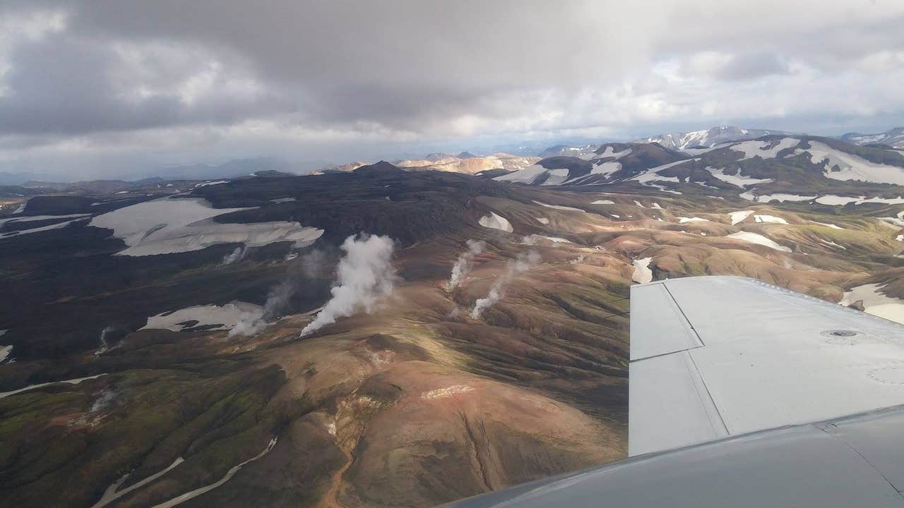
After this, you will soar over the colorful valleys of the Landmannalaugar geothermal area in the Icelandic highlands. This gorgeous place was formed during an eruption in 1477 and is full of geothermal pools and multicolored rhyolite mountains.
After more than an hour up in the air, you'll fly back to the airport, passing over the Skaftafell Nature Reserve as you go. This reserve is one of Iceland's most picturesque forested areas, tucked between several glaciers. Make sure you snap a final photo or two!
After landing, you'll have plenty of time to enjoy the other wonders of southeast Iceland, such as the Jokulsarlon glacier lagoon, the Diamond Beach, and the ice cap of Skaftafellsjokull.
Don't miss your chance to take flight over stunning geothermal landscapes, witnessing mountains, sand plains, rivers, and sparkling glaciers from above. Check availability now by choosing a date.


