


Description
Summary
Description
Get ready to ride the friendly Icelandic horse and embark on the adventure of a lifetime in the breathtaking geothermal valley of Reykjadalur, where you will bathe in the soothing waters of a natural hot river by booking this spectacular adventure. This exciting tour is ideal for nature enthusiasts who want to combine horseback riding with a relaxing dip in nature.
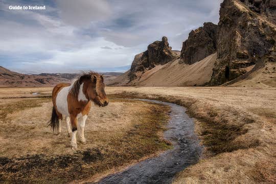
Icelandic horses descended from those brought to Iceland by the very first Viking settlers, so they are a protected breed not often seen outside of Iceland. They are also renowned for their easy riding pace and ability to cover large distances while keeping their riders comfortable. This was crucial during pre-modern Iceland when the horse was the primary method of transportation on the island.
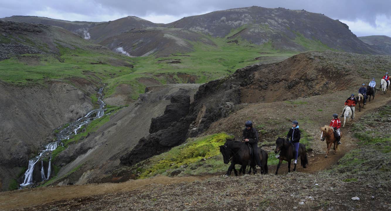
On this amazing experience, you'll spend almost six hours surrounded by stunning nature, covering about 12 miles (19 kilometers) through a beautiful geothermal valley.
Your day starts with a convenient pick-up in Reykjavik, where you will meet your driver and head to a nearby farm in Hveragerdi. After arriving at the farm, you will receive your riding gear, a short safety brief, and an explanation about the Icelandic horse and how to ride it securely.
Next, you will venture out of the farm into nature, and after a short distance in the countryside, you will ride through the mountainous Hengill volcano area. Hengill volcano is still active, causing heated water to bubble up in various fumaroles and hot springs near it. The volcano also provides much of the energy used for house heating in the southern part of the country.
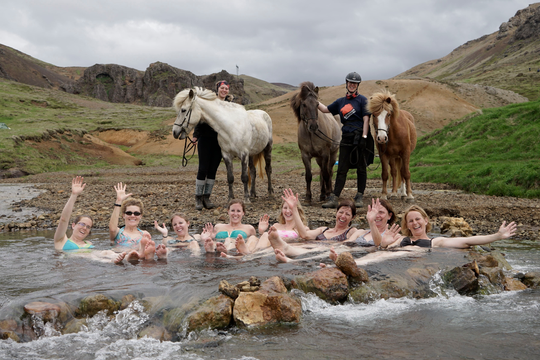
During your tour, a series of picturesque trails will take you into the rocky valley of Reykjadalur, where you will cross the steamy geothermal area and reach the river's bathing spot. While the horses take a well-deserved break, you will unwind in a beautiful, warm river surrounded by vibrant green fields and the striking silhouette of distant mountains.
After this relaxing dip, you’ll hop back in the saddle for a ride through Hveragerdi village and the surrounding farmland to the land’s edge.
On the way, you will witness the beautiful Djupagilsfoss waterfall as you make your way back to the farm, and on a clear day, you might even be able to see the striking Westman Islands off the coast.
Your journey will continue through the colorful geothermal Gududalur valley, an area that expanded dramatically during an earthquake in 2008. The path then takes you through a lush green forest, along the slopes of Reykjafjall mountain, and back to the farm, where you’ll enjoy some coffee and homemade cake before ending the day back in Reykjavik.
Don’t miss this chance to experience riding an Icelandic horse through the stunning, untouched countryside and soaking in a warm, natural hot spring by booking this tour. Check availability now by choosing a date.


