Description
Summary
Description
Explore stunning winter landscapes by day and watch for the northern lights at night on this 10-day self-drive tour of Iceland’s South Coast and Snaefellsnes Peninsula. Drive through Iceland’s most scenic routes at your own pace, allowing plenty of time to enjoy each site without rushing.
While planning an Iceland self-drive itinerary can be a rewarding experience, it normally requires weeks of research, time, and effort. Lucky for you, you can skip this lengthy process! This package ensures a seamless adventure from arrival to departure so you can focus on enjoying every moment.
With our detailed itinerary, you'll explore Iceland’s best attractions while discovering hidden gems only known to locals. This itinerary is built with local expertise, including knowledge about winter conditions and daylight hours, so you can make the most of your northern lights hunt and winter road trip.
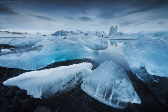
Expect to visit all the must-see landmarks in Iceland, from the soothing Blue Lagoon to the rugged Snaefellsnes Peninsula. Marvel at the thundering Golden Circle waterfalls, walk on the majestic Vatnajokull Glacier, and watch icebergs drift in the Jokulsarlon Glacier Lagoon.
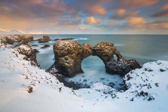
Go off the beaten path to discover hidden gems like Deildartunguhver, Europe’s most powerful hot spring, and the colorful waters of Kerid Crater. Enjoy the charm of Hofn, known for its fresh seafood, and soak in the lively atmosphere of Reykjavik.
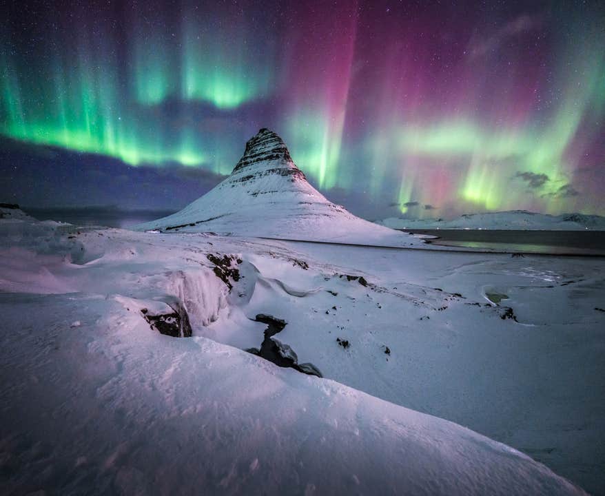
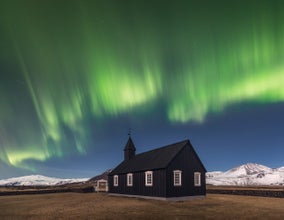
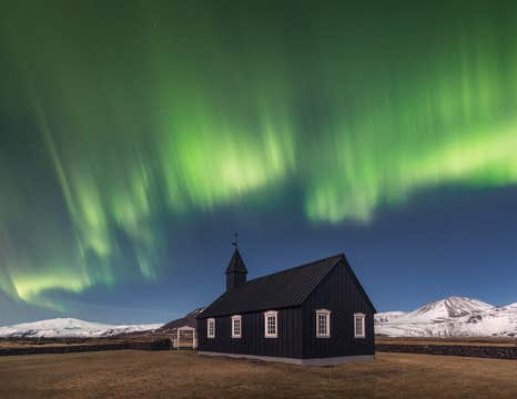
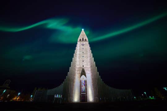
Of course, let’s not forget about the northern lights! Iceland is one of the best places to view them, so each night is a chance to witness their magic. With the right sky and weather conditions, you may find yourself standing beneath a stunning aurora borealis display. This unforgettable sight is often the highlight of any Icelandic winter journey.
Rest easy in handpicked hotels chosen for comfort, great locations, and warm Icelandic hospitality. You can customize your lodging, choosing from various options to match your budget and travel style.
Beyond the carefully planned route, this Iceland self-drive tour gives you the flexibility to control your pace. You’ll have plenty of time to give each place the appreciation it deserves or skip a few attractions so you can have more time with your favorite locations.
Make your Icelandic journey as unique and exciting as you want it to be! Choose from the top-rated experiences available at unbeatable prices to enhance your adventure.
Dive between continents while snorkeling in crystal-clear waters, hike across a shimmering glacier, or race across the snow on a thrilling snowmobile ride. If you’re visiting between October and March, don’t miss the chance to step inside a breathtaking ice cave.
A dedicated 24/7 personal travel agent will be available to support you and ensure a stress-free experience. This includes assisting you with itinerary changes, even after booking.
Reserve your winter vacation in Iceland with confidence, knowing you can cancel your trip for free up to 24 hours before departure and get a full refund.
Spend your nights under the winter sky and explore the South Coast and Snaefellsnes Peninsula on this unforgettable 10-day self-drive tour in Iceland. Check availability now by choosing a date, and say yes to a one-of-a-kind road trip adventure!


