Description
Summary
Description
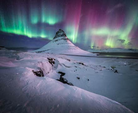
Experience the wonders of Iceland on this 12-day winter package, taking you to all the classic sights, such as the Blue Lagoon, Seljalandsfoss Waterfall, Kirkjufell Mountain, Thingvellir National Park, and many hidden treasures off the beaten track.
This tour package is ideal for travelers wanting to experience the winter beauty of Iceland without the hassle of driving in winter conditions. Expert guides, skilled in safely navigating wintery roads, ensure a worry-free adventure through Iceland's stunning landscapes.
This package offers a locally crafted, 12-day winter itinerary designed by travel experts to showcase Iceland's top attractions at unbeatable prices. Save time, hassle, and money with this all-in-one vacation package that is meticulously planned for a smooth and stress-free experience from arrival to departure.
All essential aspects of your travel are arranged for you even before you land in Iceland. For example, this package includes airport transfers, 11 nights of accommodation in different locations, a detailed itinerary, activity tours, and a personal helpline you can contact anytime.
A key highlight of this top-rated package is that friendly local guides will accompany you during your winter adventure. In addition, you'll learn more about each attraction you'll visit with the guides' expertise.
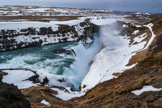
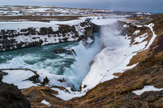
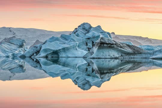
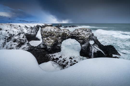
Your experienced and friendly guides will take you on an eight-day minibus ride to witness volcanic terrains, idyllic coastal towns, majestic glaciers, and mighty waterfalls. You will explore everything from the highlights of the South Coast to the snow-covered fjords of East Iceland and the versatile wonders of the Snaefellsnes Peninsula.
While circling the Ring Road, your guides will do their best to hunt down possible sightings of the elusive northern lights, the winter phenomenon that most people hope to see during their trip to Iceland.
After you've traveled around the countryside, you will spend four additional free days in Reykjavik. That means you can explore everything that the northernmost capital city in the world has to offer.
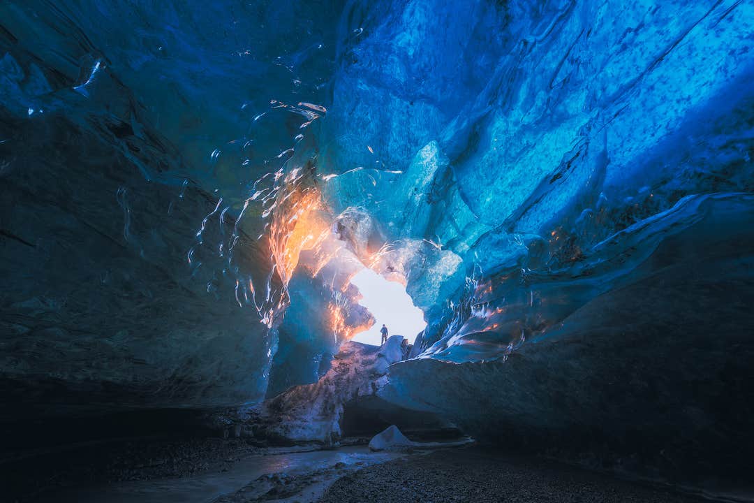
As a unique winter treat, an ice caving adventure in Vatnajokull is included in the tour price. You can also add additional excursions during the booking process. Your optional tour choices include bathing in the Blue Lagoon, snorkeling in Silfra Fissure, a helicopter tour of Reykjavik, and horseback riding in the countryside.
This entire itinerary includes all the hidden gems along with the main attractions of Iceland to make your trip as enjoyable as possible. You can also customize it according to your preferences even after booking.
We've handpicked the best hotels for your trip to make your stay unforgettable, with options to customize your accommodations through your travel agent after booking.
If any unforeseen changes come up in your travel plans, you can cancel your booking up to 24 hours before your departure and receive a complete refund.
Get ready to experience all the wonders of the Ring Road and Reykjavik with a small group on this fantastic 12-day winter tour vacation package in Iceland. Check availability now by choosing a date.


