

Description
Summary
Description
Experience the best of Iceland on this incredible 3-day tour of the South Coast and the Golden Circle sightseeing route. This multi-day tour covers South Iceland’s major attractions and hidden gems, from majestic waterfalls to breathtaking glaciers, black-sand beaches, and the stunning Jokulsarlon Glacier Lagoon.
This tour is designed to save you both time and money by taking care of all the planning and logistics. With a carefully crafted itinerary based on local knowledge, you’ll experience the best of South Iceland without the hassle of researching or booking accommodations and transportation.
Your journey begins with a pick-up in Reykjavik, where you'll meet your guide and the other travelers joining the excursion. With a group of no more than 19 people, you'll have plenty of opportunities to connect and get personal guidance.
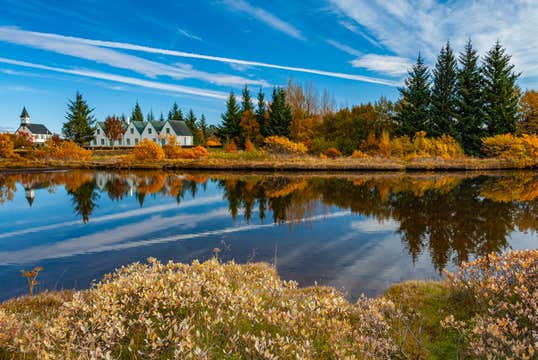
You'll explore the Golden Circle, an iconic route featuring three of Iceland’s most popular attractions: Thingvellir National Park, Geysir Geothermal Area, and Gullfoss Waterfall.
At Thingvellir, you'll cross the rift that separates the Eurasian and North American tectonic plates. It’s also here that the Althing, the world’s oldest ongoing parliament, was established in 930 AD.
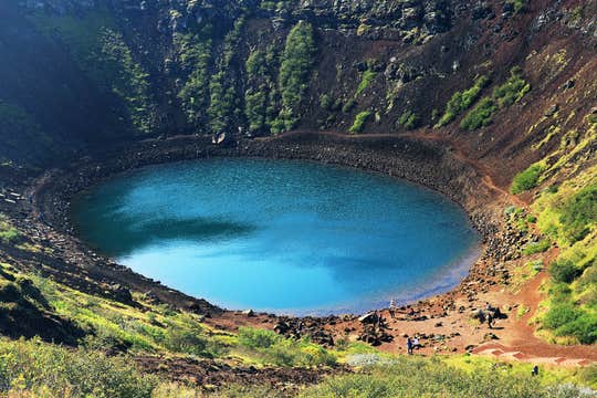
Marvel at the bubbling hot springs, steam vents, and the erupting Strokkur Geyser at the Geysir Geothermal Area. Last but not least, be awe-struck by the breathtaking sight of water tumbling into a deep canyon at Gullfoss Waterfall.
With Wi-Fi available on the minibus, you can stay online and instantly share the beauty of your adventure as it happens. You'll also enjoy two nights at carefully chosen accommodation, where you can rest after each day of adventure.
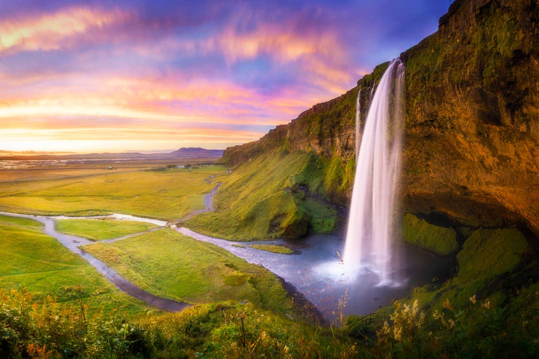
From the Golden Circle, you'll travel along the South Coast, where you'll encounter a range of stunning attractions, including the Seljalandsfoss and Skogafoss waterfalls.
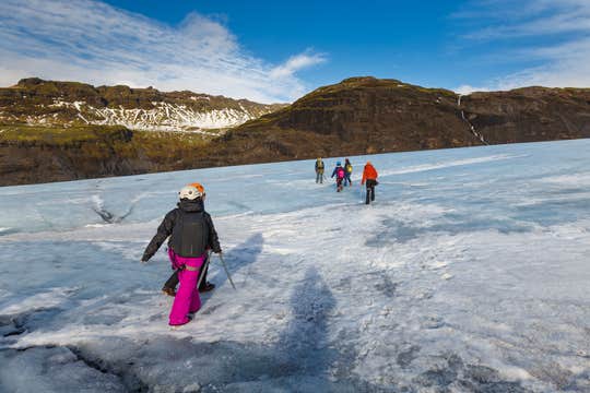
This South Coast tour also includes a glacier hike, a must-do when you're in Iceland. You’ll explore Solheimajokull, a stunning ice cap filled with deep crevasses and towering ridges. For your safety, all necessary equipment will be provided.
As you traverse the icy landscape, your guide will share fascinating insights about the significance of these massive glaciers and how global warming is impacting them.
You'll also visit "Iceland's Crown Jewel," Jokulsarlon Glacier Lagoon, where you’ll see stunning icebergs floating in the glacial meltwater. You can also join an amphibian boat tour and see these towering icebergs up close. You may even spot seals frolicking in the icy waters, adding a playful touch to this amazing experience.
The tour's final stop is the Fjadrargljufur River Canyon, a beautiful place to end your adventure and reflect on the wonders of South Iceland.
Make your time in Iceland one to remember with this immersive 3-day South Coast and Golden Circle tour. Check availability now by choosing a date.
