Hallormsstaðaskógur national forest in East Iceland is Iceland's leading woodland, covering an area of approximately. 740 hectares.
It is Iceland's first national forest and has been preserved since 1905.
Hallormsstaðaskógur is a natural birch forest, but a nursing station was established in 1903, and experiments were made with the planting of foreign tree species.
This is my travel blog in a series I wrote about my travels in East Iceland.
Top photo: hiking in Hallormsstaðaskógur forest

Hiking in Hallormsstaðaskógur forest
The oldest larch grove in Hallormsstaðaskógur forest, Guttormslundur grove, dates back to 1938 and is named after Guttormur Pálsson, the ranger.
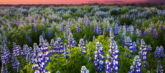
Hallormsstaðaskógur forest has a unique arboretum with approximately 85 foreign tree species from 600 locations worldwide.
And here the Icelandic joke: "What should you do when you get lost in an Icelandic forest?" The answer being: "Stand up!" doesn't apply anymore, as some of the trees are pretty tall.

Autumn colours in Hallormsstaðaskógur forest
Iceland is among the least forested countries in Europe, with forest land covering only 2% of the country.
Our ancestors, the Vikings, cut down much of the forest when they settled in Iceland, both to build houses and to make firewood and coal, and also to create grazing areas for their cattle.
We, locals, are now regaining the forests through reforestation. I worked for a couple of summers planting trees when I was a teenager, and so did the majority of my generation.

Lögurinn and Hallormsstaðaskógur forest
In Hallormsstaðaskógur forest, you can find great hiking trails, one of which leads you to the beautiful waterfall Ljósárfoss - also called Selfoss in the Ljósá river.
I got a map of the main hiking trails at the information center.
I was on my way to hike up to Hengifoss waterfall on the other side of Lagarfljót lake, but decided to visit Ljósárfoss first because it was a short, easy hike.

By Ljósárfoss waterfall
The hike to Ljósárfoss waterfall is about an hour round trip (850 meters from the road).
It is an easy hike through parts of the beautiful Hallormsstaðaskógur forest.
Ljósárfoss waterfall is 18 m high and cascades from a cliff called Ljósárhryggur. When I visited this lovely waterfall, there had been a drought in Iceland, making the waterfalls less powerful than usual.

There is a 3-meter-high waterfall a little bit below Ljósárfoss.
On your way to the waterfall, you walk through the forest, and you can see trees planted in 1965-67 from Siberia and Alaska.
Atlavík Cove

Atlavík cove
Atlavík cove is a beautiful cove in Hallormsstaðaskógur woods. It is right by the lake Lagarfljót, and here you will find a popular camping area.
This area is so serene, and the lake Lagarfljót sometimes looks like a mirror.
It is a milky white, greyish lake, which frequently changes its colour, ever so serene, until Lagarfljótsormurinn monster shows its head!

Atlavík cove
Atlavík used to be a popular meeting place for locals and visitors during the big Atlavíkurhátið festivals.
In 1985, the Beatle Ringo Starr performed here with the popular Icelandic band Stuðmenn.
These festivals, which were really big and popular, were held for the last time in the last decade of the last century.

Atlavík cove
The name Atlavík derives from the settler Graut-Atli Þiðrandason, who is mentioned in the old Landnámabók, the Book of Settlement in Iceland.
Graut-Atli settled the eastern shore of the Lagarfljót river between Giljár and Vallarnes west of Uxalækur.
Klifá stone arch and the bull

Klifá stone arch
In Hallormsstaðaskógur, a river named Klifá runs. In one place beneath the road, it runs through a beautiful natural rock arch.
I found folklore is linked to that rock arch in Þjóðsögur Jóns Árnasonar - the Compilation of Folklore by Jón Árnason:
"It so happened in Hallormsstað a long time ago that a bull was killed here.
The men ran inside to make the so-called "skyndilifur", which is blood from the bull, which is solidified, cut into pieces, boiled quickly, and pickled!!

The stone arch and the bridge
But as the butchers returned to the farmyard, they saw that the bull had stood up and was walking away. The men followed the bull to the river Klifá.
There, the bull ran under the rock arch in the river. The men then returned home.
But the bull is said to live under the rock arch - even today!"
(Roughly translated into English from the Compilation of Folklore of Jón Árnason).

Klifá stone arch
I have walked down to the rock arch several times and, fortunately, have never seen this bull, but I love legends connected to the places I visit, and I have written several travel blogs that include such legends.
Another legend is connected to the Lagarfljót lake, as there is a monster living in the lake - the Lagarfljótsormurinn Serpent or Lagarfljótsormurinn Worm!
I have written another travel blog about the Lagarfljótsormurinn Serpent.
So be on the lookout for a monster when you visit this area!

Lögurinn and the bridge
You should drive around the lake and hike up to Hengifoss, Iceland's second-largest waterfall. The return hike takes around 2 hours.
And drop in at Skriðuklaustur as well:
The majestic Hengifoss and Litlanesfoss Waterfalls in East Iceland
Skriðuklaustur and the Archaeological Excavations in East Iceland
Egilsstaðir in East Iceland and the Pearls of Fljótsdalur Valley

Hengifoss waterfall
The round-trip from Egilsstaðir around the lake is some 70 km long on Ring Road 1 and Road 931, with a lot of interesting sights on the way.

To reach Hallormsstaðaskógur in East-Iceland, you can rent a car in Reykjavík and drive on Ring Road 1 for a couple of days, either clockwise or anticlockwise.
Also check out the self-drive tours: Self-drive tours including East Iceland.
The best Eastfjord tours: Eastfjord tours
GPS: N65° 5' 41.302" W14° 43' 59.575".
Have a lovely time in East Iceland :)

Hi, my name is Regína Hrönn, and I was born and raised here in Iceland.