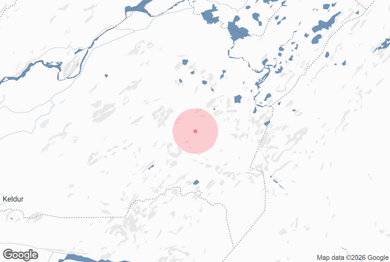
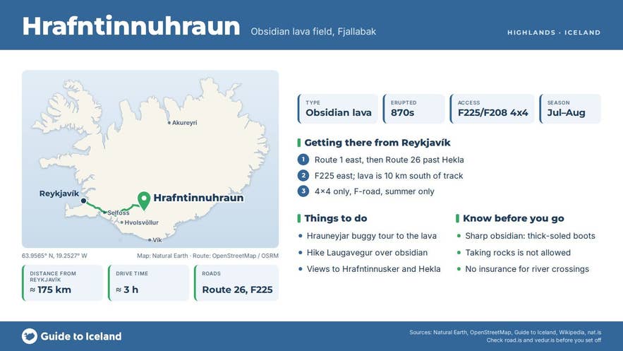
Hrafntinnuhraun is an obsidian lava field in the Torfajökull volcanic area of the southern highlands, about 10 kilometres south-west of Landmannalaugar and a few kilometres north-west of the mountain Hrafntinnusker. The Icelandic name is literal: hrafntinna is obsidian (word for word "raven flint", for its glossy black colour) and hraun is a lava field.
The lava erupted from the western rim of the Torfajökull caldera in the 870s, around the time Iceland was settled, and it is one of the best-known sources of obsidian in the country. The lava sits inside the Fjallabak Nature Reserve (Friðland að Fjallabaki), protected since 1979.
Key Takeaways About Hrafntinnuhraun
- Rhyolite lava field rich in obsidian, erupted from the western rim of the Torfajökull caldera in the 870s, around the time of settlement.
- Lies about 10 km south-west of Landmannalaugar and 4-5 km north-west of Hrafntinnusker, inside the Fjallabak Nature Reserve.
- F-road access only (F225 Landmannaleið or F208); seen from rough highland tracks, the Hrauneyjar buggy tour or the Laugavegur trail.
- Obsidian from this area clads the National Theatre in Reykjavík; collecting rock in the reserve is not allowed.
- Season roughly late June to mid-September; weather at around 1,000 m can bring snow in any month.
Why visit Hrafntinnuhraun
Most Icelandic lava is dark basalt. Hrafntinnuhraun is rhyolite, a silica-rich lava that is thick and slow-moving, and where it cooled quickly it formed obsidian, a natural volcanic glass.
The Torfajökull system is the largest rhyolite area in Iceland, with an 18 by 12 km caldera and one of the country's largest geothermal areas, around 150 km².
Hrafntinnuhraun is one of several rhyolite flows in the area; the oldest Hrafntinnusker lava nearby is about 7,500 years old, while Hrafntinnuhraun itself formed in a historic eruption, dated to about 871–877 (the 'settlement layer' tephra), that also laid down ash across Iceland shortly after settlement began.
The younger part of the field has a round crater in the middle where the viscous lava piled up into a mound, so you can read the eruption in the landscape.
The obsidian has a human story too. In the first half of the 20th century it was quarried in this area and carried to Reykjavík, where it decorates the exterior of the National Theatre (Þjóðleikhúsið).
Surrounding the lava are the rhyolite mountains that make the Landmannalaugar region famous, streaked yellow, red and green, with steam vents and hot springs.
Hrafntinnusker (1,128 m) rises to the south-east with its small ice cap and a well-known ice cave, and on a clear day the views stretch to Hekla in the west.
How to get to Hrafntinnuhraun
Hrafntinnuhraun is in the highlands and can only be reached in summer on F-roads with a 4x4. From Reykjavík, Landmannalaugar is about 180 km and roughly 3 hours' drive on Roads 1 and 26. The two usual approaches are:
- Landmannaleið (F225) from Road 26 north-east of Hekla, through Dómadalur. This track passes about 10 kilometres north of the lava field on its way east to Frostastaðavatn and Landmannalaugar.
- Fjallabaksleið nyrðri (F208) from the north via Road 26 and Sigalda, or from the south via Skaftártunga. The northern F208 is generally the easier of the two; the southern section includes river fords.
Rougher highland tracks south of F225 lead toward Hrafntinnusker and Laufafell; they are for experienced highland drivers only, and the guided buggy tour from Hrauneyjar is the easiest way to see the lava field from a vehicle.
The Laugavegur trail, which runs 12 km from Landmannalaugar up to the Höskuldsskáli hut at Hrafntinnusker (4-5 hours), passes east of the field with obsidian underfoot for much of the climb.
The nearest places with fuel and food are the Highland Center at Hrauneyjar on Road 26 and the summer huts at Landmannalaugar. F-roads are for 4x4 vehicles only; rental contracts normally ban two-wheel-drive cars from them, and no insurance covers damage from river crossings.
Best time to visit
The F-roads are usually closed from about mid-September until June or July, depending on snow; outside the open season the area is snowbound and the tracks are closed. July and August are the safest months, with the longest days and the most tour departures.
The buggy tour from Hrauneyjar is offered from June to November, depending on conditions. Early September brings autumn colours and far fewer people, but check road.is daily because the first snow can shut F225 overnight.
Safety and practical tips
- Obsidian is natural glass and very sharp. Wear boots with thick soles, keep children close and do not sit or kneel on the lava.
- The lava field is inside a nature reserve. Leave the obsidian where it is; taking rocks damages the site for everyone and the whole area is protected.
- Off-road driving is illegal everywhere in Iceland and the rhyolite soils here scar for decades. Stay on the marked tracks.
- Weather at around 1,000 m is cold and changeable even in July. Snow in August is not unusual at Hrafntinnusker. Carry wind- and waterproof layers and a map or GPS; fog hides the cairns.
- Do not enter ice caves at Hrafntinnusker. A roof collapse there killed a hiker in August 2006.
- There are no services, toilets or phone coverage in the lava field itself. Toilets, huts and a summer café are at Landmannalaugar, where a parking reservation and service fee apply in summer (parka.is).
Nearby attractions
- Hrafntinnusker Mountain Peak – the 1,128 m obsidian mountain south-east of the lava, 4 km
- Hrafntinnusker Hut – Höskuldsskáli, the first hut on the Laugavegur, 5 km
- Stórihver – a large hot spring on the Laugavegur, 5 km
- Brennisteinsalda – the "sulphur wave", one of Iceland's most colourful mountains, 6 km
- Dómadalur – the valley F225 follows north of the lava, 10 km
- Landmannalaugar – huts, hot pool and trailhead, 10 km
Tours that visit Hrafntinnuhraun
- Half-Day Landmannalaugar Buggy Adventure from Hrauneyjar Highland Center – a 5-hour guided buggy drive from Hrauneyjar across Sölvahraun and Skjólkvíahraun with Hekla in view, past the geothermal ground at Pokahryggir and through Dalamót, where the route takes in the coloured rhyolite mountains and the Hrafntinnuhraun lava field before reaching Landmannalaugar.
