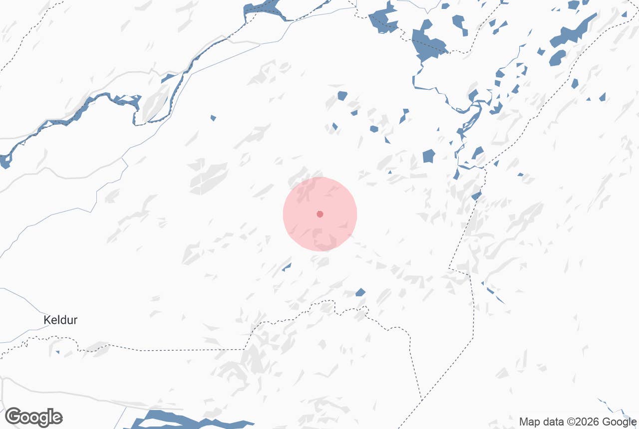
Reykjadalir ("smoke valleys" or "steam valleys", plural) is a cluster of geothermal valleys in the Fjallabak Nature Reserve, in the western part of the Torfajökull caldera, immediately west and south-west of the mountain Hrafntinnusker.
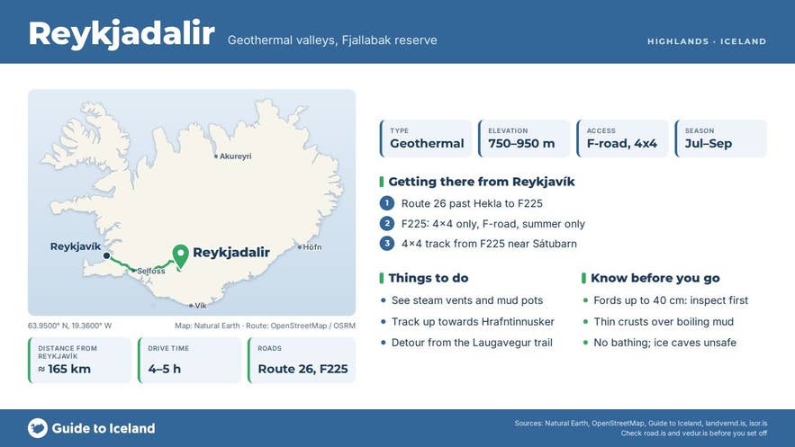
Steam rises from dozens of vents across the valley floors and slopes, which is how the area got its name. The valleys are split into Austur-Reykjadalir (east), hard against Hrafntinnusker, and Vestur-Reykjadalir (west), at roughly 750-950 metres above sea level.
A rough mountain track runs through them, and the Dalakofinn hut stands in Vestur-Reykjadalir.
Key Takeaways About Reykjadalir
- Austur- and Vestur-Reykjadalir lie at roughly 750-950 m in the Torfajökull geothermal area, immediately west of Hrafntinnusker (1,128 m).
- Reached only by marked 4x4 tracks from F225 (Landmannaleið) and F210 (Fjallabaksvegur syðri), with fords up to about 40 cm.
- Not the Reykjadalur hot-spring valley near Hveragerði.
- Open roughly late June/July to late September; no bathing, boiling mud and unstable ice caves.
- Inside Friðland að Fjallabaki: collecting obsidian or disturbing the ground is prohibited.
Why visit Reykjadalir
Torfajökull is Iceland's largest high-temperature geothermal area, with surface activity spread over roughly 150 square kilometres (about 15 km from west to east and up to 12 km wide). Its largest single geothermal cluster is in Austur-Reykjadalir, reaching south towards Jökultungur and the Kaldaklofsjökull glacier; other large clusters lie in Kaldaklof, in Vestur-Reykjadalir and at Brennisteinsalda above Landmannalaugar.
Here you find powerful steam vents, boiling mud pots and hot pools set among ridges of palagonite tuff and pale, rust- and ochre-coloured rhyolite. The steam, colour and altitude are what the Laugavegur trail is known for, and in Reykjadalir you see them with far fewer people.
Hrafntinnusker itself rises to 1,128 m beside the valleys. Its name means "obsidian skerry", and black volcanic glass lies scattered across the ground; in places the track surface is made of obsidian shards.
Hrafntinnuhraun, the lava field beside the peak, erupted around the time of Iceland's settlement (c. 870s), and its obsidian was used to decorate the exterior of the National Theatre in Reykjavík. Below the summit, hot springs steaming under what remains of a small glacier have carved ice caves.
The whole area lies inside Friðland að Fjallabaki, a nature reserve of about 446 square kilometres protected since 1979. Nothing may be collected or disturbed.
How to get to Reykjadalir
Reykjadalir is deep in the central highlands and reached only by highland tracks. Two marked 4x4 tracks lead in: one from Landmannaleið (F225, the Landmannalaugar road, turning off near Sátubarn) and one from Fjallabaksvegur syðri (F210) near Laufafell.
They meet at a signpost in Vestur-Reykjadalir, and the track then climbs almost to the top of Hrafntinnusker before splitting towards different hot spots and the glacier remnant. Expect several small fords and one medium ford of around 40 cm (a branch of Markarfljót).
This is a route for high-clearance 4x4 vehicles with river-crossing experience, or for a super-jeep tour; normal cars and small SUVs are not suitable.
From Reykjavík, the F225 turn-off is reached via Route 26 past Hekla; the drive to Reykjadalir is about 165 km and takes roughly 4-5 hours depending on conditions, most of it on gravel and F-roads.
Landmannalaugar, the nearest hub with a hut and campsite, is about 15 km away in a straight line. The nearest towns with fuel are Hella and Hvolsvöllur on the Ring Road.
On foot, the Laugavegur trail passes Hrafntinnusker hut, and the steaming slopes of Austur-Reykjadalir lie just west of the hut.
Best time to visit
The highland tracks open only when snow has cleared, usually from late June or early July to late September; the super-jeep tours that pass through run June to October. Early July often still has snow banks on the higher ground.
August usually gives the most reliable road and weather conditions. Outside this window the area is closed to vehicles and only reachable by experienced winter travellers.
Safety and practical tips
- Stay on the track and on firm ground near the hot springs. Crusts over boiling mud can be thin and give way.
- Do not enter the ice caves below Hrafntinnusker. They are unstable; a visitor was killed by ice falling from the cave roof on 16 August 2006.
- At 750-1,100 m the weather is colder and faster-changing than in the lowlands, with fog and sleet possible in any summer month. Carry warm, windproof layers.
- Check road.is for F-road openings and river levels before you set out, and never cross a ford you have not inspected.
- There are no services in Reykjadalir. The nearest huts are Dalakofinn (in the valley) and Höskuldsskáli at Hrafntinnusker, a Ferðafélag Íslands hut at about 1,050 m (the first hut there was built in 1977) that sleeps 52 and must be booked in advance.
- Collecting obsidian or any rock is prohibited inside the nature reserve.
- There is no entrance fee and no opening hours, only the seasonal road closures.
Nearby attractions
- Dalakofinn hut - the hut in Vestur-Reykjadalir at the junction of the two tracks, under 1 km
- Hrafntinnusker Mountain Peak - the 1,128 m obsidian mountain beside the valleys, 9 km
- Hrafntinnusker Hut - Höskuldsskáli on the Laugavegur trail, 9.5 km
- Rauðufossar - the red waterfalls below Rauðufossafjöll, 8 km
- Álftavatn - the lake and hut on the Laugavegur trail, 12 km
- Landmannalaugar - rhyolite mountains and the warm bathing stream, 15 km
- Frostastaðavatn - lake on the Landmannalaugar road, 16 km
- Hekla - one of Iceland's most active volcanoes, 17 km
Tours that visit Reykjadalir
- Highlands Super Jeep Tour with Laugavegur & Fjallabak Areas - an 11-hour super-jeep day starting in Hella that visits Hekla, then Dómadalur, Ljótipollur, Frostastaðavatn and Landmannalaugar, along the Laugavegur area and through Reykjadalir, then on past the glacier views to Emstrur and Markarfljótsgljúfur canyon. Runs June to October.
