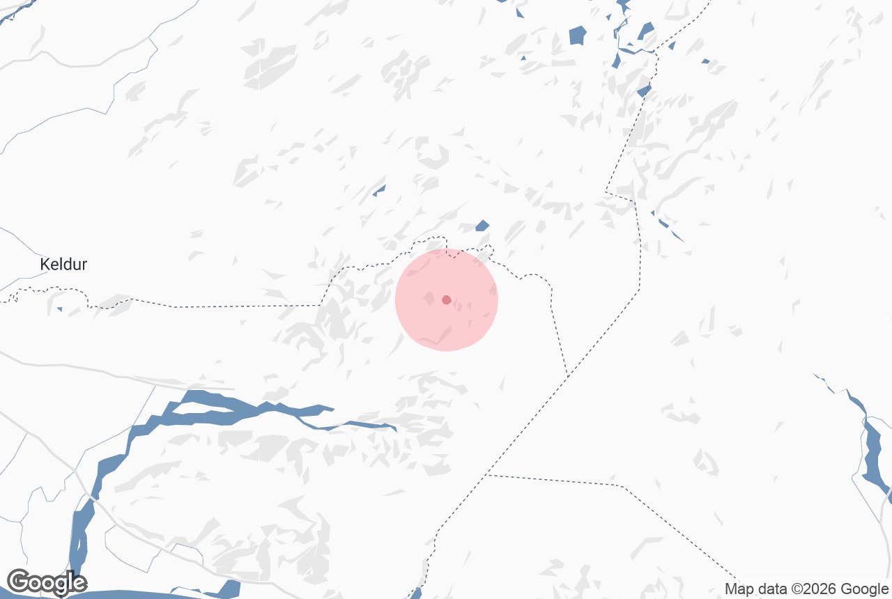
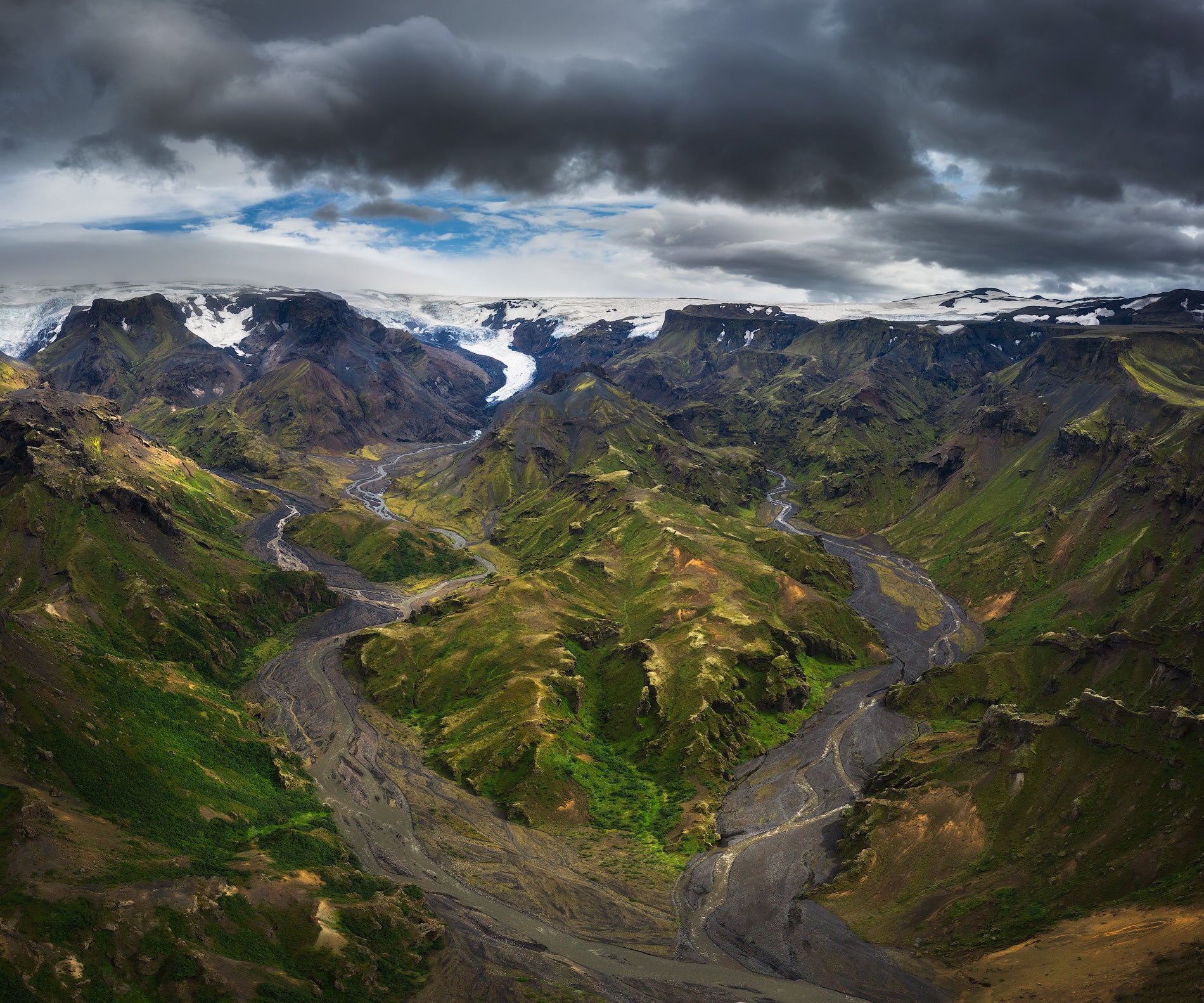
The Laugavegur Hiking Trail is Iceland's most popular multi-day trek, a 34-mile (55-kilometer) route through the southern Highlands between Landmannalaugar and Thorsmork. Read on to plan the itinerary, huts, and transport for your hike.
With an estimated 75,000 to 100,000 people hiking it every year, the Laugavegur Trail is widely considered one of the best hiking and trekking experiences in Iceland. The route crosses the Icelandic Highlands between the geothermal springs of Landmannalaugar and the valley of Thorsmork.
Why You Can Trust Our Content
Guide to Iceland is the most trusted travel platform in Iceland, helping millions of visitors each year. All our content is written and reviewed by local experts who are deeply familiar with Iceland. You can count on us for accurate, up-to-date, and trustworthy travel advice.
The trailhead is about a four-hour Highland bus ride from Reykjavik, and drivers need 4x4 rental cars to handle the mountain roads. The hiking window is short, so most people walk the trail in July or August, at the peak of the Icelandic summer.
To bring first-hand knowledge into this guide, we spoke to Arnar Haukur Rúnarsson, one of the leading experts on the Laugavegur Trail at the Iceland Touring Association. He has worked as a guide and hut warden along the route, and his expert insights appear throughout this guide.
Read on for the day-by-day itinerary, hut booking advice, a packing list, and the best time to hike.
Quick Facts About the Laugavegur Trail
-
Distance: The trail covers 34 miles (55 kilometers).
-
Duration: Most hikers complete the trail in 4 days, though seasoned hikers can finish in 3 by combining the first two stages. Adding the Fimmvorduhals crossing brings it to 5 or 6 days.
-
Difficulty: The hike is moderate to hard. The biggest challenges are long hiking days, river crossings, and fast-changing Highland weather rather than technical terrain.
-
Season: The hiking season runs from late June to early September, with July and August offering the most reliable conditions.
-
Accommodation: There are hut stations with campsites along the trail. Advance booking is required.
-
Booking: The Iceland Touring Association only issues hut bookings from Landmannalaugar to Thorsmork.
-
Getting there: Highland buses take about four hours from Reykjavik. Self-drivers need an authorized 4x4 for F-roads.
Laugavegur Trail Map and Itinerary
The Laugavegur Trail itinerary runs north to south, with overnight stops at Hrafntinnusker, Alftavatn or Hvanngil, and Emstrur before the finish in Thorsmork. The Highland trek should not be confused with the Laugavegur Shopping Street in Reykjavik, which shares its name.
Walking the route in reverse, starting from Thorsmork, is one way to escape the northbound crowds and meet oncoming hikers rather than travel with the flow. However, the Iceland Touring Association only issues hut bookings from north to south.
The table below outlines the standard 4-day itinerary, including the daily distances, hiking times, and elevation changes. An optional fifth day continues over the Fimmvorduhals Pass to Skogar.
|
Day |
Route |
Distance |
Walking time |
Elevation change |
|
1 |
Landmannalaugar to Hrafntinnusker |
7.5 miles (12 kilometers) |
4 to 5 hours |
1,540 feet (470 meters) up |
|
2 |
Hrafntinnusker to Alftavatn |
7.5 miles (12 kilometers) |
4 to 5 hours |
1,600 feet (490 meters) down |
|
3 |
Alftavatn to Emstrur (Botnar) |
10 miles (16 kilometers) |
6 to 7 hours |
130 feet (40 meters) down |
|
4 |
Emstrur to Thorsmork |
9.3 miles (15 kilometers) |
6 to 7 hours |
980 feet (300 meters) down |
|
5 (optional) |
Thorsmork to Skogar via Fimmvorduhals |
14 to 16 miles (22 to 25 kilometers) |
8 to 10 hours |
3,300 to 3,600 feet (1,000 to 1,100 meters) up |
Fit, experienced hikers can compress the trek into 3 days by combining Days 1 and 2 and walking straight to Alftavatn. This skips the overnight at Hrafntinnusker, the highest and most exposed camp on the route, where snow lingers and conditions are often bleak. It makes for a long first day, so it's only advisable in good weather.
For a first-hand account of the crossing, read this Laugavegur trek diary by a local hiker.
Day 1: Landmannalaugar to Hrafntinnusker
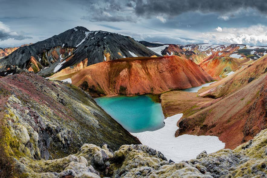
The first day climbs out of the rhyolite hills of Landmannalaugar, through the Laugahraun Lava Field, and past steaming vents and obsidian fields. Many hikers sleep at the Landmannalaugar hut the night before and soak in the natural hot springs before setting off.
At the Landmannalaugar Service Center, you can buy a badge marking that you've walked the trail, and there's a bench beneath a "Laugavegur, start of trail" sign that makes for a classic start-line photo.
The day ends at Hrafntinnusker, the highest and most exposed stop on the trail. Snow patches linger here all summer, and fog is common, so follow the trail markers closely on this section.
Day 2: Hrafntinnusker to Alftavatn
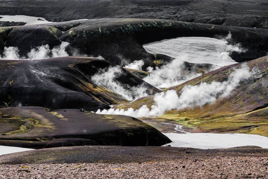
Day 2 crosses snow-filled ravines below the Reykjafjoll Slopes before reaching the edge of Jokultungur. In clear weather, this viewpoint takes in three glaciers at once: Eyjafjallajokull, Myrdalsjokull, and Tindfjallajokull.
A steep, rocky descent leads to the Grashagakvisl River, the first crossing that is usually waded on foot. The day ends on the flat valley floor at Alftavatn, a lake whose name means "Swan Lake," with the smaller Hvanngil hut a short distance farther as an alternative stop.
Day 3: Alftavatn to Emstrur
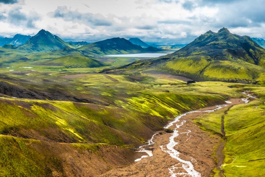
Day 3 is the flattest stretch, following the black sand desert of Maelifellssandur with views of Storasula and the surrounding volcanic peaks. Hikers ford the Bratthalskvisl River early. A footbridge spans the Kaldaklofskvisl, and the Blafjallakvisl must be waded, so keep your river shoes handy.
The night is spent at the Botnar hut in the Emstrur area, near deep canyons and moss-covered cliffs. If conditions allow, take the short side trail to Markarfljotsgljufur, a canyon about 650 feet (200 meters) deep.
Day 4: Emstrur to Thorsmork

The final official day descends past deep gorges, crosses the Fremri-Emstrua River on a footbridge, and fords the Thronga River before entering the woodland of Thorsmork. The valley is named after the Norse god Thor, and its birch forest makes a green finish after days of volcanic desert.
The valley wedged between three glaciers has its own microclimate. According to Arnar, the surrounding glaciers can hold back poor weather, sometimes leaving clearer conditions over Thorsmork.
Hikers can end the trek at Langidalur or at Basar. Buses back to Reykjavik leave from Thorsmork in the afternoon.
Day 5 (Optional): Thorsmork to Skogar via Fimmvorduhals

An optional final day continues over the Fimmvorduhals Pass, the volcanic ridge between Eyjafjallajokull and Myrdalsjokull, where you can stand on craters formed in the 2010 eruption. The Baldvinsskali hut provides an overnight stop for hikers who prefer to divide the crossing into two days.
This extension covers roughly 14 to 16 miles (22 to 25 kilometers) with 3,300 to 3,600 feet (1,000 to 1,100 meters) of climbing, and it ends at Skogafoss Waterfall on the South Coast. It is the hardest day of the trip and suits experienced hikers.
How To Get to the Laugavegur Trail
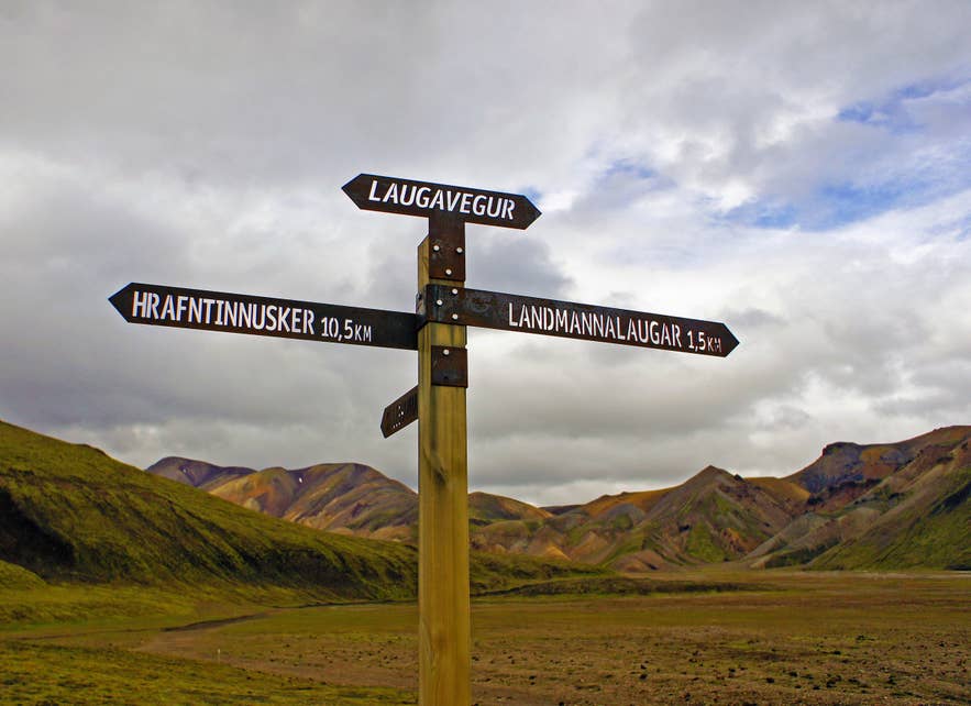
The Laugavegur Trail starts at Landmannalaugar, about four hours from Reykjavik by Highland bus, and ends at Thorsmork, where afternoon buses run back to the capital. Highland buses run daily during the hiking season, with morning departures from Reykjavik arriving at the trailhead before midday.
A one-way Highland bus from Reykjavik costs around 15,000 ISK, and hiker passes covering both the outbound ride and the Highland bus ride back from Thorsmork or Skogar are available for about 28,000 ISK. Buses also stop in Hella and Hvolsvollur along the way.
Driving yourself requires a 4x4 vehicle authorized for F-roads in Iceland, since the routes to Landmannalaugar (F208, F225, and F210) are rough mountain tracks. Book suitable rental cars early and check current road conditions before setting out.
Arnar cautions that not every 4x4 is suitable for the rough roads to Landmannalaugar, as the vehicle also needs enough ground clearance. Drivers can also avoid river crossings by choosing the right route and parking before the final ford.
Self-drivers should note the Landmannalaugar parking rules: between June 20 and September 13, drivers arriving between 9 AM and 4 PM must reserve a parking space in advance through Parka. A service fee applies to all vehicles entering the area during the season, regardless of arrival time.
Huts, Camping, and Booking on the Laugavegur Trail
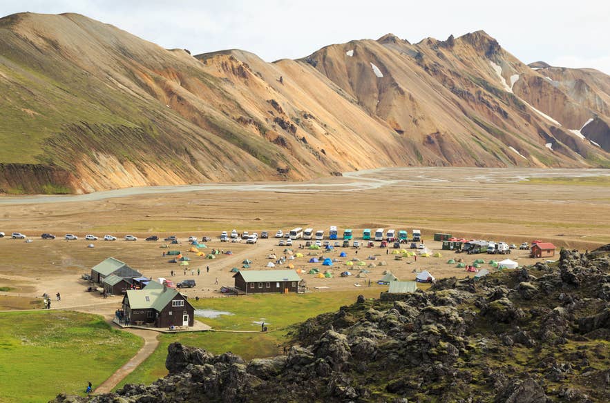
Several hut stations serve the Laugavegur Trail, and every bed must be booked in advance through the Iceland Touring Association, which only issues hut bookings from north to south. Demand is very high, and beds sell out months ahead.
Booking has recently become easier, according to Arnar:
FÍ is constantly looking to improve people's experience on the trail. The most recent change is a new online booking system for huts and campsites, which makes it easier for people to see what days might be busier than others."
All huts are heated, either with geothermal water or gas, and their kitchens have gas stoves, pots, pans, and utensils. Tap water at the huts is safe to drink straight from the tap. There is no electricity in any hut, so devices cannot be charged, though battery packs are sold at the huts.
Showers are available at every hut except Hrafntinnusker for a separate fee paid to the warden. Camping is allowed only at the designated sites beside the huts, and advance booking is strongly recommended for tent spots too. Wild camping is not permitted anywhere on the trail.
Overnight rates and shower fees are set each year by the touring association, so check the current price list when you book.
Guided vs. Self-Guided Laugavegur Trail Hike
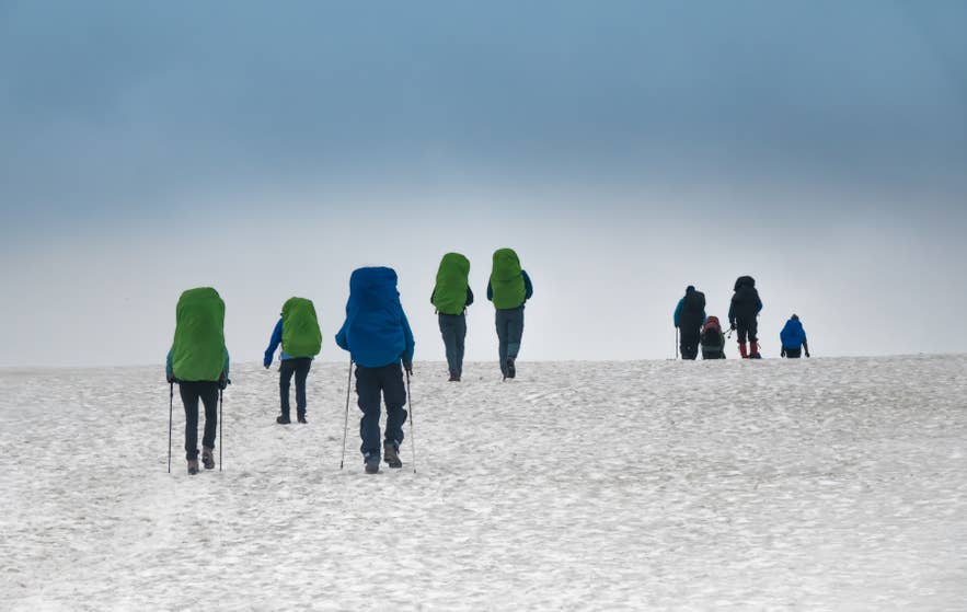
A guided Laugavegur Trail hike includes hut reservations, meals, luggage transfer, and a trained guide, while self-guided hikers must carry all their own gear and handle every booking themselves. The right choice depends on your backcountry experience and how much logistics you want to manage.
Going without a guide is realistic only for seasoned, self-sufficient hikers. If you choose a self-guided hike, you'll need to:
-
Book every hut or campsite months in advance.
-
Carry all your food, gear, and supplies for the full crossing.
-
Navigate independently, including in fog and on snowfields.
-
Register your route with SafeTravel, Iceland's official safety website, so rescue teams can respond if something goes wrong.
A guided trek removes most of those risks. Guides are trained in mountain safety, weather interpretation, and first aid, and operators typically handle trip registration and emergency communication, though you should confirm this when booking.
Recommended Laugavegur Hiking Trail Tours
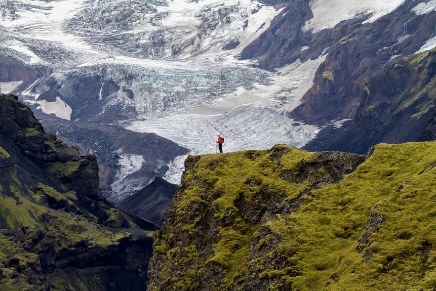
Laugavegur Trail tours take care of hut bookings, meals, luggage transfer, and guiding, which removes the hardest logistics of the hike. These are the standout options:
-
6-day Laugavegur and Fimmvorduhals hiking tour: The complete trek that combines the Laugavegur Trail with the Fimmvorduhals Pass.
-
5-day Landmannalaugar to Thorsmork hiking tour: A guided hike with extra time to explore Thorsmork after completing the Laugavegur Trail.
-
4-day Laugavegur Trail hiking tour: The classic guided crossing with mountain huts, meals, and luggage transport included.
For more options and seasonal availability, browse all Highland tours in Iceland.
River Crossings and Safety on the Laugavegur Trail
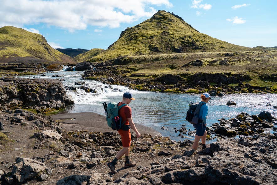
Four rivers on the Laugavegur Trail are typically waded on foot: the Grashagakvisl before Alftavatn, the Bratthalskvisl shortly after Alftavatn, the Blafjallakvisl on the way to Emstrur, and the Thronga before Thorsmork. Other crossings, including the Kaldaklofskvisl and Fremri-Emstrua, have footbridges.
Rain and glacial melt can raise river levels quickly. Sustained winds above 22 to 27 miles per hour (10 to 12 meters per second) make hiking difficult, and thick fog is common between Landmannalaugar and Alftavatn, where most of the trail's snow also lingers.
Prepare thoroughly for the hike. Research the route, understand the river crossings, and check the weather forecast before each stage. Talk to the hut wardens, who know the conditions ahead and will sometimes hold hikers back until it is safe to continue. In an emergency, call 112.
What To Pack for the Laugavegur Trail Hike
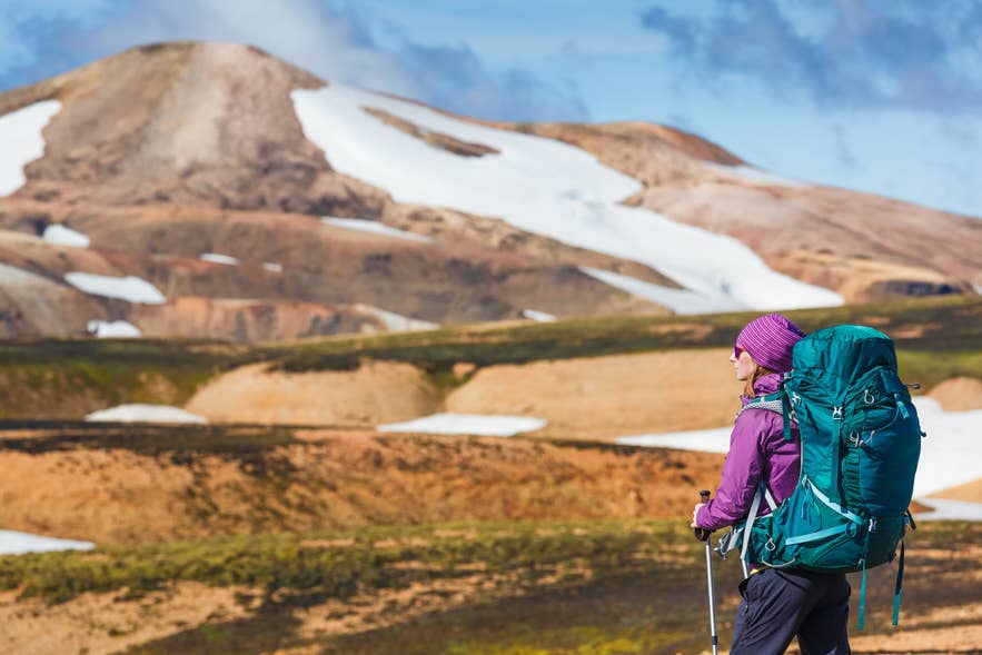
A Laugavegur Trail packing list starts with layered clothing, sturdy hiking boots, and dedicated river-crossing shoes. Highland weather changes quickly, so be prepared for cold, rain, wind, and glacial water, sometimes all in the same day.
Asked what hikers most often get wrong, Arnar pointed to two items:
Boots and sleeping bags. Many people expect the huts to be closer to what you find in the Alps and leave their sleeping bag at home. Boots need to be sturdier than people expect."
Based on Arnar's recommendations, pack the following:
Clothing
-
Moisture-wicking base layer, insulating mid-layer, and waterproof jacket and trousers
-
Sturdy, waterproof hiking boots
-
Warm hat, gloves, and a buff or neck gaiter
-
Moisture-wicking hiking socks
-
River-crossing shoes, such as lightweight sneakers or sandals
-
A spare set of dry clothes
Essential gear
-
A 50 to 60-liter backpack, or 60 to 70 liters if camping
-
Refillable water bottle or hydration pack
-
Enough food for the hike
-
GPS device or offline navigation app, plus a map and compass
-
Headlamp with spare batteries
-
First-aid kit with blister treatment
-
Trekking poles
-
Dry bags to keep gear dry
-
Sunglasses and sunscreen
-
Toiletries and a small towel
Camping gear (if camping)
-
Lightweight, weather-resistant tent
-
Sleeping bag and sleeping pad
-
Portable stove, fuel, and cooking utensils
Self-guided hikers should also bring a repair kit, a multitool, and an emergency communication device such as a Garmin inReach or SPOT.
To save luggage space, consider renting camping equipment in Iceland, and read these tips for backpacking in Iceland while you plan.
When To Hike the Laugavegur Trail
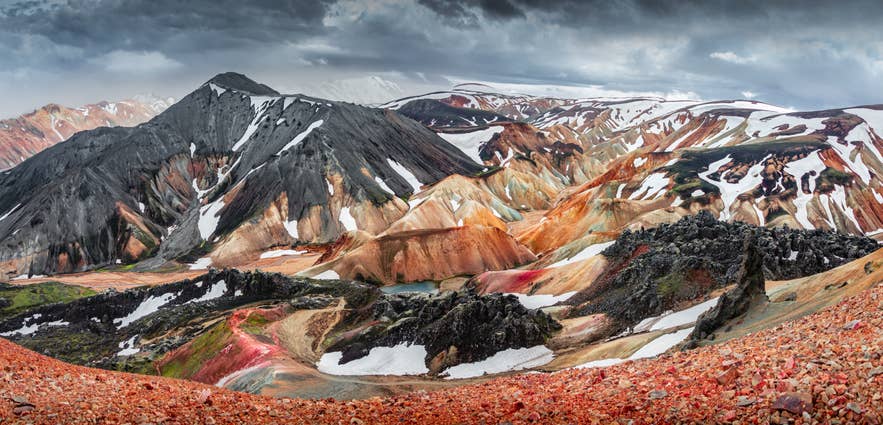
The Laugavegur Trail hiking season runs from late June to early September, when the huts are open, the Highland roads are passable, and the trail is mostly snow-free. On average, the route opens around June 25 and closes by September 15.
July and August are the most reliable months. Daytime temperatures typically range between 41 F and 57 F (5 C and 14 C), while nights can drop near or below freezing, especially around Hrafntinnusker. Sudden wind, rain, and even summer snow are possible at any point in the season.
Even in peak season, Arnar explains that crowding is manageable with smart timing.
There are days where you can feel the increase in hiker traffic. On most days, you can still start a little earlier or later than the general traffic and have the trail almost to yourself.”
For wider seasonal planning, see when the best time to visit Iceland falls for each region.
What Else To See Near the Laugavegur Trail
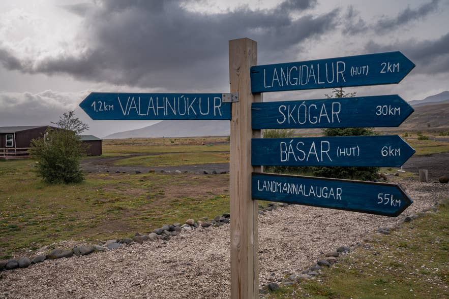
The Laugavegur Trail connects three of the Highlands' top destinations, and each rewards extra time: Landmannalaugar, Thorsmork, and the Fimmvorduhals area. Arriving a day early or leaving a day late turns the trek into a fuller Highland trip.
For an extra day in Landmannalaugar, Arnar recommends hiking through Graenagil Canyon and Laugahraun Lava Field to Brennisteinsalda Volcano. Hikers can also climb Blahnukur Mountain Ridge for views of the colorful mountain before relaxing in the natural hot spring.
In Thorsmork, many day visitors get off the bus at Husadalur Valley, climb Valahnukur Mountain, and continue to Langidalur Campsite for pickup. Arnar prefers starting at Langidalur and hiking Tindafjallahringur Trail, which has another excellent viewpoint and lets visitors see more of the valley.
His biggest recommendation for Thorsmork is to spend more than one day there.
Hikers with extra time can take a day hike on the Fimmvorduhals Pass or continue along the South Coast to visit Skogafoss and the region's other waterfalls. The wider Highlands Region also offers many more remote valleys and hot spring areas to add to your itinerary.
Plan Your Hike to the Laugavegur Trail
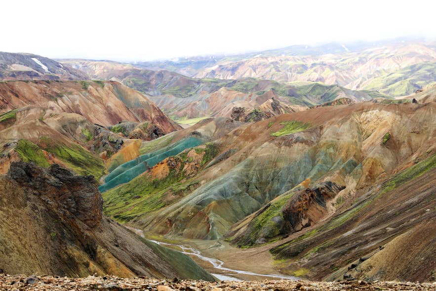
The Laugavegur Trail rewards travelers who plan ahead. Hut reservations, transport, and access to the Highlands are all limited during the short hiking season, so securing the essentials early makes for a smoother trip.
If you want to explore more of the country before or after the trek, combine it with top-rated Iceland self-drive tours or one of these Iceland summer packages. It also pays to book your flights and accommodations in Iceland early, since the hiking season overlaps with peak travel months.
