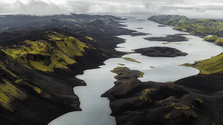
Langisjór between Tungnaárfjöll and Fögrufjöll. Photo: Wikimedia Commons, CC BY-SA 3.0
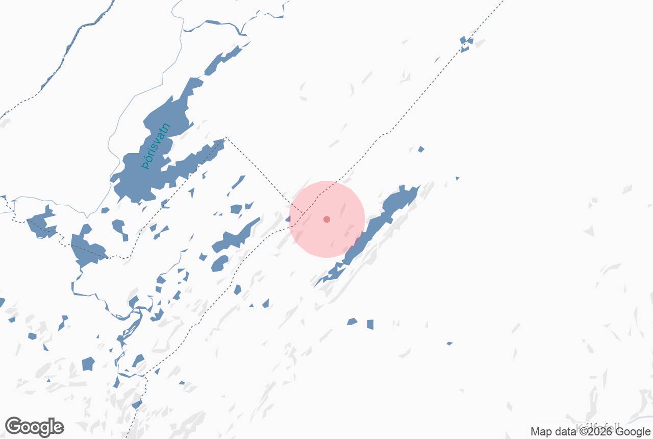
Tungnaárfjöll is a range of hyaloclastite mountains in the southern highlands of Iceland, rising to just under 1,000 metres (the highest surveyed spot height on the ridge is 997 m) on the north-western side of Langisjór, the long highland lake at the south-western edge of Vatnajökull.
The name means "mountains of Tungnaá", after the glacial river Tungnaá that flows out of Vatnajökull just to the north and separates these mountains from the Veiðivötn lake district.
Together with Fögrufjöll on the opposite shore, Tungnaárfjöll forms the frame that makes Langisjór one of the best-known lakes in the Icelandic interior. The range lies inside Vatnajökull National Park and is reached only by F-roads in summer.
Key Takeaways About Tungnaárfjöll
- Long hyaloclastite (móberg) ridge rising to almost 1,000 m north-west of Langisjór, between the lake and the Tungnaá river.
- Inside Vatnajökull National Park; Fögrufjöll is the matching ridge on the opposite shore.
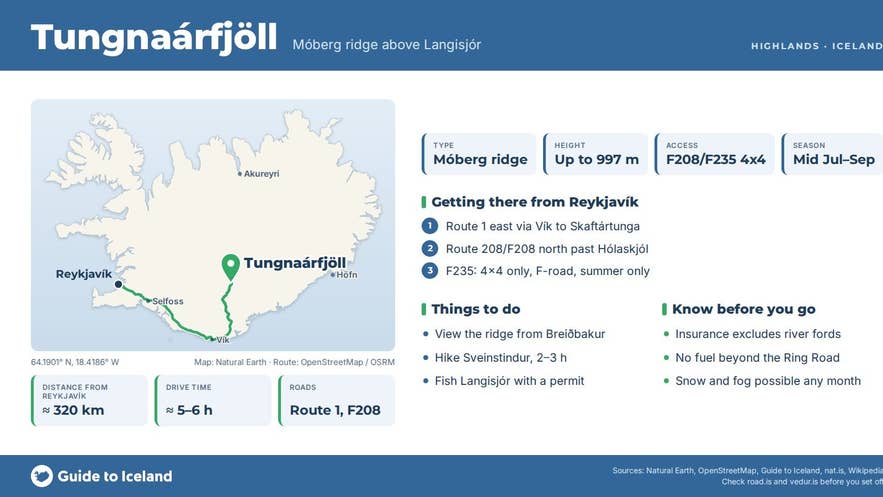
- Access only by 4x4 on F208 and F235 (about 25 km of track with fords), usually late June/July to September.
- Roughly 320 km from Reykjavík; the F235 track ends at the park campsite and ranger station below Sveinstindur.
- No marked trail onto the ridge; most visitors view it from the lake, the Breiðbakur track or Sveinstindur.
Why visit Tungnaárfjöll
The mountains around Langisjór are long, parallel ridges of hyaloclastite (móberg), the dark rock formed when fissure eruptions take place under thick ice-age glaciers. Tungnaárfjöll is a wall of black and grey rock, streaked green with moss, dropping into a lake 20 kilometres long, up to 2 kilometres wide and 75 metres deep at 670 metres above sea level.
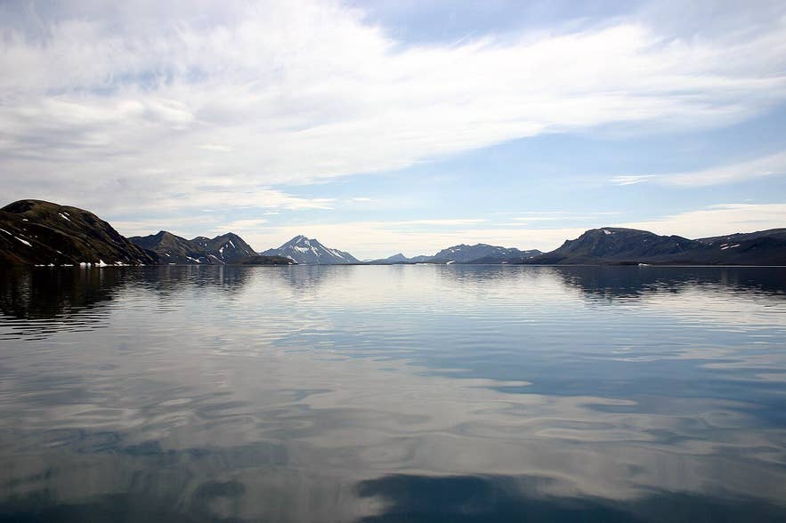
Langisjór with Tungnaárfjöll reflected. Photo: Gumol, CC BY-SA 3.0
Shepherds from the lowlands were the first to see the lake, in the latter half of the 19th century, and the geologist Þorvaldur Thoroddsen gave it its name in 1889.
There is almost no vegetation on the surrounding sands and ridges, so on a still day the mountains reflect perfectly in water clear and cold enough to hold Arctic char and trout.
The views are the main reason to come. From the Breiðbakur track on the lake's western side you look across Langisjór to Fögrufjöll and south to Sveinstindur, the 1,089-metre pyramid at the lake's southern tip, with Vatnajökull filling the horizon to the east.
From the ridge itself, when the summit is clear, the Tungnaá valley opens to the north: Tungnaárjökull outlet glacier, the braided river, and the craters and lakes of Veiðivötn.
Anglers fish beneath the range: permits for Langisjór and nine smaller lakes in Fögrufjöll are sold at Hólaskjól highland centre.
How to get to Tungnaárfjöll
Tungnaárfjöll is in the highlands, roughly 320 kilometres from Reykjavík by road, and is accessible only to 4x4 vehicles with good ground clearance, from about late June or early July until September, depending on snow. There are unbridged rivers on every approach.
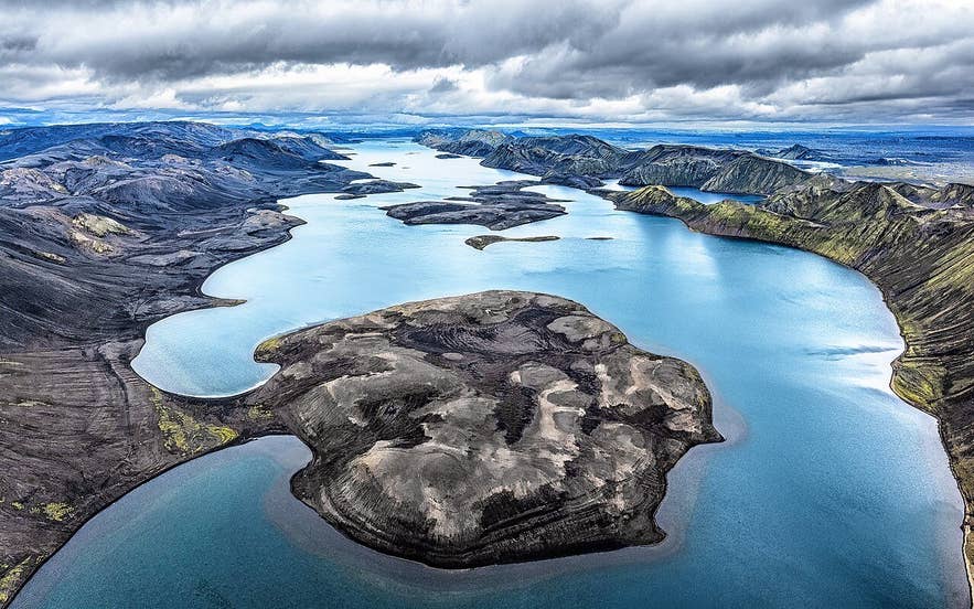
Langisjór among the Tungnaárfjöll ridges. Photo: Simaron, CC BY-SA 2.0
- From Reykjavík, drive the Ring Road (Route 1) east through Vík. In Skaftártunga, about 17 kilometres before Kirkjubæjarklaustur (roughly 250 km and 3.5 hours from the city), turn north onto Route 208, which becomes F208 (Fjallabaksleið nyrðri) towards Eldgjá. Past Hólaskjól, turn north onto F235 (Langisjórsleið). F235 is a track of about 25 kilometres across sand and ash with several fords; allow about an hour. It ends at the national park's camping area and ranger station at the southern end of Langisjór, below Sveinstindur.
- From Landmannalaugar, follow F208 east over Fjallabak to the F235 junction; longer, with more rivers.
- From the F235 end, the rough Breiðbakur 4x4 track runs north along the western side of the lake with the Tungnaárfjöll ridge to its west; rangers can advise on conditions.
- Hólaskjól highland centre on F208 has accommodation, a camp site and fishing permits, but no fuel.
There is no road onto the mountains themselves and no marked trail; most visitors are content with the view of the range from the lake and from Sveinstindur.
Best time to visit
Mid-July to early September. F208 and F235 usually open in late June or early July and close with the first autumn snows in September or October; the Icelandic Road Administration (road.is) shows the current status. Fishing permits are sold for July and August.
August is the most reliable month for stable weather and lower rivers, though water can rise sharply after rain or on warm afternoons when glacier melt peaks.
Safety and practical tips
- A high-clearance 4x4 is mandatory on F-roads, and rental insurance does not cover river crossings. Walk fords first if in doubt and never cross alone if the water is above knee height.
- Fill up in Vík or Kirkjubæjarklaustur; there is no fuel on F208 or F235.
- Snow is possible in any month, and fog can hide the whole range for days. Mobile reception is patchy; leave a travel plan at safetravel.is.
- The only facilities are the national park camping area and ranger station at the south end of Langisjór and the Sveinstindur hut nearby.
- Stay on marked tracks; off-road driving is illegal, and the moss on the ridges takes decades to recover.
- Fishing requires a permit (about 5,000 ISK per 24 hours according to the permit listing, children 15 and under free; check the current price), sold at Hólaskjól.
Nearby attractions
- Breiðbakur - 1.5 km, the ridge and 4x4 track between Tungnaárfjöll and the lake, with the classic Langisjór viewpoint.
- Langisjór campsite - 8 km, the national park camping area and ranger station at the south end of the lake.
- Sveinstindur - 10 km, the 1,089 m peak at the southern tip of Langisjór, a steep two-to-three-hour hike with the best view of the whole lake.
- Fögrufjöll - 9 km, the ridge on the opposite, eastern shore, through which the lake drains to Skaftá at Útfall.
- Langisjór Lake - 10 km to the lake's centre, a 20 km long highland lake.
- Veiðivötn - 15 km across the Tungnaá, the crater-lake fishing district north of the river.
- Eldgjá - 27 km, the great eruptive fissure and Ófærufoss waterfall on F208.
Tours that visit Tungnaárfjöll
- Fishing License in Lake Langisjor - a 24-hour permit for Arctic char and trout fishing in Langisjór and nine smaller lakes in Fögrufjöll, beneath the Tungnaárfjöll and Fögrufjöll ridges; collected at Hólaskjól highland centre, valid July and August.
