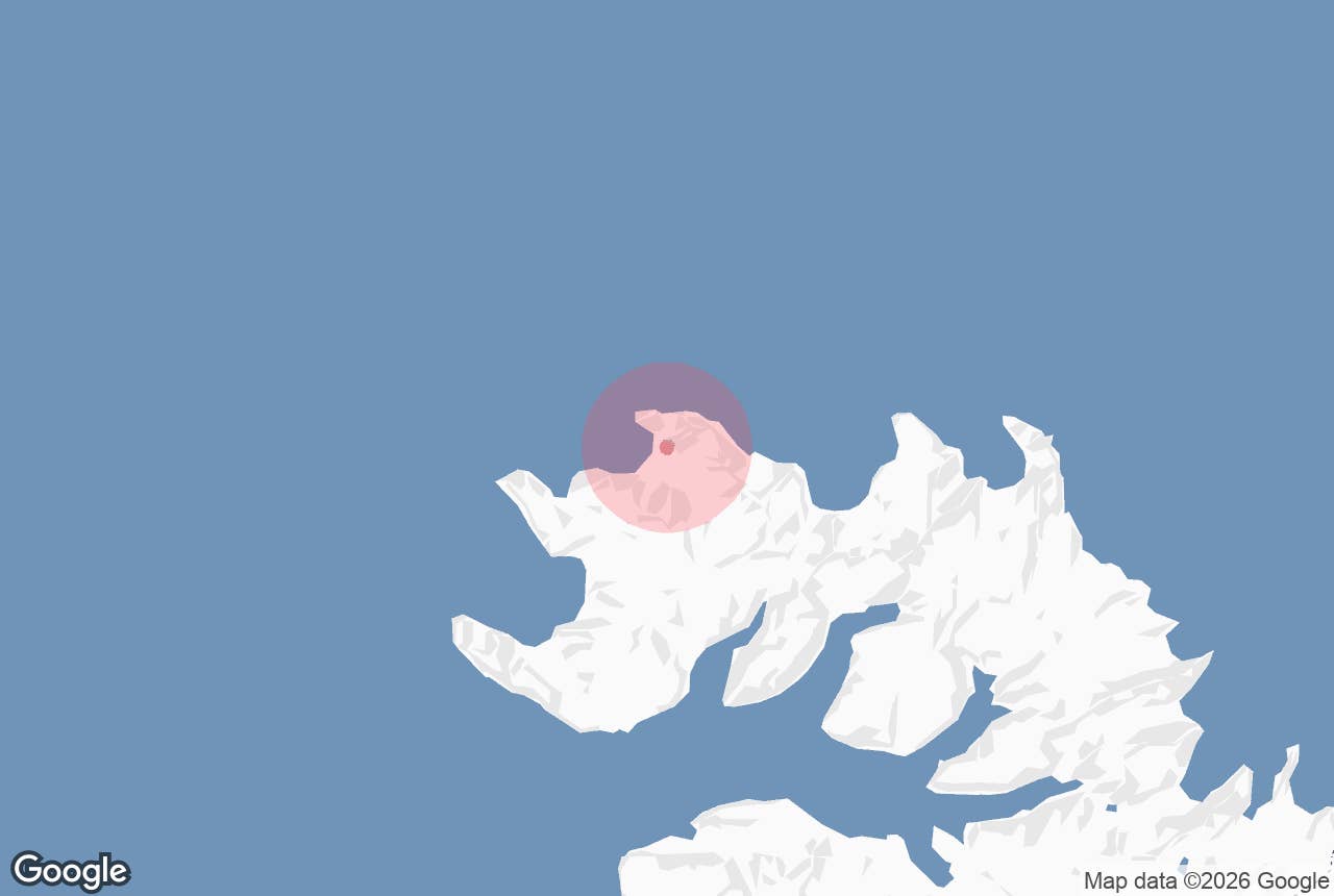
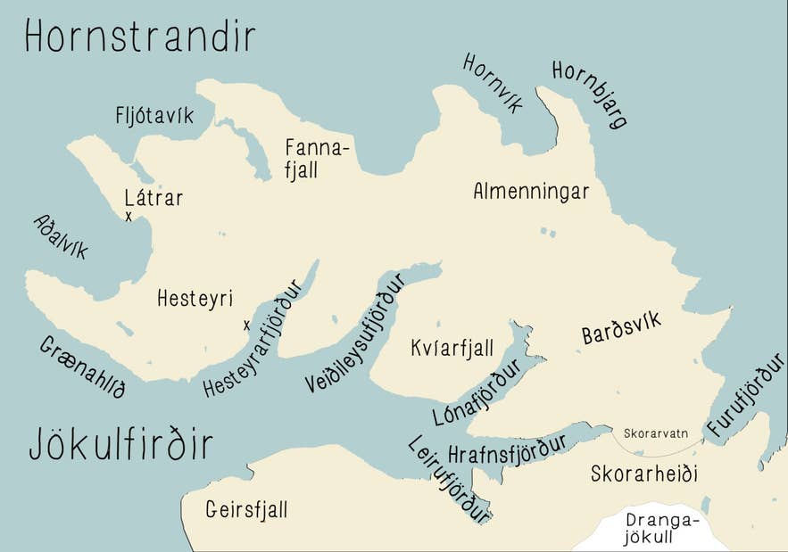
Map of Hornstrandir showing Fljótavík. Photo: Salvör Gissurardóttir, CC BY-SA 3.0
Atlastaðir is an abandoned farm and a designated campsite on the eastern side of Fljótavík, a wide bay on the north-west coast of the Hornstrandir Nature Reserve in the Westfjords.
The farm stood on flat ground a few hundred metres from the sea, between the shallow lake Fljótavatn (also written Fljótsvatn) and the sand bar that separates the lake from the ocean, under the steep, almost bare headland of Kögur; the campsite and emergency shelter are about a kilometre north-west of the old farm, near the outlet of the lake.
There are no roads; you arrive on foot over the mountains or by boat from Ísafjörður.
The Icelandic name means Atli's farm: according to the Book of Settlements, Atli, a slave of the chieftain Geirmundur heljarskinn, ran the farm here, took in the shipwrecked Vébjörn Sygnakappi and his party for a winter, and was rewarded with his freedom and the farm.
Key Takeaways About Atlastaðir í Fljótavík
- Abandoned farm, summer-house cluster and designated campsite on the east side of Fljótavík, Hornstrandir Nature Reserve
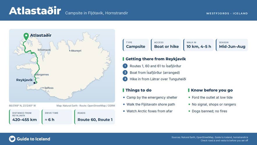
- No roads: walk in from Látrar in Aðalvík (about 10 km, 4–5 h over Tunguheiði) or from Kjaransvík, the bay next to Hlöðuvík (about 15 km, 7–8 h), or land by boat by arrangement
- Fljótavatn, the largest of the few lakes in Hornstrandir, has a marked ford at its outlet that can be calf- to groin-deep; cross at low tide or walk round the eastern shore
- Season mid-June to end of August; camp only at Atlastaðir (by the emergency shelter) or Glúmsstaðir
- Private land with summer houses; Arctic foxes protected, dogs banned, no fires
Why visit Atlastaðir
Fljótavík was once the settlement of Fljót, with three farms: Atlastaðir, Glúmsstaðir and Tunga. Like the rest of Hornstrandir it emptied in the mid-twentieth century; the last permanent resident of the peninsula left in 1952 and the reserve was protected in 1975.
Descendants of the farming families still own the land and have built a cluster of summer houses in the bay, so in July you may meet people here, which is rare in Hornstrandir.
The farm is also where, in the Book of Settlements, the shipwrecked Vébjörn Sygnakappi and his siblings spent a winter with Atli after losing their ship at Sygnakleif.
The setting is the attraction of Atlastaðir. Fljótavatn is the largest of the few lakes in Hornstrandir, a long, shallow lake barely above sea level whose outlet, Atlastaðaós, runs across the sand to the sea and rises and falls with the tide.
Several rivers and streams, including Bæjará, Svíná and Hvanná, feed it, and it holds sea-run trout and char; fishing is managed by a local angling association, so ask the landowners about permits. The floodplain around the lake is a fine sight from the passes above.
Kögur, the 590 m headland east of the bay, is an internationally important seabird colony with roughly 27,000 fulmar pairs, and Hornstrandir is one of the most important Arctic fox habitats in Europe; the foxes are protected here and unusually easy to see.
Driftwood piles up on the beach, and in early summer the lowland is thick with wildflowers.
Atlastaðir farm is a natural staging post on the long north-coast route between Aðalvík and Hlöðuvík, and a base for a tough day hike up the 590 m headland of Kögur, with the Krossadalur valley as a possible extension.
How to get to Atlastaðir
Hornstrandir has no road access.
The nearest town is Ísafjörður, roughly 50 km by sea to the south, from where scheduled boats run to the reserve in summer (roughly June to early September; check the operators); the harbour in Ísafjörður is about 420–455 km from Reykjavík by Route 1 and Route 60 or Route 61, roughly a six-hour drive, or a 40-minute flight.
Boat operators will land passengers in Fljótavík by arrangement, but there is no harbour, only a small landing for flat-bottomed boats, and landings depend on the sea; most hikers instead walk in from Látrar in Aðalvík or from Hlöðuvík.
From Látrar the route crosses Tunguheiði (480 m) and descends steeply into Tungudalur to the lake, about 10 km and 4 to 5 hours; the marked ford at the lake, opposite Langanes, can be anything from calf- to groin-deep, so time it for low tide.
From Kjaransvík (the bay next to Hlöðuvík) the route goes over Þorleifsskarð (360 m) and Almenningaskarð (430 m) across the stony Almenningar plateau, about 15 km and 7–8 hours, with boulder fields, only partly marked, and a reputation for being easy to lose in fog.
A path along the eastern shore of Fljótavatn lets you reach the farm without wading the outlet, at the cost of a long detour. Camping is allowed only at the designated sites; at Fljótavík these are the Atlastaðir campsite, beside the emergency shelter, and Glúmsstaðir on the far side of the lake.
Best time to visit
The hiking season is short: mid-June to the end of August, with boats running roughly from June to early September.
Snow often lies in the passes until late June, and anyone travelling between 1 March and 15 June, or between 1 September and 1 November, must register a travel plan with the Nature Conservation Agency (Náttúruverndarstofnun, formerly the Environment Agency).
July has the most reliable weather, the flowers and the summer-house families; late August is quieter. Outside the season there is no transport and no one in the bay.
Safety and practical tips
- This is a wilderness area with no shops, no rangers' station in Fljótavík and no mobile signal in much of the reserve. Carry all food, a storm-proof tent and a map and compass or GPS.
- Weather can turn to gale and sleet in any month; tents have been destroyed in August storms. Always have a bail-out plan.
- Camp only at the designated sites, take all rubbish out, do not light fires and do not move driftwood. Keep at least 40 m from fox dens, do not linger near them and do not feed the foxes.
- Dogs are not allowed in the reserve (only landowners may bring theirs, on a lead), bicycles are banned, and drones may not be flown without a permit from the Nature Conservation Agency.
- The land and houses are private; respect the summer houses and stay on paths through the home field.
- Get information at the Hornstrandir visitor centre (Hornstrandastofa, Silfurgata 1, Ísafjörður), register your trip with the agency when required and check safetravel.is.
Nearby attractions
- Fljót (Fljótavík) – the settlement name for the whole bay, about 1.6 km
- Fljótavatn – the lake, about 3 km to its page pin
- Almenningar – the plateau crossed on the way to Hlöðuvík, about 4 km
- Straumnesfjall – the mountain with the abandoned radar station west of the bay, about 9 km
- Aðalvík – the bay where the walk in from Látrar begins, about 12 km
- Læknishúsið, Hesteyri – the doctor's house café at Hesteyri, about 13 km
- Skálakambur – the ridge above Hlöðuvík on the trail east, about 13 km
- Hornstrandir – the nature reserve as a whole
Tours that visit Atlastaðir
- 6 Day Hiking Tour in Hornstrandir | Camping in the Remote Westfjords – a guided camping trek from Ísafjörður; on day two the group walks from Aðalvík over the pass, fords the Atlastaðaós at low tide and camps at Atlastaðir before continuing along Fljótavatn to Hlöðuvík.
