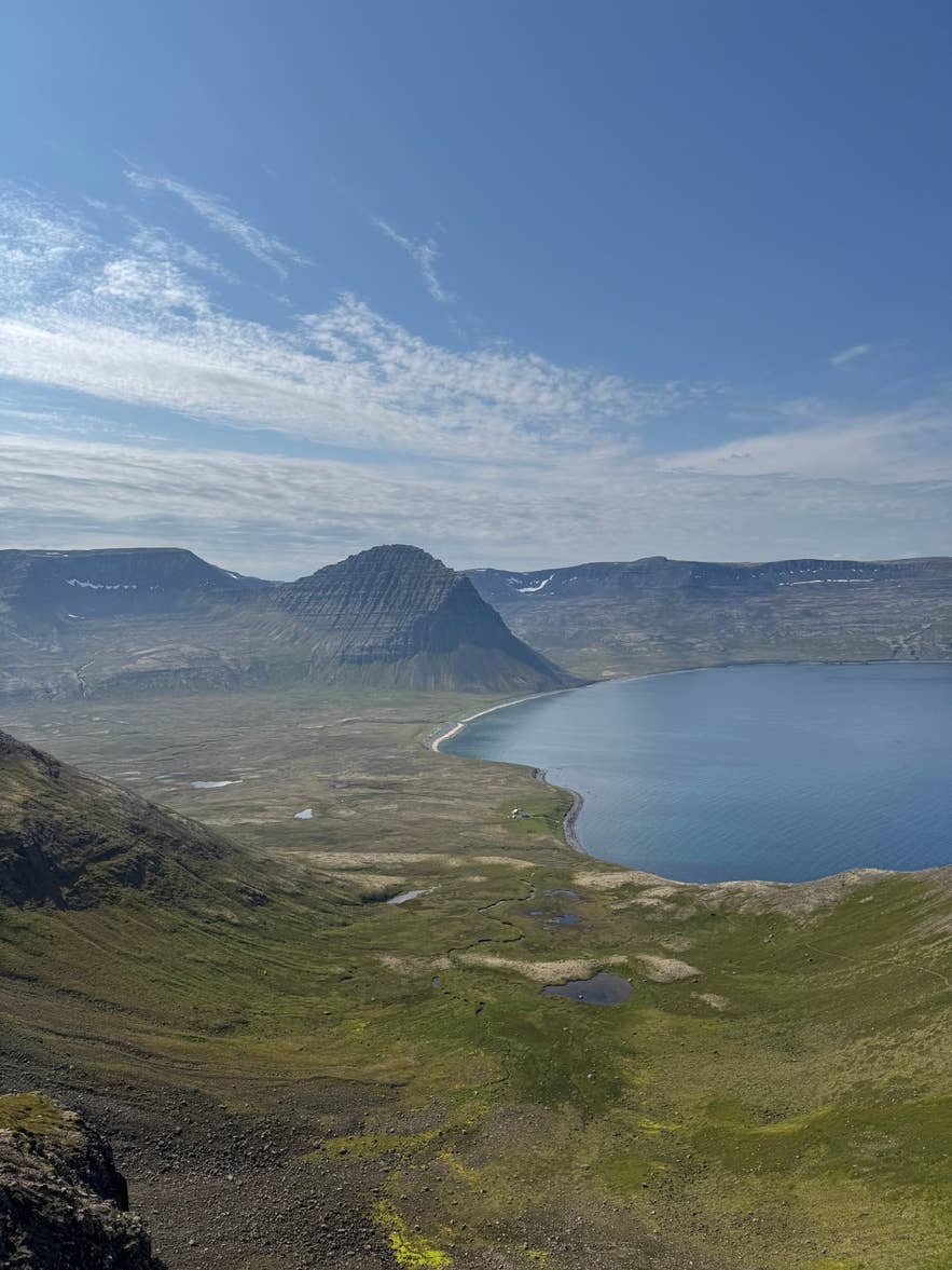
Hlöðuvík from Skálakambur. Photo: Elinarbur, CC BY-SA 4.0
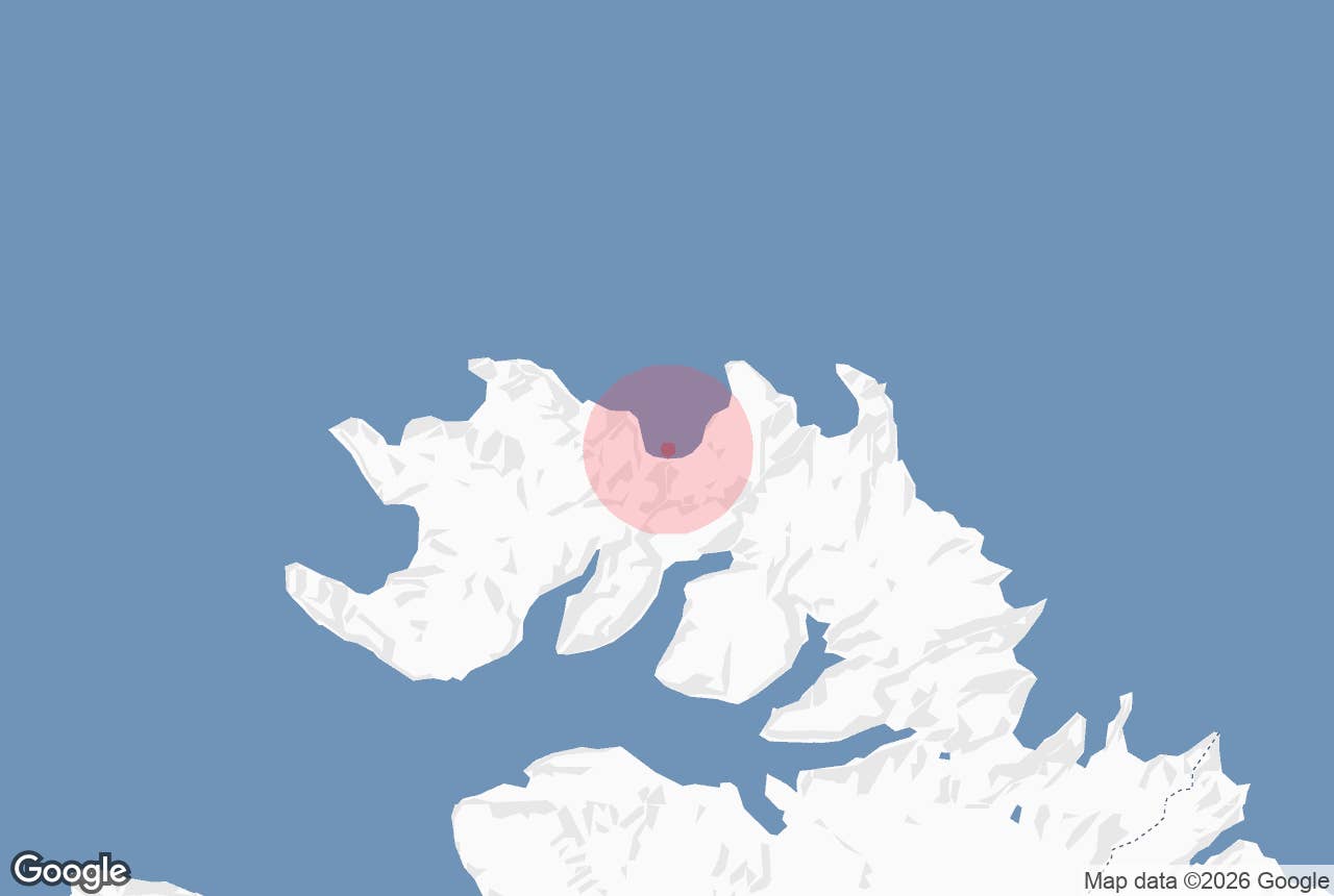
Hloduvik (Hlöðuvík) is a wide, north-facing bay on the outer coast of the Hornstrandir Nature Reserve in the Westfjords, between Fljótavík to the west and Hælavík to the east, with the smaller Kjaransvík tucked in behind the mountain Álfsfell on its western side.
There are no roads anywhere near it: you arrive on foot over a mountain pass or by small boat, and you leave the same way. A black sand beach, the river Hlöðuvíkurós, two abandoned farm sites, two privately owned summer houses and an emergency shelter are all there is.
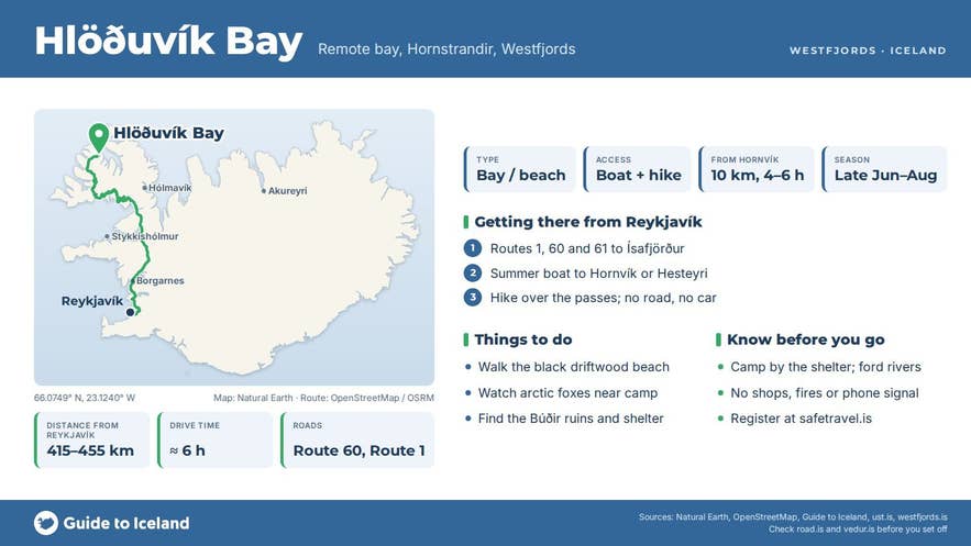
Key Takeaways About Hlöðuvík
- No road: reach Hlöðuvík on foot from Hornvík, Aðalvík/Hesteyri or Veiðileysufjörður, or by boat (Strandferðir from Norðurfjörður; some Ísafjörður operators on request)
- Hornvík–Hlöðuvík is about 10 km over Atlaskarð (327 m) and Skálakambur (350 m); 4–6 hours, graded challenging
- Farmed on and off since the Middle Ages; the last residents left in 1943
- Camping only at the designated site by the emergency shelter at the river mouth; the shelter is for emergencies
- Season late June to late August (rangers in the reserve 7 June–late August); arctic foxes are common and protected
Why visit Hloduvik
Hlöðuvík bay is one of the quietest overnight stops on the classic Hornstrandir traverse, and for many hikers the place where the reserve feels most remote. The bay faces north into the open ocean, and the beach collects driftwood carried across the Arctic.
Behind the beach is flat, green grassland that the Sléttuhreppur local-history wiki calls the best-placed grassland of any farm on this coast.
On either side the mountains come straight down to the sea: Álfsfell to the west, under which the original Hlöðuvík farm stood, west of the river mouth, and Skálakambur to the east, a 350 m ridge that the same wiki calls one of the most difficult mountain routes in the old Sléttuhreppur district.
The late-19th-century farm Búðir sits under Skálakambur, and the shipwreck shelter built by the Icelandic search and rescue association stands near the river mouth at the back of the bay, with the designated campsite beside it.
Hornstrandir has been a nature reserve since 1975 and covers about 580 km². The last farmers left the area in the 1950s, and the arctic fox, which is protected inside the reserve, has lost its fear of people; it is common to see one trotting along the beach at Hlöðuvík or investigating a campsite.
The bay also has a long written history.
Hlöðuvík is mentioned in Landnámabók and in the medieval tale of Geirmundur heljarskinn; a Norwegian ship captained by Ólafur af Steini was wrecked here in 1239, and church records from 1327 and 1383 set out who had the right to whales that drifted ashore.
The farm was abandoned and resettled several times in the 18th century; in 1920 sixteen people lived at Búðir, and the last residents left in 1943.
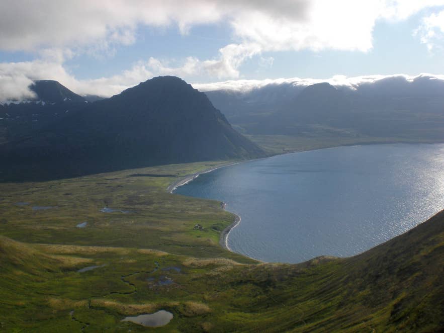
Hlöðuvík bay toward Álfsfell. Photo: Aronlh, CC BY-SA 3.0
How to get to Hloduvik
There is no road access to any part of Hornstrandir. The nearest town is Ísafjörður, about 415 to 455 km from Reykjavík depending on the route through the Westfjords (roughly six hours' drive) or a 45-minute flight.
From Ísafjörður, scheduled Hornstrandir boats run from June to late August to Hesteyri, Veiðileysufjörður, Hornvík and Aðalvík, and most hikers walk to Hlöðuvík from one of these landings:
- From Hornvík, over Atlaskarð pass (327 m) into Hælavík and then over the north side of the Skálakambur ridge (350 m) down past Búðir to the bay. The Westfjords tourism board grades this route as challenging, with unbridged river crossings, loose stone and strong gusts, and gives 4 to 6 hours for it; the Environment Agency lists it at 10 km.
- From Aðalvík or Hesteyri, via Fljótavík and the pass down into Kjaransvík and on to Hlöðuvík.
- From Veiðileysufjörður in Jökulfirðir, over Hlöðuvíkurskarð pass directly into the bay.
Strandferðir runs a boat from Norðurfjörður on the Strandir coast directly to Hlöðuvík in summer, and some Ísafjörður and Bolungarvík operators list Hlöðuvík as a drop-off on request. All boat landings in Hornstrandir depend on the weather and may be moved or cancelled.
There is nowhere to park a car and no F-road: the walk starts where the boat drops you. From the campsite it is a short walk to the beach.
Best time to visit
Late June to late August. Snow usually lingers on the passes until late June, and the scheduled boats stop running in late August or early September. July has the midnight sun and usually the most settled weather. Rangers are in the reserve from 7 June until late August.
Safety and practical tips
- Camping is allowed only at designated sites; at Hlöðuvík the campsite is by the emergency shelter at the river mouth (Hlöðuvíkurós), and the bay's rivers have to be forded. Bring neoprene socks or sandals for crossings.
- The emergency shelter is for emergencies only. There is a basic toilet at the campsite but no shops, no rubbish collection and no mobile coverage you can rely on. Carry all food, fuel and a stove.
- Weather changes quickly on the north coast. Fog can close in on Skálakambur and Atlaskarð, and gusts on the ridges can knock a person over. Carry a map, compass or GPS and warm, windproof layers even in July.
- Do not feed or approach foxes, and keep food sealed at night.
- There are no fees to enter the reserve, but the boat fares are significant (Strandferðir's Norðurfjörður to Hlöðuvík sailing is listed at ISK 20,500 one way). Book boats before you travel.
- Tell someone your route and register your trip at safetravel.is.
Nearby attractions
- Skálakambur – the steep 350 m ridge east of the bay, about 3 km.
- Hælavíkurbjarg – seabird cliffs east of Hælavík, about 7 km.
- Fljótavatn – lake in Fljótavík on the route from Aðalvík, about 8 km.
- Hornvík – the main camping bay below Hornbjarg, about 9 km.
- Hesteyri Whaling Factory – ruins of the Norwegian whaling station at Hesteyri, about 11 km.
- Hornbjarg – the great bird cliff at the tip of Hornstrandir, about 12 km.
Tours that visit Hloduvik
- 6 Day Hiking Tour in Hornstrandir | Camping in the Remote Westfjords – a guided camping traverse from Hesteyri via Aðalvík and Fljótavík; day 3 ends on the shore of Hlöðuvík with an optional evening walk to Hælavík beach, and day 4 climbs Skálakambur and Atlaskarð to Hornvík.
