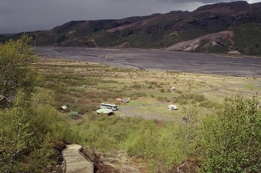
Krossá's gravel bed in Þórsmörk. Photo: Reykholt, CC BY-SA 3.0
Krossá river is the glacial river that runs through the heart of Þórsmörk in South Iceland, separating the wooded ridges of Þórsmörk proper on its north bank from Goðaland and the Básar huts on its south bank. The name combines *kross* (a cross) and *á* (a river).
It is fed by meltwater from Krossárjökull, an outlet glacier on the north-western side of Mýrdalsjökull, and by side streams such as Hvanná from Eyjafjallajökull, and it joins Markarfljót below Valahnúkur just west of Þórsmörk after a course of roughly 12 kilometres.
Krossá is the last and most dangerous of the fords on the F249 road, and the reason almost everyone arrives in Þórsmörk by highland bus or super jeep rather than in their own car.
Key Takeaways About Krossá
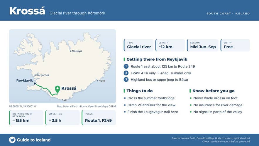
- Glacial river through Þórsmörk, about 12 km long, fed from Krossárjökull on Mýrdalsjökull, with side streams from Eyjafjallajökull, joining Markarfljót west of the valley
- The last and most dangerous ford on F249; only highland buses and modified super jeeps should cross
- A movable footbridge links Básar (south bank) with Langidalur (north bank) in summer; never wade
- About 125 km / 1 h 45 min from Reykjavík to the Route 249 turn-off, then 1.5–2 hours on the F-road
- Season mid-June to early September; winter only on super jeep tours
Why visit Krossá
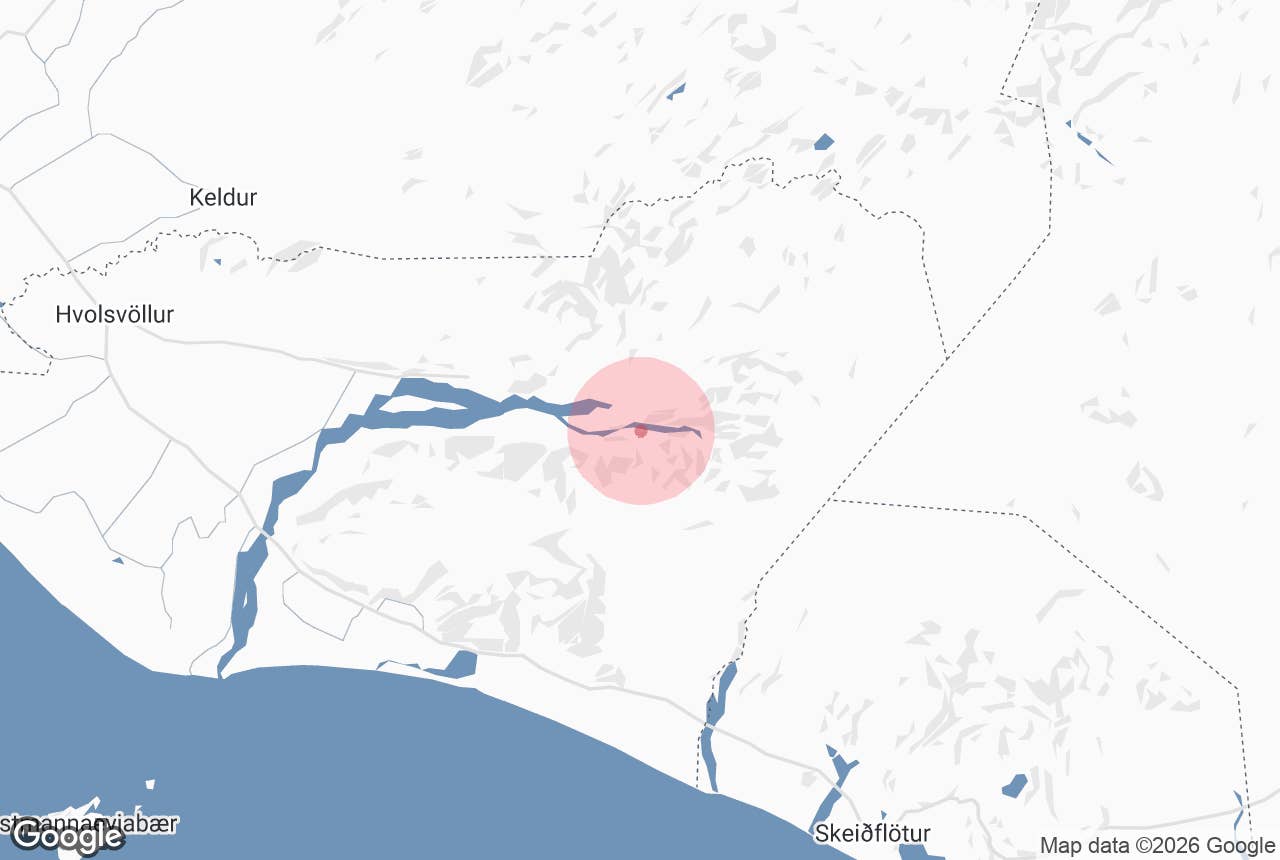
Krossá is a textbook braided glacial river. Its bed is a wide plain of black gravel between the mountains, and the water splits into many channels that shift from day to day as sediment is dumped and re-cut. The river is notorious for sudden changes in water level: it can rise within hours in warm weather or heavy rain.
The setting is what draws visitors.
From the gravel flats you look up at the ice cap of Eyjafjallajökull to the south and the outlet glaciers of Mýrdalsjökull to the east, while birch woodland climbs the slopes of Þórsmörk and Goðaland on either side.
The short climbs to Valahnúkur and Réttarfell, both beside the river, give the classic views over the braided channels running down to Markarfljót.
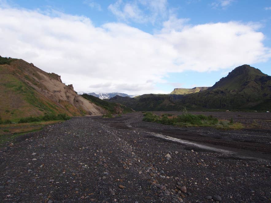
Braided channels of Krossá. Photo: rheins, CC BY 3.0
The Laugavegur trail ends on the north bank at Langidalur and the Fimmvörðuháls trail from Skógar ends on the south bank at Básar; the two are connected only by a movable footbridge over the river.
How to get to Krossá
Krossá river is at the end of the F249 Þórsmerkurvegur mountain road, about 30 kilometres from the Ring Road at Seljalandsfoss.
From Reykjavík it is roughly 125 kilometres (78 miles) to the start of Route 249, around 1 hour 45 minutes of driving, then 1.5 to 2 hours more on the F-road. Hvolsvöllur, about 23 kilometres west of the turn-off by road, is the last town for fuel and shopping.
F249 has several unbridged fords before Krossá, including Steinsholtsá and Hvanná, and these alone are too deep for ordinary cars. Krossá itself is described by F-road guides as arguably one of the biggest unbridged crossings on any marked F-road.
Only modified super jeeps and the scheduled highland buses should attempt it; most rental agreements forbid driving into Krossá, and rental insurance does not cover river damage.
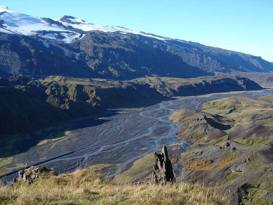
Eyjafjallajökull above the Krossá. Photo: borkur.net, CC BY 2.0
The practical options are:
- Take the summer highland bus from Reykjavík, Hvolsvöllur or the Brú base about 5 km up Route 249 from Seljalandsfoss to Básar, Langidalur or Húsadalur. The buses run daily from roughly mid-June to early September and are high-clearance vehicles built for the fords.
- Join a guided super jeep tour from Reykjavík or the South Coast, which includes the fords and usually time at Stakkholtsgjá and the viewpoints.
- Drive an F-road-approved 4x4 as far as Básar, which can be reached without crossing Krossá, park, and continue on foot over the footbridge to Langidalur or Húsadalur.
- Hike in on the Laugavegur or Fimmvörðuháls trails and leave by bus.
There is parking at Básar; the huts at Húsadalur, Langidalur and Básar have toilets.
Best time to visit
Mid-June to early September, when F249 is open and the footbridge is in place. July and August have the fullest river and the warmest weather. In early June and September the river is usually lower, but buses may run less often and the bridge can be removed. Winter visits are only possible on super jeep tours.
Safety and practical tips
- Never wade Krossá on foot. The current is strong, the water is just above freezing and the bed is uneven and invisible in the grey water. Use the footbridge, and if it has been moved or removed, ask hut wardens where the current crossing is.
- Do not drive into Krossá in a rental vehicle. Recovery and repair bills are large and are not covered by rental insurance.
- Þórsmörk is a protected area. Stay on marked paths, do not drive off the track onto the gravel flats, and camp only at Básar, Langidalur or Húsadalur.
- There is no mobile coverage in parts of the valley. Leave a travel plan on safetravel.is and check road.is for F249 before you set out.
Nearby attractions
- Þórsmörk – the valley Krossá flows through; the Langidalur hut is about 1 km from the river's main channels.
- Básar, Þórsmörk – 1 km, the huts and campsite on the south bank in Goðaland.
- Valahnúkur – 1.5 km, the short summit hike with the best view over the braided river.
- Réttarfell – under 1 km, a viewpoint hill above the Krossá flats.
- Stakkholtsgjá – 3 km, the narrow canyon walk on the F249 approach.
- Fimmvörðuháls – 5 km, the pass between the two ice caps whose trail ends at the river.
- Gígjökull – 7 km, outlet glacier of Eyjafjallajökull beside the F249.
Tours that visit Krossá
- Spectacular 3 Day Tour of the Icelandic Countryside with Thorsmork Hikes & the Golden Circle – includes hikes in Þórsmörk where you see Krossá cutting through the valley.
- Scenic 10 Hour Super Jeep Tour of Thorsmork with Waterfalls & Transfer from Reykjavik – crosses the F249 fords by super jeep into the valley where Krossá winds between the mountains.
- Luxury Full-Day Jeep Adventure to Thorsmork, Valley of Thor, From Reykjavik – a private jeep day that crosses the rivers into Þórsmörk, which sits between Krossá, Þröngá and Markarfljót.
