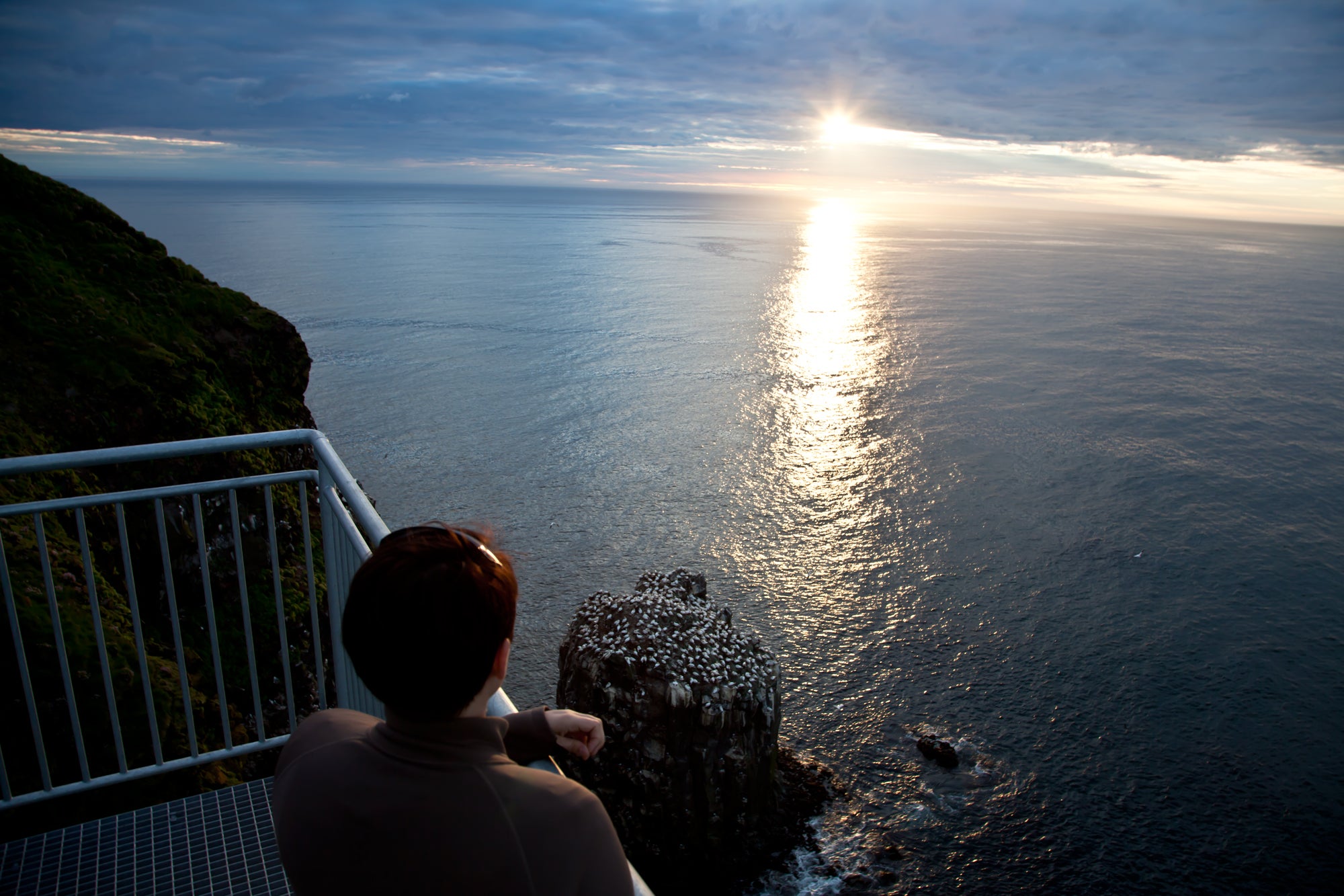
The viewing platform above Stóri Karl.
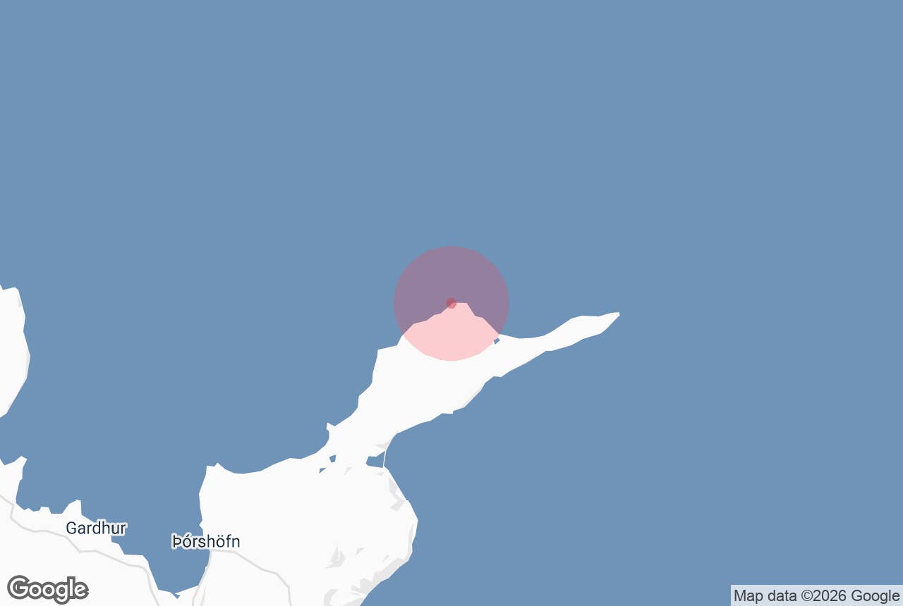
Stóri Karl (Icelandic: Stórikarl, "the big old man") is a sea stack off the Skoruvíkurbjarg cliffs on the north shore of the Langanes Peninsula in Northeast Iceland. It and the cliffs beside it hold Iceland's second-largest colony of northern gannets.
A viewing platform reaching out about 10 m from the cliff edge gives you a close look at the birds.
Key Takeaways About Stóri Karl
- Sea stack off the Skoruvíkurbjarg cliffs on the north shore of Langanes, Northeast Iceland
- Iceland's second-largest northern gannet colony, plus puffins, guillemots and razorbills
- Viewing platform (2014) reaching about 10 m out from the cliff edge
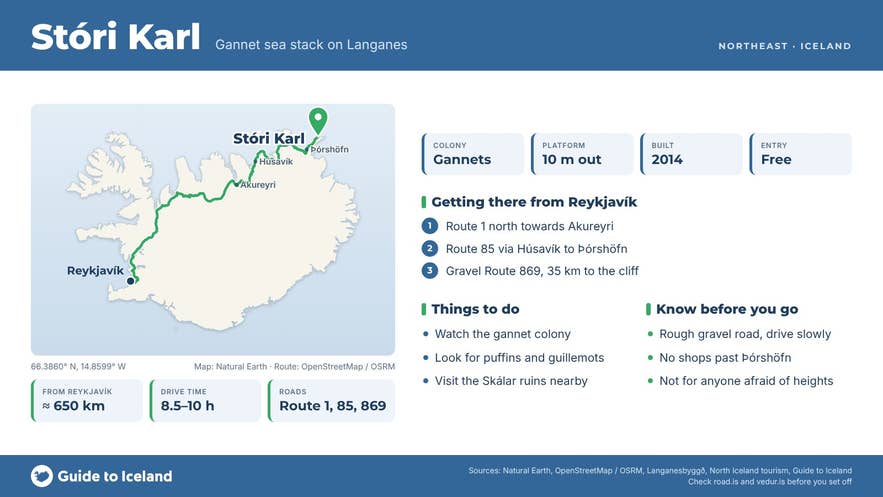
- About 35 km (45 to 50 minutes) from Þórshöfn on gravel Route 869; about 650 km from Reykjavík
- Best June to August; combine with the abandoned village of Skálar and Fontur
Why visit Stóri Karl
Stóri Karl (also written Stórikarl or Stóri-Karl) is a rock stack in the sea just off Skoruvíkurbjarg, a line of sea cliffs midway along the north shore of the Langanes Peninsula in Northeast Iceland. Its top is white with nesting northern gannets, and together with the cliffs it holds Iceland's second-largest gannet colony.
What makes it special is how close you get. A viewing platform, completed in 2014 and nicknamed Járnkarlinn ("the Iron Man"), sticks out about 10 m from the cliff edge, so you look straight across and down at the nesting birds.
The gannet is the largest seabird in the North Atlantic. Watch for birds folding their wings and plunging into the sea after fish; they dive from heights of up to 30 to 40 m. Gannets don't reach maturity until they're about five years old, and a pair usually lays a single egg.
Birds you can see
- Northern gannets on Stóri Karl and the neighbouring cliffs
- Puffins on the surrounding cliffs
- Common guillemots and razorbills on the cliff ledges
In May and June you may also see local egg collectors at work on the cliffs.
How to get to Stóri Karl
Stóri Karl is a long way from Reykjavík. The trip is about 650 km and takes roughly 8.5 to 10 hours of driving, so most people visit as part of a trip around Northeast Iceland rather than as a detour.
- From Reykjavík (about 650 km): take Route 1 north towards Akureyri, then Route 85 past Húsavík and along the coast to Þórshöfn, the nearest village.
- From Akureyri (about 270 km, 3.5 to 4.5 hours): the same route via Route 85.
- From Þórshöfn (about 35 km, roughly 45 to 50 minutes): follow Route 869, a gravel road that runs out along the north side of the peninsula, to the platform at Skoruvíkurbjarg.
Route 869 is narrow and rough in places, so drive slowly and watch your tyres and windscreen. Guide to Iceland recommends a 4x4 on Langanes, especially if you continue to the tip of the peninsula. There are no shops past Þórshöfn, so fill up with fuel and bring food and water. Check road conditions at umferdin.is before you set off.
Without a car of your own, you can join a short guided jeep tour from Ytra Lón, a farm and retreat on Langanes (see below).
When to visit
June to August is the best time. The days are long, the gravel roads are at their easiest and the seabird colonies are busy. Langanes is very remote in winter, when snow can make the roads hard going, and it's only for experienced drivers with a 4x4.
Safety tips
- The platform is very sturdy, but it hangs out over a high cliff. It's not for anyone who's afraid of heights.
- Stay on the platform and away from the cliff edges around it.
- Weather on the coast changes fast. Bring warm, waterproof layers and good shoes, even in summer.
- Bring binoculars and a camera with a zoom lens for the best views of the birds.
- Langanes is remote, so tell someone where you're going.
Where is Stóri Karl?
What birds can you see at Stóri Karl?
How far is Stóri Karl from Reykjavík?
Do I need a 4x4 to reach Stóri Karl?
When is the best time to visit Stóri Karl?
Is the viewing platform at Stóri Karl safe?
Nearby attractions
Combine Stóri Karl with Skálar, an abandoned fishing village about 8 km to the southeast that was deserted by 1946, and with the Fontur lighthouse cliffs at the tip of the peninsula.
- Langanes Peninsula – the peninsula Stóri Karl belongs to
- Fontur Peninsula – about 15 km
- Bakkafjordur – about 39 km
- Raufarhofn Village – about 49 km
- The Arctic Henge – about 50 km
For more on the region, see our guide to Northeast Iceland.
Tours that visit Stóri Karl
- Enjoyable 3.5-Hour Sightseeing and Bird Watching Tour in Langanes (starts at Ytra Lón; includes the viewing platform and Skálar)