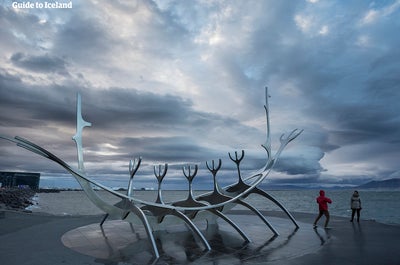
Limited availability
Reserve early to save money
Best price guaranteed
No booking fees
8 Day Photography Workshop | Summer in Iceland
Come along on a visually stimulating journey around Iceland with this 8-day nature photography workshop. Expose your camera to Iceland’s most breathtaking sights during amber nights of the midnight sun. This workshop is suitable for amateurs and professionals alike and promises to develop your landscape photography skills by leaps and bounds.
The unique character of the midnight sun in Iceland stretches what is usually a golden hour to many hours of the photo-friendly glow of summer. Under the supervision of two award-winning photographers, you will travel in comfort across the island to hone your skills and make the very best of the unique light and wondrous sights.
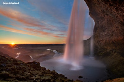
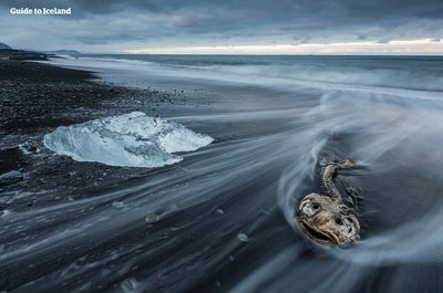
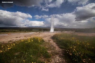
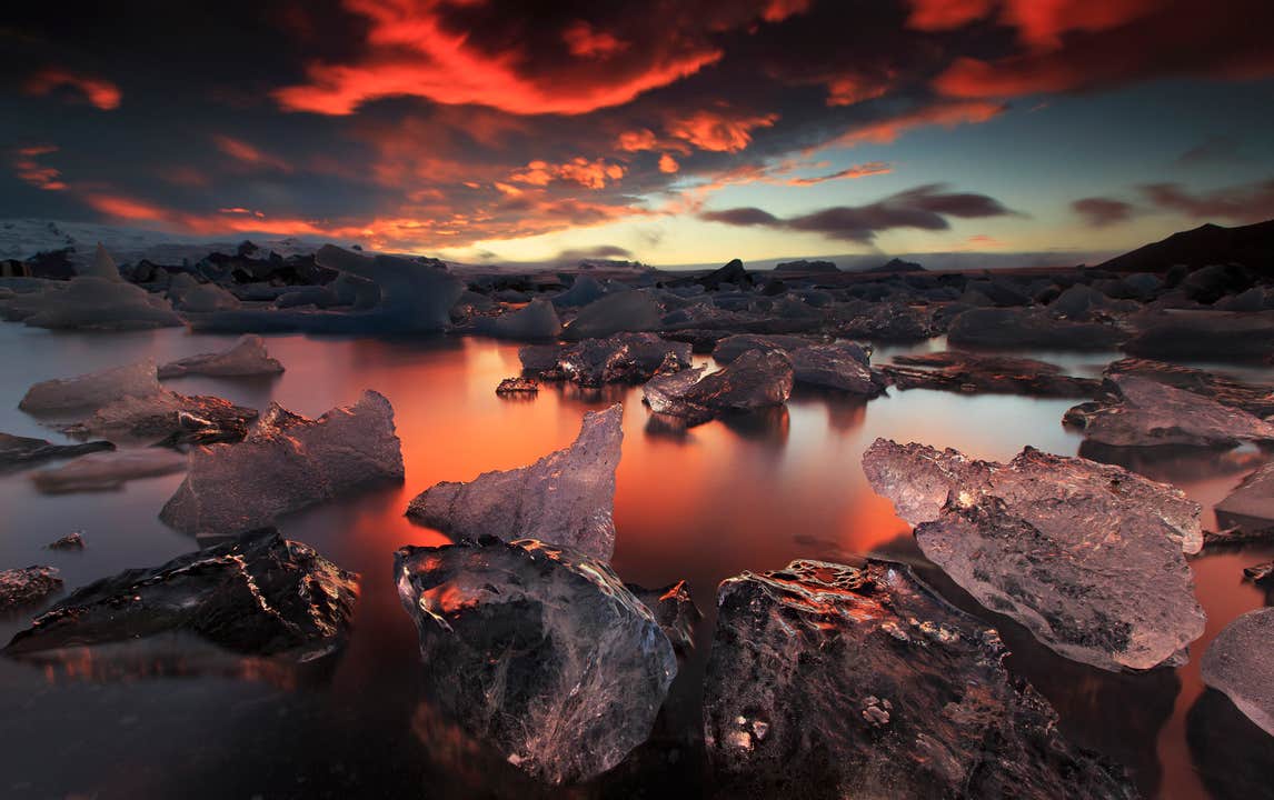
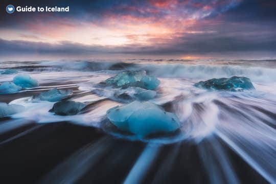
There will be no lack of inspiration as you travel east along the South Coast, exploring Vatnajökull National Park and ending with the Golden Circle. Subjects include the sublime glacial lagoon Jökulsárlón and the Diamond Beach, an array of spellbinding waterfalls, black sand deserts, geysers and much more.
Book now and explore Iceland in summer under the midnight sun. Check availability by choosing a date.
Quick facts
- Available: Jun. - Aug.
- Duration: 8 days
- Activities: Hiking, Sightseeing, Bird watching
- Difficulty: Easy
- Minimum age: 18 years.
- Languages: English
- Attractions: Golden Circle,
The Golden Circle is a 300 kilometre (186 mile) route to the three most popular natural attractions in Iceland: the Geysir Geothermal Area, Gullfoss Waterfall and Þingvellir National Park.
This sightseeing trail is easy to do within half a day from Reykjavík, either by self-drive or on one of many tours. Some of these tours have additional activities, such as snorkelling or snowmobiling, or are conducted in a unique style, such as by helicopter, or under the midnight sun.
Within the three locations of the Golden Circle are some of the clearest examples of Iceland’s fascinating geological forces, magnificent landscapes, and rich culture.
The Geysir Geothermal Area
The Geysir Geothermal Area is a hot-spring haven in Haukadalur Valley. As could be guessed, it is home to a famous geyser, the name of which has named all others: Geysir itself.
Though this feature is currently in a phase of inactivity, its neighbour Strokkur more than makes up for it. Every five to ten minutes, it blasts a column of boiling water to heights that can reach over 40 metres (131 feet).
The surrounding area is dotted with fumaroles, hot springs, and mud-pits. There are also two other smaller geysers, Smiður and Litlí-Strokkur, that can be easily visited, as well as a hotel, restaurant, cafe and gift shop across the road.
Gullfoss Waterfall
The 'Golden Waterfall', Gullfoss one of the most beautiful and powerful waterfalls in Iceland, plummeting 32 metres (105 feet) in two tiers into the river gorge of the popular rafting river Hvítá. It is just a ten-minute drive from Geysir and is the furthest point on the Golden Circle from Reykjavík.
Gullfoss was very almost lost in the early 20th century when British developers sought to harness its incredible power for geothermal energy. Though they got the lease to the land, allowing them to go ahead with their plans, they met an unlikely adversary: the daughter of the farmer who owned it, Sigríður Tómasdóttir.
This resilient woman refused to see the waterfall, to which she and her sisters paved the first path, destroyed. She, therefore, walked over 200 kilometres (124 miles) to Reykjavík and back multiple times to meet with a lawyer in order to help change the decision.
Though the process was arduous and took years, eventually Sigríður managed to exhaust the resources of the businessmen and they withdrew their plans. Because of her, all Icelandic waterfalls are now protected from foreign investors, and she is considered one of Iceland’s first environmentalists and most important historical people.
Thingvellir National Park
The largest attraction of the Golden Circle is Þingvellir National Park. The Icelandic parliament was founded here in 930 and remained until the year 1798 before moving to Reykjavík, making it the original site of what is now the world’s longest ongoing parliament.
Today it is a UNESCO World Heritage Site and one of the most important places to visit in Iceland. This is not just for its historical and cultural values, but for also its magnificent landscape and dramatic geology.
Þingvellir is surrounded by a beautiful mountain and volcanic ranges, as it is located in a rift valley directly between the North American and Eurasian tectonic plates. This makes it one of the few places in the world where you can walk between the continents, in the Mid-Atlantic Rift.
The daring and qualified even have opportunities to snorkel or scuba dive in this no-mans-land, in a ravine filled with crystal-clear spring water called Silfra. The visibility here can exceed 100 metres (328 feet), revealing incredible geological sites. Though it never freezes over due to the constant flow of water into it, it is 2°C (35°C) throughout the year, thus underwater explorers are always equipped with protective suits.
Other sites of note are the magnificent Almannagjá gorge, which you can walk down into to reach the rift valley from the North American tectonic plate, and the beautiful lake Þingvallavatn, the largest lake in Iceland, which gleams to the south of the National Park.
Surrounding sites
Due to its convenient location in south-west Iceland, it is easy to visit the Golden Circle alongside with many other sites. Those seeking relaxation could head to the Secret Lagoon in Flúðir or Fontana Spa in Laugarvatn, those seeking adventure could book a trip to the ice tunnels of Langjökull glacier, and those seeking culture could visit the Sólheimar ecovillage. For more natural beauty, you can visit the nearby Kerið crater lake.
There are many tours that include such bonuses, but if driving yourself, you should check out this guide to great detours off the Golden Circle.
Reykjavík,Reykjavík is the capital of Iceland and the northernmost capital of any sovereign state in the world.
Despite a small population (approximately 120,000, with just over 200,000 in the Greater Reykjavík area), it is a vibrant city that draws an ever increasing number of visitors every year. It is the financial, cultural and political centre of Iceland, and has a reputation of being one of the cleanest and safest cities in the world.
Geography
The city of Reykjavík is located in southwest Iceland by Faxaflói Bay. Throughout the ages, the landscape has been shaped by glaciers, earthquakes and volcanic eruptions and the area is geothermal; after all, its name translates to ‘Smoky Bay’.
Much of the current city area was subglacial during the Ice Age, with the glacier reaching as far as the Álftanes peninsula, while other areas lay under the sea. After the end of the Ice Age, the land rose as the glaciers drifted away, and it began to take on its present form.
The coastline of Reykjavík is set with peninsulas, coves, straits and islands, most notably the island of Viðey, and seabirds and whales frequent the shores. The mountain ring as seen from the shore is particularly beautiful.
Mount Esjan is the highest mountain in the vicinity of Reykjavík and the most distinctive feature of the coastline. This majestic summit is also highly popular amongst hikers and climbers. Other notable mountains that can be seen from the seaside are Akrafjall and Skarðsheiði.
On clear days, one may even see as far to the legendary Snæfellsjökull glacier, at the end of the Snæfellsnes peninsula.
The largest river to run through the city is Elliðaá in Elliðaárdalur valley, which is also one of Iceland’s best rivers for salmon fishing.
Transportation
There are no trains or trams in Iceland, but most people travel by car. The city also operates a bus system. There are two major harbours in town, the old harbour in the centre and Sundahöfn in the east.
The domestic Reykjavík Airport is located at Vatnsmýrin, not far from the city centre and close to the hill Öskjuhlíð and the restaurant, vantage point and exhibition centre Perlan. The international Keflavík Airport at Miðnesheiði heath then lies around 50 kilometres (31 miles) from the city.
Cars, jeeps and bicycles can be readily rented in the city and many organized tours are also being offered. It is, however, quite easy to walk between the major sites.
What to See & Do in Reykjavik
The local arts scene is strong in Iceland, with annual events and festivals, many of artists from which have hit the international stage.
Major events taking place in Reykjavík include Iceland Airwaves, Reykjavík Pride, RIFF (The Reykjavík International Film Festival), The Reykjavík Literature Festival, Culture Night, the Reykjavík Arts Festival, Food & Fun, the Reykjavík Fashion Festival and the Sónar music festival.
Amongst the famous people from Reykjavík are musicians like Björk Guðmundsdóttir and Sigur Rós, and writers Halldór Laxness (born on the main street, Laugavegur) and Arnaldur Indriðason.
Those eager to soak up the local culture should visit the city’s many museums, exhibitions and galleries, and check out live music at the cafés, bars, and concert venues dotted around. You could look at the programmes of what’s on at the Harpa music hall or the theatres, or else plan a few hours at the lighthouse at Grótta, the shopping street of Laugavegur, or the old harbour and the flea market.
You could even book a bird- and whale watching tour or a visit to Viðey island. There are a lot of things to do and the possibilities are endless.
Make sure to visit the public square of Austurvöllur, one of the city’s most popular gathering places, where you’ll also find the national parliament, the Alþingi, as well as the state church, a statue of independence hero Jón Sigurðsson, cafés, bars and restaurants.
Austurvöllur was central in the protests following the banking collapse of 2008, along with Lækjargata, home to the House of Government. You are also not likely to miss the great church of Hallgrímskirkja that towers over the city from the hill of Skólavörðuholt, from which you’ll get a great view of the city.
Try a walk by the city pond, Tjörnin, to greet the many birds that frequent the area and to visit the city hall, stationed by its banks. A beautiful park lies by the pond, ideal for a nice walk, and sometimes concerts get held there.
Further off is the campus of the University of Iceland, the Nordic house and the Vatnsmýrin wetland, a particularly pleasant place, but be mindful to not disturb the wildlife there by keeping to the pathways.
For a nice swim on a warm day, we particularly recommend Nauthólsvík beach, which is heated with geothermal water. Those who love a dip should also visit the Laugardalur valley, home to one of the city’s best swimming pools, which sits a short walk away from Ásmundarsafn gallery, a beautiful botanical garden and a domestic zoo.
A walk by the Ægissíða beach, with its old fishing sheds, in the west part of Reykjavík also holds a particular charm. From there, you can see all the way to president’s house at Bessastaðir, which is also a historical site in its own right, having been the educational centre of Iceland for centuries.
Another place that offers one of the city’s best views is Perlan, up on Öskjuhlíð hill. The hill itself is a popular place to spend a few hours, with over 176,000 trees and great opportunities for walking and cycling. Perlan also has and observation deck with great views, a café and an exhibition centre.
Furthermore, the city is a short drive from many of Iceland’s major attractions, most famously the Golden Circle and the Blue Lagoon. In close vicinity you’ll also find the Heiðmörk preservation area, a favourite local site of the people of Reykjavík, as well as the Blue Mountains, one of Iceland’s best skiing venues.
Finally, we’d like to stress that these are only some suggestions of the many things you might check out in Reykjavík. Whatever you choose to do, we hope you’ll be able to make the most of your visit and we wish you a pleasant stay in our capital.
Jökulsárlón,Jökulsárlón is Iceland’s most famous glacier lagoon. Conveniently located in the southeast by Route 1, about halfway between the Skaftafell Nature Reserve and Höfn, it is a popular stop for those travelling along the South Coast or around the Ring Road of the country.
Geography
As a glacier lagoon, Jökulsárlón is a lake that is filled with the meltwater from an outlet glacier. In this case, it is Breiðamerkurjökull, a tongue of Europe’s largest ice cap, Vatnajökull.
It stands out, however, due to the fact that it also fills with icebergs breaking from the glacier, some of which tower several stories high.
These icebergs, other than their scale, are notable for their colouration. Although they are, as expected, largely white, most are also dyed electric blue in part, with black streaks of ash from eruptions centuries past.
When the icebergs finally make it across the lagoon, they either drift out to sea or wash up on the nearby shore. Because of the way they glisten against the black sands of Breiðamerkursandur, this area has been nicknamed ‘the Diamond Beach’.
In spite of being a rather recent formation, Jökulsárlón is the deepest lake in the country, with depths of 248 metres (814 feet). With a surface area of 18 square kilometres (7 square miles), it is also growing to be one of the largest.
History
Jökulsárlón has not been around since Iceland’s settlement; it only formed around 1935. This was due to rapidly rising temperatures in the country from the turn of the twentieth century; since 1920, Breiðamerkurjökull has been shrinking at a dramatic rate, and the lagoon has begun to fill its space.
Today, the expansion of Jökulsárlón is accelerating. In 1975, it had less than half its current surface area.
In the relatively near future, it is expected that the lagoon will continue to grow until it becomes a large, deep fjord.
Though a dark omen for Iceland’s glaciers and ice caps in general, the retreat of Breiðamerkurjökull has resulted in an incredibly beautiful, if temporary, site. This has not been overlooked by Hollywood.
Jökulsárlón has been featured in the James Bond films A View to Kill in 1985 and Die Another Day in 2002, 2001’s Lara Croft: Tomb Raider, and 2005’s Batman Begins.
In 2017, Jökulsárlón was enveloped into the Vatnajökull National Park, thus it is now fully protected by Icelandic law.
Wildlife
Because of the wealth of herring and capelin that the tides bring into the lagoon, Jökulsárlón is somewhat of a hot-spot for Iceland’s wildlife.
In summer, it is a nesting site for Arctic Terns; stay well away from their nesting area, as these birds are notorious for the fierceness with which they protect their eggs, dive-bombing the heads of any they see as a threat. Skuas also nest on the lake’s shores in this season.
Seals can be reliably spotted here throughout the year, swimming amongst or else hauling out on the icebergs. Jökulsárlón provides them with a safe haven to rest and socialise, especially considering the waters of southeast Iceland are renowned for their population of orcas.
Vatnajökull,Vatnajökull glacier is the largest glacier in Europe, covering 8% of Iceland’s landmass.
It is the central feature of the Vatnajökull National park, found in the south west of Iceland, a popular spot for activities like glacier hiking from Skaftafell, boat tours in the Jökulsárlón glacier lagoon, and ice caving tours between November and March.
Facts about Vatnajokull
Vatnajökull has a surface area of approximately 8,100 square kilometres (3127 square miles); though it is rapidly shrinking due to climate change, its recession is not quite as advanced as at other glaciers, such as Langjökull and Mýrdalsjökull. In parts, it is a kilometre deep (over three thousand feet), and its average thickness is around half of that.
Vatnajökull also holds the tallest peak in Iceland beneath its ice; Hvannadalshnjúkur is 2,200 metres tall (7,218 feet). It also conceals some of the most active volcanoes in the country, the most notable being Grímsvötn, Öræfajökull and Bárðarbunga.
Volcanic activity in the region has occurred on and off throughout the centuries, and many geologists believe that several eruptions are overdue. If their calculations are correct, it would mean significant volcanic activity for Vatnajökull over the scope of the next half-century.
Depending on winds, this could result in worldwide consequences in terms of air-travel, agriculture and the general climate.
The glacier boasts over 30 outlet glaciers, which are channels of ice that flow out of ice caps but remain constrained on the sides of the valley. The major outlet glaciers of Vatnajökull include Dyngjujökull in the north, Breiðamerkurjökull, and Skeiðarárjökull to the south. To the west, one can find the outlet glaciers Síðujökull, Skaftárjökull and Tungnaárjökull.
Numerous rivers run out of Vatnajökull, making up some of the greatest glacial rivers in Iceland. The most notable are:
Tungnaá (west)
Köldukvísl (west)
Þjórsá (west)
Jökulsá á Fjöllum (north)
Skjálfandafljót (north)
Jökulsá á Brú (northeast)
Jökulsá í Fljótsdal (northeast)
Jökulsá í Lóni (south)
Hornafjarðarfljót (south)
Jökulsá á Breiðamerkursandi (south)
Skeiðará (south)
Núpsvötn (south)
Hverfisfljót (south)
Skaftá (south)
Vatnajokull National Park
Vatnajökull National Park was established in June 2008 and has slowly grown to include more and more areas. The park now covers an area of 14,141 square kilometres (5,460 square miles), 14% of the country. It is the second largest national park in Europe.
Rivers divide the highland plateau to the north of the park. The volcanic table mountain Herðubreið towers over this particular region, along with volcanoes Askja, Snæfell and Kverkfjöll.
The canyon Jökulsárgljúfur was carved out by glacial floods centuries ago. At the upper end of the canyon, you'll find Dettifoss, the most powerful waterfall in Europe. Further north, the horseshoe-shaped canyon Ásbyrgi is believed to have formed when Óðinn's eight-legged horse, Sleipnir, stepped his foot down from the heavens.
East around Snæfell, one can find wetlands and ranges, home to roaming herds of wild reindeer and abundant birdlife. Steep mountain ridges make up the south side of Vatnajökull, where outlet glaciers crawl onto the lowlands. The sandy plains of Skeiðarársandur also lie to the south, and the glacial river Skeiðará runs through this vast desert.
One of Iceland's most visited landmarks in the National Park is the Jökulsárlón glacier lagoon, which sits at the base of the outlet glacier Breiðamerkurjökull. Here, large icebergs that have broken off the glacier float across a vast lake before ending up in the Atlantic Ocean, or washed ashore on the nearby Diamond Beach.
This is one of the best seal-watching spots in the country.
The Future of Vatnajokull
The volume of Vatnajökull reached its peak around 1930 but has since been in a steady process of decline. Because of rising levels of global temperature, Vatnajökull has on average lost about a metre (three feet) of its thickness annually over the past 15 years.
If temperature levels continue to rise, the glacier could be all but gone nearing the end of the next century, leaving only small ice caps on top of the highest mountain summits.
Efforts are being made to prevent what some say is the inevitable, with reforestation projects going on all around the glacier, a proven method of cooling the area. Time will tell how successful they are.
Vatnajokull and Jokulsarlon in Popular Culture
The beauty of Vatnajökull National Park has not gone unnoticed by those in film or television. Many famous scenes have been shot here, starting with James Bond: A View to Kill in 1985. Other notable films with scenes here include Batman Begins, Lara Croft: Tomb Raider, and James Bond: Die Another Day.
Most famously, however, many places in Vatnajökull have been used in the HBO Series Game of Thrones, north of the Wall. The Wall itself is constructed with CGI using shots of the glacier.
Skógafoss,Skógafoss is one of Iceland’s biggest and most beautiful waterfalls with an astounding width of 25 meters (82 feet) and a drop of 60 meters (197 feet).
Due to the amount of spray the cascade produces, at least one rainbow is present any time the sun emerges from behind the clouds.
Located on the Skógá river, this mighty cascade is clearly visible from Route 1 and is an excellent place to stop and stretch the legs while travelling Iceland’s South Coast. The river below Skógafoss holds a large char and salmon population and is thus a favourite spot for fishermen in the summer.
The land underneath the waterfall is very flat, allowing visitors to walk right up to the wall of water. This will get you drenched, although, on a summer’s day, it can be quite tempting.
Skógafoss can also be viewed from the top as a steep staircase leads to an observational platform above the cascade. Many nesting seabirds can be found on the route up.
Geography
Skógafoss is located near the small village of Skógar, south of the Eyjafjallajökull glacier volcano. There you’ll find the Skógasafn folk museum, an open-air museum with both old wooden houses and turf houses, as well as a regional museum with various artefacts from this area.
A part of the Skógasafn Regional Museum is the Museum of Transportation, which showcases the history and evolution of transportation, communication and technologies in Iceland. There, you can see how this nation evolved from the age of the working horse to the digital communications of the 21st century.
The Skógasafn museum also includes a café and a museum shop, and in the village of Skógar, you will find both a hotel and a restaurant.
At the eastern side of Skógafoss, you will find one of Iceland’s most famed hiking routes; the Fimmvörðuháls pass. The 22 kilometre (14 miles) trail takes you along Skógá river, between two glaciers, Mýrdalsjökull and Eyjafjallajökull, before ending in the beautiful Þórsmörk valley.
Skógafoss is often visited alongside the waterfall Seljalandsfoss, which is just a little further along the South Coast. Both fall from cliffs of the same height, and while Skógafoss is much more powerful, Seljalandsfoss has a cave behind it, which means it can be fully encircled. It is also next to a much lesser known but still awe-inspiring waterfall, Gljúfrabúi.
Folklore
A gold ring is on display at the Skógasafn museum. According to legend, the ring is from a chest that was owned by Þrasi Þórólfsson, one of the first Viking settlers in the area, who by some accounts was a giant. Folklore states that before his death in 900 AD, Þrasi buried a chest filled with gold in a cave behind Skógafoss waterfall.
Many attempts were made to retrieve the chest after Þrasi’s death, and years later, locals managed to grasp a ring on the side of the chest. As they pulled, the ring broke off, and the treasure was lost forever. The ring was then given to the local church before it made its way to the museum.
Seljalandsfoss,Seljalandsfoss is a waterfall that can be fully encircled, situated on the South Coast of Iceland with a drop of 60 metres (200 feet).
Due to the waterfall’s close proximity to the Ring Road and impressive natural features, it is one the country's most famous and visited falls. Majestic and picturesque, it is one of the most photographed features in all of Iceland.
Geology and Surroundings
Seljalandsfoss waterfall, part of the river Seljalandsá, has its origins underneath the glacier Eyjafjallajökull. The volcano beneath this ice cap was the one that erupted in 2010 and caused havoc at airports across Europe.
The cascade of the falls is relatively narrow but falls from a tall cliff that once marked the country's coastline, the sea is now located across a stretch of lowlands and is visible from the site.
The most distinguishing feature of Seljalandsfoss is a pathway that stretches all the way around it. The cliffs behind the falls have a wide cavern, and rocks and paths allow guests to fully encircle it in summer.
Though a mesmerising opportunity, visitors should be prepared to get dampened due to the perpetual mist of the falls, which also tends to make the rocks of the pathway slippery.
Floodlights have been set up on both sides of the waterfall, which impressively illuminate the scene during the night when the midnight sun is not out. The lights were installed in 2001 due to the growing popularity of the falls as a tourist destination.
After visiting Seljalandsfoss, it is common for visitors to continue north to the waterfall Gljúfrabúi, which is found partially hidden behind a rock face. Because of Seljalandsfoss extreme popularity, Gljúfrabúi is widely considered the hidden gem of the scene, as it is too often overlooked.
Seljalandsfoss is also usually visited alongside the nearby Skógafoss. The waterfall falls from the same height, and while it cannot be encircled, it is much more powerful and steeped in the legend of a giant’s hidden treasure.
Visitor Centre Controversy
In 2017, it was announced that a visitor’s centre was to be constructed near the falls. The design of the building indicated that it would be seven metres (23 feet) high and 2,000 square metres (21,500 square feet) in size. Landowners in the area opposed to the idea, proclaiming that the centre would greatly alter the natural appearance of the waterfall’s renowned scenery.
The project has neither been fully approved nor wholly cancelled, with ideas surfacing of either significantly reducing the size of the construction, or moving the visitor centre’s location further away, for instance to the nearby farmstead Brekkuhorn.
Seljalandsfoss in Popular Culture
Along with a multitude of South Iceland’s most famous natural attractions, Seljalandsfoss can be seen in Justin Bieber’s music video for his song ‘I’ll Show You’. Please enjoy the video without emulating any antics that will endanger yourself or the environment.
The waterfall was also a featured waypoint during the first leg of the sixth season of The Amazing Race, an American reality TV series.
Geysir,Geysir is a famous hot spring in the geothermal area of Haukadalur Valley, found in south-west Iceland.
Making up just one of the attractions along the world-renowned Golden Circle sightseeing route, alongside Þingvellir National Park and the mighty Gullfoss waterfall, Geysir is most well-known for having lent its name to geysers all around the world.
Geography
Though Geysir itself is rarely active these days, Haukadalur Valley boasts a plethora of hot springs and geysers, including the powerful Strokkur, Smiður and Litli-Strokkur.
Strokkur is, arguably, the country’s most famous hot spring, shooting vast jets of boiling water from 20 metres (65 feet) up to 40 metres (130 feet) high. Don’t worry about missing this incredible spectacle of nature, as Strokkur erupts every five to ten minutes; just make sure to have your camera ready.
Geysir is much larger, but years can go by between eruptions here; it is currently in an inactive phase. When it does erupt, the water can shoot up in the air as high as 70 metres (230 feet).
Just a few minutes walk north of Geysir are a wealth of fumaroles emanating steam and gas into the cool Icelandic air. Aside from watching the hypnotic pillars of steam, you will also be able to observe the yellow sulphuric stains along the fumaroles themselves, a result of the earth’s minerals crystallising around the rock bed.
At the southern part of the valley, Þykkuhverir, you’ll find various bubbling mud pots. These spooky brown cauldrons are actually fumaroles that boil up through the loose ground; after a dry spell, these mud pools are likely to transform into a hardened fumarole.
Nearby Attractions
About two kilometres (one mile) from Geysir is a preserved natural pool called Kúalaug. It has room for three to five people at a time, but care should be taken, as the area around the pool is very delicate. The temperature is 39-43°C (102-109°F), depending on where you are positioned in the pool.
The water is slightly muddy, as the pool is built on soil, and the bottom is slippery due to algae, so caution is advised when relaxing here.
Haukadalur has also seen a rise in reforestation in recent times thanks to continued experiments and research in the area. Today, Haukadalsskógur is one of the largest forests in south Iceland, boasting accessible walking paths (also for wheelchair users), fascinating vegetation and The Tree Museum, built in the memory of forester Gunnar Freysteinsson.
History
Haukadalur has been inhabited and used as a church site since the Age of Settlement. Given its historic value, it should be noted that scholar, Ari “The Wise“ Þorgilsson, grew up here; it was also where the first pastoral school in Iceland was built.
The current wooden church was last rebuilt in 1938 but its architectural style dates back to 1842, making it well worth a visit to see how Iceland looked before industrialisation.
For accommodation, Hotel Gullfoss is approximately 7 kilometre from the Geysir area, and closer still is Hotel Geysir on the other side of the road from the attraction, where you will also find a restaurant, café and a souvenir shop.
Gullfoss,Gullfoss (translated to ‘Golden Falls’) is one of Iceland’s most iconic and beloved waterfalls, found in the Hvítá river canyon in south-west Iceland.
The water in Hvítá river travels from the glacier Langjökull, before cascading 32 meters (105 feet) down Gullfoss’ two stages in a dramatic display of nature’s raw power. This incredible site is seen by most visitors, as it is on the Golden Circle sightseeing route.
Because of the waterfall’s two stages, Gullfoss should actually be thought of as two separate features. The first, shorter cascade is 11 metres (36 feet), whilst the second drop is 21 metres (69 feet). The canyon walls on both sides of the waterfall reach heights of up to 70 metres (230 feet), descending into the great Gullfossgjúfur canyon. Geologists believe that this canyon was formed by glacial outbursts at the beginning of the last age.
In the summer, approximately 140 cubic metres (459 cubic feet) of water surges down the waterfall every second, whilst in winter that number drops to around 109 cubic metres (358 cubic feet). With such energy, visitors should not be surprised to find themselves drenched by the waterfall’s mighty spray.
As mentioned, Gullfoss makes up a part of the highly popular Golden Circle sightseeing route, alongside Geysir geothermal area and Þingvellir National Park. Many Golden Circle tours include additional activities that can be taken from Gullfoss, such as ascending the mighty nearby glacier Langjökull and entering its ice tunnels, or snowmobiling along its gleaming surface.
History
In the early days of the last century, Gullfoss was at the centre of much controversy regarding foreign investors and their desire to profit off Iceland’s nature. In the year 1907, an English businessman, Howell, sought to utilise the waterfall’s energy and harboured ambitions to use its energy to fuel a hydroelectric plant.
At the time, Gullfoss was owned by a farmer named Tómas Tómasson. Tómas declined Howell’s offer to purchase the land, stating famously “I will not sell my friend!” He would, however, go on to lease Howell the land without the knowledge of a loophole that would allow him to proceed with his plans.
It was Tómas’ daughter, Sigríður Tómasdóttir, who would lead the charge to stop Howell’s ambitions. Having grown up on her father’s sheep farm where she helped pave the first road to Gullfoss, she sought to get the contract nullified, hurriedly saving her own money to hire a lawyer.
The ensuing legal battle was an uphill struggle; the case continued for years, forcing Sigríður to travel many times by foot to Reykjavík, a distance of over 100 kilometres (62 miles). Circumstances became so difficult that Sigríður threatened to throw herself into the waterfall if any construction began.
Her tenacity, however, resulted in success. In 1929, Howell’s withdrew from the lease, unable to keep up with the costs and difficulties of his plan. The waterfall fell back into the hands of the Icelandic people.
Today, Sigríður is recognised for her perseverance in protecting Gullfoss and is often hailed as Iceland’s first environmentalist. As such, she is one of the most famous figures in Iceland’s history. Her contribution is forever marked in stone; a plaque detailing her plight sits at the top of Gullfoss.
Interestingly, the lawyer who assisted Sigríður, Sveinn Björnsson, went on to go down in history too; he became the first president of Iceland in 1944.
Restaurant / Cafe
Besides Gullfoss, visitors can enjoy the views from Gullfoss Cafe, a locally run delicatessen that serves a wide variety of refreshments and meals. The menu has options to tantalise everyone’s taste buds: hot soups, sandwiches, salads and cakes. There is also a shop on site where visitors’ can browse and purchase traditional Icelandic souvenirs.
Þingvellir,Þingvellir National Park is the only UNESCO World Heritage site on the Icelandic mainland and one of the three stops on the world famous Golden Circle sightseeing route, alongside the Haukadalur Geothermal Valley (Geysir) and Gullfoss Waterfall. Just to the south of the park is Þingvallavatn, Iceland’s largest natural lake.
Geography
The first thing that visitors to the National Park notice is its sheer aesthetic beauty; dried magma fields, covered in Icelandic moss, sit carved by glacial springs and surrounded by a bowl of ancient mountain peaks.
Two of the greatest attractions in the park are the exposed North American and Eurasian tectonic plates; it is one of the only regions in the world where you can see geology such as this on land.
Visitors are encouraged to walk along the North American tectonic plate, where they can read more about the area’s fascinating formation and history, before descending into the valley below.
History
Þingvellir can be anglicised to ‘Fields of Parliament’, a nod to the area’s fascinating history and relevance to Icelandic culture. It is here, after all, that the world’s first democratically elected parliament that remains functioning, Alþingi, was formed in 930 AD.
It may seem unlikely that Vikings would want to be under such an uncombative government, but the thirty or so clans that lived in Iceland at the time sought to prosper in their harsh new environment.
The first gathering was such a success that the meetings became annual, and it became a place where disputes were settled, criminals were tried, and laws to the benefit of all were laid down.
This saw the birth of the Icelandic Commonwealth, a time of independence and freedom for the Icelandic people before they became constituents of the Norwegian monarchy. Sessions would continue to be held at Þingvellir until 1798.
Though the parliament was removed by the Danish at this time, it returned 1845 to Reykjavík.
Another major reason as to why Þingvellir is considered so important to Icelanders is the fact that this is where the decision was made to abandon the belief of Paganism and the Norse Gods; the people adopted Christianity in 1000 AD under threat of invasion from Norway.
This turning point in history was left to the pagan lawspeaker, Þorgeir Þorkelsson, who rested on the choice for one day and one night before reappearing to share his decision.
To symbolise the country’s change, he threw idols of his old deities into the northern waterfall Goðafoss, the name of which translates to ‘Waterfall of the Gods’.
Silfra Fissure
Þingvellir is one of the most widely visited attractions in Iceland, in large part due to the fact that it is home to the glacial spring, Silfra fissure, one of the top ten sites in the world for snorkellers and scuba divers.
Silfra (meaning ‘Silver’) is a submerged ravine within the park, boasting visibility of up to 100 metres (328 feet) and a temperature just above freezing. Participants in these tours will be attired at the Silfra carpark in neoprene hoodies and gloves, as well as an undersuit and drysuit for thermal protection.
Strokkur,Strokkur is Iceland’s most visited active geyser. One of the three major attractions on the world-famous Golden Circle sightseeing route, it is usually visited alongside Gullfoss Waterfall and Þingvellir National Park.
Strokkur is found in the Geysir Geothermal Area, titled after the Great Geysir, which lent its name to all others across the world. It is the greatest active geyser on site; Geysir itself is in a period of inactivity. Strokkur erupts more regularly than Geysir ever did, blasting water to heights of around fifteen to twenty metres every five to ten minutes, although it is known to reach up to forty metres.
Strokkur and Haukadalur Valley
Strokkur is the primary feature of the Haukadalur valley and the main reason why it is one of the most visited sites in the country. While Geysir will very occasionally still erupt to enormous heights, it is nowhere near reliable enough to justify the area’s popularity.
Haukadalur valley, however, has many other features that make it worth a visit. The natural beauty of the area is shaped by the forces of the earth; fumaroles, hot-springs, mud-pits and other little geysers are littered around, and the ground itself is dyed vividly by elements such as sulfur (yellow), copper (green) and iron (red).
Opposite the main geothermal area in Haukadalur Valley is a restaurant, cafe, hotel and luxury gift shop.
Science behind Strokkur
Active geysers like Strokkur are rare around the world, due to the fact that many conditions must be met for them to form. They are thus only found in certain parts of highly geothermal areas.
The first condition that is necessary is an intense heat source; magma must be close enough to the surface of the earth for the rocks to be hot enough to boil water. Considering that Iceland is located on top of the rift valley between the North American and Eurasian tectonic plates, this condition is met throughout most of the county.
Secondly, you will need a source of flowing underground water. In the case of Strokkur, this comes from the second largest glacier in the country, Langjökull. Meltwater from the glacier sinks into the surrounding porous lava rock, and travels underground in all directions.
Evidence of this flowing water can be found in Þingvellir National Park, where there are many freshwater springs flowing straight from the earth.
Finally, you need a complex plumbing system that allows a geyser to erupt, rather than just steam from the ground like a fumarole. Above the intense heat source, there must be space for the flowing water to gather like a reservoir. From this basin, there must be a vent to the surface. This vent must be lined with silica so that the boiling, rising water cannot escape before the eruption.
Environmental Issues with Strokkur
One of the main reasons that Geysir entered a period of inactivity was due to the fact soap used to be pumped into the vents to make the eruptions more dramatic; it damaged the structure of the vent and prevented water building up. Strokkur, therefore, is guarded against all interference, with chains keeping visitors a good distance away.
Unfortunately, however, there have been incidents where people have meddled with its natural state. For example, an artist called Marco Evaristti once poured food colouring into it to make the eruption pink. He defended himself by claiming that nature was open to artists to utiltise and the fact the colouring was all-natural, but he became a pariah amongst many Icelanders, and was arrested and fined (though never paid it).
Skaftafell,Skaftafell is a nature reserve located in Vatnajökull National Park in the south-east of Iceland. It is an oasis of this nation’s diverse landscapes and features, so beautiful it was once a national park in its own right.
Nature of Skaftafell
Skaftafell is notable for its rich flora, growing between sands and glaciers, and for its amazing, contrasting scenery. Visitors will find a wealth of natural attractions, from cascading waterfalls to glacier lagoons, geological formations to black sand deserts.
The rugged region is known for its fantastic photo opportunities, with many awe-inspiring panoramic views.
Like many areas along the South Coast of Iceland, Skaftafell Nature Reserve is known for its glorious hiking trails, often called a ‘hiking paradise’. Unlike in the Highlands, where hikes tend to go on for multiple days, here there are far shorter. There are easy treks that lead to diverse sites such as the waterfall Svartifoss which is surrounded by bizarre and beautiful basalt columns, as well as to glaciers such as Svínafellsjökull.
With a qualified guide, it is an excellent region to try your hand at a spot of either ice climbing or glacier hiking; both activities are two of the most authentically Icelandic experiences you can partake in whilst in the country.
The nature reserve is also the perfect base camp for those seeking to climb Iceland’s highest peak, Hvannadalshnúkur, or for those wishing to spend a number of days exploring the region's attractions, including Vatnajökull glacier, Jökulsárlón glacial lagoon and the nearby Diamond Beach.
Getting to Skaftafell
Just off the Ring Road in the south-east of the country, it takes approximately four hours to reach Skaftafell from Reykjavík. The South Coast, however, is one of the regions most popular sightseeing routes, so the journey usually takes much longer, as visitors will want to make several stops along the way.
Examples of the beautiful natural features found en route to Skaftafell include the waterfalls Seljalandsfoss and Skógafoss, the glaciers Mýrdalsjökull and Eyjafjallajökull, the black sand deserts of Sólheimasandur and Skeiðarársandur, as well as the dramatic coastal rock formations at Dyrhólaey and Reynisdrangar. The villages of Vík and Kirkjubæjarklaustur are also along Route 1 if you need to stop and refuel on refreshments.
Those who have made it all the way to Skaftafell will want to be sure to check out the Jökulsárlón glacier lagoon, a giant lake filled with enormous icebergs breaking from a glacial tongue, and slowly drifting to sea. At the nearby Diamond Beach you can watch them wash upon the shore, and in both the sea and lagoon are many seals which can routinely be spotted.
Skaftafell Visitor Center
You will find a Visitors Centre at Skaftafell which acts as the main information and meeting point for tour operators and independent travellers. At the Skaftafell Visitor Centre, you will find answers to virtually any questions you might have about the greater Skaftafell area, including its history and geology. The Visitors Centre also contains information about nearby hiking trails, recreational options and accommodation.
There is also a hotel at Skaftafell, though it tends to book up very early. Luckily, the south-east is dotted with hotels, cabins and cottages in which you can stay, and the area is not far from the settlements of Höfn or Kirkjubæklaustur.
Þingvallavatn,Þingvallavatn (anglicised to Thingvallavatn, ‘the Lake of the Fields of Parliament’) is a rift valley lake located roughly forty-minutes drive from Iceland’s capital city, Reykjavík.
Features of Thingvallavatn
Þingvallavatn is partially within the boundaries of Þingvellir National Park, Iceland’s oldest National Park and only one with UNESCO World Heritage Site status.
Covering an area of 84 square kilometres (32 square miles), Þingvallavatn is the largest natural lake in Iceland with its greatest depth measuring at 114 metres (374 feet). Þingvallavatn is situated on the Mid-Atlantic Rift, on a part of the ridge known as the Reykjanes Ridge.
The lake has only one outflow, the river Sog.
Of particular note to biologists and fishermen are the four morphs of Arctic Char that inhabit the lake. The lake’s char are an excellent example of species evolving to fit and adapt to a secluded environment; over ten thousand years, one species of Char has transformed into four different-sub branches. Other fish in the lake include the the Brown Trout and the Three-Spine Stickleback.
History and Geology
Þingvallavatn takes its name from the historical founding of the Alþingi, which occurred in 930 AD at what is now known as Þingvellir National Park. Þingvellir literally translates to ‘Fields of Parliament’.
The Alþingi was the first democratically elected representative parliament in world history (examples such as Ancient Athens were direct, not representative, democracies); Icelanders used to travel by foot or horseback simply to congregate at Þingvellir where they would hear the latest laws and judgements of the island.
Þingvellir National Park is also notable for its geology. Given its position on the Mid Atlantic Ridge, the park is one of the only places on the planet where visitors can see both the North American and Eurasian tectonic plates standing exposed from the earth.
Footpaths allow you to get up close and personal to the plates, standing right where the ancient settlers once did. In between the tectonic plates lies fields of dried volcanic rock, blanketed with a thick, yet fragile layer of Icelandic moss.
Scuba Diving in Thingvallavatn
Scuba diving around Þingvallavatn revolves around two sites, Silfra Fissure and Davíðsgjá (David’s Crack), the former being one of the most popular spots on the planet for snorkelling and underwater exploration.
Silfra Fissure is situated between the North American and Eurasian tectonic plates and is filled with crystal-clear glacial water originating from the Langjökull ice cap. The water measures at between two degrees Celsius all year round, with a slight current preventing the fissure from ever freezing over.
Davíðsgjá is found within Þingvallavatn and is often considered the darker and more dramatic cousin of Silfra Fissure, resembling the gorge formation so prevalent across the Mid Atlantic Rift.
Only certain tour operators provide tours into Davíðsgjá, so make sure to do some research beforehand if you are looking to access this dive site during your time in Iceland.
Reynisfjara Black Sand Beach,Reynisfjara is a world-famous black-sand beach found on the South Coast of Iceland, just beside the small fishing village of Vík í Mýrdal.
With its enormous basalt stacks, roaring Atlantic waves and stunning panoramas, Reynisfjara is widely considered to be the most beautiful example of Iceland’s black sand beaches. In 1991, National Geographic voted Reynisfjara as one of the Top 10 non-tropical beaches to visit on the planet.
Reynisfjara is found around 180 kilometers (112 miles) from Iceland’s capital city, Reykjavík, and is a popular stop-off for those taking a sightseeing tour along the popular South Coast.
Driving to the beach is particularly easy, taking an approximate two and a half hours from the capital, so can easily be done within half a day, or a full one combined with other features.
Folklore
Upon visiting the beach, travelers will immediately observe rocky sea stacks sitting off the shoreline, known as Reynisdrangar.
According to local Icelandic folklore, these large basalt columns were once trolls trying to pull ships from the ocean to shore. However, these trolls were dim and went out too late in the night; dawn broke on the horizon, turning the trolls into solid stone.
Another legend tells of a husband whose wife was kidnapped and killed by two trolls. The man followed the trolls down to Reynisfjara where he froze them, ensuring that they would never kill again.
So mesmerizing are these features that they featured in Season 7 of the HBO Series Game of Thrones; you can spot them in a few scenes shot ‘North of the Wall’.
The sea stacks themselves are home to thousands of nesting seabirds. Species that can be found here include puffins, fulmars and guillemots, making it a must-see location for all birdwatchers out there.
Surrounding Sites
Reynisfjara beach is located conveniently in the middle of the South Coast, adjacent to the village of Vík. This means that those taking the Ring Road around the country, or else those heading to the Jökulsárlón glacier lagoon, will pass it, and are encouraged to make a stop.
The closest major landmark is the Dyrhólaey rock arch and cliffs. While many seabirds are found at Reynisfjara, it is nothing compared to the numbers here. From May to August, it is one of the best places to see puffins from land.
En route to Reynisfjara from Reykjavík, you will discover waterfalls, such as Seljalandsfoss and Skógafoss, and glaciers, such as Eyjafjallajökull and Mýrdalsjökull. Further along the South Coast, you will reach the Vatnajökull National Park, with its many glacier tongues, glacier lagoons, black sand deserts, and the incredible Skaftafell Nature Reserve.
Potential Dangers
Visitors to Reynisfjara must be made well aware of the potential dangers present at the beach. First of all, the rolling, roaring waves of Reynisfjara are particularly violent, often pushing far further up the beach than many would expect.
These are called sneaker-waves, and they can appear when least expected, even on incredibly still days. There are no significant landmasses in between Antarctica and the shores of Reynisfjara, meaning waves have thousands of kilometers to build.
Visitors are advised to never turn their back on the waves, and keep a safe distance of at least 30 meters (98 feet).
Aside from these sudden and dramatic shifts in the tide, the rip currents offshore are infamous for their strength and ability to drag helpless people out into the freezing cold open ocean. A number of fatal accidents have occurred at Reynisfjara, the last of which occurred in January 2017.
Vík í Mýrdal,Vík í Mýdral, or just Vík, is the southernmost village on the Icelandic mainland, located 186 kilometres (110 miles) from the capital Reykjavík.
Often visited by those travelling the popular sightseeing route along the South Coast, it is a wonderful place to stop, recharge, and if you are taking your time, rest for the night. Though it only has around 300 residents, the village is very popular amongst tourists for its convenience and beautiful surrounding landscapes.
Features near Vik
Reaching Vík from Reykjavík takes approximately two and a half hours, and en route, there are many marvellous features to admire. Two of the country’s most famous waterfalls, Skógafoss and Seljalandsfoss, lay between the two destinations; the former has awe-inspiring power, whereas the latter can be fully encircled.
The glaciers Eyjafjallajökull and Mýrdalsjökull can also be seen on clear days; both of these cover volcanoes which are particularly explosive, with Eyjafjallajökull famously disrupting European air travel in 2010. Out to sea in especially good weather, the Westman Islands can also be seen on the horizon.
Just before Vík are the popular birdwatching cliffs of Dyrhólaey, where you can also find an enormous rock arch curving out into the ocean. This is one of the best places for birdwatching in Iceland, with thousands of puffins nesting here from May to August.
The village itself sits opposite one of the country’s most famous features: Reynisfjara black sand beach. Considered one of the world’s most beautiful non-tropical beaches, it boasts incredible geology.
Particularly of note are the Reynisdrangar sea-stacks, said to be two trolls frozen in the light of the morning sun as they tried to pull a ship into shore.
Though this beach makes for a lovely walk, particularly for those staying in Vík overnight, as they can see it under the midnight sun or northern lights, it has its dangers. Sneaker waves can be notorious here, so visitors should stay far from the water’s edge, and never go for a swim. Lives have been lost here before.
The route to Vík from Reykjavík is beautiful and continues to be so as you travel further along the South Coast, through the Skeiðarásandur black-sand-plains into Vatnajökull National Park. This beautiful region is often the final destination of those passing through Vík, as it is home to the largest glacier in Europe, the Skaftafell Nature Reserve, and Jökulsárlón Glacier Lagoon.
Of course, ambitious travellers will carry on from here to encircle the full country.
Wildlife around Vik
Vík, due to its closeness to the Reynisfjall and Dyrhólaey cliffs, has a rich birdlife. Short walks from the village will take you to the nesting grounds of gulls, fulmar, guillemots, and in summer, puffins.
Due to its coastal location, visitors to Vík have a decent chance to see seals on the shore. There is also a slim chance to see whales or dolphins; the twenty or so species that live in Iceland’s waters can appear at any time.
Services in Vik
Vík has a wide variety of public services, due to its remoteness and its importance in connecting the east and west of Iceland. There are gas stations, shops and cafes, a swimming pool, a wool factory that can be visited, and a wide range of accommodation options for all budgets.
Please note, however, that as the village has such a small year-round population, those with special dietary requirements should purchase their food from Reykjavík before departing.
Stokksnes,Vestrahorn, on the Stokksnes peninsula in Southeast Iceland, is one of the country’s most breathtaking mountains. With peaks reaching up to 454 metres (1490 ft), steep cliffs rising from the sides of a stunning lagoon, and black sand beaches all around, it promises to blow away anyone with an appreciation of stark natural beauty.
Slightly off the beaten track, Vestrahorn is less ‘touristy’ than many of Iceland’s other mountains, making it popular with avid photographers. The Stokksnes peninsula also has an interesting history stretching back to the 9th Century, with Horn being one of the country’s first settlements; it was also a vital location of the British army during World War Two.
Just over an hour’s drive from the incredible glacial lagoon Jökulsárlón, and close to Europe’s largest glacier Vatnajökull, Vestrahorn is a natural wonder amongst natural wonders, and a great place to experience the isolated, quiet, beautiful charm of this island. Be aware, however, that the beach at Stokksnes is private, and has a small entrance fee, which allows the landowner to keep up the maintenance of the road.
South Coast,
The South Coast of Iceland is one of the most popular parts of the country for travellers. South Iceland is lined with countless natural wonders including cascading waterfalls, volcanoes, glaciers and black sand beaches.This incredible South Shore of Iceland stretches from the greater Reykjavík area in the west to the magnificent Jökulsárlón glacier lagoon in the east. It’s possible to incorporate a trip to The Golden Circle before heading South. This is another popular area with visitors to Iceland. Here you can see Þingvellir (or Thingvellir) National Park, the Geysir geothermal area, a volcanic crater called Kerið, and one of Iceland's biggest waterfalls; Gulfoss.
Highlights of the South Coast of Iceland
The South Coast offers an array of natural wonders that draw thousands of visitors each day.The whole area is geologically very young, formed during the last Ice Age by the lava flows from numerous volcanoes in the area. The lowlands are surrounded by volcanically active mountains, notably Eyjafjallajökull and Hekla. If you stop at Hveragerði, you can visit the Quake 2008 exhibition where you can witness the split in the North American and Eurasian tectonic plates.
In terms of culture in the South, it is rich and diverse. Most towns have amateur groups for theatre, poetry reading, and choir song. Community is a big part of an Icelander’s life and one of the key things that help them get through the winter months. The South was once home to the ancient bishop seat of Skálholt. Also, Iceland's most famous saga, Njal's Saga, takes place in the region.
When driving the South Coast route from Reykjavík city, the first major features are the two great waterfalls of Seljalandsfoss and Skógafoss. These falls which sit beneath the notorious subglacial volcano, Eyjafjallajökull. On clear days, the Westman Islands can be seen across the ocean from these beautiful cascades. Less than a kilometre from Seljalandsfoss is the hidden gem of Gljúfrabúi waterfall.
Skógar, which is home to Skogafoss waterfall, has a very interesting museum that discusses some of the nation’s history and culture. One of Iceland’s most famous hiking trails, Fímmvörðuháls, cuts through the area and is worth the walk if you have time.
A little further down the route is the glacier Mýrdalsjökull glacier, which covers one of Iceland’s most explosive volcanoes, Katla. Many glacier hikes are taken here upon the glacier tongue, Sólheimajökull.
This landscape has also been shaped by volcanic eruptions, although these were much more recent. Vast expanses of the black sand stretch from the Highlands to the sea, part of several glacial outwash plains that flood during a volcanic eruption. One such sandplain, Sólheimasandur, is home to a crashed DC-3 Plane Wreck.
The Dyrhólaey cliffs are next, home to many seabirds. Jutting out to sea is an enormous rock arch of the same name, which you can marvel at from many angles.
Adjacent to the village of Vík is the famous black-sand beach, Reynisfjara, which is home to basalt columns and the Reynisdrangar rock formations. These pillars are said to be two trolls frozen by the light of the sun.
Though beautiful, this area is notorious for its dangerous sneaker waves. Even on seemingly calm and still days, visitors should keep a distance from the shoreline. There are no landmasses between Reynisfjara beach and the continent of Antarctica, so you can imagine how the waves can build momentum.
After passing through Vík you will cross the glacial sandplain of Skeiðarársandur before entering Vatnajökull National Park. Here you can see Vatnajokull Glacier, Iceland’s largest glacier. Many ice cave tours take place in Vatnajokull in the winter months.
Move on to the dramatic Skaftafell Nature Reserve in the National Park. Here you can enjoy a diversity of landscapes and terrains. The area was considered a National Park in its own right because it was so beautiful.
Finally, you will approach the famous Jokulsarlon glacier lagoon, a deep lake that fills with icebergs as the Breiðamerkurjökull glacier slowly breaks down. Here there are plenty of options for boat tours that take you around the lagoon and up close to icebergs. A short distance from Jökulsárlón you will find the Diamond Beach, where blue icebergs wash on the black-sand beach, and another glacier lagoon called Fjallsárlón.
Geography, Nature & Wildlife
The South Coast is the most easily accessible part of the country’s southern region, found along the Ring Road (Route 1), which encircles Iceland. The area is made up of diverse landscapes; marshlands, bays, cultivated pastures, estuaries and black sand deserts.
Underneath the soil rests a vast lava field, known as Þjórsárhraun. Reaching several hundred metres offshore, it provides a protective factor to the lowland as ocean waves crash upon it. This results in the South Shore being unusually lacking in the deep fjords that so distinctly characterise the rest of Iceland's shoreline.
Unlike most early Icelandic settlements, few of the communities in the south were based on fishing. The only town with a significant harbour in the south is Þorlákshöfn, where the ferry to the Westman Islands leaves. Some agriculture is found here, with farms nestled in the mountains, but because of the glacial floods, they are few and far between.
There are, however, plenty of hot springs in the area. The most famous is the Blue Lagoon Spa which is close to Keflavik airport. The lagoon formed as a result of the overflow from a nearby power plant.
However, there are lots of natural geothermal hot springs in more remote locations, where you can avoid the crowds and have a more natural experience. Some of the spots travellers recommend are Seljavallalaug, which is close to Skogar, and Reykjadalur, the Valley of Steam, which is close to Hveragerði.
The South region boasts vibrant bird life during all seasons. Freshwater birds nest in the marshlands and around the estuaries, while seabirds flock around the cliffs of Reynisdrangar and Dyrhólaey.
You may be able to spot North Atlantic puffins nesting on the cliffs between May and August. In summer there are 2-3 times as many Arctic Tern as Icelanders so you are bound to spot some of them on your travels. Some species stay throughout the harsh Icelandic winter, including the northern diver, the loom and various species of gulls and ducks.
Seals are often found along the shore, particularly around the Jökulsárlón Glacier Lagoon and Diamond Beach. As with everywhere in Iceland, you should always keep an eye out to sea, as whales and dolphins reside all along its coastline.
In terms of sports; horse riding is popular, as is fishing, hiking, snorkelling, sightseeing and river rafting.
Diamond BeachThe Diamond Beach is a strip of black sand belonging to the greater Breiðamerkursandur glacial plain, located by Jökulsárlón glacier lagoon on the South Coast of Iceland.
Here, the icebergs which fill Jökulsárlón glacier lagoon wash up on shore, standing dazzling and defiant in stark contrast to the black sand beach. It is, therefore, a favourite amongst photographers, nature-lovers, and wildlife-enthusiasts. Many seals call this beach home, and it is one of the best places in the country to see orcas from the shore.
Breiðamerkursandur
Breiðamerkursandur is a glacial outwash plain located in the municipality of Hornafjörður. The sand stretches approximately 18 kilometres along Iceland’s South Coast, more specifically from the foot of Kvíárjökull Glacier to the famed glacier lagoon Jökulsárlón, that nests by the foot of Breiðamerkurjökull Glacier.
Both glaciers make up part of the 30 outlets of Vatnajökull, Europe’s largest ice cap and the central feature of the Vatnajökull National Park. Many of these are seen en route to the Diamond Beach as you travel along the South Coast.
The outwash plain was formed when three of Vatnajökull’s outlet glaciers, Breiðamerkurjökull, Hrútárjökull and Fjallsjökull, flowed forward due to volcanic activity and ground the rocks of the underlying surface, creating and pushing forward the glacial sediments.
Such sand plains are a common part of the Icelandic landscape, due to the island being volcanically active as well as boasting numerous ice caps. The terminus (the tip of a given glacier) also dug deep into the ground and left what is now the Jökulsárlón glacier lagoon. Although now the deepest lake in all of Iceland, it only began to form in 1935.
The glacier lagoon and Diamond Beach are fantastical sites, however, the rate of their expansion is, unfortunately, a consequence of climate change. With the rate that the glaciers are melting, there may be no ice left at either site within decades.
Jökulsárlón Icebergs
Jökulsárlón glacier lagoon is one of the most famed and visited attractions in Iceland. Floating on the lagoon are enumerable icebergs that have broken off the resident glacier, creating an ever-changing scenery of incredible allure.
The river Jökulsá connects the lagoon to the Atlantic Ocean, meaning that these icebergs eventually drift out to sea where they are polished by the waves before floating back to the black sands of Breiðamerkursandur. The name ‘Diamond Beach’ thus comes from the white ice on the black sand appearing like gemstones or diamonds, as they often glisten in the sun and sharply contrast their jet black surroundings.
Safety at the Diamond Beach
The Diamond Beach is a safe place for any responsible traveller; unlike at Reynisfjara, another South Coast black-sand-beach, sneaker waves and rip currents are not notorious for whisking unwitting tourists out to sea. However, there are still dangers to consider.
The main one of these is the icebergs themselves. Under no circumstance should you climb upon an iceberg, due to their slippery surfaces and sharp edges.
This is especially the case if the iceberg is at all in the water, as it could flip and trap you underneath, or else be pulled out to sea by a current with you on it.
The risk of injury and illness in the form of hypothermia is so great that extortionate fines exist to deter any ‘rebels’ looking for a thrill-seek. These have only come about due to serious incidents, to protect not only tourists at the lagoon but guides and staff who may feel obligated to embark on a dangerous rescue if they see someone at risk.
Pickup time : Flexible.
Professional photo guide
Transportation in a comfortable vehicle
7 nights in hotels and guesthouses, room with private bathrooms
All breakfasts on tour, and group dinner on day 1 and 7
Airport transfer on arrival/departure
Alcohol, snacks and beverages
Meals apart from those mentioned above
Flights
What to bring:
Photography Equipment
Warm Outdoor Clothing
Waterproof Jacket & Pants
Snacks/Drinks
Swimsuit & towel
Good to know:
This tour is led by award-winning instructors:
12-19 Jun 2019 Guided by Raymond Hofmann and Kaspars Dzenis
21-28 Jun 2019 Guided by Raymond Hofmann and Kaspars Dzenis
25 Jun - 2 Jul 2019 Guided by Alban and Brynjar Ágústsson
29 Jun - 6 Jul 2019 Guided by Raymond Hofmann and Kaspars Dzenis
5-12 Jul 2019
11-18 Jul 2019
20-27 Jul 2019 Guided by Raymond Hofmann and Kaspars Dzenis
28 Jul - 4 Aug 2019 Guided by Raymond Hofmann and Kaspars Dzenis
5-12 Aug 2019 Guided by Raymond Hofmann and Kaspars Dzenis
14-21 Aug 2019 Guided by Raymond Hofmann and Kaspars Dzenis
23-30 Aug 2019 Guided by Raymond Hofmann and Kaspars Dzenis
Please note that the tour is always dependent on weather, as the Icelandic weather can indeed be highly unpredictable.
Daily itinerary
Day 1 - Arrival to Iceland

Welcome to Iceland! You will make your way via a bus from Keflavík International Airport to your hotel in central Reykjavík.
Get checked in and relax until dinner-time when you will be picked up and taken to a distinguished Reykjavík restaurant to get to know your group and guide for the next week.
Day 2 - The South Coast

Time to start exploring Iceland through your camera lens, first stop: Seljalandsfoss. This special waterfall cascades over a spacious cavern, offering the unique opportunity to walk behind it and capture its splendour from all angles.
Skógafoss is your next subject, one of the biggest waterfalls in Iceland, dropping an awesome 60 meters, and creating an exhilarating mist in its crash. When the sun hits this band of mist you can often see a rainbow or two which you’ll want to capture to make the best of this unique lighting phenomena.
Next stop is the dramatic black pebble beach Reynisfjara where the might of the Atlantic ocean hits a coastline defined by towering sea stacks and impressive basalt columns. The raw power of the sea can be dangerous here so do not stray too close to the shoreline and follow instructions on the beach and from your guide. You will spend the evening in Vík.
Day 3 - Vatnajokull National Park I

Your third day will be your introduction to the ever-varied and engaging Vatnajökull National Park, the largest of its kind in Iceland. Home to Europe’s largest glacier, this park will delight you with features such as lava fields, waterfalls and black sand deserts.
The real treat comes in the second half of the day when you will first set eyes on Jökulsárlón, the glacial lagoon where no iceberg is the same and seals come to play on sunny days. Under the supervision of your expert landscape photographers, you will be instructed how to best snap these breathtaking phenomena.
As the sun gets lower, attention will shift from the lagoon to the famous Diamond beach where icebergs are stranded on the black sand shore, offering a unique opportunity to capture the sun as it hits the ice.
Day 4 - Vatnajokull National Park II

Day four and you will be up early for a sunrise shoot at Jökulsárlón to experience the effect that the morning light has on nature photography in Iceland. You will also return to the Diamond Beach and visit other lesser known locations to bulk out your glacial portfolio, getting you to grips with the ins and outs of photographing ice.
Day 5 - Vatnajokull National Park III

Sunrise will be spent on the Diamond Beach once more to capture the hypnotic beauty of these glacial giants before they eventually melt away. You will then travel further east past the quaint town of Höfn to see the dramatic Vestrahorn mountain on Stokksnes peninsula.
Standing 454 meters above the coast, the arresting peaks and slopes provide no end to photo opportunities. You will also have a choice of backdrops, from the strong Atlantic waves to black sand dunes, allowing you to experiment through different compositions to get that perfect photo.
Once you have familiarised yourself with the scenery, you will be ready for the golden hours when the midnight sun’s long beams grip the mountain in shadows.
Day 6 - Skaftafell Nature Reserve
Day six and you will travel to the idyllic Skaftafell Nature Reserve to further your landscape photography skills. The available subjects are extensive and you can hope to shoot forests, rivers, waterfalls, glacial features and more.
For the magical golden hours, you will return to the black shores of Reynisfjara and its iconic sea stacks. Here you will harness all you have learned as well as the unique light conditions to create some truly beautiful photographs. You will stay in Vík for the night.
Day 7 - The Golden Circle

You will be presented with plenty of scenery to which to apply your now honed photography skills.
The Golden Circle is by far Iceland’s most travelled route and your first stop will be the UNESCO World Heritage site Þingvellir. You will have the opportunity to stand between two tectonic plates and the whole area offers breathtaking views for miles around. Þingvellir was the original meeting point for the Icelandic parliament over 1000 years ago and is also home to spectacular Þingvallavatn, Iceland’s largest natural lake.
The next stop is the geothermal park Geysir, named after its once largest geyser which is now dormant. Not to despair though, the hot spring Strokkur still erupts every 5 minutes or so giving you plenty of moments to snap this rare phenomenon as well as practising expert timing.
Your last stop is the incredibly photogenic Gullfoss or ‘golden falls’ as it is known. You can experience this waterfall from different spots and heights promising stunning photos from varied perspectives. Should the sun come out, you will be lucky enough to see a rainbow in the spray of the falls adding to its majesty. You will then return to Reykjavík for your final night.
Day 8 - Departure Day

You have completed your photo workshop and tour of Iceland. As well as stunning photos, you will have developed your nature and landscape photography skills greatly. The bus will take you back to Keflavík International Airport as you say goodbye to Iceland and the midnight sun.