Limited availability
Reserve early to save money
Best price guaranteed
No booking fees
Waterfalls & Valleys Helicopter Tour
Witness Iceland’s incredible waterfalls, mountains and valleys from the sky with this exciting helicopter excursion. This tour is perfect for those who crave adventure but don’t want to miss a moment of sightseeing.
You will begin at Reykjavík's Domestic Airport, where, after a briefing on your route from your pilot, you will take to the skies. The capital of Iceland is spectacular from above; you will be able to enjoy its famous sites such as Hallgrímskirkja church, its incredible surrounding nature, and its beautiful architecture.
Following this, you will soar north, with stunning countryside unfolding beneath you. Your first destination is Glymur waterfall, the second-tallest waterfall in the country, nestled in the verdant, mountainous fjord of Hvalfjörður.
At 198 metres tall, tumbling in a narrow cascade, Glymur is a beautiful feature. From your vantage point in the sky, you will truly be able to appreciate its scale, as well as its wealth of surrounding flora.
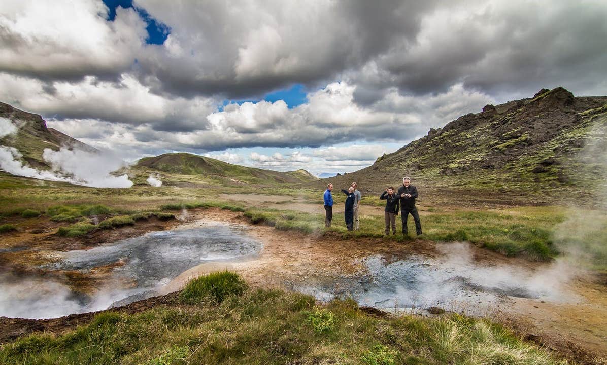
After circling it so that you can photograph it from all angles, you will head inland, towards Þingvellir National Park. En route, you will pass over seething geothermal springs, steaming power plants, and stark lava fields, all whispering of the geological activity at work in Iceland.
Nowhere, however, shall it be more obvious than at Þingvellir. Here, you can clearly see the rift valley between the North American and Eurasian tectonic plates, marked at its edges by the walls of the continents.
Within the National Park is a wealth of spectacular nature; the largest natural lake in the country, Þingvallavatn, stretches to its south; the waterfall Öxarárfoss tumbles off the North American plate; and birch, springs and lava fields all reside within its boundaries.
You will make a landing on your journey, somewhere far from the crowds, where you will attain spectacular views of the surrounding areas, and have a chance to take some incredible photos.
You will return to Reykjavík’s Domestic Airport after an hour and a half or so. Your memory cards will no doubt be packed with photographs of this awe-inspiring adventure.
Enjoy Iceland’s cityscapes and natural features from above, with this excellent helicopter tour. Check availability by choosing a date.
Quick facts
- Available: Feb. - Dec.
- Duration: 1,5 hours
- Activities: Sightseeing, Helicopter
- Difficulty: Easy
- Languages: English
- Highlights: South Iceland,
South Iceland is the most popular part of the country amongst travellers and contains some of Iceland’s most beautiful natural attractions.
Amongst these are the sites of the world famous Golden Circle, and the features of the South Coast, such as the beautiful Jökulsárlón glacier lagoon.
The south of Iceland can be roughly split into two areas, the lowlands in the west, and the east.
The South Icelandic lowlands
The South Icelandic lowlands stretch nearly 100 kilometres (over sixty miles) from Hellisheiði in the west to Eyjafjallajökull in the east. This region is flat and fertile farming land, and home to many Icelandic horses and sheep.
The whole area is geologically very young, formed during the last Ice Age by the lava flows from numerous volcanoes in the area. The lowlands are surrounded by volcanically active mountains, notably the aforementioned Eyjafjallajökull and Hekla.
The most notable features of the South Icelandic lowlands are the three on the Golden Circle, the country’s most popular sightseeing route.
These consist of the Geysir Geothermal Area, where geysers erupt and hot springs bubble, Gullfoss, a powerful two-stepped waterfall, and Þingvellir National Park, an oasis of forests and lava located between the tectonic plates.
The fissures and lava landscapes of this latter feature reveal the extent to which earthquakes and eruptions have shaped the region. The area is still very active; take, for example, the 1975 eruption in the Westman Islands that nearly destroyed the town and formed a new island.
It should be noted that Þingvellir is not just a site of natural, geological wonder. It was also the original site of the parliament Icelanders formed in 930 AD. This was a convenient place, considering the fertile lands of south Iceland meant that many settlers populated it.
Unlike most early Icelandic settlements, few of the communities formed in the south were based off fishing. The only town with a significant harbour in the south is Þorlákshöfn, where the ferry to the Westman Islands leaves.
Other towns in the lowlands are Selfoss, Hveragerði, Hella and Hvolsvöllur, all conveniently located by the Ring Road.
In terms of culture in the lowlands, it was once home to the ancient bishop seat of Skálholt. Also, Iceland's most famous saga, Njal's Saga, takes place in the region.
For sports, horse riding is popular, as is fishing for salmon and trout, hiking, snorkelling, sightseeing and river rafting.
Eastern South Iceland.
The areas south and east of Mýrdalsjökull, the glacier that covers the volcano Katla, are considered the eastern part of south Iceland. Glaciers, volcanoes and the Highlands dominate the view.
This landscape has also been shaped by volcanic eruptions, although these were much more recent, and thus the area looks dramatically different. Vast expanses of black sand stretch from the Highlands to the sea, part of several glacial outwash plains that flood during a volcanic eruption.
Some agriculture is found here, with farms nestled in the mountains, but because of the glacial floods, they are few and far between.
A few large glacial rivers flow through this area, creating incredible features such as Skógafoss and Seljalandsfoss. These are hardly the only sites in this part of the south worth seeing, however.
Sólheimajokull is a beautiful outlet glacier, a tongue of the greater Mýrdalsjökull, that you can hike on so long as you are with a guide. Skógar has a very interesting museum that discusses national traditions during Iceland’s development. One of Iceland’s most famous hiking routes, Fímmvörðuháls, cuts through the area.
Southwest of the village of Vík is one of Iceland’s most spectacular beaches, Reynisfjara. Near the promontory of Dýrholaey, and boasting incredible views of the Reynisdrangar sea stacks, it is a marvellous stretch of black sand.
Even further east is the Skaftafell preservation area, an area so beautiful it was once a national park in its own right. Today it is part of the greater Vatnajökull National Park, which covers parts of the south, east, north and much of the Highlands.
Just a little further from here is the incredible, world famous Jökulsárlón glacier lagoon, a deep lake that fills with icebergs. At the adjacent Diamond Beach, they wash upon the shore.
West Iceland ,West Iceland is home to the country’s capital city, Reykjavík, and an array of impressive natural sites. These include Europe's most powerful hot spring, Iceland's most significant lava tube, fascinating glaciers, beautiful waterfalls important historical sites and more. It has three main districts outside of the capital area: Borgarfjörður, the Snӕfellsnes Peninsula, and Breiðafjörður.
Though also in the west, the Westfjords and Reykjanes Peninsula are considered to be in separate regions.
The Capital Area
Iceland’s capital city is Reykjavík, a settlement of 120,000 people (over 200,000 in the Greater Reykjavík Area) that was founded in 870 AD by Ingólfur Arnarson; this makes it the country’s oldest inhabited area.
It is a hot spot of culture, with festivals such as Sónar, Airwaves and Secret Solstice, events such as Pride and Culture Nights, and countless museums and galleries. The city is also renowned for its vibrant live music, cabaret and drag scenes, its street art, many sculptures, and its delicious cuisine.
Its architecture is particularly of note, with impressive buildings such as Hallgrímskirkja Church and the Harpa Concert Hall.
Reykjavík is where most visitors base themselves and the point from which most tour leaves. There is a comprehensive guide to Reykjavík on this site.
Borgarfjörður
Borgarfjörður is the fjord north of Reykjavík, within which is a wealth of beautiful historical and natural sites. Reykholt, for example, is a tiny village where medieval historian and poet Snorri Sturluson, author of Snorra-Edda and Heimskringla, once lived. Borgarnes, the main village of Borgarfjörður, is one of Iceland’s earliest towns, and home to the fascinating Settlement Centre.
In terms of nature, Borgarfjörður is home to the second highest waterfall in the country, Glymur. Other beautiful waterfalls include the magical and peaceful Hraunfossar and the raging rapids of Barnafoss which lie only a stone's throw apart. The area is also home to the longest lava cave in the country, Viðgelmir, the highest flowing hot spring in Europe, Deildartunghver, and just inland is Iceland’s second biggest glacier, Langjökull.
Snӕfellsnes
The Snӕfellsnes peninsula is a marvellous stretch of land in west Iceland. It is home to a unique mountain ridge with the majestic Snӕfellsjokull glacier and National Park at its westernmost point.
The region is often called Iceland in miniature due to its diverse sites, which include beautiful mountains such as Kirkjufell, geological wonders such as the Gerðuberg cliffs, and coastal formations such as Lóndrangar rock pinnacles.
Breiðafjörður
Breiðafjörður is the fjord that separates the Westfjords from the Snӕfellsnes Peninsula. It is a natural reserve with countless small islands and home to thousands of birds, including puffins.
The inner part of Breiðafjörður is the old farm site Eiriksstadir, the home of Eric the Red, the first European to land in Greenland, in the year 984 AD. His son was Leif Ericsson, the first European to land in America, in the year 1000.
Reykjavík,Reykjavík is the capital of Iceland and the northernmost capital of any sovereign state in the world.
Despite a small population (approximately 120,000, with just over 200,000 in the Greater Reykjavík area), it is a vibrant city that draws an ever increasing number of visitors every year. It is the financial, cultural and political centre of Iceland, and has a reputation of being one of the cleanest and safest cities in the world.
Geography
The city of Reykjavík is located in southwest Iceland by Faxaflói Bay. Throughout the ages, the landscape has been shaped by glaciers, earthquakes and volcanic eruptions and the area is geothermal; after all, its name translates to ‘Smoky Bay’.
Much of the current city area was subglacial during the Ice Age, with the glacier reaching as far as the Álftanes peninsula, while other areas lay under the sea. After the end of the Ice Age, the land rose as the glaciers drifted away, and it began to take on its present form.
The coastline of Reykjavík is set with peninsulas, coves, straits and islands, most notably the island of Viðey, and seabirds and whales frequent the shores. The mountain ring as seen from the shore is particularly beautiful.
Mount Esjan is the highest mountain in the vicinity of Reykjavík and the most distinctive feature of the coastline. This majestic summit is also highly popular amongst hikers and climbers. Other notable mountains that can be seen from the seaside are Akrafjall and Skarðsheiði.
On clear days, one may even see as far to the legendary Snæfellsjökull glacier, at the end of the Snæfellsnes peninsula.
The largest river to run through the city is Elliðaá in Elliðaárdalur valley, which is also one of Iceland’s best rivers for salmon fishing.
Transportation
There are no trains or trams in Iceland, but most people travel by car. The city also operates a bus system. There are two major harbours in town, the old harbour in the centre and Sundahöfn in the east.
The domestic Reykjavík Airport is located at Vatnsmýrin, not far from the city centre and close to the hill Öskjuhlíð and the restaurant, vantage point and exhibition centre Perlan. The international Keflavík Airport at Miðnesheiði heath then lies around 50 kilometres (31 miles) from the city.
Cars, jeeps and bicycles can be readily rented in the city and many organized tours are also being offered. It is, however, quite easy to walk between the major sites.
What to See & Do in Reykjavik
The local arts scene is strong in Iceland, with annual events and festivals, many of artists from which have hit the international stage.
Major events taking place in Reykjavík include Iceland Airwaves, Reykjavík Pride, RIFF (The Reykjavík International Film Festival), The Reykjavík Literature Festival, Culture Night, the Reykjavík Arts Festival, Food & Fun, the Reykjavík Fashion Festival and the Sónar music festival.
Amongst the famous people from Reykjavík are musicians like Björk Guðmundsdóttir and Sigur Rós, and writers Halldór Laxness (born on the main street, Laugavegur) and Arnaldur Indriðason.
Those eager to soak up the local culture should visit the city’s many museums, exhibitions and galleries, and check out live music at the cafés, bars, and concert venues dotted around. You could look at the programmes of what’s on at the Harpa music hall or the theatres, or else plan a few hours at the lighthouse at Grótta, the shopping street of Laugavegur, or the old harbour and the flea market.
You could even book a bird- and whale watching tour or a visit to Viðey island. There are a lot of things to do and the possibilities are endless.
Make sure to visit the public square of Austurvöllur, one of the city’s most popular gathering places, where you’ll also find the national parliament, the Alþingi, as well as the state church, a statue of independence hero Jón Sigurðsson, cafés, bars and restaurants.
Austurvöllur was central in the protests following the banking collapse of 2008, along with Lækjargata, home to the House of Government. You are also not likely to miss the great church of Hallgrímskirkja that towers over the city from the hill of Skólavörðuholt, from which you’ll get a great view of the city.
Try a walk by the city pond, Tjörnin, to greet the many birds that frequent the area and to visit the city hall, stationed by its banks. A beautiful park lies by the pond, ideal for a nice walk, and sometimes concerts get held there.
Further off is the campus of the University of Iceland, the Nordic house and the Vatnsmýrin wetland, a particularly pleasant place, but be mindful to not disturb the wildlife there by keeping to the pathways.
For a nice swim on a warm day, we particularly recommend Nauthólsvík beach, which is heated with geothermal water. Those who love a dip should also visit the Laugardalur valley, home to one of the city’s best swimming pools, which sits a short walk away from Ásmundarsafn gallery, a beautiful botanical garden and a domestic zoo.
A walk by the Ægissíða beach, with its old fishing sheds, in the west part of Reykjavík also holds a particular charm. From there, you can see all the way to president’s house at Bessastaðir, which is also a historical site in its own right, having been the educational centre of Iceland for centuries.
Another place that offers one of the city’s best views is Perlan, up on Öskjuhlíð hill. The hill itself is a popular place to spend a few hours, with over 176,000 trees and great opportunities for walking and cycling. Perlan also has and observation deck with great views, a café and an exhibition centre.
Furthermore, the city is a short drive from many of Iceland’s major attractions, most famously the Golden Circle and the Blue Lagoon. In close vicinity you’ll also find the Heiðmörk preservation area, a favourite local site of the people of Reykjavík, as well as the Blue Mountains, one of Iceland’s best skiing venues.
Finally, we’d like to stress that these are only some suggestions of the many things you might check out in Reykjavík. Whatever you choose to do, we hope you’ll be able to make the most of your visit and we wish you a pleasant stay in our capital.
Glymur,Wikimedia, Creative Commons, photo credit: Andreas Tille
Glymur is Iceland’s second-tallest waterfall, and the tallest that is easily accessible by foot. Located in the fjord of Hvalfjörður, it stand at a height of 198 metres (650 feet).
Glymur is fed by the river Botnsá, which has sources in Iceland’s glaciers and runs from a lake above.
Getting to Glymur
To get to the carpark of Glymur, from which you can hike to it, takes about forty five minutes if driving from Reykjavík.
You first will head north on Route 1, before turning right on Route 47, before Hvalfjörður tunnel. This road will take you along the edge of the fjord itself, providing stunning views of the coast, mountains, flora and more smaller waterfalls.
From the carpark, the hike takes approximately three and a half hours to do in total. It is largely through nature, without any paved roads, and at some points can be a little challenging; the most used route, for example, involves wading across a river with the help of a rope, passing through a cave, and walking along a narrow mountainside path.
The hike, therefore, should only be taken by those with a reasonable level of fitness, who are sturdy on their feet. Even then, only those with decent hiking shoes and clothes for any weather should attempt the journey, and it is highly recommended that you bring walking poles, water and snacks.
The route is marked by cairns with yellow markers as well as signs, and is easy enough to follow. Be aware that there are some offshoot trails that can lead you away from the waterfall, so take care to be mindful of your surroundings.
Surroundings of Glymur
Wikimedia, Creative Commons, photo credit: Jabbi
As part of Hvalfjörður in west Iceland, many other sites can be seen in conjunction with Glymur. It is close to the settlements of Akranes and Borgarnes, both of which are commerce centres of the region, perfect to refresh at. Both are also historically significant, having been settled for over a millennium.
The earliest days of Iceland can be learnt about at the Settlement Centre of Borgarnes.
In terms of natural attractions, Glymur is relatively near to two other notable waterfalls, Hraunfossar and Barnafoss. Hraunfossar is serene, with many rivulets pouring off of a shelf of lava rocks, while Barnafoss is turbulent, racing down a narrow canyon.
Not far from these sites is the highest flowing hot spring in Europe, Deildartunghver, which sits near the geothermal and historical settlement of Reykholt.
Glymur can also be visited as part of a trip to the Snæfellsnes Peninsula, the arm which extends off of west Iceland. Some of the country’s most marvellous sites can be found here, such as the basalt cliffs of Lóndrangar, the mountainside gorge of Rauðfeldsgjá Gorge, the peak Kirkjufell, and of course, Snæfellsjökull National Park.
Be aware, however, that this would be a long time out for a day trip, and would not give you as much time at the sites as you may necessarily desire. There are, however, many options for accommodation on the peninsula and in the west.
Similar waterfalls to Glymur
When it comes to scale, the only waterfall taller than Glymur in Iceland is Morsárfoss, which is found by a melting outlet of Vatnajökull Glacier. It stands at around 240 metres (787 feet) tall, and was only discovered in 2007. It was only noted to be greater than Glymur in 2011.
Iceland has many other waterfalls of note, but the only other with an international title is Dettifoss, which boasts the highest rate of water flow out of any other falls in Europe.
Þingvellir,Þingvellir National Park is the only UNESCO World Heritage site on the Icelandic mainland and one of the three stops on the world famous Golden Circle sightseeing route, alongside the Haukadalur Geothermal Valley (Geysir) and Gullfoss Waterfall. Just to the south of the park is Þingvallavatn, Iceland’s largest natural lake.
Geography
The first thing that visitors to the National Park notice is its sheer aesthetic beauty; dried magma fields, covered in Icelandic moss, sit carved by glacial springs and surrounded by a bowl of ancient mountain peaks.
Two of the greatest attractions in the park are the exposed North American and Eurasian tectonic plates; it is one of the only regions in the world where you can see geology such as this on land.
Visitors are encouraged to walk along the North American tectonic plate, where they can read more about the area’s fascinating formation and history, before descending into the valley below.
History
Þingvellir can be anglicised to ‘Fields of Parliament’, a nod to the area’s fascinating history and relevance to Icelandic culture. It is here, after all, that the world’s first democratically elected parliament that remains functioning, Alþingi, was formed in 930 AD.
It may seem unlikely that Vikings would want to be under such an uncombative government, but the thirty or so clans that lived in Iceland at the time sought to prosper in their harsh new environment.
The first gathering was such a success that the meetings became annual, and it became a place where disputes were settled, criminals were tried, and laws to the benefit of all were laid down.
This saw the birth of the Icelandic Commonwealth, a time of independence and freedom for the Icelandic people before they became constituents of the Norwegian monarchy. Sessions would continue to be held at Þingvellir until 1798.
Though the parliament was removed by the Danish at this time, it returned 1845 to Reykjavík.
Another major reason as to why Þingvellir is considered so important to Icelanders is the fact that this is where the decision was made to abandon the belief of Paganism and the Norse Gods; the people adopted Christianity in 1000 AD under threat of invasion from Norway.
This turning point in history was left to the pagan lawspeaker, Þorgeir Þorkelsson, who rested on the choice for one day and one night before reappearing to share his decision.
To symbolise the country’s change, he threw idols of his old deities into the northern waterfall Goðafoss, the name of which translates to ‘Waterfall of the Gods’.
Silfra Fissure
Þingvellir is one of the most widely visited attractions in Iceland, in large part due to the fact that it is home to the glacial spring, Silfra fissure, one of the top ten sites in the world for snorkellers and scuba divers.
Silfra (meaning ‘Silver’) is a submerged ravine within the park, boasting visibility of up to 100 metres (328 feet) and a temperature just above freezing. Participants in these tours will be attired at the Silfra carpark in neoprene hoodies and gloves, as well as an undersuit and drysuit for thermal protection.
Hvalfjörður,Hvalfjörður is a fjord in southwest Iceland. The fjord is approximately 30 kilometres (19 miles) long and five (three miles) kilometres wide.
Nature and Landscape
The landscape of Hvalfjörður is varied and beautiful, with wide areas of flat land along majestic mountains, green vegetation in summer and beaches cut with creeks.
The area is rich in bird life and is home to seals, but despite its name, which translates to ‘Whale Fjord,’ it is not known for its whale or dolphin populations. Two theories exist on how it got its name; either that it was once home to whales before fish stocks moved away, or because of the general shape of the bay.
The area has recently been part of Iceland’s successful reforestation effort.
Natural attractions in the area are plentiful but most significant is Iceland's highest waterfall, Glymur, in the river Botnsá. There are also plenty of interesting hiking trails in the area, such as Síldarmannagotur, leading north, and Leggjabrjótur, leading east towards the area of Þingvellir National Park.
History and Culture
Historically, Hvalfjörður was home to one of the main whaling stations in Iceland, with ships heading out into Faxaflói Bay. It was one of the most important naval stations in the North Atlantic during World War Two, when Iceland was occupied by the Allies after the Nazis conquered Denmark.
The old whaling station and a war museum can be found in the fjord.
Iceland's main psalm poet, Hallgrímur Pétursson, writer of the ‘Passia Hymns,' lived in Hvalfjörður. The area was also the home of the late Sveinbjörn Beinteinsson, poet and performer and head of the Icelandic Pagan Association.
Economy
Most inhabitants of the fjord live in rural areas, and there is some farming in the area. Until the 1990s those travelling between Borgarnes and Reykjavík had to take a long detour around the fjord, but this was solved with a tunnel that travels beneath it, finished in 1998.
Grundartangi promontory in Hvalfjörður has one of the largest harbours in the country and two industrial plants. One is a ferrosilicon plant, operated since 1979, the other an aluminium smelter, operated since 1998.
Both of these were controversial during their construction, and continue to be controversial during their ongoing operation. Along with whaling and hydroelectric dams, smelters and silicone plants are the hottest environmental debates going on in Iceland.
ÞingvallavatnÞingvallavatn (anglicised to Thingvallavatn, ‘the Lake of the Fields of Parliament’) is a rift valley lake located roughly forty-minutes drive from Iceland’s capital city, Reykjavík.
Features of Thingvallavatn
Þingvallavatn is partially within the boundaries of Þingvellir National Park, Iceland’s oldest National Park and only one with UNESCO World Heritage Site status.
Covering an area of 84 square kilometres (32 square miles), Þingvallavatn is the largest natural lake in Iceland with its greatest depth measuring at 114 metres (374 feet). Þingvallavatn is situated on the Mid-Atlantic Rift, on a part of the ridge known as the Reykjanes Ridge.
The lake has only one outflow, the river Sog.
Of particular note to biologists and fishermen are the four morphs of Arctic Char that inhabit the lake. The lake’s char are an excellent example of species evolving to fit and adapt to a secluded environment; over ten thousand years, one species of Char has transformed into four different-sub branches. Other fish in the lake include the the Brown Trout and the Three-Spine Stickleback.
History and Geology
Þingvallavatn takes its name from the historical founding of the Alþingi, which occurred in 930 AD at what is now known as Þingvellir National Park. Þingvellir literally translates to ‘Fields of Parliament’.
The Alþingi was the first democratically elected representative parliament in world history (examples such as Ancient Athens were direct, not representative, democracies); Icelanders used to travel by foot or horseback simply to congregate at Þingvellir where they would hear the latest laws and judgements of the island.
Þingvellir National Park is also notable for its geology. Given its position on the Mid Atlantic Ridge, the park is one of the only places on the planet where visitors can see both the North American and Eurasian tectonic plates standing exposed from the earth.
Footpaths allow you to get up close and personal to the plates, standing right where the ancient settlers once did. In between the tectonic plates lies fields of dried volcanic rock, blanketed with a thick, yet fragile layer of Icelandic moss.
Scuba Diving in Thingvallavatn
Scuba diving around Þingvallavatn revolves around two sites, Silfra Fissure and Davíðsgjá (David’s Crack), the former being one of the most popular spots on the planet for snorkelling and underwater exploration.
Silfra Fissure is situated between the North American and Eurasian tectonic plates and is filled with crystal-clear glacial water originating from the Langjökull ice cap. The water measures at between two degrees Celsius all year round, with a slight current preventing the fissure from ever freezing over.
Davíðsgjá is found within Þingvallavatn and is often considered the darker and more dramatic cousin of Silfra Fissure, resembling the gorge formation so prevalent across the Mid Atlantic Rift.
Only certain tour operators provide tours into Davíðsgjá, so make sure to do some research beforehand if you are looking to access this dive site during your time in Iceland.
Departure time : Flexible.
Reykjavík Domestic Airport
70-90 minute Helicopter Tour
Pilot/Guide
Lunch and Dinner
What to bring:
Good Shoes
Warm clothing
Hats, Gloves and Scarves.
Your Camera
Good to know: