


Description
Summary
Description
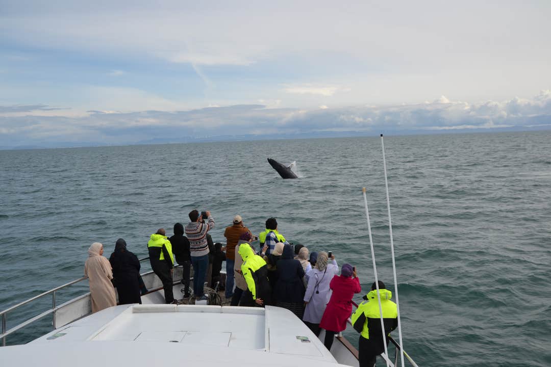
Join Harpa Yachts for a comfortable whale & dolphin watching cruise from Reykjavik Old Harbor. On this cruise with a maximum of 35 guests we sail out from the old harbor in downtown Reykjavik out to Faxafloi bay looking for whales & dolphins.
Depending on the season you might experience a wide variety of wildlife in the picturesque surroundings of Reykjavik with mountains and stunning scenario everywhere you look. During the summer months we also stop at one of the puffin islands and watch these magnificent birds.
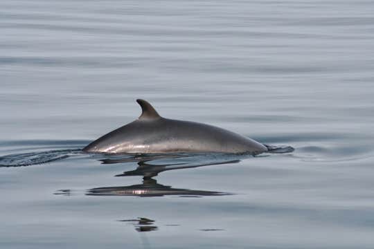
The most common whales in our bay are the baleen whales, minke whales, humpback whales, white-beaked dolphins and harbour porpoises. Besides the whales, we also see a lot of sea birds — different kinds of ducks and seagulls, puffins, razorbills, kittiwakes, sea gannet and more. Occasionally we see killer whales, pilot whales and other types. Although highly unusual, fin whales and blue whales have been seen on occasion.
This boat tour is made even more incredible due to the incredible views you can enjoy from the boat. These include Snaefellsnes peninsula (sometimes called “Iceland in miniature”), Reykjanes Peninsula, the Blue Lagoon, Reykjavik City, and the mountains Esja and Akrafjall.
The yacht is a 70 feet luxury yacht, made by the legendary Cantiery di Pisa. It is very stable and boasts a beautiful newly renovated interior: with a lounge, bar, salon & fly-bridge. Licensed to accommodate up to 35 people on day tours makes Harpa yachts the perfect company for guests looking to travel with small groups.
Harpa yachts is a family owned and operated company, the owners have decades of experience in providing visitors with experiences of a lifetime.


