Here we find the only fjord in Ísafjarðardjúp within the Jökulfirðir fjords, and this detour from the main road 61 is well worth the 40 km drive to the end of the road.
I will show you the hike to Drangajökull glacier, the only glacier in the Westfjords, and visit three churches and two exhibitions on the way.
Top photo: by the base of Drangajökull glacier
Hiking to Drangajökull glacier

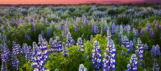
Flowers on the hike to Drangajökull glacier
I love exploring the side-roads and valleys in Iceland, as those of you who read my travel blogs know, and I also search for all the churches in Iceland, so exploring Road 635 was essential.
I also very much wanted to hike to Drangajökull, Iceland's northernmost glacier and the only glacier in the Westfjords.
The glacier's highest point is at 925 meters, making it the only glacier in Iceland with an altitude below 1,000 metres.
 A glacial mound - moraine
To reach Drangajökull glacier, Iceland's 5th-largest glacier, measuring around 145 km2, we drove into the Kaldalón fjord, a beautiful five km-long fjord. The roads in this area are gravel roads, built in 1956 and 1964.
We stopped the car by a large glacial mound, which blocked our view of the glacier. The information sign tells us that Drangajökull reached the huge glacial mound in the mid-19th century.
The part of the glacier which we will be visiting, or more likely seeing, as we can only see it from a distance, is called Lónsjökull (Kaldalónsjökull), a glacier tongue in Drangajökull.
 Drangajökull glacier
Iceland's glaciers are shrinking, but I have read that Drangajökull both recedes and advances in 50-60-year cycles. But due to climate change, this might be changing; we don't know yet.
My photos are from 2016, and you can compare them to what the glacier looks like now.
I have shown you in another travel blog about my only glacier hike that the Sólheimajökull glacier in South Iceland has shrunk considerably. Earlier, it reached the parking lot, but nowadays you have to hike 800 metres to reach the base of the Sólheimajökull glacier.
See also my travel blog: Glacier hike & Ice Climbing on Sólheimajökull Glacier.
 A cairn on the hike to Drangajökull
Now, let's start the hike to Drangajökull glacier.
A trail through some magnificent terrain will take you almost to the glacial lagoon.
Along the way, you will see beautiful, colourful rocks and flowers, and small waterfalls cascading down from the mountain sides.
This part of Iceland is ever so beautiful.
 Stepping stone on the creeks
Along the path, there are some small creeks that are easy to cross: jump or use the stones in the creeks as stepping stones.
I really liked the small waterfalls, which cascade from the mountain, and for some reason, they reminded me of my grandfather, and to this day, I don't know why, but it felt like he was with me on this hike, and maybe he was, who knows?
 A red vein behind the waterfall and a large red spot on the left
Sometimes, you can see red veins behind waterfalls, and you can see such a red vein behind the Jewel of the Westfjords, the magnificent Dynjandi waterfall.
I spotted one such vein while admiring the waterfalls along the way. These veins, as it were, are called rauðalög or rauðaberg in Icelandic, and they are iron-rich layers of soil.
You will see more interesting and colourful rocks on the hike, and I was in awe when I saw a heap of rocks in very bright colours: orange, blue, and yellow. They must be rhyolite.
 Large colourful rocks on the hike - can you spot the yellow rock inside the orange rock?
It delayed our hike a bit and annoyed my husband that I was constantly stopping to examine and photograph these rocks.
But it was so worth it, just being in the moment, admiring and breathing in this beautiful nature, so far away from our home in Reykjavík.

Crossing the creeks on stepping stones
We finally reached the end of the hike, all the while enjoying a fantastic view of Drangajökull glacier and the freedom of being outside in nature, in the sunshine.
It was getting a bit dark, though, so we didn't stay for very long. I just sat down on a rock and admired the glacier from afar for a while.
Waterfalls cascade down from glaciers, but some of Iceland's tallest waterfalls are by glaciers, like the one by Morsárjökull, which is considered the tallest waterfall in Iceland.
 Waterfalls in Drangajökull glacier
It was breathtaking standing so close to the glacier, albeit a little scary. We, Icelanders, are, or at least were, brought up to fear the glaciers and their deadly fissures, and the sight of glaciers always frightens me a bit.
Never go unaccompanied on a glacier, even if you think that you are safe by the edge of the glacier. They are moving and filled with deadly fissures.
And the sand beneath them is not safe either, as there is often quicksand so close to them. So, let's admire them from a safe distance, which is of utmost importance.
 I didn't go any further than this. The sun disappeared, and we were now in a shadow
If you want to hike on a glacier, there are plenty of guided tours to choose from.
Along the way to the glacier, you will see the rust-brown glacial river Mórilla.
Such glacial rivers are the glacier's discharge and are usually brown in colour, unlike the blue rivers in Iceland.
 The glacial river Mórilla
The glacial river Mórilla runs from the glacial tongue of Drangajökull, called Lónsjökull, towards the sea in a vascular or tunnel-like system that isn't so obvious when you stand next to the river, but is very vivid when seen from above (from a drone or a plane).
There are many glacial rivers in Iceland, and Iceland's longest river, the 230 km-long Þjórsá, originates in Hofsjökull glacier, cuts through the central highland of Iceland, and flows into the sea in South Iceland.
Another word of warning, always be careful close to glacial rivers, they are deadly.
 Small waterfalls that merge with the glacial river Mórilla
The waterfalls I saw cascading down the mountains on the hike merge with Mórilla.
You can see here, and in many places in Iceland, different colours of the freshwater rivers and creeks when they merge with the brown glacial water.
 The map of this area from Náttúrufræðistofnun - Kortasjá
The mountains that frame the valley are called Lónseyrarhlíð, Háafellshjallar, Trymbilsstaðahlíð, and Votubjörg.
From these mountains, springwater trickles or cascades down the mountain slopes in smaller waterfalls and merges with Mórilla.
 See how the water changes colour when the rivers meet
I always find this fascinating to watch, the beautiful rivers, from which we drink, become one with the turbulent, brown (from sediments) glacial rivers, which I fear.
I almost feel sorry for the innocent-looking creeks that disappear into the monster rivers, which devour them.
Glacial water is filled with sediment, and if you pour water from a glacial river into a glass, the sediment slowly settles to the bottom.
 Vatnasafnið - the Library of Water
There is an interesting museum on the Snæfellsnes peninsula, called Vatnasafnið - the Library of Water, where you can see the water from all of Iceland's glaciers inside columns.
The sediments have settled to the bottom of the columns, and the water is crystal clear.
The river Mórilla leaves such sediments in its track and slowly fills up the fjord.
We had now reached the car and the end of the hike. Isn't it funny how the return hike is always much quicker than the hike to the destination?
 Mórilla and spring water creeks merge on their way to the sea
We had been totally alone on the hike so far, but met some people by the glacial mound.
It is such a treat being alone in Iceland's nature, and so rare these days.
This was an easy 1.5-hour hike (3 hours round trip), and what a beautiful hike. You can, of course, prolong it and enjoy the stunning landscape.
But we still had three churches and two exhibitions to visit before the end of the day.
 In Kaldalón
On the southwest side of Drangajökull glacier is the Strandir area of the Westfjords, which I showed you in my travel blog: The remote Strandir in Iceland - Stillness & Sorcery.
Drangajökull gets its name from the breathtaking Drangar and Drangaskörð in Drangavík on the other side of the glacier. By the way, Drangajökull means the Glacier of the Pillar Rocks or something like that :)
High up on my list of things to do in Iceland is sailing by these beautiful rock formations on the other side of the glacier.
Kaldalón - the Cold Lagoon

The memorial stone for Sigvaldi Kaldalóns
Now, let's have a look at the memorial stone at Seleyri in Kaldalón - the Cold Lagoon, as the inlet is called. The memorial stone for Sigvaldi Kaldalóns was erected in 1999. It is basalt and weighs almost 7 tonnes.
Those of us who have not yet visited Kaldalón are familiar with the name, though, as it is the surname of one of our noted composers, Sigvaldi Kaldalóns Stefánsson.
Sigvaldi loved this area so much that in 1916, he took Kaldalóns as his surname. Back then, when the laws for surnames were changed, several Icelanders took the names of places they loved as surnames.

The information sign by the memorial stone
Sigvaldi Kaldalóns (1881-1946), apart from being one of Iceland's most beloved composers, was a medical doctor. All Icelanders are familiar with his works "Á Sprengisandi" and "Ísland ögrum skorið".
Sigvaldi was born in the winter of 1881, the winter of the great frost, in Garðastræti in Reykjavík, in the so-called Vaktarahúsið house (built 1848).
He later moved to Ármúli, near the mouth of the Kaldalón lagoon, where he served as a medical doctor from 1910 to 1921 in the county of Nauteyri.
 Vaktarabærinn in Reykjavík, where Sigvaldi was born, and a car covered in snow
Sigvaldi was married to a Danish nurse, Karen Margrethe Mengel-Thomsen, whom he met in Copenhagen while studying.
Karen Margrethe was a pioneer in growing horticultural plants and vegetables in this area.
The married couple performed surgery together at their home in Ármúli. What an asset they were for this medical county.
 Kaldalón inlet - what a beautiful area this is in the summertime
In 1920, there were 230 inhabitants in the Nauteyrar county. In 1995, the inhabitants were down to 25.
Above this area is the Hornstrandir Nature Reserve, which can only be reached by boat. While Hornstrandir were inhabited, the thoroughfare was across Drangajökull glacier.
And driftwood was transported on horses across the glacier from the Strandir area, where there is driftwood in abundance.
 Driftwood at Strandir - can you spot the Arctic fox?
There were no roads here back when he was working in this region, and the medical doctors had to cross rivers and sometimes cross glaciers.
His most challenging case must have been when he was on a boat, on his way to visit a patient, and got caught in a raging storm.
He was stuck without food for 2 days on Borgarey Island (one of the three islands in Ísafjarðardjúp) while the storm passed. It was not easy being a medical doctor or a midwife back in those days.
 This is no place for pregnant women or small children
Once, a patient with a severe stomachache, Pétur by name, traversed the Drangajökull glacier from Drangavík on the other side of the glacier for 10 hours to call upon Sigvaldi.
Pétur settled in this area, but times were hard, and years later, after burying one child and losing his livestock in a storm, Pétur returned to Drangavík with his wife and two children.
His wife, Sigríður, was 7 months pregnant, and their journey across the Drangajökull glacier (their second attempt) took 18 hours! Just imagine being 7 months pregnant and having to cross a glacier with two young children.
Plus, their remaining ewes were also pregnant and giving birth to their lambs.
 The other side of the memorial stone
Those of you who are familiar with Páll's work from Húsafell will recognise his work on the memorial stone, the low-relief, and Sigvaldi sitting by his grand piano.
You will find Páll's subtle work in many places in Iceland.
By the memorial stone is an information sign that tells us about Sigvaldi Kaldalón's life. I must tell you one story about how Sigvaldi came into the possession of a grand piano.
In 1919, Sigvaldi's neighbours wanted to surprise him by giving him a grand piano, as he owned only an old organ.

Kaldalón and the memorial stone
So they bought a grand piano in the USA and had it transported to Iceland, without Sigvaldi's knowledge.
They took the opportunity when a doctor was needed on the Æðey island, and secretly moved the grand piano to Ármúli farm, where Sigvaldi lived. They faced a problem: the grand piano was too big to fit through the door.
In a great hurry, Sigvaldi's father cut through the wall so that the grand piano could be transported into the living room, just in the nick of time before Sigvaldi returned.
You can imagine how surprised Sigvaldi was when he saw the grand piano in his living room.
 Ruins in Kaldalón
Note the -s ending in Kaldalóns, which indicates that the surname is in the genitive case, as was the case with such surnames, like Jón Víðis, my husband's great-uncle, who surveyed the roads in the Westfjords.
Víðis is the genitive case of the small island Víðir in the Laxárdalur valley. I have told you about Laxárdalur valley up north in this travel blog: Þverá turf houses in Laxárdalur valley in North Iceland.
 Old ruins in Kaldalón
We also stopped by the ruins of the farm Trymbilsstaðir, which was swept away in a glacial outburst.
We don't know what "Trymbill" means, but the nearby moraine is called Trymbilsstaðahryggur (ref. Vísindavefur).
It was not easy living this close to a glacier, and there are many stories from Iceland about farms being swept away in glacial outbursts and people fleeing in panic from massive glacial floods.
 The bridge over the glacial river Mórilla
Now, let's cross the glacial river Mórilla on a bridge and visit one of the three churches in this area: the Unaðsdalskirkja church. The church is almost at the end of this road, which we are exploring today.
We have been driving on the Langadalsströnd coast and will now enter the Snæfjallaströnd coast, but Kaldalón divides the two.
Unaðsdalskirkja church - the end of the road

Inside Unaðsdalskirkja
We visit all the churches in Iceland, and sometimes they are very remote. I love the name of this valley, Unaðsdalur - Pleasure Valley.
Ólafur jafnakollur settled the whole northern part of Djúpið, from Langadalsá to Sandeyrará river, and lived in Unaðsdalur, Landnáma - the Book of Settlements, tells us.
He must have given this valley such a beautiful name.

Unaðsdalskirkja church in the dusk
By the mouth of the river Dalsá, you will find a timber church, built in 1898.
It replaced an older turf church from 1866-1867, which stood further away from the sea than the current church. In the olden times, all of Iceland's churches were turf churches.
That old turf church was the first church here at Unaðsdalur, but earlier, a church was located at Staður at Snæfjöll, from at least 1200, the earliest mention of that church.
 The altarpiece in the Unaðsdalskirkja church
In the extensive collection of books on preserved churches in Iceland (100 years and older), Kirkjur Íslands, all of which I own and refer to often, I found that electricity was added to the church during repairs in 1969, and that it was repaired again in 1990-1995.
Iceland's churches are locked due to vandalism and theft. They used to be open when I started visiting them decades ago, but nowadays it is more difficult to enter them, and we have to search for the person who has the key.
Sometimes we have travelled far to visit a church only to be unable to enter, which is always a letdown.

Crucified Christ in Unaðsdalskirkja
We were fortunately able to enter the Unaðsdalskirkja church, which is painted in cheerful colours, so lovely. The altarpiece depicts Christ healing Bartimaeus, the blind man.
The altarpiece was painted in 1899 by Anker Lund, but as far as I know, he painted altarpieces in 24 of Iceland's churches.
The Crucified Christ was carved by Guðmundur "bíldur" Pálsson (1830-1884), a well-known and prolific woodcarver in Iceland.
There is mass in this beautiful church once a year, in the summertime.
 Ísafjarðardjúp in the dusk - so calm and beautiful. Bolungarvík in the distance
The view of Ísafjarðardjúp from the church in Unaðsdalur valley was so peaceful and lovely. We could see as far as Bolungarvík in the distance, but Bolungarvík is at the end of road 61, which I will be showing you in another travel blog.
It was now time to turn back, as we had reached the end of road 635.
We made a quick stop at the Snjáfjallasetur Heritage Center at Dalbær, the area's information and heritage center.
Snjáfjallasetur is open for 6 weeks in the summertime, offers travel services, and runs a café.

At the Snjáfjallasetur exhibition
They were about to close, so I got permission to take a photo of all the invaluable information posters at their exhibition, so that I could read up on this area at my hotel.
Now, let's visit some more churches.
Melgraseyrarkirkja church

Melgraseyrarkirkja church
We passed the glacial river Mórilla again and Ármúli farm, where Sigvaldi Kaldalóns lived, and checked out Melgraseyrarkirkja church on Langadalsströnd, one of the three churches along road 635.
This church is not included in the collection of preserved churches because the old church was damaged in a severe storm in 1966.
A new church was built and consecrated on the 10th of September, 1972. It is timber-panelled, a lovely church that seats up to 70 people.

Inside Melgraseyrarkirkja church - I look a bit worn out after a busy day
Do you see the similarities between the crucifixes in both churches? To me, they are almost identical.
Guðmundur "bíldur" carved the crucifix in Unaðsdalskirkja church, and he is bound to have carved this one as well. Correct me if I am wrong.
Guðmundur carved, e.g., the upper part of the old altarpiece in Þingeyrakirkja, which I have shown you in another travel blog.
 Melgraseyrarkirkja church
Melgraseyri might be where the farm Valbrandsstaðir, mentioned in Hávarðar saga Ísfirðings, once stood, according to Kaalund.
If this is Valbrandsstaðir, then the brothers of Bjargey, the wife of Hávarður, lived here on three farms named after each brother, Valbrandsstaðir, Þorbrandsstaðir, and Ásbrandsstaðir.
Place names might have changed, or the author may not have been very familiar with them, so it is difficult to determine where in this area Hávarðar saga took place.
 The Christian sign on Melgraseyrarkirkja church
Other place names in the Hávarðar saga Ísfirðings are Lónseyri and Lónhóll in Kaldalón, but at Lónseyri lived Þórálfur, and at Lónhóll, which is called Hvoll in the Saga, lived Þórdís, the sister of Þorbjörn.
And Hávarður lived at Snæfjallaströnd, where Hávarðsstaðir farm once stood. It is further away than Tirðilmýri. This is an interesting Saga, which I recommend reading before you visit this area.
Nauteyrarkirkja church
 We couldn't enter Nauteyrarkirkja church
The 3rd church we visited is Nauteyrarkirkja church at Langadalsströnd.
It is preserved and mentioned in the book collection Kirkjur Íslands, as it is over a hundred years old, consecrated in 1886, thoroughly renovated in 1986, and preserved in 1990.
The church site at Nauteyri was previously at Kirkjuból in Langidalur. As the name Kirkjuból indicates, there was a church at this site, as the Icelandic word kirkja means "church".
 I took this photo through the window of Nauteyrarkirkja church
The church was locked, and we couldn't find the person with the key, so we couldn't enter. Nauteyrakirkja church is also a timber church, clad in corrugated iron to protect the wood, as is the church in Unaðsdalur valley.
The church is panelled and white-painted. Too bad that we couldn't enter it, so I cannot show you what it looks like inside.
Here you can see a photo on Sarpur.is of the interior of the church.
 Jón Halldórsson erected this church in 1885
I noticed a colourful, carved board above the church door, on which is written: "Þessa kirkju hefur reist óðalsbóndi Hón Halldórsson árið 1885" - "Jón Halldórsson, farmer, has erected this church in the year 1885".
Steinshús - the House of Steinn Steinarr

Steinshús
It was now time to make the last stop on Snæfjallavegur road number 635 and visit Steinshús - the House of Steinn Steinarr. And have a cup of coffee and some waffles.
They also offer Icelandic meat broth, kjötsúpa.
Steinn Steinarr was one of Iceland's best-known modernist poets, and at Steinshús you can visit an exhibition about Steinn's life and work during the summer months.
 Inside Steinshús
Steinn Steinarr is his allonym; his real name was Aðalsteinn Kristmundsson.
He was born at Laugaland in Nauteyrarhreppur district in 1908, but had to move away to Dalir in West Iceland when he was only 2, as his family went bankrupt.
Here is the website of Steinshús with more information about his work.
And if you are interested in learning more about him, there is good information on the website Steinnsteinarr.is.
 The exhibition inside Steinshús
As I mentioned earlier, in and around this area of the Westfjords, two of the Sagas took place: Hávarðar saga Ísfirðings and Fóstbræðrasaga.
I recommend reading the Sagas before you travel around Iceland.
I am a Saga enthusiast and have read them all, and they enrich my travel experience. And I seek out the places mentioned in the Sagas.
 A Viking sword found in Iceland
I try to add a bit of knowledge from the Sagas when I write my travel blogs, and some travel blogs I have written entirely about Saga places in Iceland:
Viking Areas in Iceland - Eiríksstaðir Long House in West Iceland and Leifur the Lucky
Guðrúnarlaug Hot-tub - the Saga Hot-tub in Sælingsdalur Valley in West Iceland
The Saga Locations of Gísli the Outlaw Súrsson in the Westfjords of Iceland
 Road 635 to Unaðsdalur valley
We have now explored the sights along Snæfjallastrandarvegur - Snowy Mountain Coastal road 635, and will continue travelling west on Djúpvegur road 61 to explore the sights along that road.
Djúpvegur is approx. 206 km long from Steingrímsfjarðarheiði heath all the way to the end of the road in Bolungarvík village. We will start by driving farther into Ísafjörður fjord.
 A road map of the Westfjords
Kaldalón is located at 66.0833793,-22.4329137,1428
Have a lovely time in the beautiful Westfjords of Iceland :)
Ref.:
Kirkjur Íslands - volume 28
Íslenskir sögustaðir - Vestfirðingafjórðungur - P.E. Kristian Kaalund

Hi, my name is Regína and I was born and raised here in Iceland. Since 2013 I have written 320 travel blogs about various interesting places to visit in Iceland. I hope you enjoy reading my travel-blog :)