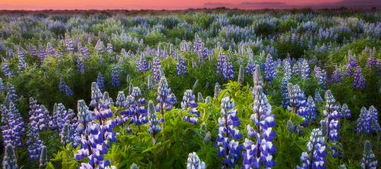
In this travel blog, I want to show you Kirkjubæjarklaustur - a village in South Iceland by Ring Road 1, the first village you encounter after driving through the vast glacial outwash of Mýrdalssandur. It is a lovely little village rich in history.
The name of the village, Kirkjubæjarklaustur, is as long as it is actually three words linked together - kirkju = church, bæjar = the genitive of a farm or a town, and klaustur = convent. We Icelanders usually refer to Kirkjubæjarklaustur as Klaustur for short.
Top photo: Systrafoss waterfall

Byrði sögunnar - the Burden of History, by Magnús Tómasson
These names date back to the year 1186, and the local names tell you a story from that time. There was a Benedictine convent at Kirkjubæjarklaustur from 1186 to 1550.
The statue in my photo above is located in the middle of the village. It is called Byrði sögunnar - the Burden of History, by Magnús Tómasson, and I think it speaks volumes. Byrði sögunnar depicts two monks carrying a heavy burden on their heads. This area has for sure carried several heavy burdens, such as the massive volcanic eruption of Skaftáreldar in 1783.
The statue, which weighs a whopping 10 tonnes, was unveiled on the 20th of July 1997 on the Eldmessudagur - the Day of the Fire Sermon.
Systrafoss waterfall

Systrafoss waterfall at Kirkjubæjarklaustur in the winter sun
Systrafoss, the Sisters' Falls, is a beautiful waterfall right in the middle of the village. The Icelandic word systur refers to the nuns who lived in the convent at Kirkjubæjarklaustur.
The Sisters' Falls is special in that there are two equal waterfalls side by side, almost falling like two white rivers down the mountain slope.
In cold weather, the waterfall freezes over, yet it remains beautiful. My winter photo was shot in the golden-red morning sun, with freezing November temperatures.

Systrafoss nowhere to be seen
See how different it looks - I love it when the winter sun casts its red hue on the landscape. The days are so short in Iceland in the wintertime that the sun barely manages to rise during the darkest months.
On several occasions when I have visited Kirkjubæjarklaustur, the Systrafoss waterfall couldn't be seen at all. As you can see in my photo above, there is no visible waterfall.
I added this photo here because I don't want you to be looking for a waterfall all over the place (like I did once) when it's dried up.

Systrafoss with only one cascade
And at times, I have seen only one cascade at Systrafoss.
It looks much prettier with two cascades, which is characteristic of the lovely waterfall.

Systrafoss waterfall in Kirkjubæjarklaustur
The Fossá river cascades from the edge of the mountain hill from Lake Systravatn and down into the Fossárgil rift.
If you look closely at my photo above, you will see a huge rock just above some picnic tables.

Fossasteinn rock is huge.
This rock, appropriately named Fossasteinn, plummeted into the rift in 1830 during a rare thunderstorm in Iceland.
Systravatn - Sisters' Lake

Lake Systravatn
The source of the waterfall is the lake on top of the mountain, Systravatn or Sisters' Lake. The waterfall is "fed" by the lake's overflow.
In Þjóðsögur Jóns Árnasonar - the Compilation of Folklore by Jón Árnason, you will find the folklore on how Systravatn - Sisters' Lake got its name.
"Above Kirkjubær, you will find a beautiful mountainside with green grass up to its edge. On this mountain, a vast grassland surrounds a lake called Systravatn - Sisters' Lake, where two nuns from the convent went, either together or separately.

Lake Systravatn
A lovely golden comb is said to have been extended from the lake, and one of the nuns waded into the lake in an attempt to reach the golden comb, which proved to be too deep, so she drowned.
The other nun also wanted to own the comb, but she couldn't figure out how. Finally, she spotted a dapple-grey horse by the lake and decided to ride it.
The horse was so big that the nun couldn't mount it (Icelandic horses are smaller than other horses, RHR).

The view of Kirkjubæjarklaustur from the top of the Systrafoss waterfall
The horse lowered itself or knelt. She rode it into the lake, and none of them, the nun, the horse, or the comb, has been seen ever since. This is the story of how the lake got its name - Sisters' Lake".
(Translated into English from Þjóðsögur Jóns Árnasonar - the Compilation of Folklore of Jón Árnason).

The trail leading to Lake Systravatn.
There is a rather steep uphill hike from the waterfall to the lake on top of the hill, with steps taking you up to the top.
It is well worth visiting the lake, as the view from the top is very beautiful. The hike is marked in red.
Sönghellirinn - the Singing Cave

Sönghellirinn - the Singing Cave above Kirkjubæjarklaustur
Another hike, marked in yellow, takes you to Sönghellirinn - the Singing Cave.
The first part of the hike is the same as for Lake Systravatn and marked in red, but further up, it splits into two.
I took the path leading to the Singing Cave. I was alone, and the path was wet and narrowing. So I was not at ease here looking down at the treetops ;)

Inside the Sönghellirinn - Singing Cave
The nuns from the Kirkjubæjarklaustur nunnery would sing in this cave for the monks from Þykkvabæjarklaustur when they came to visit the nuns.
In Landbrot, there is a hill called Sönghóll where the monks would start chanting on their way to visit the nuns.
Systrastapi - Sisters' Rock

Systrastapi rock
Systrastapi - Sisters' Rock is a distinctive, historical rock hill west of Kirkjubæjarklaustur. The hike to the rock is about 30 minutes from the village.
It is a lovely hike, with a path just above the farmer's pastures. Please stay on the path and avoid entering the pastures, since they are private land.
In the summertime, it is so lovely watching the sheep with their lambs grazing in the pastures.

Rauðárfoss waterfall
The hike will take you right by Rauðárfoss fall, a beautiful basalt column waterfall, russet in colour due to the iron in the soil.
Rauðárfoss was almost dried up, which made the beautiful basalt very apparent. Rauðárfoss literally means Red River Falls in Rauðá river, and it is not hard to guess where it got its name from :)
I just stood by it in awe as the little water left in the waterfall made this beautiful artwork of nature glisten.

Rauðárfoss waterfall
You have to tiptoe over the river here to get to the Sisters' Rock, which was easy to do as the small river was all but dried up.
I wanted to show it to you anyway, as it is part of the hike to Sisters' Rock and is such a beautiful waterfall.
On this hike, you will also see this strange-looking rock formation.

I don't know its name, but it must have one...
Now we have reached the oddly shaped precipitous Sisters' Rock.
The story goes that two nuns were buried on top of the rock after being burnt at the stake in the 14th century for breaking their vows.

Systrastapi rock
One of them, Katrín, is said to have sold her soul to the Devil, taking the consecrated bread (wafer - the body of Christ) to the privy and had sex with many a man - thus she was condemned to be burnt alive at the stake.
The other nun is said to have talked badly about the Pope (blasphemy) or not spoken about him with enough respect - she was burnt at the stake with Katrín.

The nun Katrín, as depicted at the Saga Museum in Reykjavík
After the Reformation in 1550, the second nun was regarded as innocent, and it is said that beautiful flowers grew on her grave, whereas the other nun's grave was barren.
On top of Sisters' Rock, two tussocks can be found, and they are said to be the graves of the nuns.

My husband trying to climb the Systrastapi rock
It is possible to climb up to the top of the rock using a rope - it proved to be way too difficult for me, but my husband tried it. I would love to see the tussocks on top one day.
For those unable to climb to the top of Sisters' Rock, it is lovely just walking around the rock on a narrow footpath and continuing up the river Skaftá to see where the lava actually stopped in the river.
In the photo below, you can see where the lava flow stopped, right before it reached Sisters' Rock and the church, which was filled with people (see my next chapter). This spot is called Eldmessutangi - the Spit of Fire.

Eldmessutangi spit where the lava flow stopped
Here is the location of Systrastapi (Sisters' Rock) on the map. It is not marked correctly on Google Maps, so I zoomed in to show the exact location.
You can even see on the map where the lava flow stopped in the river.
Skaftáreldar Volcanic Eruption

The old site of the church
On the 8th of June 1783, a massive volcanic eruption in Iceland, called Lakagígar (a row of craters), started in the Skaftáreldar volcanic eruption.
The volcanic ash spread as far as China, Africa, and America, and this summer is known as the Blue Summer in Europe due to ash from Skaftáreldar.
On the 20th of July 1783, the lava flow was only two km away from the church in Kirkjubæjarklaustur.
People went to church, fearing this would be the last time they saw it, as the lava headed straight for the church.

Kapellan á Kirkjubæjarklaustri - the Chapel in Kirkjubæjarklaustur
On their way to church, it was so hot outside and foggy from volcanic ash that people couldn't see the church until they stood right in front of it.
Inside the church, Rev. Jón Steingrímsson held a sermon. Jón was the reverend at Prestbakki at Síða east of Kirkjubæjarklaustur and served the church at Klaustur from 1778 to 1791. After that day, he was called Eldklerkurinn, or the Pastor of the Fire.
There was dreadful thunder and bolts of lightning outside. Jón and the congregation prayed to God for help with blood and tears.

Hér var Eldmessan - here was the Fire Sermon on the old site of the church
Their prayers were answered - a miracle happened - the lava flow stopped by Sisters' Rock! Isn't that amazing!!
The sermon of Rev. Jón Steingrímsson is referred to as Eldmessan or the Fire Sermon.
After the Fire Sermon, the congregation walked over to Systrastapi - Sisters' Rock to have a look at the Eldmessutangi lava spit to see what had happened.

Eldmessutangi in Kirkjubæjarklaustur
The lava flow seems to have stopped in its tracks in the same place as it had been before the sermon started! You can see where the lava stopped.
On the site of the old church west of the chapel, a big white cross has been erected. A sign on the cross reads "Hér var Eldmessan 20. júlí 1783," or Here the Fire Sermon took place on the 20th of July 1783.

The site of the church at Kirkjubæjarklaustur, where Eldmessa took place
The white cross has now been replaced with another wooden cross.
There is actually another church in Iceland where a similar thing has happened, Reykjahlíðar church in Mývatn in North Iceland, about which I have written another travel blog.

Kapellan á Kirkjubæjarklaustri - the Chapel in Kirkjubæjarklaustur
The lava flow covered 580 square km in this area, with its origin west of Vatnajökull glacier, where a 25 km-long eruptive fissure opened, called Lakagígar, the Craters of Laki.
You can visit Lakagígar from the 10th of June until the end of September on a guided tour: I haven't been there yet, but hopefully, this year (2021).
Lakagigar Day Tour by Super Jeep

Inside Kapellan á Kirkjubæjarklaustri - the Chapel at Kirkjubæjarklaustur - a model of the old church
Finally, the volcanic eruption ended on February 7th, 1784. Hard times followed, ice-cold winters, and what we in Iceland call Móðuharðindin - the Calamity of the Mist - which reached as far as Siberia. In Scotland, a crop failure occurred due to the mist.
In Iceland, 70% of the stock died because of the toxic sulphuric dioxide mist, and 10,000 people died (20% of the nation) of famine and outbreaks of diseases. In 1760, the number of sheep fed during the winter months was 357.000, but after the volcanic eruption in 1783-1784, only 50.000 sheep were left in Iceland!
At the turn of the century, the number was fortunately up to 304.000 (Bændablaðið).
The gravestone of Rev. Jón Steingrímsson
In Kirkjubæjarklaustur, a chapel was erected in memory of Rev. Jón Steingrímsson next to where the old church stood. Inside the chapel, you will find a model of the old church, which seems to have been quite big.
In the graveyard, you will find the old gravestone of Rev. Jón Steingrímsson (1728-1791).
Next to the graveyard, you will see the fenced-off convent area, with an information sign about the archaeological digs conducted on the convents in 1995-2006.

Information signs about the convent at Kirkjubæjarklaustur
Also, a doorstone from the convent that connected two rooms. It is so worn that the nuns' footprints are visible in it.
It was found in the remains of the 16th-century convent, which was the last of the convents before the Reformation in 1550.

The door-stone at Kirkjubæjarklaustur with the footprints of the nuns
In my photos above, you will see the location of the old convent, and beneath the second information sign lies the door-stone, where you can see the footprints.
Kirkjugólfið - the Church Floor, a basalt column formation

Kirkjugólfið - Church floor basalt formations
By Kirkjubæjarklaustur, you will find a bizarre natural columnar basalt formation, which looks like a tiled church floor, thus the name kirkjugólf - the church floor. It totally looks man-made.
But it is actually the top of many vertical hexagonal basalt columns, which the surf and glaciers have abraded.

Kirkjugólfið basalt formations
It stands there alone with grass all around it, very close to the road; it is just amazing and hard to believe that it wasn't man-made.
It is undoubtedly worth a visit, and you can walk on it. There is parking nearby, and a path leads you to the church floor.
By the path leading to Kirkjugólf, you will see Hildishaugur burial mound.
Hildishaugur Burial Mound

Hildishaugur burial mound
This is the burial mound of Hildir Eysteinsson. The information sign says:
"The first inhabitants at Kirkjubær were Irish hermits, and the story goes that heathens were forbidden to live there.
The Christian Settler Ketill lived all his life at Kirkjubær, but when the pagan Hildir Eysteinsson planned to move there, "he fell dead as soon as he set foot on the estate, and he is buried in Hildishaugur."

Hildishaugur burial mound
This fascinating area of Iceland is one of my favourite places to visit while driving through the vast, desolate sand plains of South Iceland. Like Skaftafell, it is an oasis in the middle of the vast glacial outwash.
Only 5 km away from Kirkjubæjarklaustur, you will find another interesting area called Landbrot.
I have written about this area in my travel blog: Hotel Laki and its Amazing Surroundings. There you will find the City of the Elves, the Elf-Church, pseudocraters, an old collapsed Viking wall, and many other interesting sights.

Stjórnarfoss waterfall by Kirkjubæjarklaustur
There is another beautiful waterfall by the road leading to Geirland farm. It is called Stjórnarfoss waterfall in the river Stjórn. It has a pretty, round shape.
You can walk almost right up to the waterfall, and it is very popular to camp in the camping site next to Stjórnarfoss. In 2020, I visited Stjórnarfoss waterfall on three occasions.
In July, the camping site was filled with Icelanders, and in front of Stjórnarfoss, there were crowds.

Stjórnarfoss waterfall in July
In September 2020, I stayed in this area for 2 nights - it was late in the month, and the camping site was closed. So my mother and I were the only ones visiting Stjórnarfoss.
It is so special to be alone by waterfalls, and it reminds me of my childhood, when not many people were travelling in Iceland.
Kirkjubæjarklaustur is located by Ring Road 1 in South Iceland. You can rent a car in Reykjavík and make Kirkjubæjarklaustur your first overnight stay.
I have stayed in many places in this area, as I mentioned above, both at Landbrot at Hotel Laki and at Síða, but I have also stayed at Geirland, which is just north of Kirkjubæjarklaustur.
For more information about the hikes, contact the information center Skaftárstofa.
Here is the location of Systrafoss waterfall and Kirkjubæjarklaustur on the map. GPS: 63°47'12.5"N 18°03'32.2"W

About 10 km east of the village, you will find the beautiful Foss á Síðu & Dverghamrar, about which I have written another travel blog.
I stayed at Foss at Síða at Hamrafoss Guesthouse for one night with my mother.
And for 2 nights at Hörgsland at Síða with my husband and my father-in-law. This is such a lovely area that I cannot wait to go back next summer :)
In the vicinity of Kirkjubæjarklaustur on the west side is the magnificent canyon Fjaðrárgljúfur, about which I have written another travel blog:
The Picturesque Fjaðrárgljúfur Canyon in South Iceland
Have a lovely time in Iceland :)

Hi, my name is Regína and I was born and raised here in Iceland. Since 2013 I have written 320 travel blogs about various interesting places to visit in Iceland. I hope you enjoy reading my travel-blog :)