In other travel blogs in this series about the Reykjanes peninsula, I covered Húshólmi, west of Krýsuvíkurberg, the burial mounds of Krýsa and Herdís, and the two Eldborg craters on the other side of the Suðurstrandarvegur road.
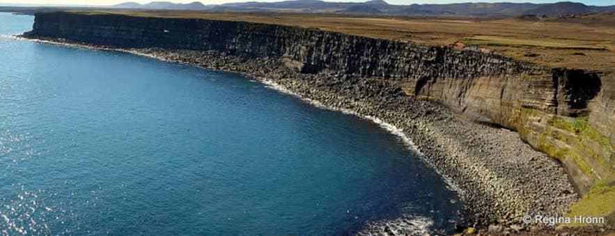
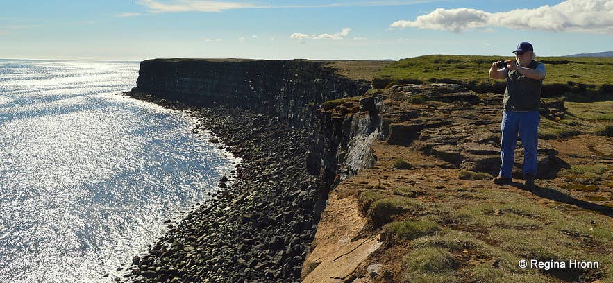
Top photo: Krýsuvíkurberg - Hælsvík and Heiðnaberg
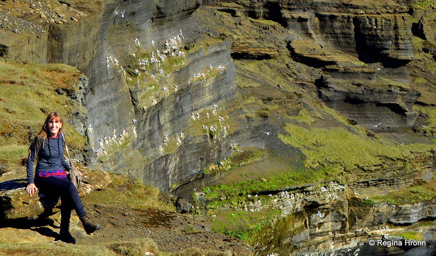
By Krýsuvíkurberg - nesting birds in the cliffs
Krýsuvíkurberg, on the southern edge of Krýsuvíkurheiði heath, is the largest bird cliff on the Reykjanes peninsula.
In fact, it is the largest bird cliff from the Westman Islands and all the way to Látrabjarg in the Westfjords.
This massive cliff stretches 8 kilometers, and Atlantic Ocean waves constantly crash beneath it, slowly eroding the cliff.
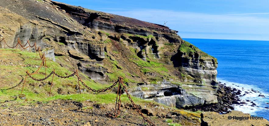 Chains for our protection
Here we are visiting the area below Mt. Geitahlíð and Selalda. The cove is called Hælsvík, and this part of Krýsuvíkurberg is called Heiðnaberg and Skriða (Rauðaskriða).
We don't really know how old this basalt cliff is, but it may have formed from the basalt shield volcano Geitahlíð in Krýsuvík and could be as old as the last interglacial period, more than 120,000 years old.
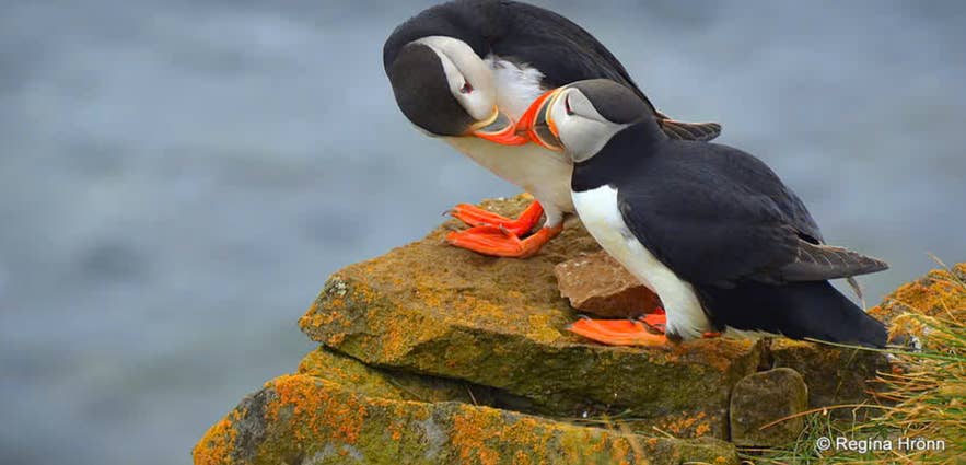 Puffins resting on a cliff
Here at the eastern edge of the Ögmundarhraun lava field, the massive lava flow rushed toward the sea in 1151 and miraculously spared an ancient church and human habitation, as I showed you in my Húshólmi travel blog.
At the Krýsuvíkurberg bird cliff, you will see seabirds in abundance, and I always feel like I am trespassing on their turf when I visit large cliffs like Krýsuvíkurberg and Látrabjarg in the Westfjords, Iceland's largest seabird cliff.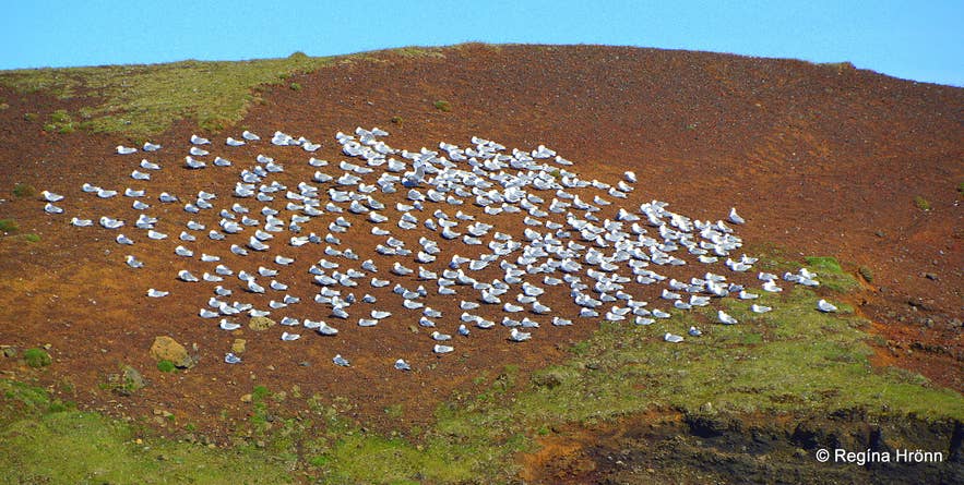 I zoomed in on these seabirds, but it was so windy that they were out of focus
Here, a large seabird colony includes about 58,000 pairs of 9 seabird species, including the long-tailed duck, the Arctic tern (my main nemesis in Iceland), the eider, the great black-backed gull, the herring gull, the puffin, and others.
I've included a photo I took of the puffins at Látrabjarg, since I found it too risky to use my zoom camera at Krýsuvíkurberg. I didn't want to risk losing my balance here so close to the edge.
On my way to the Rauðaskriða part of Krýsuvíkurberg, I zoomed in on a white colony of birds resting above the cliffs, but the wind blurred them.
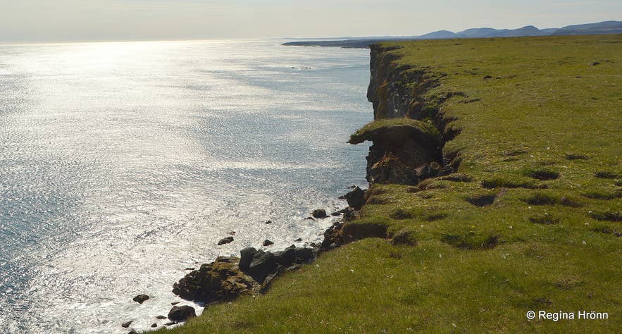 See how the edges are eroding and falling into the sea below
Ocean waves constantly crash into the cliff, slowly eroding it; cracks form at the edges, and sections collapse into the sea below.
The fall is high, so don't go too close to the cliff edge, as these edges have been known to collapse without warning, as I showed in another travel blog: Disappearing Landscape - Ketubjörg Cliffs and Dalshorn at Skagi in North Iceland
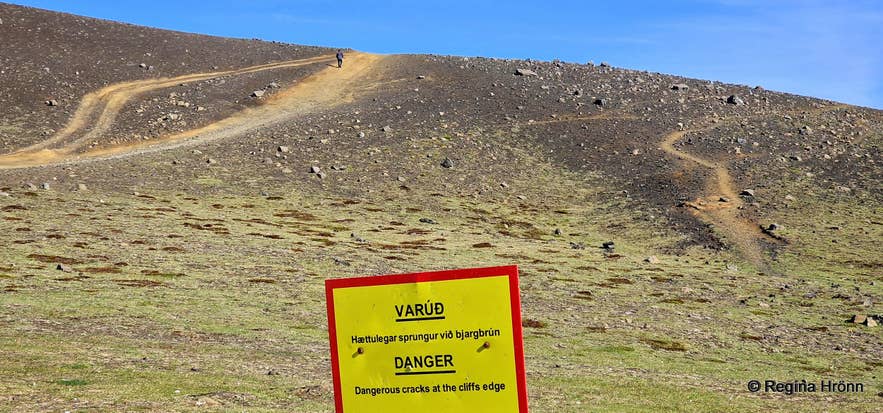 We are warned about dangerous cracks at the cliff's edge - track leading to Rauðaskriða
I once guided my friend Ólafur, a guide who owned his own travel company, on a tour of the Reykjanes peninsula to point out some of the main sights, as he wanted to start guiding tourists in the area.
The weather was fine, but a shadow fell across Krýsuvíkurberg, so I didn't get a good photo of the cliffs.
I have visited Krýsuvíkurberg several times, including once in January in the snow, which isn't recommended.
My late friend Óli was such a funny guide and a good friend
An employee at Guide to Iceland needed photos for an article he was writing about this area, and my father-in-law offered to drive us in his jeep.
It was snowing, and the road was in bad condition, but we made it down to the sea under the skillful guidance of my father-in-law, who worked his whole life at Vegagerðin - the Road Administration of Iceland.
Skriða - Rauðaskriða cliffs
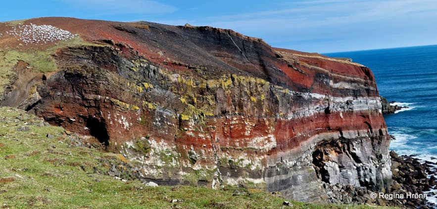
Rauðaskriða - Skriða
My father-in-law even managed to drive to the top of Rauðaskriða in those awful driving conditions.
Not to be repeated, though, and when my husband and I visited Krýsuvíkurberg in the summertime, in sunshine, 22 degrees C, and strong wind, we walked up the hill to Rauðaskriða.
On that visit, we visited Krýsuvíkurberg first, then walked up the hill to see the most beautiful part of the cliff, Skriða/Rauðaskriða, which almost glistened in the sun, making the red colour pop out.
It was beautiful to see the red cliffs approaching as I walked towards them in the strong wind.
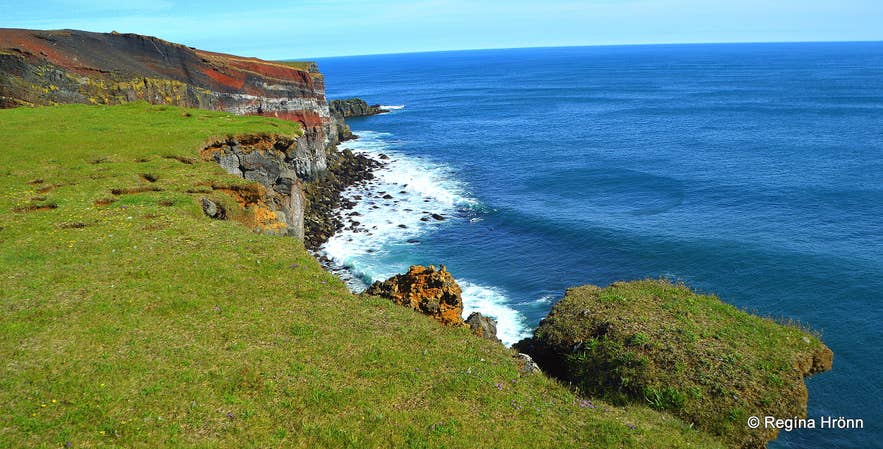 On my way to Rauðaskriða
I tried to stay well away from the edge, as I could see parts of it would soon fall into the sea below. With the edges disappearing, it wasn't a safe place to be.
Only when I was right opposite Rauðuskriða could I see how beautiful the cliffs looked.
I took a very short video of Rauðaskriða. The wind was so strong that I didn't risk going any closer, for fear I would lose my balance and be blown into the sea below. My husband had stayed behind, and it is better to be safe than sorry.
Isn't it amazing, though, how colorful and majestic it is in the sun? And you can see the white birds on top of the cliff.
Rauðaskriða
Krýsuvíkurberg is sometimes spelled Krýsuvíkurbjarg, but -berg and -bjarg in Icelandic mean cliff wall. I follow the spelling on the map of Náttúrufræðistofnun Íslands - the Natural Science Institute of Iceland.
That official website also says Krýsuvíkurberg is about 8 km long and 60 m high, and I wrote to them to confirm that number, since other websites say it is 15 km long and 40 m high.
You will notice the sign below at Krýsuvíkurberg. Reykjanesfólkvangur means the Reykjanes Nature Reserve, which covers approx. 300,000 square meters of the Reykjanes peninsula, including the Krýsuvíkurberg cliff.
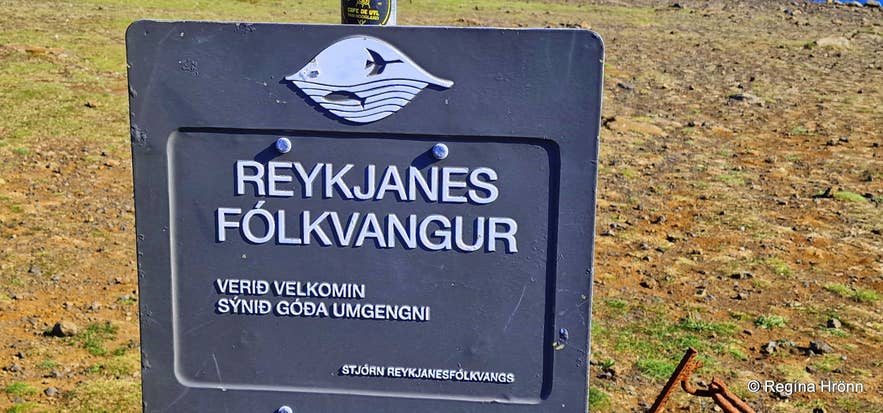 Krýsuvíkurberg is part of Reykjanesfólkvangur - the Reykjanes Nature Reserve
A little bit east of here is Ræningjastígur, where the Turks came ashore in the 17th century. It is the only passage up the cliff, and I will tell you that story in the next chapter of this travel blog.
Now, let's visit the amazing Selalda and Strákar ridge.
Selalda and Strákar
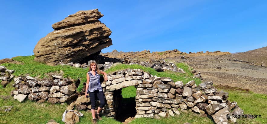
The old sheep barn is made of rocks and turf
We parked below Selalda and Strákar and walked up to the beautiful ridge, with amazing sandstone formations and an old sheep barn called Strákafjárhús.
In my opinion, this is the coolest sheep barn in the country. Originally, there was a small cave here called Strákahellir, and the sheep barn was built next to it.
This turf sheep barn might date from 1550-1900.
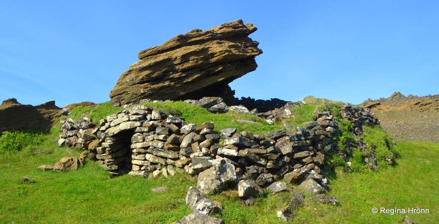 Strákafjárhús
Here is a description of the turf house and tuff cliff, from Heiðrún Eva Konráðsdóttir (2019) - Archaeological inventory of detailed developmental plan by Krýsuvíkurberg, which I found in Fornleifaskrá Hafnarfjarðar - page 175:
"The structure is simple but substantial, measuring approximately 9 × 15 m. Its walls are about 1–2 m high and 1 m thick. It is built against a roughly 10 m-high tuff cliff, which forms the structure’s north wall.
The cliff curves over the structure, covering about one-third of it. The roof was probably built sloping up against the cliff. The entrance faces west and is 0.7 m wide, 1 m deep, and 1–1.4 m high. A stone slab spans the entrance, with masonry on top of it."
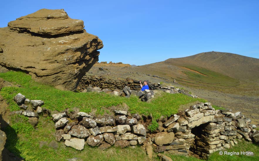 Strákafjárhús from a slightly different angle
Some turf-and-rock sheep barns remain in Iceland, but this is by far the coolest one I have seen.
You can see the other ones in several places in Iceland, and I have written another travel blog where I list the turf houses in Iceland and include some of the outhouses as well:
A List of the beautiful Icelandic Turf Houses - Torfhús - I have visited on my Travels in Iceland
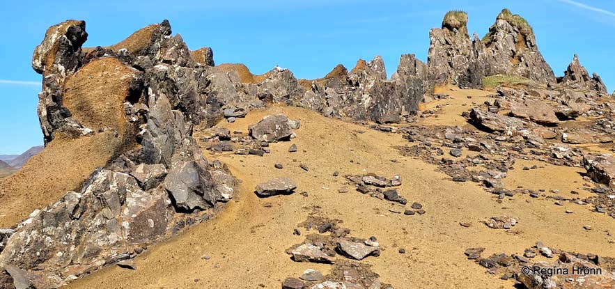 The majestic Selalda ridge
We then walked to the impressive Selalda ridge, where you can see the width of the volcanic dyke by stretching your hands through it. And the Strákar lava formations, in the western part of Selalda.
There are some amazing rock formations here, which can be seen from the Suðurstrandarvegur road, and I've always been intrigued to visit them, so I am glad we finally got to see them on this beautiful summer day.
It is a very cool ridge, and you can see the view from it all the way to Krýsuvíkurberg cliff in my video below.
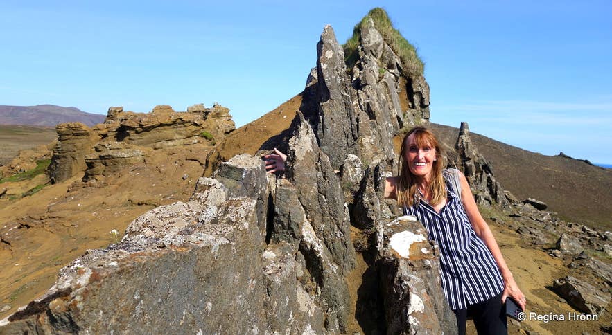
Here you can see the width of the volcanic dyke
One formation is called Rjúpan, the Ptarmigan, because it looks like a ptarmigan sitting on top of the ridge. And I am sure that other rock formations have names as well.
My husband loves filming me peeking out from behind rocks, so I humored him, as I have done before in so many places in Iceland, where he sees some rock formations.
But the video also shows how shy and wobbly I am and at unease when I walk on rocks, and I somehow stumble through rocky areas with no dignity at all ;)
Maybe that is what my husband loves when insisting on taking videos of me in rocky areas :D
Stumbling on the rocks
On our way back from Selalda and Strákar, we visited the ruins of an old farm just opposite the road where we parked, west of Selalda.
Here are the ruins of Krýsuvíkursel and the Fitjar turf farm. Such ruins show us how Icelanders lived through the ages, in houses made of turf and rock.
Turf houses needed constant maintenance, and you can find turf-house ruins scattered across Iceland.
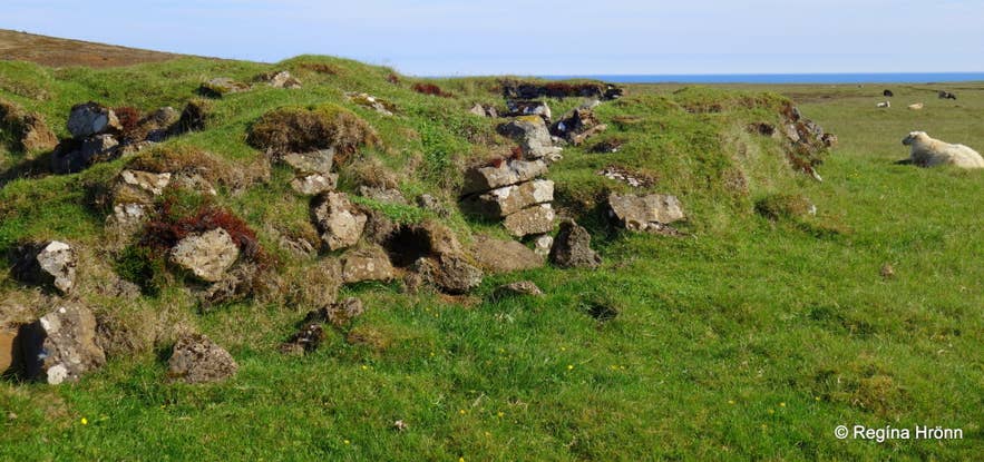 Ruins of an old turf farm, Fitjar, by Selalda
I now want to tell you about the Turkish pirates who raided Iceland in the 17th century. We have many stories about this terrible kidnapping of Icelanders, who were sold into slavery.
But this folklore tells us about when the Turks came to Krýsuvíkurberg and Selalda.
The Turks come to Selalda — The Turks come to Krýsuvík
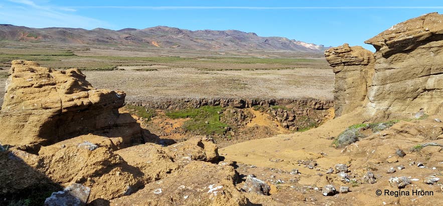
The view from the lava dyke
I found one story from this area in Þjóðsögur Jóns Árnasonar - the Compilation of Folklore by Jón Árnason, which I often refer to in my travel blogs.
The story happened a little east of where we are now, and the photo below shows where the Ræningjastígur path was located.
This is a screenshot I took of the Náttúrufræðistofnun map for this area.
I took the photo above from the top of the ridge. The view shows the Suðurstrandarvegur road, and in the distance is the geothermal area at Seltún.
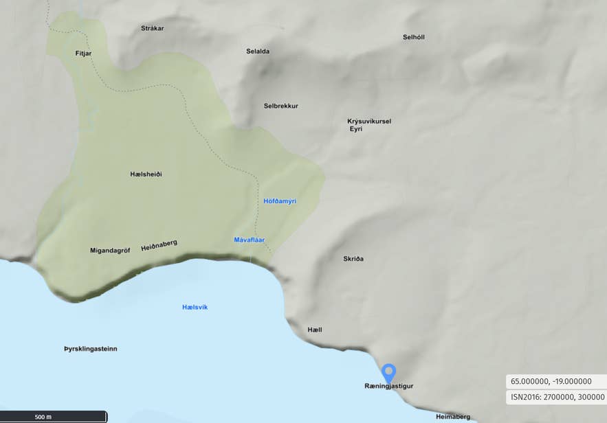
The story goes like this, translated into English:
"Once, the Turks came beneath Krýsuvíkurberg Cliff and walked up to where it has since been called Ræningjastígur - the Robbers’ Path or the Pirates' Path.
There was a female cook at Selalda, and the Turks went there, killed her, and chased the shepherd home to Krýsuvík.
It was Sunday, and the priest Eiríkur (Eiríkur Magnússon í Vogsósum - RHR) was saying Mass in Krýsuvíkurkirkja church.
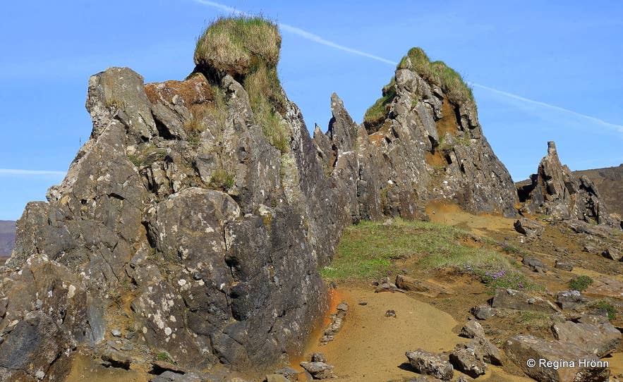
Selalda and Strákar
Some say he was at the altar, but it is more likely he was in the pulpit when the shepherd ran into the church and cried aloud: “The Turks came and killed the cook, and chased me here.”
The priest said, “Will you not allow me to walk to the door, good people?” They agreed.
Eiríkur walked to the door, looked out, and saw the Turks coming across the field.
He said to them, “Do not go any farther! Kill one another there! If it were another day or if I were otherwise clothed (dressed), you would eat one another.”
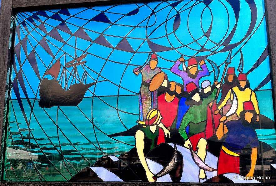 Pirates attacking Grindavík - photo of an information sign by Grindavíkurkirkja church
They fought and were killed there; the place has since been called Battle Hill (Orrustuhóll) or Robbers’ Hill (Pirates' Hill), where they fought, and Robbers’ Mound, where they are buried.
Then Eiríkur piled a cairn on Mt. Arnarfell and declared that, as long as it stood, the Turks would never destroy Krýsuvík. That cairn still stands now (1859)."
(Translated into English from Þjóðsögur Jóns Árnasonar - the Compilation of Folklore by Jón Árnason)
Eiríkur at Vogsósar (1638-1716) was a well-known minister in this area, and he was nicknamed "galdraprestur" a sorcery minister, as he seemed to have some supernatural powers.
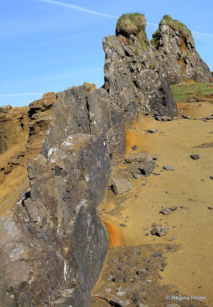 Quite an impressive ridge, right?
The Turks raided Iceland in the summer of 1627 and kidnapped many an Icelander in nearby Grindavík and sold them into slavery.
Another pirate ship came from Algeria two weeks later and kidnapped people in the Eastfjords and in the Westman Islands. They sailed away with hundreds of Icelanders and sold them into slavery :(
In this travel blog, I have shared my take on this area and hope it enriches your visit.
Have a lovely time on the Reykjanes peninsula and stay safe :)
Ref.:
Sagnagrunnur - Tyrkir koma í Krýsuvík - Þjóðsögur Jóns Árnasonar

Hi, my name is Regína Hrönn, and I was born and raised here in Iceland.