In this last part of my Mývatn in North Iceland series, Part I-IV, I am going to show you the extraordinary geothermal areas and lava fields by Mt. Námafjall and Krafla.
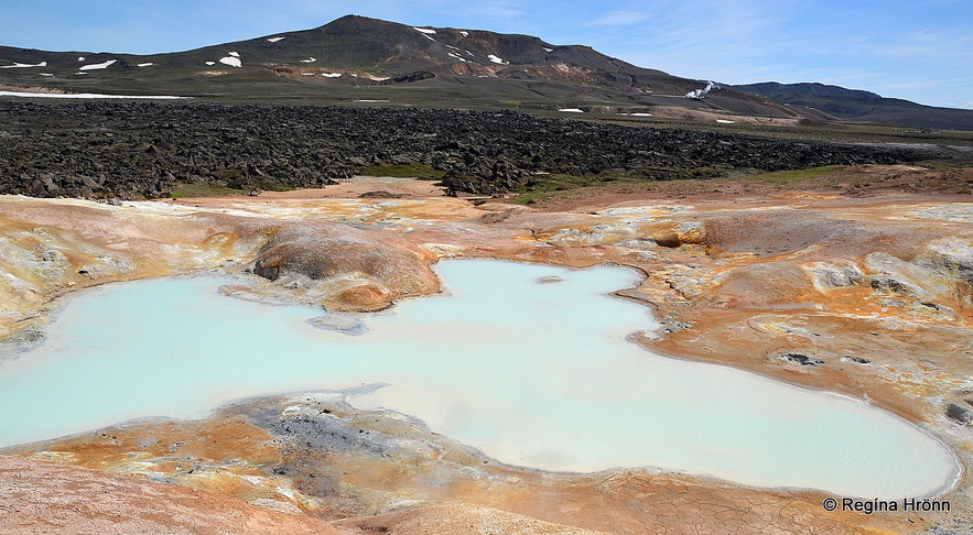
This area is only some 5 km from Mývatn, and here you will see a stark contrast in the landscape and vegetation, changing from the green, vegetated Mývatn area to the barren, colourful geothermal landscape of the Krafla area.
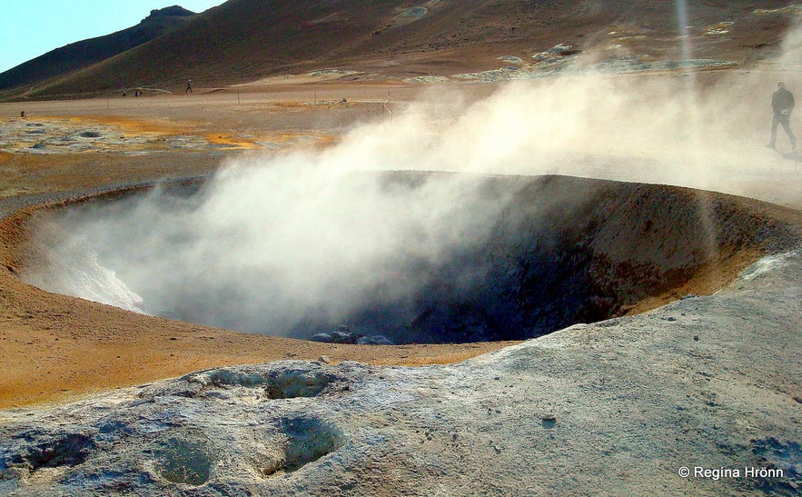
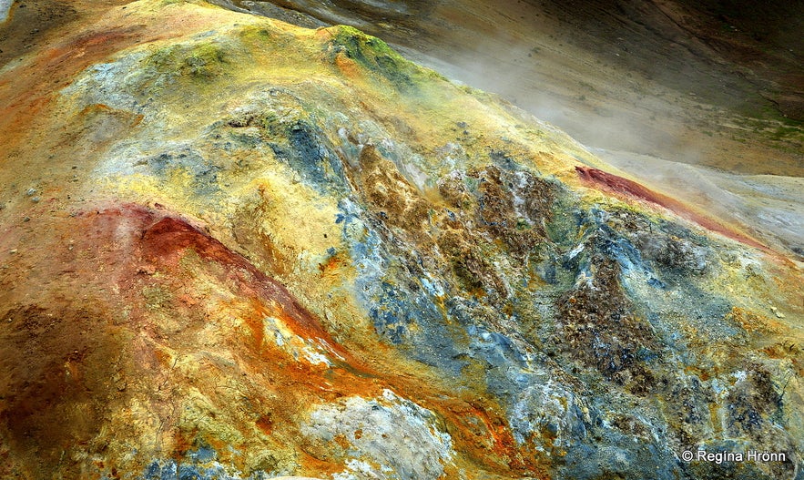
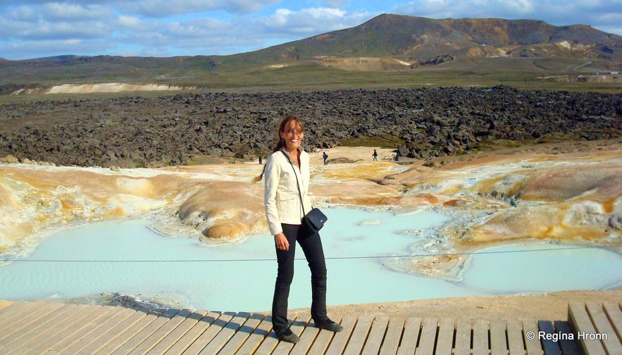
Top photo: A huge solfatara at Hverir
Mt. Námafjall - Hverir geothermal area
Alone at Hverir and Mt. Námafjall
Let's first stop at Mt. Námafjall, which is the orange/yellow rhyolite mountain south of Námaskarð, towering over the geothermal area Hverir.
The geothermal area by Mt. Námafjall is one of Iceland's most accessible ones.
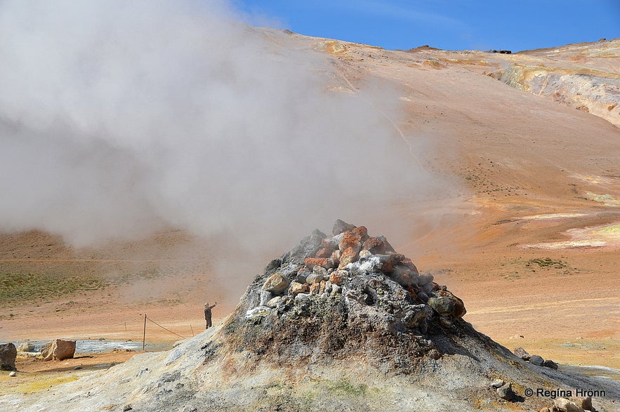
A fuming borehole
Hverir is a barren, high-temperature geothermal area with the biggest fumaroles east of Mt. Námafjall, and the whole area is boiling, bubbling, and hissing.
This area is sometimes called "eldhús djöfulsins" in Icelandic, or Hell's (Devil's) Kitchen due to the boiling and steaming hot pots and the strong smell of sulphur in the air - coming from the all surrounding steam and fumarole gas, amongst them hydrogen sulfide.
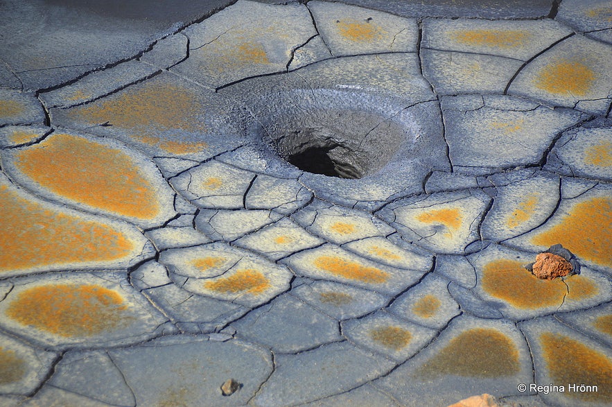
Hverir
The sulphur fumes can overwhelm you at times there, especially when the wind is strong. Try to stay upwind, as the fumes can be toxic and cause headaches and nausea.
I once got sulphur poisoning when the wind was so strong that it blew the fumes straight onto my face, and it took me 2 days to recover!
We don't want that to happen when we are on the road.
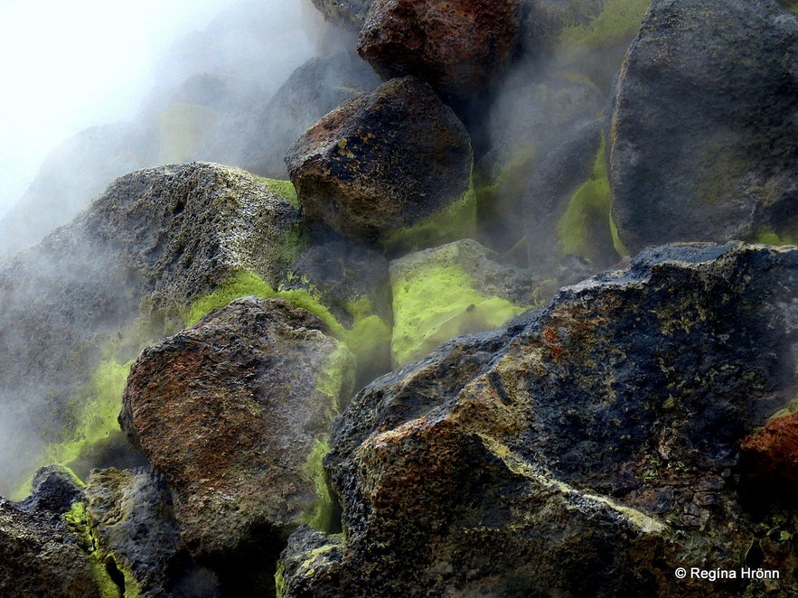
Sulphur in the borehole
The yellow colour you will see in the geothermal areas, e.g., in my photo above, is sulphur deposits, of which the hot springs produce considerable amounts.
Sulphur was mined in Iceland in the olden times, exported, and used in the production of gunpowder.
Now, let's be very careful in this area, as it is extremely hot and one can easily get severely burnt if not careful. We want our foreign visitors to be safe here, so don't stray from the marked paths and never go inside a fence.
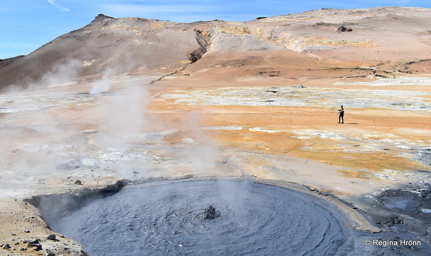
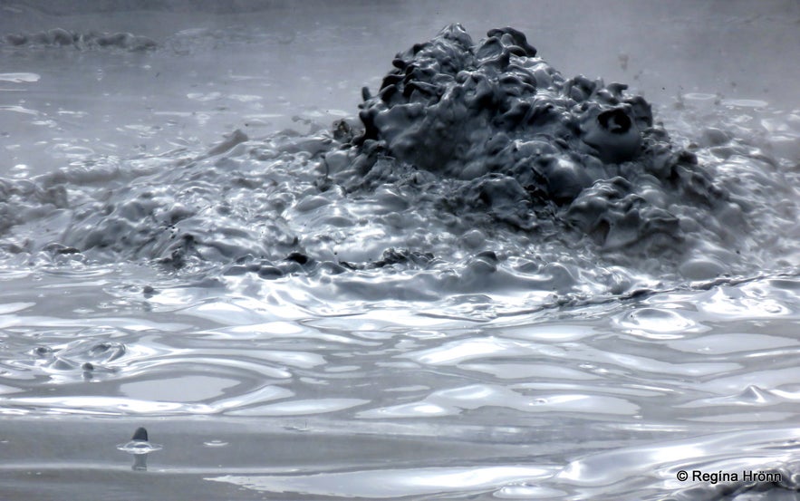
Boiling mud pools
I always get startled when I see people stepping inside a fence to get better photos - your next step might be inside a hidden mud pool with boiling hot water!
I understand the urge to get a little closer to get a better photo or a better look at the mud pools, but it is not worth it.
We Icelanders are warned by our parents from an early age to fear the dangers in Iceland, so we wouldn't even dream of stepping inside a fenced-off geothermal area.
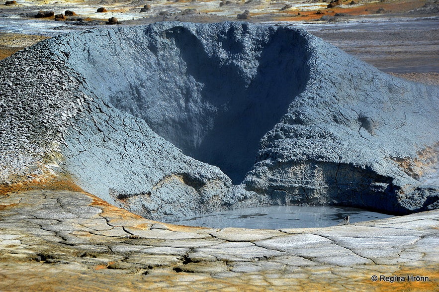
Boiling mud pools at Hverir
We hear horror stories about what happens when people step into hidden mud pools, and the skin comes straight off.
This has happened way too many times in Iceland. So let's be safe here!
In August 2019, actions were taken to close off some areas to keep people safe and to preserve this delicate area.
Hiking on Mt. Námafjall
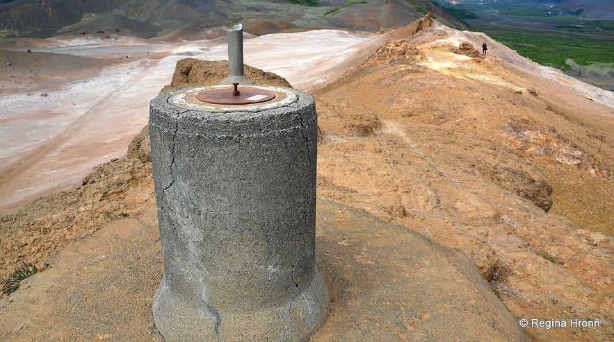
Mt. Námafjall - here the view-dial was located before it was removed
It is possible to hike to the top of Mt. Námafjall via trails from the geothermal area. We hiked to the top to have a look at the pillar where the view-dial was located.
We search for all the view-dials in Iceland, since my father-in-law has designed many of them.
The view-dial on top of Mt. Námafjall was designed by Jón J. Víðis, who was the instigator for view-dials in Iceland and designed 23 of Iceland's view-dials. He was my husband's great-uncle. The view-dial was erected in 1972 by Pétur Jónsson at Reynihlíð in Mývatnssveit.
The fumes from the geothermal area eroded the view-dial, and it was removed in 1994.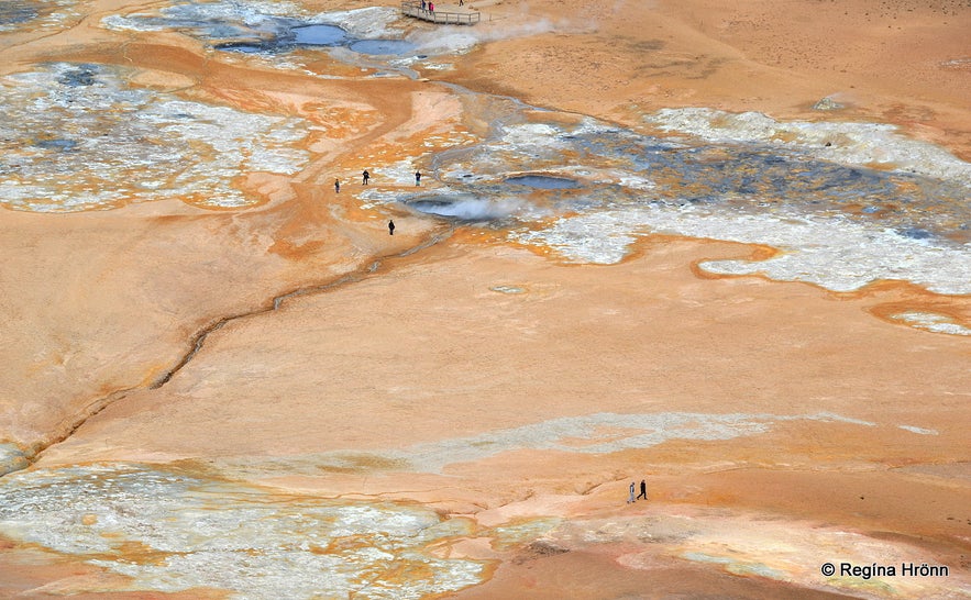
Looking down at the geothermal area Hverir from Mt. Námafjall
This is a marvelous hike with fantastic views, and it was beautiful seeing the geothermal area below. We went on this hike in the summer of 2020 when very few tourists visited Iceland due to COVID-19 restrictions.
As you can see in my photo above, only a handful of people were visiting the geothermal area.
Earlier that same day, I had been alone in this area, which was quite eerie.
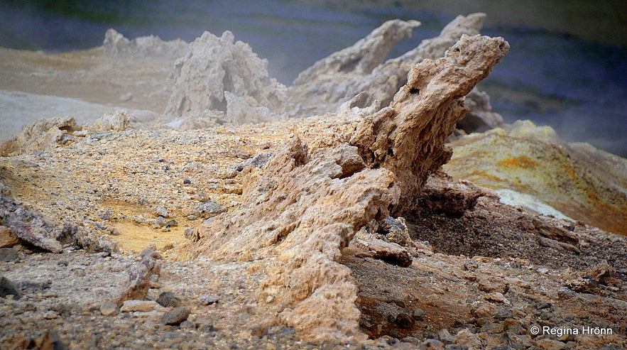
Strange-looking geothermal formations on Mt. Námafjall
We saw all kinds of strange formations and colours on our hike on Mt. Námafjall, including the ones in my photo above. To me, they looked like they were alive :)
Steam was rising everywhere from the ground, making the surroundings even more mystical. Let's always stay on the paths, as we never know what lies beneath our feet in such hot areas, and it is easy to stray from the path here on the mountain.
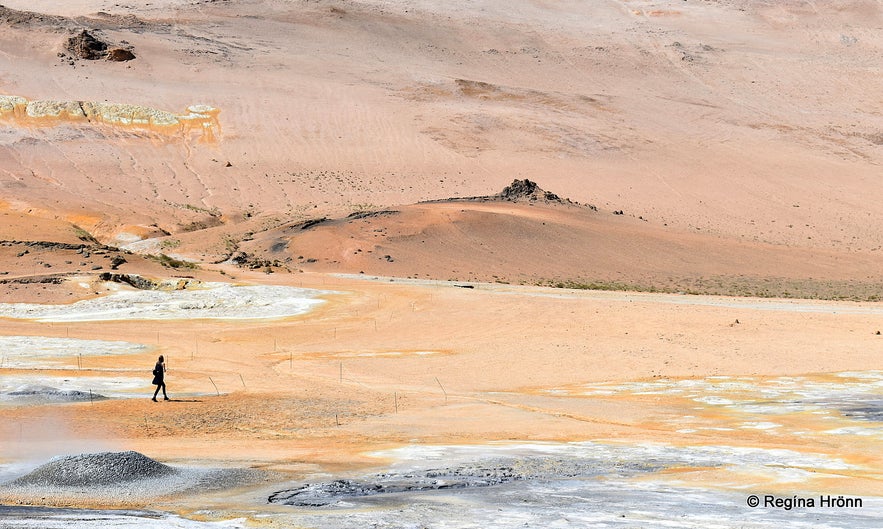
Walking alone in the pink landscape at the Hverir geothermal area
Mt. Námafjall is located along Ring Road 1, just "behind" the Mývatn area. Right on the other side of Mt. Námafjall is the Blue Lagoon of the North, the Mývatn Nature Baths.
This is a highly volcanic area with Mt. Krafla just a few kilometres away, where the last volcanic eruption took place in 1984.
Mt. Krafla and Stóra-Víti crater
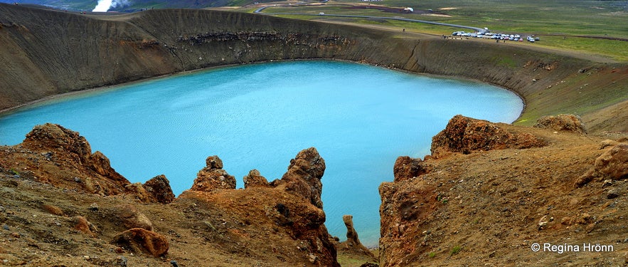
Stóra-Víti
Krafla, which is located only a short distance north of Mt. Námafjall and Hverir, is a major volcano, situated on the border of the tectonic plates of Eurasia and North America. The Krafla caldera is 10 km in diameter and contains one of the Víti craters in Iceland.
I have written another travel blog about Askja and Víti so that you can see the difference between the two explosion craters.
There is a big difference, and you can actually swim in the Víti at Askja as it is warm, albeit sulphurous.
The geothermal area behind Stóra-Víti
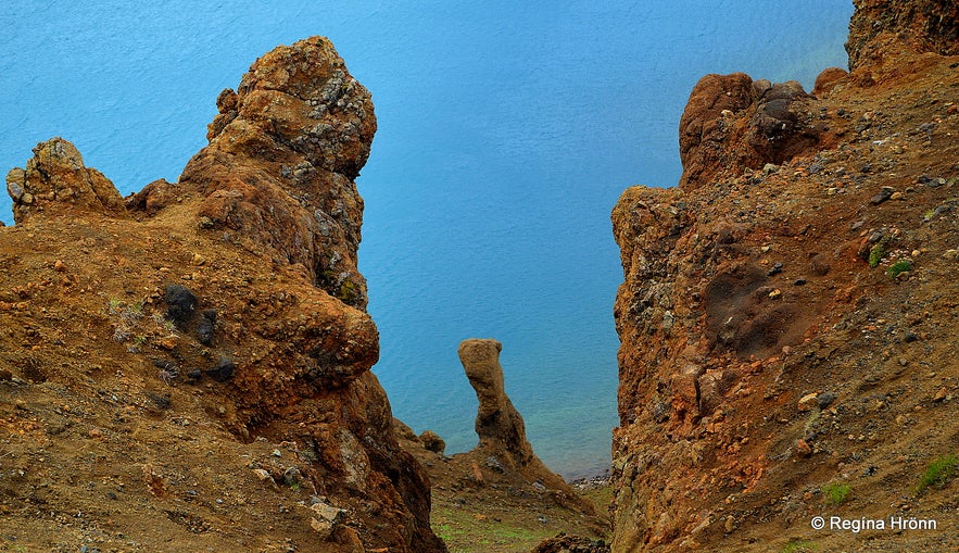
This Víti at Krafla is called Helvíti or Stóra-Víti, meaning Big Hell. It is an explosion crater formed in 1724 in the Mývatnseldar Fires, which erupted from 1724 to 1729.
Víti is the Icelandic word for Hell, as people often believed Hell to be located beneath volcanoes.
The explosion crater is filled with a lake, which takes on the most beautiful azure colour in still weather and changes to royal blue when it is windy.
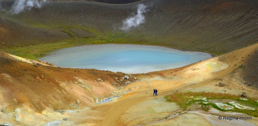
We were able to hike on the rim of Stóra-Víti and visit the colourful geothermal area behind the explosion crater. There, the striking geothermal colours are like something out of this world. 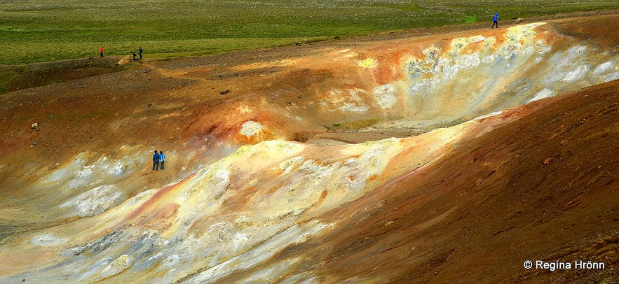
Colourful geothermal area - people who seemed unaware of the dangers of leaving the path
Just be very careful when you are hiking on the rim, as it can be very windy, and I have seen people all but fly off the rim, yours truly included. We do not want to end up in the 30-meter-deep Hell!
Always be very careful when visiting geothermal areas and stay on the paths. I was pretty startled to see the couple in the photos above and below!
They had strayed from the path to get a closer look at the colourful geothermal area and to take some photos, probably not realising they were in grave danger.
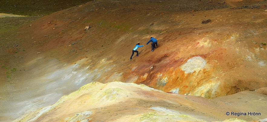
This sight startled me
I understand that they wanted to get closer to the most colourful spot, which you can see in my photo below. And I felt so sorry for them and was worried about their safety. The man was helping the woman up as she was sliding down again. One false step in these boiling geothermal areas can lead you to step through the thin crust and be seriously injured with dreadful burn wounds.
It is impossible to see where boiling hot pots or mud pools are hiding just beneath the crusty surface. This is why we have these paths: to visit these beautiful but dangerous areas. So please stay on the paths so no one gets hurt.
The hike around the Stóra-Víti crater and the geothermal area east of it takes about 50 minutes.
This hike was closed in August 2019 to preserve this area and to keep people safe.
Very vivid geothermal colours
Krafla erupted 9 times from the 20th of December 1975 until the 18th of September 1984, giving us Icelanders a lot to think about during the nine massive fissure eruptions. The last eruption lasted 2 weeks and produced a lava flow of 24 sq. km.
This gave the eruption a name, Kröflueldar or the Krafla Fires. When visiting the Krafla area, keep this in mind, as it is really calm now, but when will it erupt again?
I followed the Krafla Fires on TV when I was younger and am very aware, during my visits to this area, that I am walking through a lava field from a massive eruption.
Stóra-Víti
The inhabitants of the nearby populated area by Mývatn were greatly affected both by the 9 years of the Krafla Fires and during the biggest eruption of the Mývatnseldar Fires in the year 1729.
That year, the lava flowed from Leirhnjúkur all the way to Lake Mývatn, destroying three farms. Reykjahlíðarkirkja church miraculously escaped the lava flow, called Eldhraun.
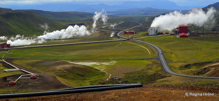
When you enter the Krafla area, you will notice the Krafla geothermal power station on your left-hand side. It has been operating since 1977, but Krafla erupted at that time, making it dangerous to be in this area, as the eruptions were only 2 km away from the power station.
Krafla power station has drilled 33 boreholes, but only half of them are in use.
The Visitor Centre of the Krafla power station is open during the summer months.
The Krafla area
To reach Krafla, you have to pass the Krafla geothermal power station and drive up a steep hill. Here, you might actually get stuck behind a truck, of which there are many in this area, as this is a working area.
The paved hill is steep, and these heavy trucks drive very slowly up the hill. I once got stuck behind a heavy truck, and it was no fun. If you see a truck on the hill, it's better to wait by the power plant for it to pass.
Mt. Leirhnjúkur volcano
Leirhnjúkur and Stóra-Víti in the distance
As you get to the top of the hill of the Krafla area, the Leirhnjúkur area is on the left-hand side, a viewpoint on the right-hand side, and just a little further is the Stóra-Víti explosion crater.
The view from here is fantastic, all those colours and steam coming up from everywhere. And there is a lot of activity and traffic, especially to Leirhnjúkur and Stóra-Víti crater.
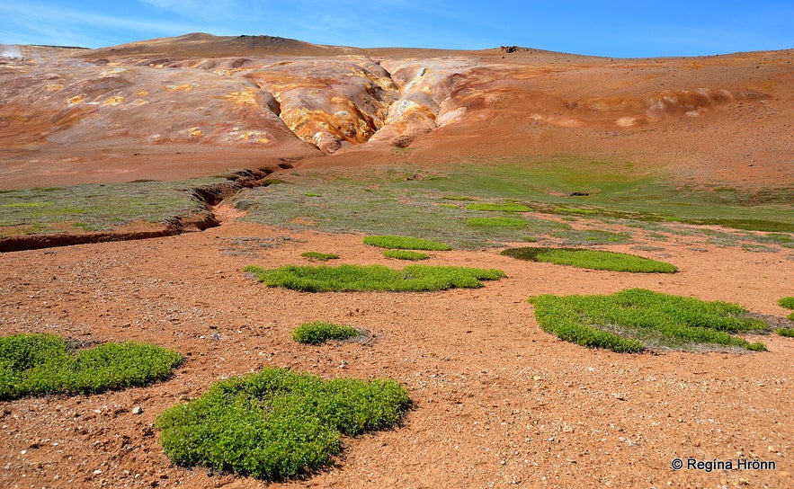
Leirhnjúkur volcano
An easy walk from the parking lot to Mt. Leirhnjúkur takes something like 10 minutes. And from there, a trail will lead you through the geothermal area of Leirhnjúkur.
The name Leirhnjúkur means "Clay Hill," and the volcano got its name from the clay, which stems from rhyolite melting due to geothermal heat.
Mt. Leirhnjúkur itself is a yellowish, red clay coloured tuff mountain that rises 593 meters above sea level with a myriad of hot springs and mud pools by its roots.
Here was an eruption in the Kröflueldar fires from 1975 to 1984.
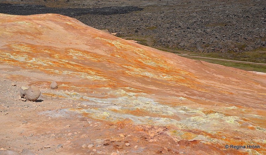
Leirhnjúkur volcano - the view from the top of the volcano
You might not even know this is a volcano, as it rises only about 50 meters above the ground.
We hiked to the top of Leirhnjúkur, and this is what it looks like from the top, see my photo above. It is an easy hike and well worth it, especially on a sunny day like the one we got, when the geothermal colours become even more vivid and bright.
Here you will see fumaroles and bubbling mud pools in abundance. The lava is still hot in some places, and steam from hidden boiling hot springs rises through holes in the lava.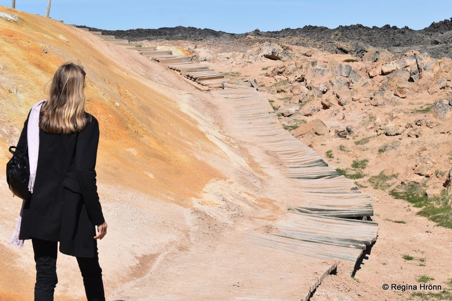
In 2020, the paths at Leirhnjúkur were a bit ruggedly looking ;)
The hike to the top of Leirhnjúkur is part of the hike around this area, but you can choose whether or not to add it to your hike. So the hike starts behind the volcano, never from the front.
Just follow the paths, even though they might look like the one in my photo above.
Actions were taken in August 2019 to keep people safer here and to preserve this delicate area. But the Icelandic winters take their toll, and in June 2020, the path was damaged in some places.
At Leirhnjúkur, back in 2008, when I first visited this area
Leirhnjúkur is a very colourful geothermal area with brilliant hues, like stepping into another world; it features stark contrasts and a moon-like landscape.
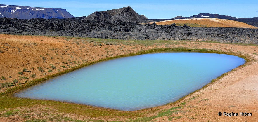
Leirhnjúkur - the oblong lake - Hófur crater in the distance
The shorter hike takes a little over an hour or so, depending on how many stops you make to take photos, and if you are anything like me, then there will be many stops ;)
As always, please stay on the paths, as it is bubbling and boiling all around you, and the area beneath is extremely hot and dangerous.
You might melt the sole of your shoes if you're not careful here and get burnt.
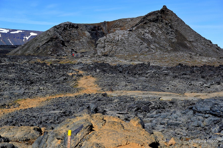
Hófur crater
The more extended version of the hike leads through the lava field to the crater Hófur, north of Leirhnjúkur. It is another easy hike.
Hófur crater was formed during the Mývatnseldar fires in 1724-1729. Here, the lava is pitch black.
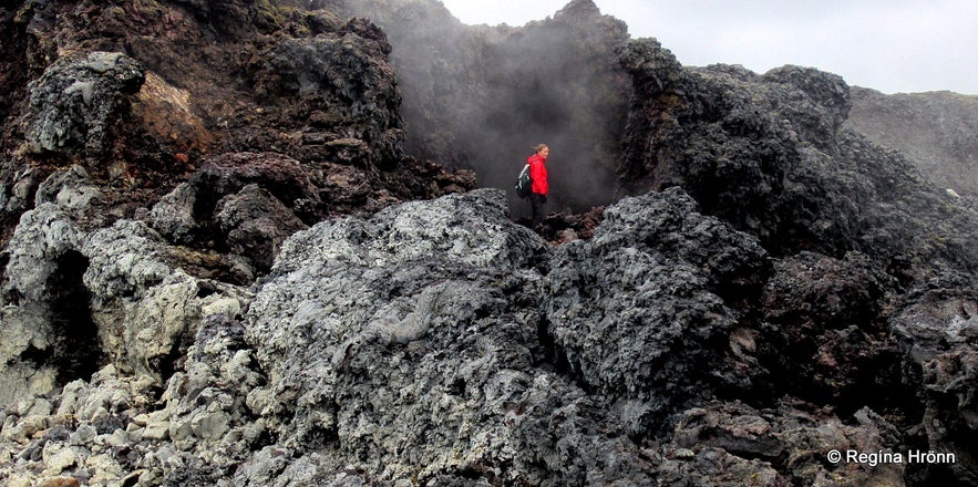
At Leirhnjúkur
We spent 2.5 hours at Leirhnjúkur and took a myriad of photos.
Don't miss it while visiting Iceland. I try to visit Leirhnjúkur once a year and am always blown away by the extraordinary lava landscape here in the geothermal area of Krafla.
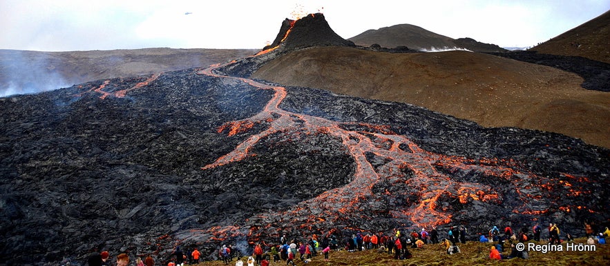
The volcanic eruption in 2021 in Geldingadalir in SW-Iceland
And now we have our own volcanic eruption and a brand-new lava field in SW-Iceland, where I live:
The Volcanic Eruption in Geldingadalir Valley on Reykjanes Peninsula in SW-Iceland
Gjástykki lava field
Gjástykki lava field - amazing lava formations
Further on lies Gjástykki, which belongs to the same volcanic zone as Leirhnjúkur, the northern part of the Krafla fissure swarm. At Gjástykki, you will see the colourful and brittle lava formations from the Krafla volcano-tectonic eruptions in 1975-1984.
The tectonic plates are active in this area, and Gjástykki and the whole Krafla area are located on the border of the Eurasian and North American tectonic plates.
The Gjástykki lava field was formed in 1981-1984, when eruptions were most active in this northernmost part of Krafla.
Colourful Gjástykki lava field
Here you will see steam coming from the lava in the 2-5 km wide rift valley, which was ripped apart during the Krafla Fires.
The two geothermal areas in the south of Gjástykki still contain geothermal heat and produce steam.
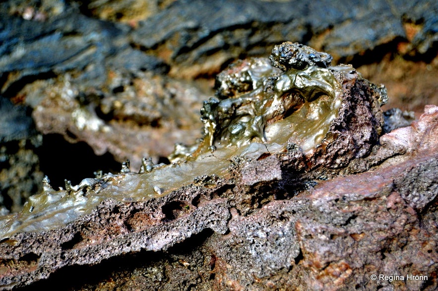
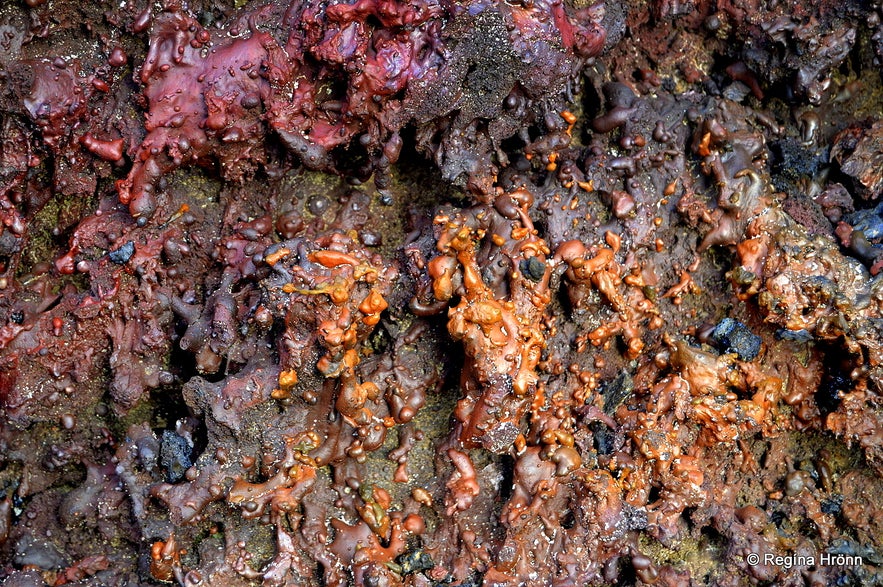
At Gjástykki I saw lava which looked like a dinosaur egg - one of the eggs was open and inside it was filled with the most vibrant lava colours - it looked like a piñata :) Lava never ceases to amaze me, and I was so happy to visit Gjástykki at last.
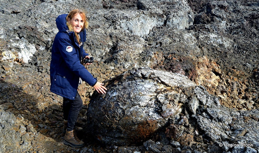
At Gjástykki lava field
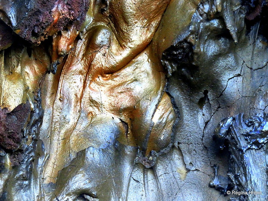
Here at Gjástykki, I saw the most beautiful, colourful, and shiny lava I have ever seen above ground in Iceland. Such lava is most often only seen down in lava caves.
The details were amazing. I would have needed a whole day at Gjástykki to roam around, take in the various lava formations, and photograph them.
Lava formations and shiny colours at Gjástykki
I joined a guided tour of Gjástykki and have written a separate travel blog with a lot more information and photos: Unique Lava Walk through the Colourful Lava Field at Gjástykki in North Iceland.
Now this concludes my journey around the major sights, in my opinion, of the Mývatn and Krafla area, about which I have now written five travel blogs.
I hope you have enjoyed travelling in this area with me :)
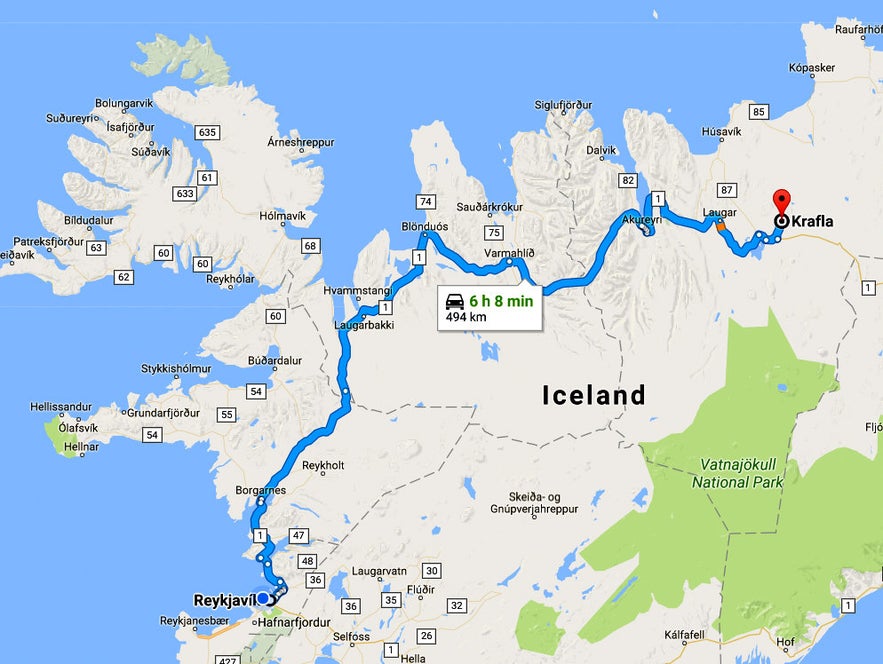
To reach Mt. Námaskarð and the Krafla area, you can rent a car in Reykjavík and drive up here in a couple of days.
I have added several travel blogs about the Mývatn area:
The Amazing Mývatn area - part I
The Amazing Mývatn area - part II
The Amazing Mývatn area - part III
The Amazing Mývatn area - part IV
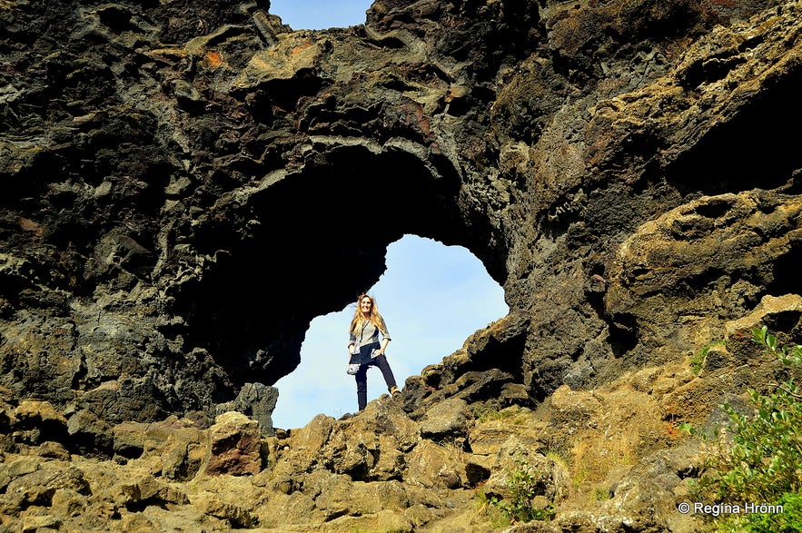
In the gap at Dimmuborgir at Mývatn
The Amazing Mývatn area - a Compilation of the Sights
The Sigurgeir's Bird Museum at Mývatn - Breeding Birds in Iceland
Úlfhildur the Elf-lady at Lake Mývatn in North Iceland - an Icelandic Folklore
A Wonderful Day of Exploring the Extraordinary Mývatn Area in North Iceland
The Extraordinary Ice Sculptures in Lofthellir Cave in Mývatn, North Iceland
A Unique Lava Walk through the Colourful Lava Field at Gjástykki in North Iceland
Have a fantastic time in the beautiful Mývatn area, and I hope that my travel blogs will help you plan your Iceland trip :)

