The Magical Snæfellsnes Peninsula in West-Iceland - Part II - Lóndrangar and the Elves and much more
- Svalþúfa-Þúfubjarg rock formations
- Kolbeinn and the devil at Þúfubjarg rock
- Lóndrangar volcanic plugs
- Malarrif
- Vatnshellir lava cave
- The Purkhólar crater family
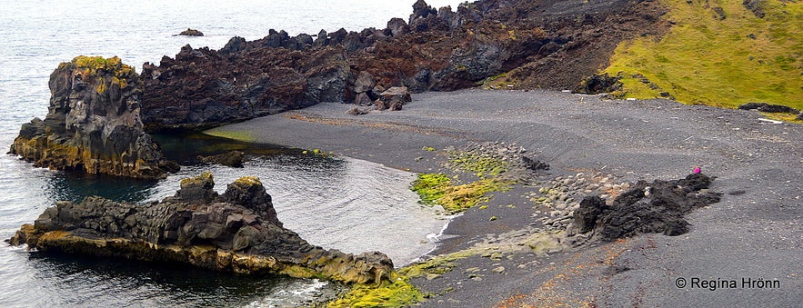
- Djúpalónssandur - the Black Lava Pearl beach
- Dritvík cove
- Einarslón - the Lagoon of Einar
- Hólahólar craters
- Saxhólar craters
- Skarðsvík
- Svörtuloftaviti a.k.a. Skálasnagaviti lighthouse
- Öndverðarnes cape
This is part II of my travels around the magical Snæfellsnes peninsula and a direct continuation of my travel-blog the Magical Snæfellsnes Peninsula Part I. There is just so much to do and see here that I have written 5 travel-blogs where I show you the sights on the Snæfellsnes peninsula in chronological order.
In part I, we explored the peninsula from Eldborg scoria crater to Laugarbrekka and were heading towards the beautiful Lóndrangar and Þúfubjarg-Svalþúfa rock formations.
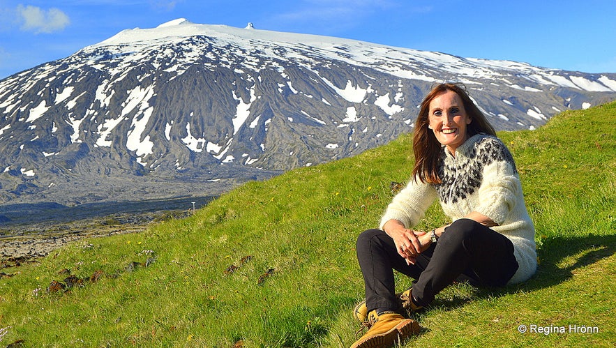
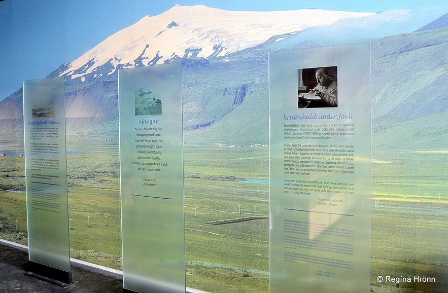
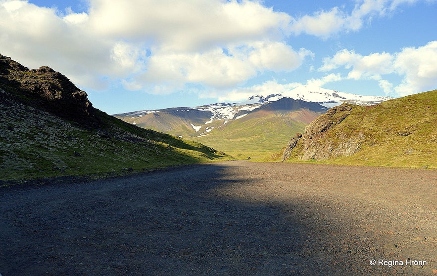
Top photo: By Snæfellsjökull glacier
Svalþúfa-Þúfubjarg rock formations
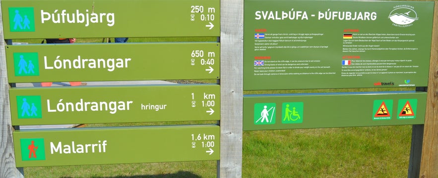
The information sign for Lóndrangar and Þúfubjarg
Now, let's return back to road 574 from Laugarbrekka and drive just a short distance to two magnificent volcanic plugs called Lóndrangar. The parking lot is by the road on your left-hand side so you cannot miss it. But I have seen people getting confused by the sign above, so I will explain a bit ;)
Þúfubjarg cliff is the first stop, 250 meters uphill Svalþúfa, which is right in front of the parking lot, and from where you will get a beautiful view of the 2 cliffs of Lóndrangar in the distance. The hill looks innocent enough, but it turns into a sheer rock so caution is needed here. Svalþúfa is the name of the hill and Þúfubjarg is the name of the cliff. This is most likely the eastern part of the old crater.
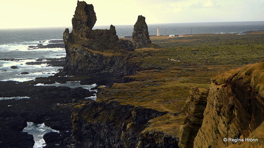
The view of Lóndrangar from Þúfubjarg cliffs - I must get a decent photo
A 1.6 km hike will take you to the white lighthouse at Malarrif in the distance in my photo above. We will be driving there, after visiting Lóndrangar to see what it looks like. The Snæfellsnes Information centre is located at Malarrif.
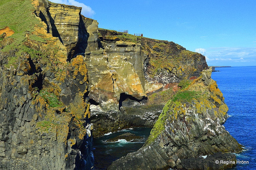
In the summer of 2015 platforms were put up at Lóndrangar view-platform to make this place less dangerous. Before the platforms were put up I used to stop when I started to smell the guano from the sea-birds in the cliff, which are mostly guillemot and kittiwake, then I knew that I was too close for comfort!
Þúfubjarg cliffs
Lóndrangar volcanic plugs are on your right-hand side, 650 meters away from Svalþúfa-Þúfubjarg and you can see on the sign that going back and forth to Lóndrangar - hringur means a circle - is 1 km and a one-hour easy hike on a path through the lava field.
Let's hike up Svalþúfa. I have seen such beautiful photos of the magnificent Lóndrangar cliffs from Svalþúfa, but have never been able to take such photos myself, as it always seems that the sun is in the "wrong" position for good photos or that it is rain when I visit these cliffs. But I will show you what Svalþúfa-Þúfubjarg look like from a "new" perspective - see my photo above ;)
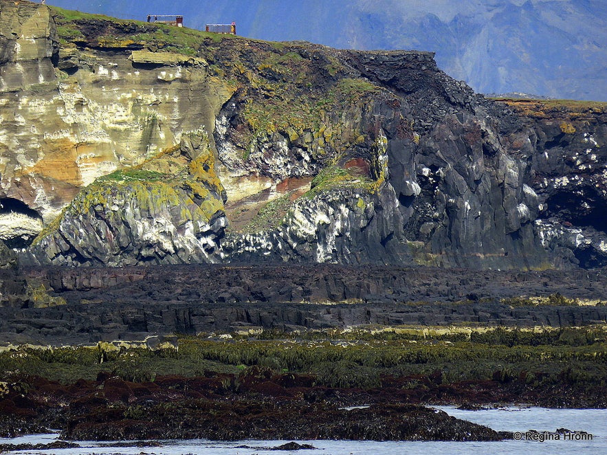
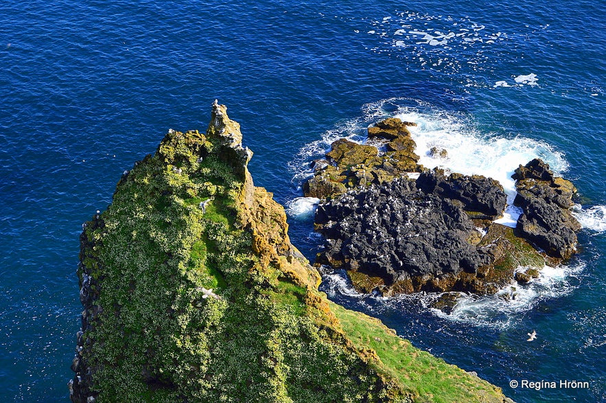
Þúfubjarg as seen from Lóndrangar - see how black the lava is
Svalþúfa hill is believed to have been named by the couple Sval and Þúfa, who came to Iceland with the settler Bárður Snæfellsás. Svalþúfa is believed to be inhabited by the elves and it is forbidden to mow the grass on Svalþúfa, like in so many other elf-locations in Iceland. We never mow these elf-locations as it is believed that misfortune will happen were we to do so.
The medium Margrét from Öxnafell saw fully dressed clergymen once when she passed Svalþúfa, performing some rituals.
Kolbeinn and the devil at Þúfubjarg rock
At Þúfubjarg
Þúfubjarg is the rocky side of Svalþúfa. There is one well known Icelandic folklore in Þjóðsögur Jóns Árnasonar - the Collection of Folklore of Jón Árnason about Þúfubjarg.
It tells the story of Kolbeinn Jöklaskáld - Kolbeinn the glacier poet, and the devil himself. The devil had made a bet with Kolbeinn and the deal was for them to sit opposite one another on Þúfubjarg and compete in verse-making at the high surf.
The devil was to create the first part of the verses during the first part of the night, but Kolbeinn was to finish the verses and vice versa during the latter part of the night. If one of them were not able to finish a verse that one was supposed to plunge from the rock into the sea and from then on be in the other one's power.
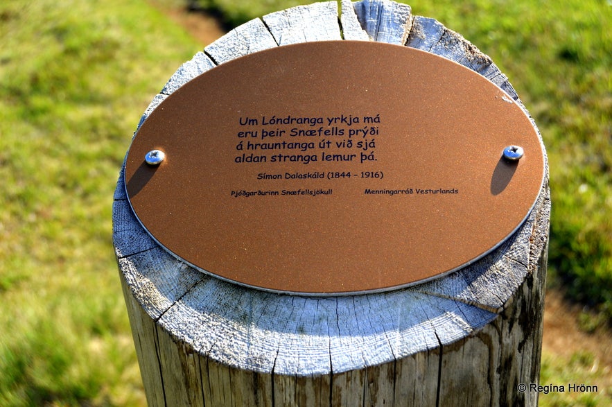
Poems on the hike to Lóndrangar
They sat on the rock one night and started competing in verse-making. Kolbeinn passed with flying colours the attempts of the devil and then it was Kolbein's turn. The devil did very well in finishing the verses until Kolbeinn pulled up a knife from his pocket and held it in front of the eyes of the devil - and the moon shone on the blade of the knife. Kolbeinn created the first part of a verse (in Icelandic):
"Horfðu í þessa egg egg
undir þetta tungl tungl"
which translates into
"Look into this blade (edge) blade
beneath this moon moon" - this, of course, cannot be translated to make it rhyme in another language.
The devil was at a loss for words and couldn't find any Icelandic word rhyming against the Icelandic word tungl - the moon - and said in despair: "This is not a verse (poetry), Kolbeinn!". But Kolbeinn finished the verse and said:
"Ég steypi þér þá með legg legg
lið sem hrærir ungl ungl"
which makes no sense in English, but refers to Kolbeinn pushing the devil into the sea with his wrist, but the wrist in Icelandic is úlnliður, and the first part of the word "úln-" rhymes with tungl - the moon.
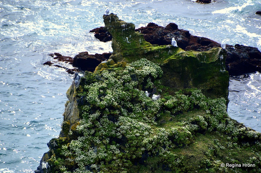
By Þúfubjarg cliffs
When the devil heard this he plunged from the rock into the surf and did not invite Kolbeinn to compete with him in verse-making ever since.
(Loosely translated into English from Þjóðsögur Jóns Árnasonar - the Collection of Folklore of Jón Árnason)
I wanted to include this folklore here as we Icelanders are so familiar with it and I never visit these rocks without thinking about this folklore.
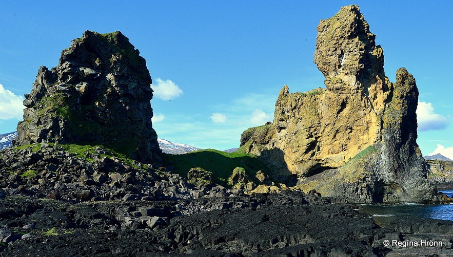
Lóndrangar volcanic plugs
Lóndrangar
Let's walk the short distance down to Lóndrangar. A path from the parking lot of Svalþúfa leads directly to Lóndrangar. It is only 1 km back and forth from the parking lot to Lóndrangar.
This hike will take about an hour to complete as you will want to explore the cliffs at Lóndrangar a bit further and if the tide is out then it is possible to walk down to the pitch-black lava beach.
It is not a sandy beach but made of solid lava rock. My photo above is from that angle. Be careful though and watch out for the tide coming in.
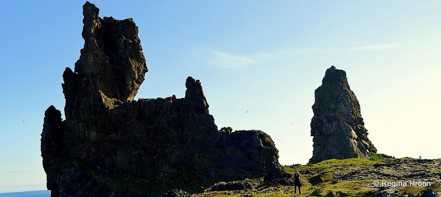
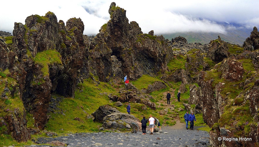
Hiking to Lóndrangar
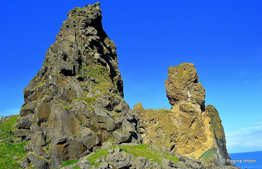
Lóndrangar basalt cliffs are 2 ancient volcanic plugs, 61 m and 75 m high, the smaller one is called Lóndrangur rock or the Troll. One of the cliffs is believed to be the church of the elves and the other one to be their library according to an Icelandic medium.
She, Margrét from Öxnafell, saw a church with many icons in the bigger rock and a library in the smaller one where an old man was writing.
I read this account in the book Skyggna konan II, by Eiríkur Sigurðsson, published in 1963. I already told you about the elves at Arnarstapi, which Margrét in Öxnafell had seen: The Magical Snæfellsnes Peninsula in West-Iceland - Arnarstapi and Hellnar. 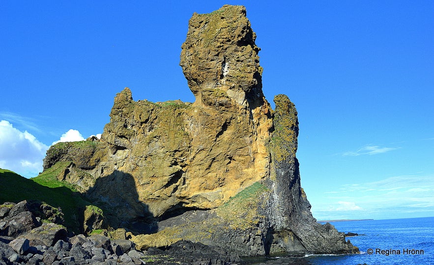
Lóndrangar
Now I want to tell you about what Margrét has to say about Lóndrangar.
Always when Margrét visited Lóndrangar she saw the same sight; she saw a big church, resembling a Catholic church, in the bigger rock with many beautiful icons. And one very beautiful icon was a life-size icon of the Virgin Mary. Beneath it was a table covered with a red cloth with flowers standing on the table.
The bigger rock, the church, looks like a natural castle, don't you agree? We don't have any castles in Iceland, but the volcanoes have provided us with natural lava formations in the liking of fortresses and castles. At another angle, this volcanic plug looks like the Sphinx.
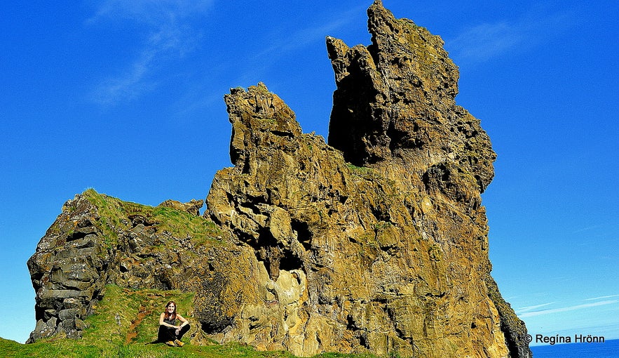
By Lóndrangar cliffs - you can see how big it is compared to me
In the smaller rock, Margrét saw a big library, where an old man sits by a table and writes. Margrét believed that he was a librarian guarding the book and that he was a clergyman.
When Margrét saw the librarian for the first time she noticed that he got startled; he then became long-faced, but as he noticed that Margrét was not a dangerous person, he softened :)
(Translated into English from the book Skyggna konan II pages 87-88).
Once, when I was maybe 4-years old I saw an elf in my home in Reykjavík. I got so startled, that I shouted out and he was equally startled and disappeared. I wish I could see the hidden people now.
I took a video of Lóndrangar and its surroundings as it is so beautiful.
Standing just next to these majestic volcanic plugs is amazing. These rocks are one of the landmarks of the Snæfellsnes peninsula and there is something very magical about them.
In Landnáma - the Book of Settlement - there is a story of a troll sitting on Lóndrangar splashing his feet in the sea :)
Lóndrangar cliffs
You will find Karl and Kerling troll formations standing side by side in several locations in Iceland.
They are not always together though as at Lóndrangur the male troll, Karl or Lóndrangur, is located by the sea, while his fiancée troll, Kerling, is stuck in Kerlingarskarð pass carrying a bundle of trouts on her back.
She was on the way to visit her fiancé when she got caught in the first rays of the sun and turned into stone. Lóndrangur was waiting for her and also got caught in the first rays of the sun; thus these troll lovers stand apart forever.
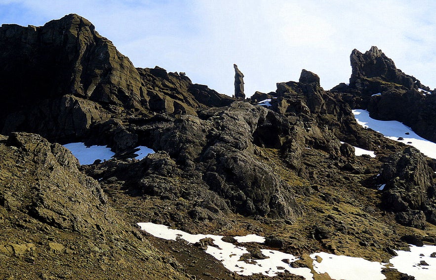
Kerling in Kerlingarskarð pass on the Snæfellsnes peninsula
See also my travel-blog about Kerling in Kerlingarskarð pass:
Kerlingarskarð Pass in Snæfellsnes in West-Iceland - the Folklore of the Giantess & her Fiancé
Now let's go back to road 574 and drive to the white lighthouse at Malarrif and visit Snæfellsjökull Visitor Centre.
Malarrif
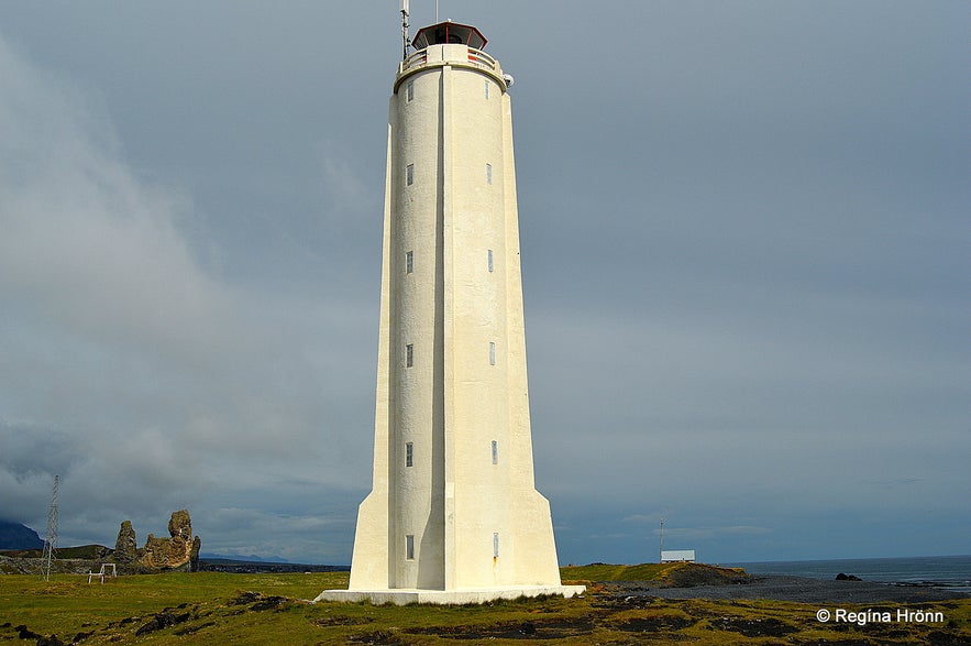
Malarrifsviti lighthouse
There is just a short drive from Lóndrangar volcanic plugs to Malarrif, and in my photo above you can see Lóndrangar in the distance. Turn left from road 574 and drive towards the white lighthouse.
At Malarrif there used to be fishing for centuries, or until 1900, even though this was considered to be the number 1 most dangerous spot for fishing on the peninsula. At Malarrif there was a farm until 1997, but it is now abandoned like several farms on the peninsula.
Here we are on the southernmost spot of Snæfellsnes south of the Snæfellsjökull glacier, which hovers over and protects this area.
At the Visitor Centre
Seeing that this is a 170 km2 large national park, then Snæfellsnes has a Visitor Centre. The location of the Visitor Centre of the National Park of Snæfellsnes, Snæfellsjökull þjóðgarður, is at Malarrif (Hellnar earlier) and will be moved to Hellissandur. There is also one at Breiðablik, but I haven't visited it yet. Do visit the visitor centres and get additional information about Snæfellsnes.
I am trying to fork out as much information as I can on Snæfellsnes in my series of travel-blogs about the peninsula, but I am sure that you can benefit from stopping by at the Visitor Centre. My photo above is taken at the Visitor Centre.
The opening hours at the Visitor Centre vary, so check them out on the website of the Environmental Agency of Iceland before your visit to Snæfellsnes.
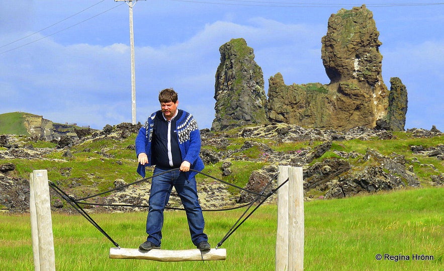
My husband loves to play ;) He is a comedy magician and a delight to travel with :)
The landmark for Malarrif is the white and tall (24.5 m) concrete lighthouse, Malarrifsviti. This lighthouse, which is one of the protected lighthouses in Iceland, was built in 1946 after the first lighthouse at Malarrif, built in 1917, had run its course.
You will find some playground equipment at Malarrif, which my husband used as always, and walking paths leading to the lighthouse and to Lóndrangar. This is a lovely area to visit.
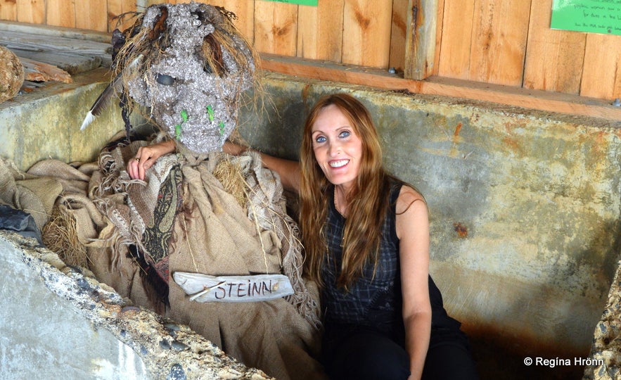
By the troll Steinn at Malarrif
I visited the very pebbly beach where it felt like mountain climbing ascending from the beach, and the small museum with the troll called Steinn or the Rock :)
Here you can see the location of Malarrif on the map. Now, let's return back to road 574 and drive for a very short distance, and park by Vatnshellir cave on the right-hand side of the road.
Vatnshellir lava cave
On a guided tour inside Vatnshellir cave
I now want to show you the extraordinary subterranean lava world in Vatnshellir cave.
Vatnshellir cave is located almost by road 574. You can get your ticket at the ticket office right by the road, where you will also find a parking lot, or buy it beforehand here on Guide to Iceland. You can also join a Private tour of the Snæfelllsnes peninsula with Vatnshellir cave included in the tour.
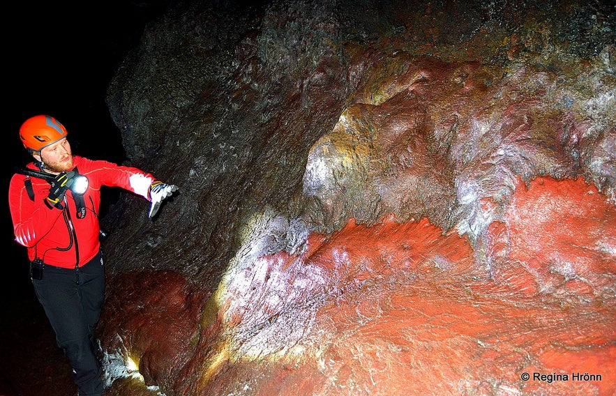
A guide will then take you down into the cave through a couple of winding staircases. Vatnshellir cave is said to be the most accessible cave in Iceland, and for sure the winding staircases help. The cave is a 200-meters long lava tube, where you will walk in the path of a former lava flow. The cave system reaches down 35 meters below the surface!
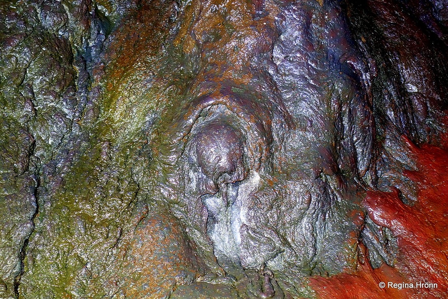
Extraordinary lava colours inside Vatnshellir cave
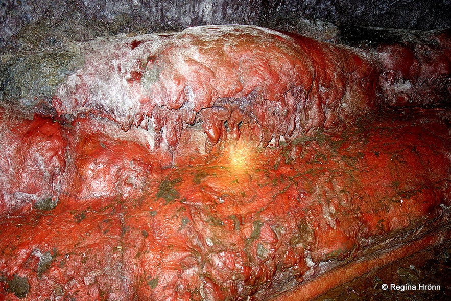
There are amazing colours down in this lava cave system as you can see in my photos. In one place there was a big bright red pattern of lava, almost scary looking!
Vatnshellir cave was closed in 2010 for a protective purpose, but the Summit Adventure Guides have been guiding people in the cave since then.
Vatnshellir cave is located in the 8-thousand-year-old Purkhólahraun lava field which erupted from the Purkhólar crater family. There are hundreds of caves in this area, 4 of which belong to Vatnshellir cave.
Vatnshellir is very colourful
I have written a separate travel-blog about my visit to Vatnshellir cave with loads of photos and more information about this extraordinary lava cave system.
The Colourful Vatnshellir Lava Cave on Snæfellsnes in West-Iceland & its Beautiful Lava Formations
Here you can see the location of Vatnshellir cave on the map. Now let's drive for one minute on road 574 and have a look at Purkhólar crater on your right-hand side.
The Purkhólar crater family
Purkhólar
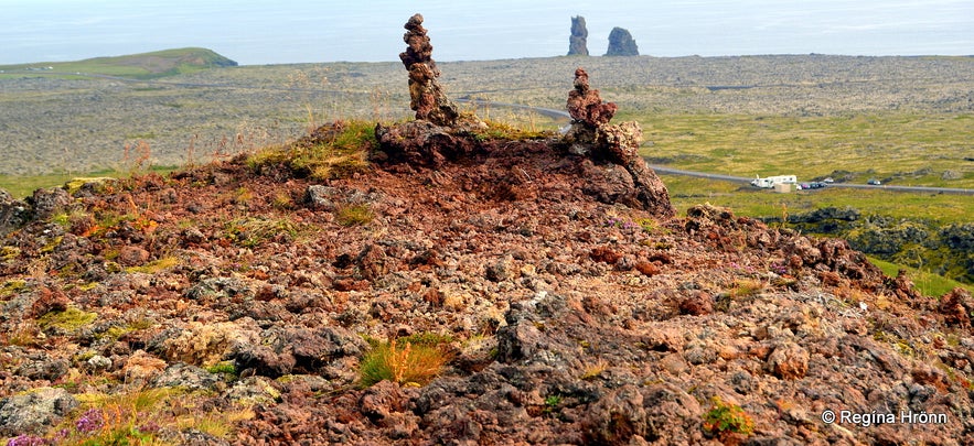
Just above Vatnshellir cave, you will find Purkhólar crater or at least one of the craters in the Purkhólar family, which erupted 8,000 years ago. The cave we just visited, Vatnshellir cave, is located in the Purkhólahraun lava field.
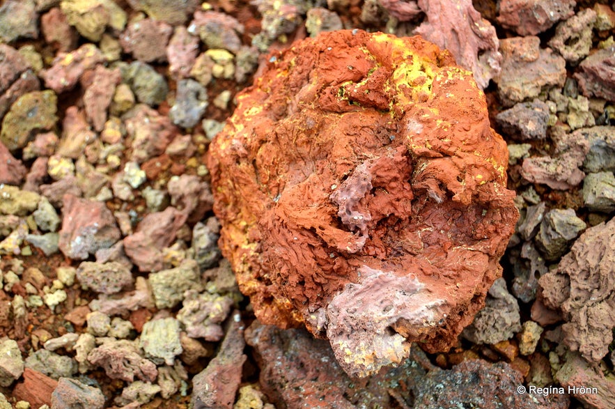
There is only a short hike up to the crater, where you will find all kinds of red, pink, and colourful lava formations. The yellow lava is sulfur. I love such colourful lava so the hike up to this crater is well worth it although there is not much to be seen there. A good view though.
Colourful lava at Purkhólar
But you will see a dent in the landscape, which is an old crater and you can see how the lava flowed. And from up there you will be very close to Snæfellsjökull glacier, with its incredible energies.
You will also get a glimpse of Lóndrangar volcanic plugs on the south side. So I would recommend this short hike. There is a parking lot beneath Purkhólar crater and an easy, but somewhat rocky hike, as you will walk in loose lava.
I didn't see any sign by the road though, but I am pretty sure that this is a crater in the Purkhólar crater family ;)
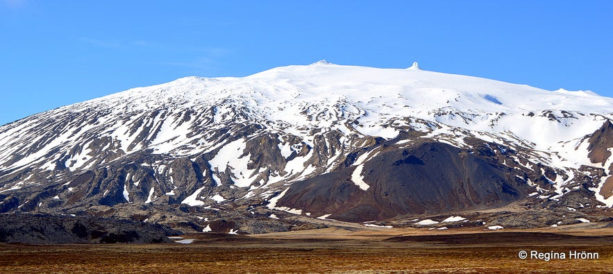
Snæfellsjökull glacier
Here is the location of Purkhólar crater on the map. Now let's return back to road 574 and drive for a short distance until you see road 572 on your left-hand side for Djúpalónssandur beach - the Black Lava Pearl Beach, which is a must stop.
Djúpalónssandur - the Black Lava Pearl beach
At Djúpalónssandur - Nautastígur path
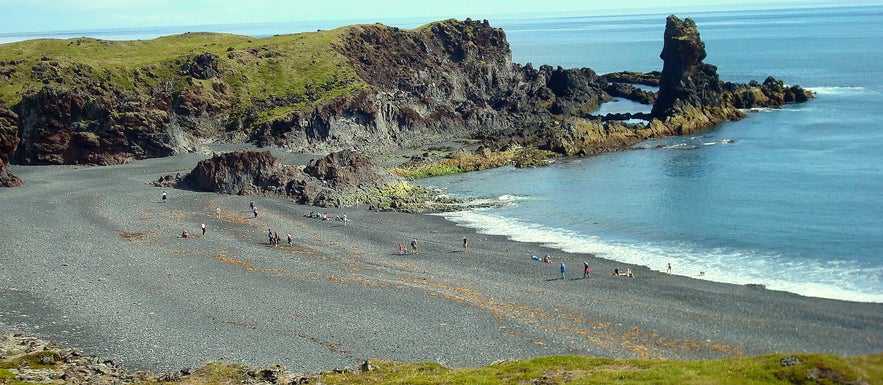
Djúpalónssandur or the Black Lava Pearl Beach is a beautiful place to visit, it is like stepping into a magical place of large lava formations. I have written a special travel-blog about Djúpalónssandur and Dritvík with folklore and a lot more information as this is such an interesting place to visit.
I am going to show you a bit of it here in this Snæfellsnes travel-blog but refer to my other travel-blog for much more information.
To reach Djúpalónssandur drive to the end of the paved road 572 and you will find a parking lot and WC (only open in the summertime though I think). There is just a short walk down the Nautastígur path - the Path of the Bulls - where you will walk through a lava field with huge lava formations.
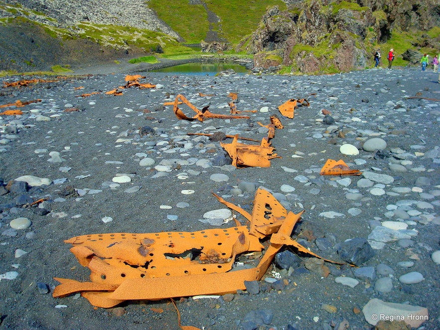
Iron pieces from the British trawler the Epine GY7
There are two small freshwater lagoons behind Nautastígur. These lagoons are called Djúpulón or the Deep Lagoons and give the name to Djúpalónssandur - the Deep Lagoon's Beach. You can see one of the lagoons in my photo above behind the beach.
On the beach, you will notice some iron pieces. This is not trash on the beach, but the protected iron pieces from the British trawler, the Epine GY7, which was wrecked east of Dritvík cove on the night of 13th March 1948. Fourteen men lost their lives and five were saved.
These iron remains are kept here in memory of these brave fishermen from England, so let's respect them and leave them in peace.
Söngklettur - the Singing Rock
The whole beach is made of small black smooth pebbles called Djúpalónsperlur or the Pearls of Djúpalón. These black lava pearls of Djúpalón are also protected.
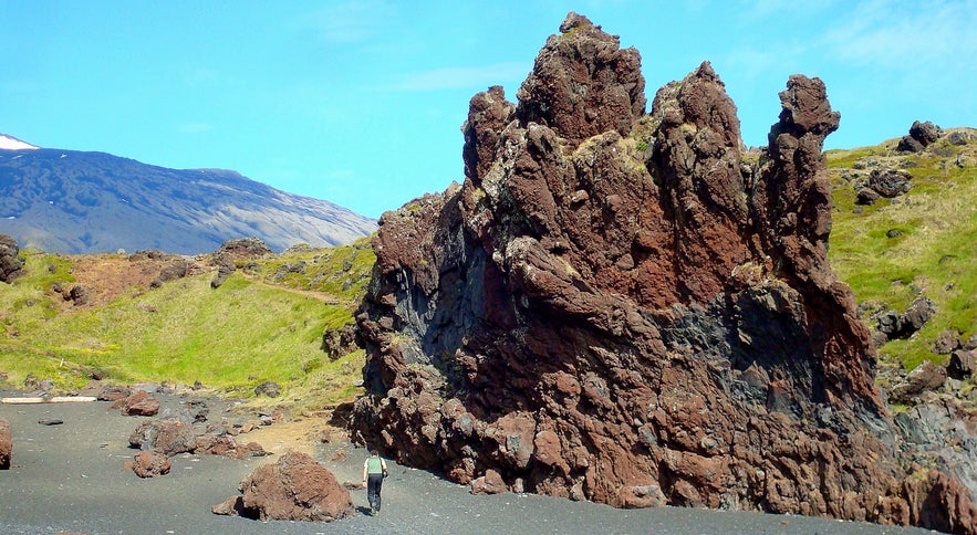
A distinctive reddish, majestic-looking lava rock on the beach, Söngklettur or the Singing Rock, is said to be the Church of the Elves! See my photo above. I tell you the story about the singing and music in the rock in my travel-blog about Djúpalónssandur.
Kerling lava rock
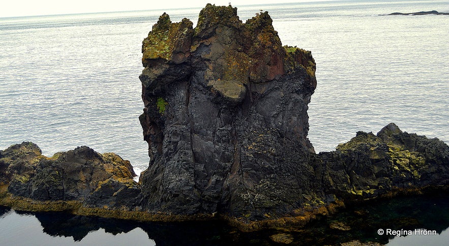
Another strangely formed lava rock is called Kerling or the Troll woman, and where there is a Kerling there is always a Karl or the male Troll close by.
Kerling is carrying a bundle of fish on her back, but Karl is located further east.
You can read much more about these trolls in my travel-blog about Djúpalónssandur.
Djúpalónssandur beach - beware of the sneaker waves
The suction of the sea in Djúpalónssandur is very powerful so please don't go too close to the sea.
There is a warning sign by the parking lot, but I have seen that many people tend to ignore these warning signs as they are just too excited about seeing the sights. The sneaker waves come unexpectedly!
See also my travel-blog about sneaker waves in Reynisfjara in South Iceland so that you will understand the dangers of these kinds of waves:
Extremely dangerous Waves by Reynisfjara and Kirkjufjara black Beaches in South Iceland!
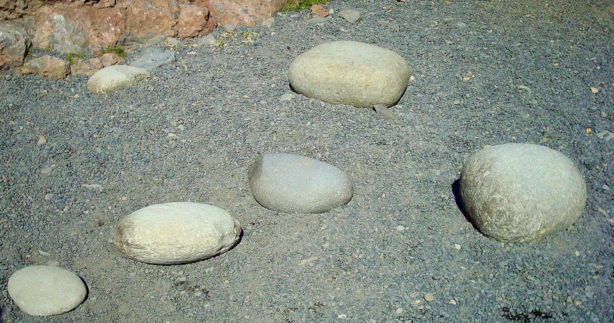
The lifting stones at Djúpalónssandur
At Djúpalónssandur beach you will find 4 differently sized stones called aflraunasteinar or the lifting-stones. They were used to measure the strength of fishermen.
If you want to read about these lifting stones in Þjóðsögur Jóns Árnasonar - the Collection of Folklore of Jón Árnason, then I have added that story in my side-blog about Djúpalónssandur and Dritvík.
And a lot more information about this area. This travel-blog series is getting to be so long that I have to add side-blogs:
Djúpalónssandur & Dritvík - the Black Lava Pearl Beach on Snæfellsnes in West-Iceland
Dritvík cove
Visiting a sea monster at Dritvík cove
It is possible to hike from Djúpalónssandur beach to Dritvík cove, which is only 1 km west of Djúpalónssandur.
From the 16th-19th century, the largest seasonal fishing station in Iceland was at Dritvík, with 40-60 boats and 200-600 fishermen!
Dritvík
There are a couple of accounts in Þjóðsögur Jóns Árnasonar - the Collection of Folklore of Jón Árnason, which are said to have happened at Dritvík. One of them explains to us why a certain cave west of Dritvík got the name Draugahellir or the Ghost Cave.
I leave you with this sentence in Icelandic from the 4th chapter of the Saga of Bárður Snæfellsás about how Dritvík got its name: "Síðan settur þeir upp skip sitt í vík einni. Þar á lóninu höfðu þeir gengið á borð að álfreka og þann sama vallgang rak upp í þessari vík og því heitir það Dritvík". Now you know - álfrek means number 2, by the way ;)
I refer to my Djúpalónssandur and Dritvík cove travel-blog for that folklore and much, much more detailed information about Dritvík.
"Somewhere" between Dritvík and Djúpalónssandur there is an ancient labyrinth, we don't know how old really, it might even be as old as from the Settlement of Iceland or even predating it. I do not want to give directions to it so that it will not be ruined by too much traffic.
Now let us return back to Djúpalónssandur and visit Einarslón by taking a path leading east from Djúpalónssandur beach.
Einarslón - the Lagoon of Einar
Einarslón ruins
A path leads from Djúpalónssandur beach to Einarslón, an abandoned farm, where there are only ruins left now. Earlier it used to be a vibrant fishing station and according to the census in 1703 some 62 people were living at Einarslón on 12 farms. There was a church at Einarslón from 1563 until 1879. It is believed that the first church on this site dated back to the year 1200.
I walked up on Höfði cape above Djúpalónssandur and followed the path above the rock Kerling which I told you about above, as I read that Karl is located a bit further east and cannot be seen from Djúpalónssandur. I walked towards Einarslón further east above the shoreline, but there are so many rock formations there that I didn't know which one of them was Karl.
The shoreline is dotted with beautiful, colourful lava rock formations, pitch black, red, and blue in colour.
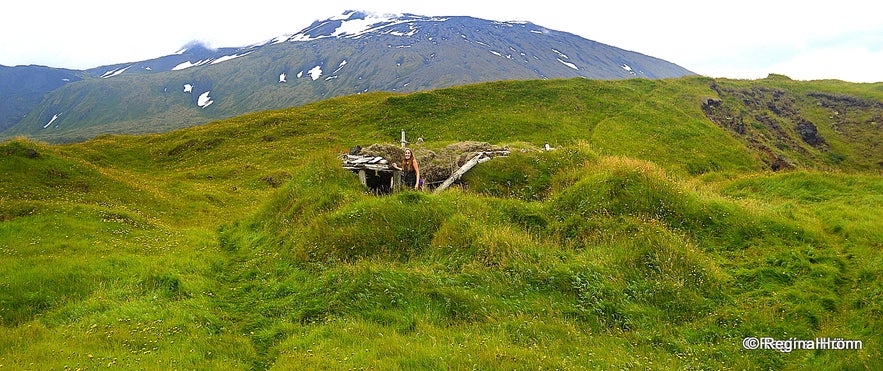
Inside the ruins at Einarslón
I had only meant to find the troll Karl, but carried on further east and the path seemed to be endless even though there is only 1 km between Djúpalónssandur and Einarslón. I had somehow believed that I was going to see a lagoon as Einarslón means the Lagoon of Einar. The Book of Settlement (28th chapter) and the Saga of Bárður (6th chapter) tell us the story of Lón-Einar who lived here and was killed by Einar at Laugarbrekka.
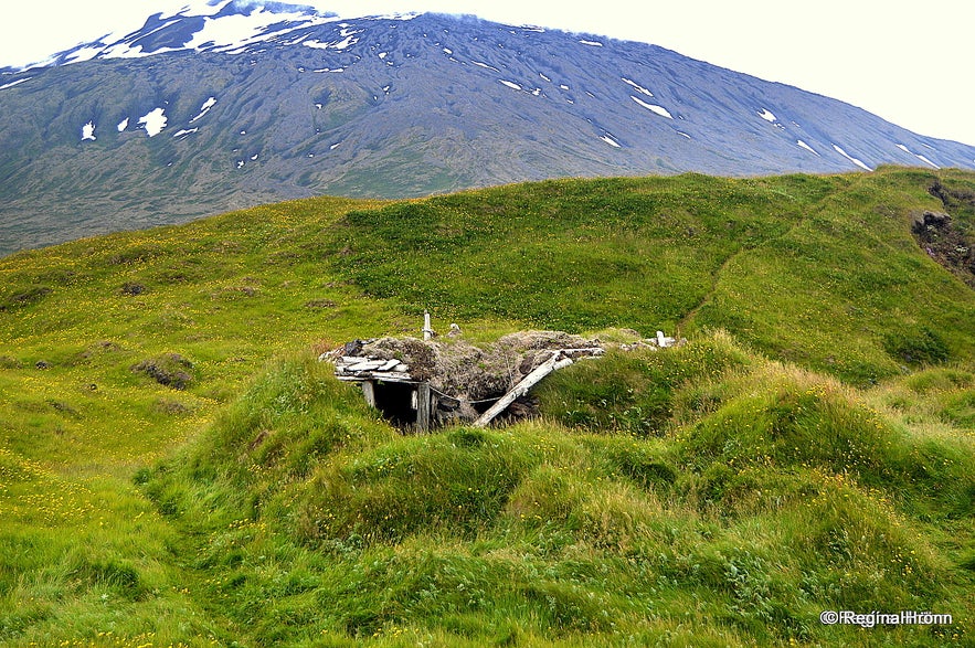
Finally, I reached several ruins covered in grass. There was only one turf outhouse that was visible, but if you walk on the hill above the outhouse you will see many ruins below.
I was kind of in a hurry as I had spent way too much time looking for Einarslón so I decided on returning back to the parking lot at Djúpalónssandur through the grass and not on the path. It was a mistake as the grass was high and there were a lot of tussocks which made it very difficult to walk, so it is best to follow the path.
A ram at Einarslón
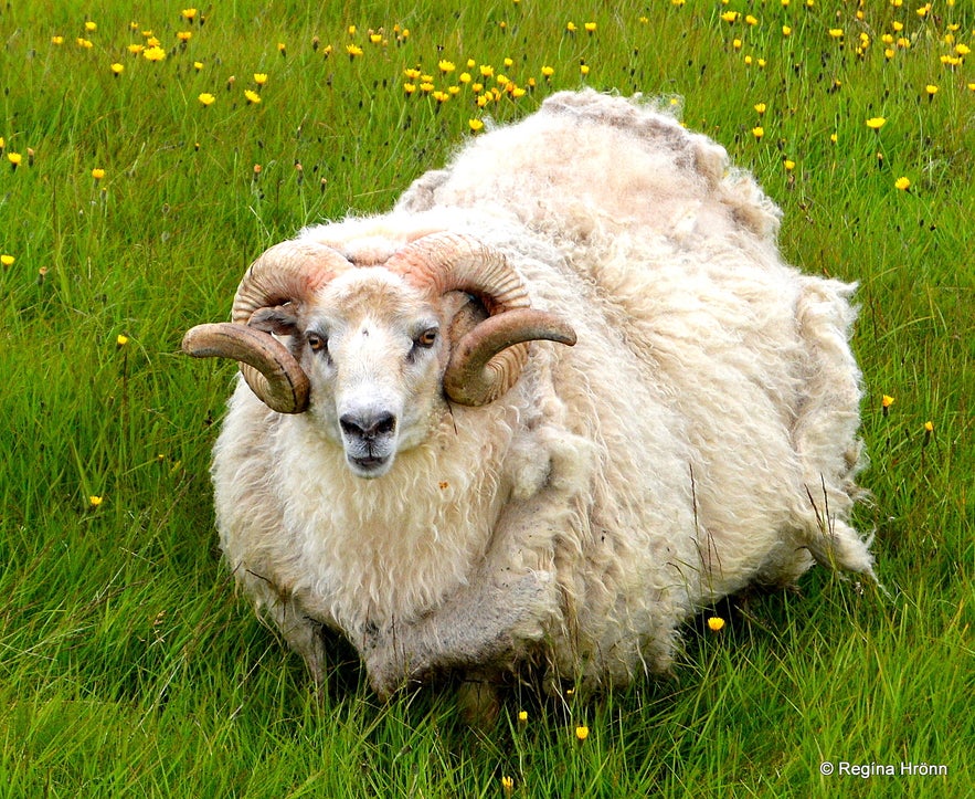
On my way back there was suddenly a big ram almost next to me! It had not been sheared and its wool was massive, making it look much bigger than it actually was. I
thought it might be a ram that had been left behind when the sheep were round-up in fall, as it was barely able to walk around in the summer heat (a whopping 20 degrees C on this July day).
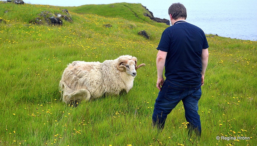
I talked to it in a soft voice trying to figure out whether it meant to attack me or not, seeing that this was his turf, but it didn't mind me. Then my husband approached it (a macho thing) and the ram went into attack mode, which made my husband jump ;)
My husband and the ram
I thought it was best to let the Information centre at Malarrif know about this sheep, but they told me that it hadn't been left behind, but the owner of this ram apparently doesn't shear it. Poor ram, it must have been so hot!
Iceland's greatest painter, the noted Jóhannes Kjarval, owned half of the land at Einarslón and from here he got material for several of his beautiful paintings of Iceland. Kjarval visited this only land, which was ever in his possession, every year from 1940-1948.
It has been said that Einarslón was the first land on the south side of the Snæfellsnes peninsula to become green in springtime.
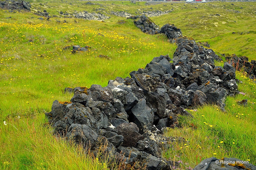
Lava enclousure at Einarslón
On my way back I saw a lava enclosure that defined the land of Einarslón. It is very close to the parking lot, so I had been walking by the land of Einarslón the whole time on the path by the shore.
Now let's return to road 574 and drive to the Hólahólar cluster of craters that are close by. Turn left on a gravel road.
Hólahólar craters
Inside Hólahólar
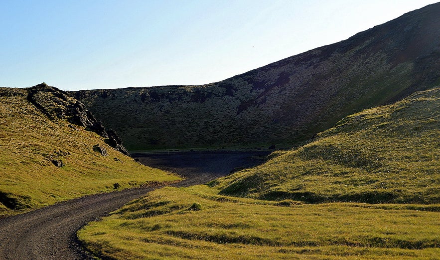
Hólahólar craters are a cluster of craters, one of which is very accessible as it is possible to drive into the crater from the road. There is an opening on the crater Berudalur and it looks like an amphitheater.
Some people have seen and heard elves in this area and there are tales of applause and cheering from the hills of the crater.
The medium Margrét from Öxnafell saw several hidden people in Berudalur and her account is written in the book Skyggna konan II from 1963:
"Margrét has seen many elves (hidden people) in this location. Once when she visited she saw on the right side of the cliff by the entrance two elf-women who were sewing fancy clothes for festive occasions. The women were dressed in blue clothes.
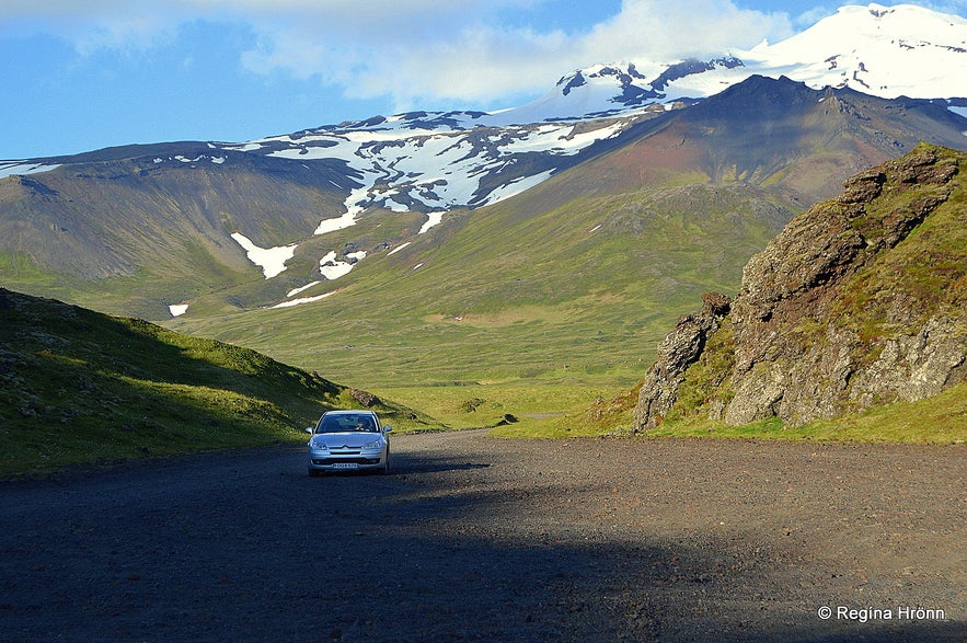
Driving into the crater
On another occasion, Margrét saw a man reading a book in the same cliff and a woman in a living room looking at something. In the cliff to the left opposite, she saw a woman with 4 small children, and it looked like she was babysitting them.
The children had all kinds of toys. The woman wore a red cardigan and a blue skirt. The children wore grey and blue clothes.
(Translated into English from the book Skyggna konan II pages 92-93)
There are ruins of the big farm Hólahólar behind the crater. This farm is connected to folklore which I told you about back when there was a fishing station at Djúpalónssandur and Dritvík cove. If you have read my travel-blog about Djúpalónssandur and Dritvík then you might remember the Ghost cave in Dritvík cove?
Hólahólar - Berudalur
If you like volcanic craters check out my travel-blog about all the craters I have visited in Iceland, in one of which you can take a dip in a warm lake:
A Local's favourite Volcanic Craters in Iceland
Here is the location of Hólahólar on the map. Now let's return back to road 574 and drive the short distance to the Saxhólar cluster of craters.
Saxhólar craters
Hiking up Saxhóll crater
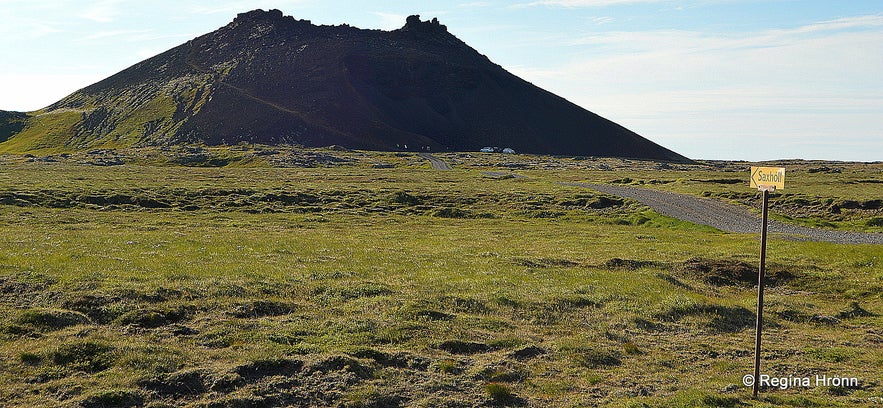
You will find several accessible craters on the Snæfellsnes peninsula, one of which is the beautiful red Saxhóll crater. There are actually 2 Saxhólar craters, Litli-Saxhóll which is 109 meters above sea level, and Stóri-Saxhóll which is 125 meters above sea level.
Litli-Saxhóll erupted some 3-4,000 years ago.
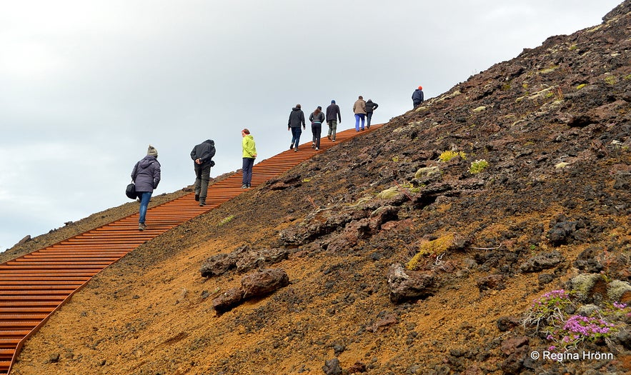
I have walked up Litli-Saxhóll (45 meters) many times, and in 2016 steps were fitted to make the ascent easier and to protect the crater, which is very delicate. It is much easier to use the steps than to slide on the loose lava on the steep footpath. These steps received the international Rosa Barba Landscape Prize in 2018, as they are thought to be so well made.
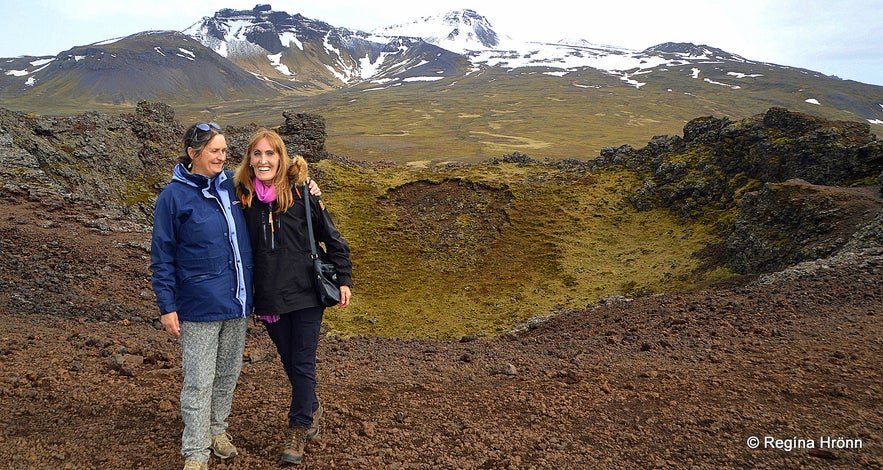
Visiting Saxhóll crater with a friend
I find it difficult though to climb these steps. Once you reach the top in 4-5 minutes, yes, it is a very short hike, which always leaves me out of breath though, there is a beautiful view of the surrounding areas of the Snæfellsnes peninsula.
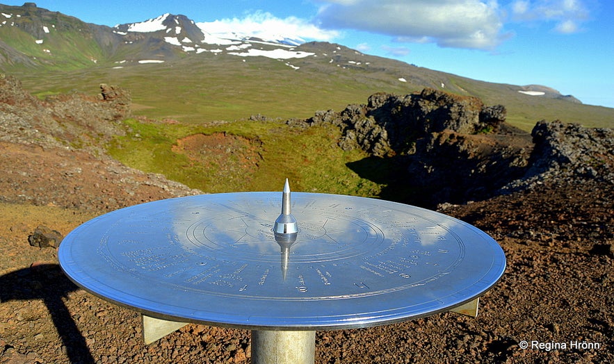
On top, you will also find a view-dial, made by my father-in-law, and erected in 2012. It shows the names and height of the mountains which can be seen from the top of Litli-Saxhóll crater.
The beautiful view-dial on top of Saxhóll crater
You can look into the red lava crater and imagine what it must have looked like when it was spewing out lava and fire. Nowadays it is so tranquil with grass growing inside the crater.
Saxhólahraun lava field, created in the eruption is block-lava, also called aa lava, but we Icelanders call it apalhraun lava.
There is a sign on the parking lot where visitors are asked to stay on the footpaths as this area is protected and we don't want to make any further damage to the crater than was already done when the red lava was quarried from the crater and used for road construction.
Saxhóll crater
Also, I must ask the visitors to refrain from making piles of stone on top of the crater. These stone piles are so annoying to us Icelanders :( I know that the makers of these stone piles mean no harm, but they might not think about the long-term effect this has on our nature, so please don't make these stone piles.
Here is the location of Saxhólar craters on the map. Now let's drive back to road 574 and see what the area around Öndverðarnes looks like.
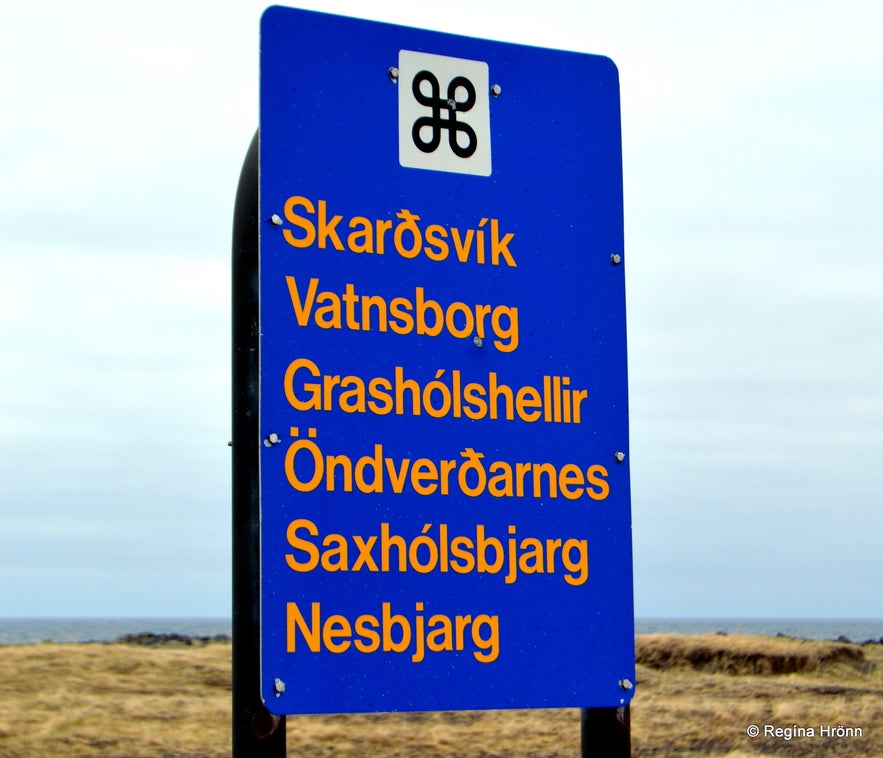
The information sign leads to many interesting locations
After visiting Saxhóll crater and returning back to road 574 take a left turn on road 579, Öndverðarnesvegur road. This is the sign you will see; the many places of interest in this area. I want to show you briefly Skarðsvík, Öndverðarnes, Svörtuloft, and Saxhólsbjarg.
Seeing that this road is kind of off the beaten path and many people skip it, I have written a side-blog about this area called:
The Majestic Skarðsvík, Saxhólsbjarg & Svörtuloft on the Snæfellsnes Peninsula in Iceland.
Do remember to return back to this page after you read the side blog so that you can continue visiting all the sights on the Snæfellsnes peninsula in chronological order :)
Skarðsvík 
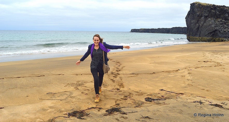
Playing in the golden sand at Skarðsvík
Skarðsvík is a secluded golden beach on the Snæfellsnes peninsula. Most beaches in Iceland are black lava beaches, and only in West Iceland and in the Westfjords of Iceland have I seen golden beaches in my country. This beach is very popular with locals.
A pagan Viking grave from the 10th century was discovered here back in 1962 and you will find an information sign about the grave by the road.
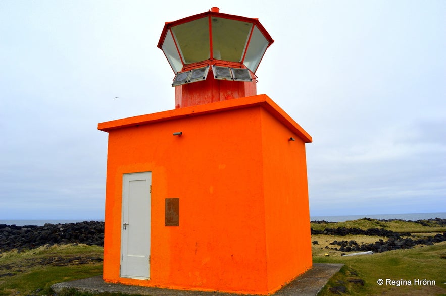
Svörtuloftaviti a.k.a. Skálasnagaviti lighthouse
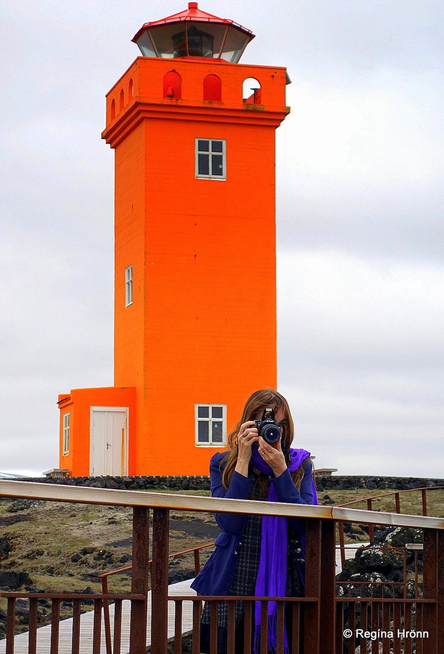
By Skálasnagaviti lighthouse at Svörtuloft
My photo above is of Skálasnagaviti, which is also called Svörtuloftaviti lighthouse if you are out at sea.
And my photo below is of Skálasnagi, which is a beautiful cliff with a stone head, so to speak, which was connected by a stone bridge to land.
Unfortunately, the stone bridge collapsed back in 1973.
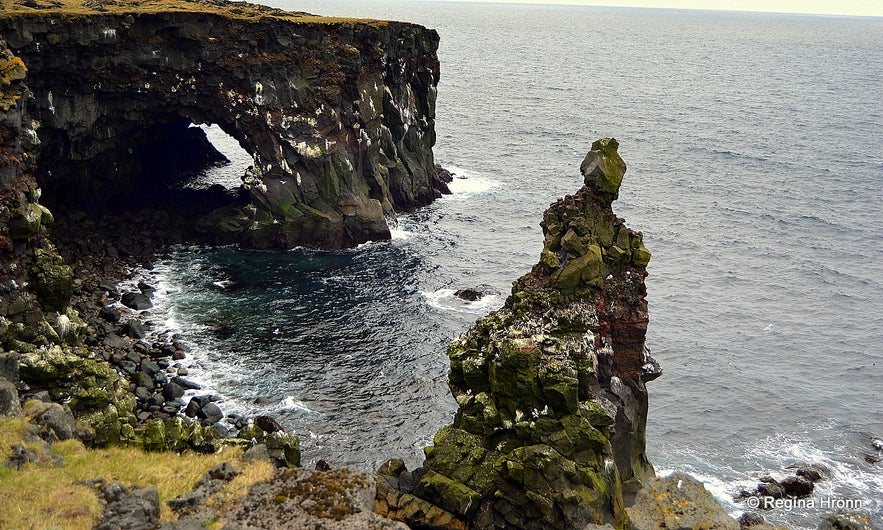
Skálasnagi rock
Here you can see the location of Skálasnagaviti lighthouse a.k.a. Svörtuloft lighthouse on the map. Now let's drive back to the fork in the road and drive to Öndverðarnes, the westernmost tip of the Snæfellsnes peninsula.
Öndverðarnes cape
Öndverðarnesviti lighthouse
Öndverðarnes cape is the westernmost point of the Snæfellsnes peninsula. Seeing that it is kind of off the beaten path, i.e. off the main road, then I have written another side-blog about Öndverðarnes Cape and the interesting sights:
Öndverðarnes Cape - the Westernmost Point on the Snæfellsnes Peninsula in West-Iceland
At Öndverðarnes you will see quite a lot of ruins and if you look closely you will encounter an ancient stone well called Fálki, which is said to provide fresh water, holy water, and ale :) I have written much more about this interesting and former vibrant area in my side-blog.
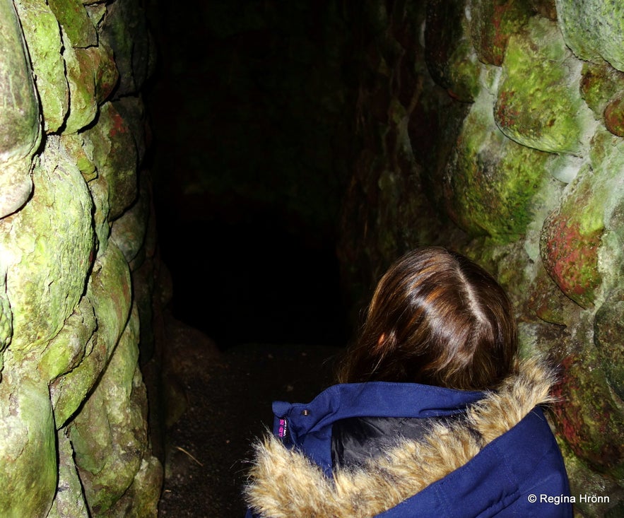
Fálki well
Here you can see the location of Öndverðarnes on the map. Now let's drive back to the fork in the road and turn left on road 579 and drive back to road 574.
There are a couple of more sights in this area which I want to show to you, one of which is another old well, Írskrabrunnur or the Well of the Irish. Drive for a short distance and turn left by the sign Gufuskálavör and Írskrabrunnur.
I will be showing you more interesting locations on the Snæfellsnes peninsula in my next travel-blog the Magical Snæfellsnes Peninsula in West-Iceland - Part III, where I will continue on my journey around the peninsula. Do join me :)
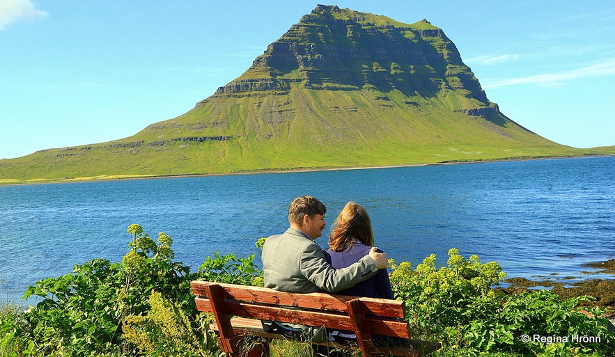
My favourite photo-angle of the famous mountain Mt. Kirkjufell in Grundarfjörður
Here are links to all of the Snæfellsnes travel-blogs in this series:
The Magical Snæfellsnes peninsula - part I
The Magical Snæfellsnes peninsula - part II
The Magical Snæfellsnes peninsula - part III
The Magical Snæfellsnes peninsula - part IV
The Magical Snæfellsnes peninsula - part V
The Magical Snæfellsnes peninsula - Arnarstapi and Hellnar
You can rent a car in Reykjavík and drive around the peninsula in 2 days or more, depending on how many sights you want to visit.
Have a lovely time on the beautiful Snæfellsnes peninsula :)
Other interesting blogs
Chasing Waterfalls in Iceland
Iceland is spectacular in so many ways and Icelandic nature is quite unique with its vast landscape, volcanic activity, geothermal areas, glacier lagoons and sceneries, black sand beaches and spectRead moreSænautasel Turf House in the Highland of Iceland
In my search for turf houses around Iceland, I visited Sænautasel, which is a rebuilt turf house on Jökuldalsheiði heath in the highland of Iceland. It is, in my opinion, an extremely cute turf hoRead moreThe Dynamic Plant Lupine
People have been asking me where to find lupines in Iceland. If you like them you should be able to find them easily in Iceland in summer. They are in bloom and visible almost wherever you drive aroRead more

Download Iceland’s biggest travel marketplace to your phone to manage your entire trip in one place
Scan this QR code with your phone camera and press the link that appears to add Iceland’s biggest travel marketplace into your pocket. Enter your phone number or email address to receive an SMS or email with the download link.

