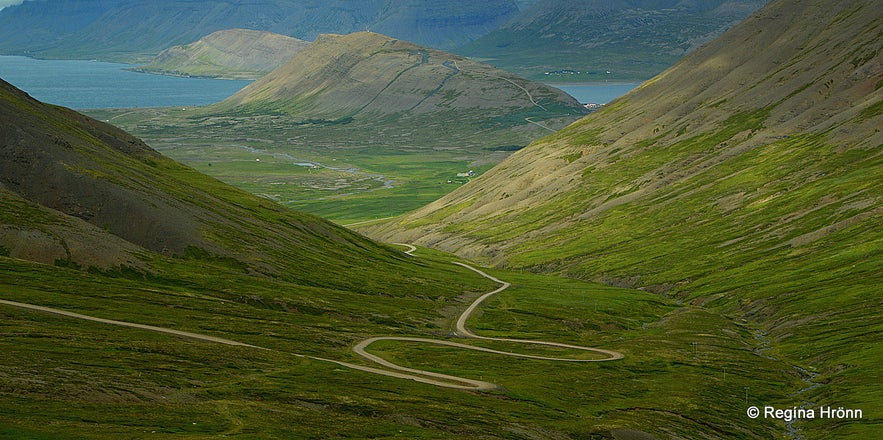
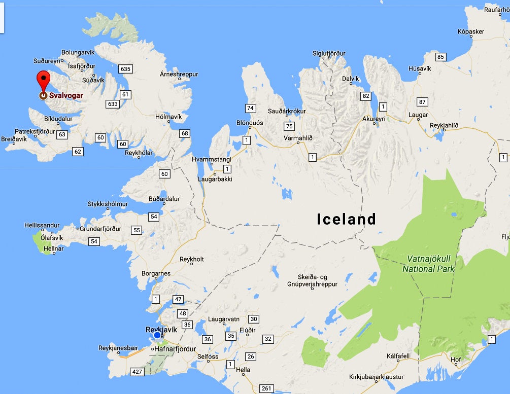
Join me on a journey on the most dangerous road construction in the Westfjords of Iceland and be rewarded with the most amazing scenery. This road, which is often called Kjaransbraut - the Kjaran's Avenue, also the Svalvogar circle, is only open for a couple of months a year and Westfjords Adventures offers guided tours on this one-lane jeep track.
Ever since I first saw photos from this scary looking road and the ruggedly beautiful surroundings I have wanted to experience this drive myself.
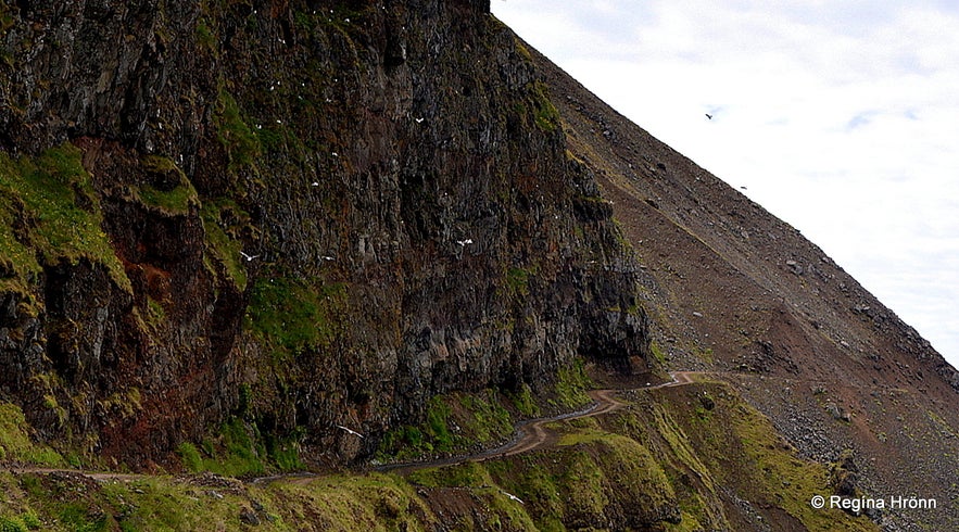
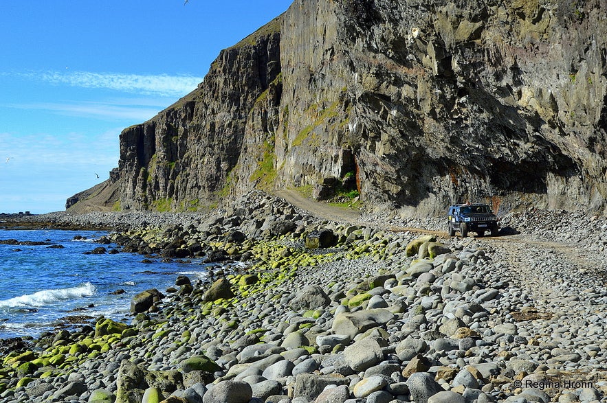
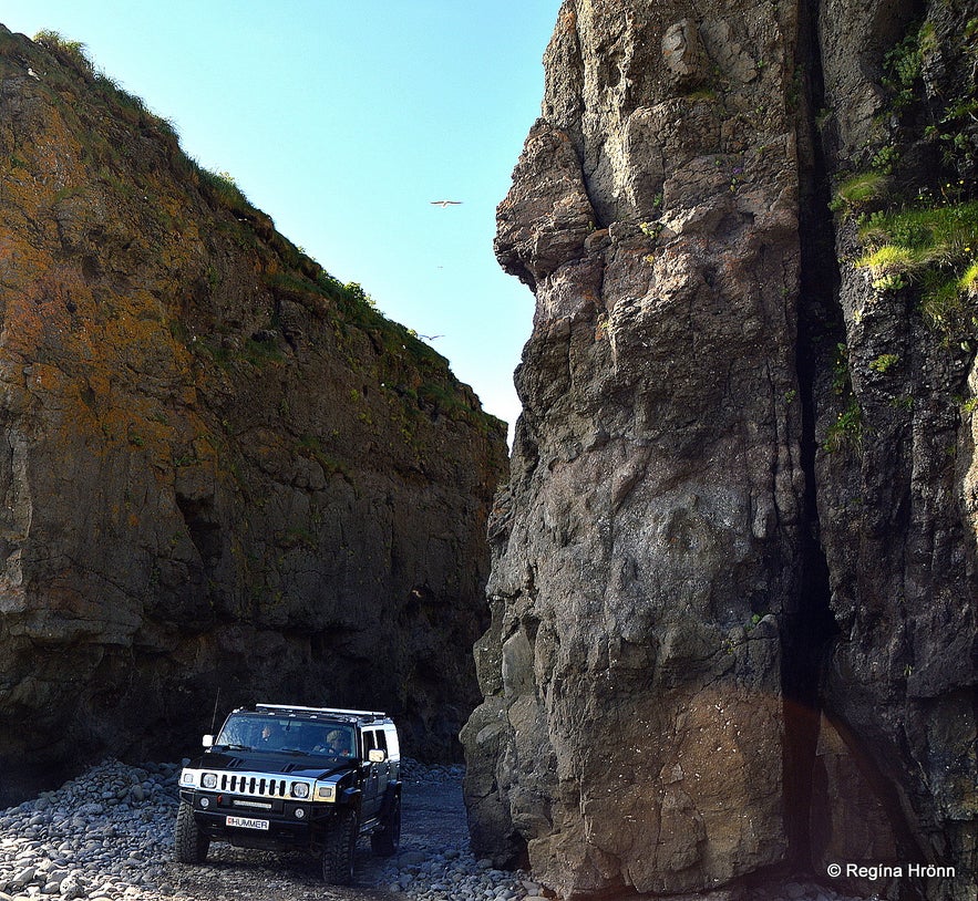
Top photo: the road by Skútabjörg
Kjaransbraut road - Svalvogavegur by Hrafnholur
What makes this road even more challenging to drive on is that it can be reached from two different directions, both from Dýrafjörður fjord on the north side and Arnarfjörður fjord on the south side - so what to do when two jeeps meet on this narrow road on the steep mountain?
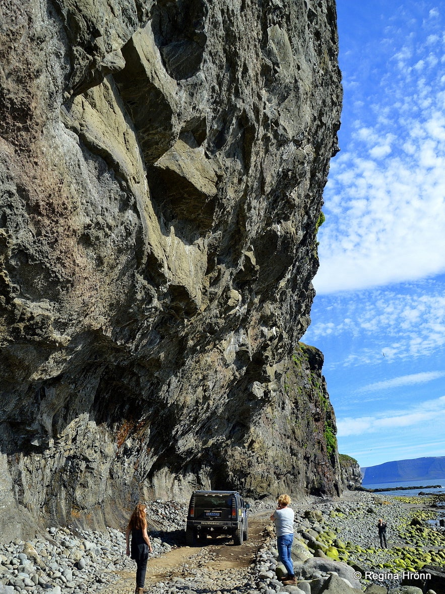
Kjaranbraut road is carved into the sheer cliff, the road is literally on the mountain ledge! Even the Icelandic Road Administration doomed this project as being Mission Impossible and told their road construction workers to give up on this project.
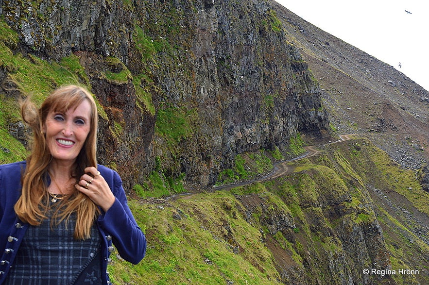
By Kjaransbraut having a look at the narrow road in the cliff by Hrafnholur - not feeling at ease at all ;)
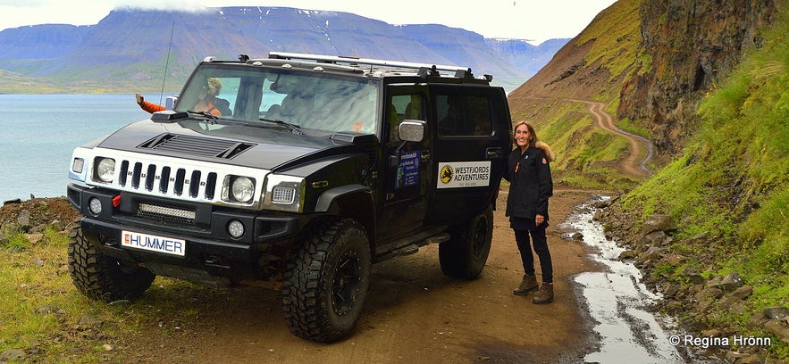
But Elís Kjaran Friðfinnsson (1928-2008), bulldozer driver from Kjaransstaðir farm in Dýrafjörður, took it upon himself back in 1973 to venture to carve a road way up in the craggy mountainside, using a small bulldozer called Teskeiðin or the Teaspoon! And here we are - driving on his road in a big Hummer :)
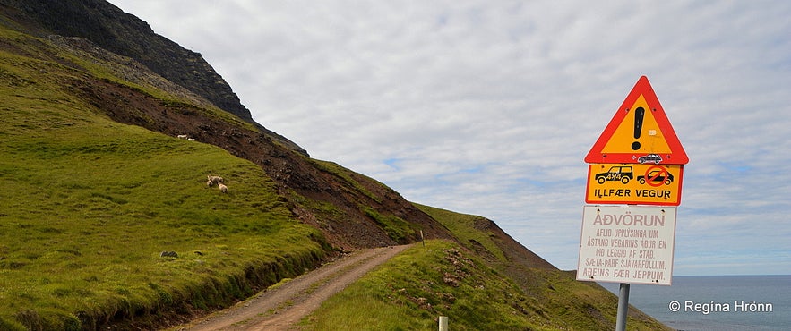
A 4x4 is needed on this road and the driver has got to have nerves of steel! And you have to know when the tide comes in in Arnarfjörður fjord. A warning sign in Icelandic at the beginning of the road warns people of this danger.
The warning sign
On the sign, you will see this warning: "Aðvörun! Aflið upplýsinga um ástand vegarins áður en þið leggið af stað. Sæta þarf sjávarföllum. Aðeins fær jeppum" - meaning: "Warning! Get information on the condition of the road before venturing on this drive. It is only passable when the tide is out. For 4x4 jeeps only".
In my opinion, it is best to not take any chances here and experience the Kjaranbraut road on a guided tour with local guidance.
Little by little Elís succeeded in carving a very steep, cliffhanging road into the rocky mountainside at Hrafnholur by Ófæruvík cove in Mt. Helgafell. The name Ófæruvík actually means Impassable cove in Icelandic.
In the video below you can see Elís maintaining the road back in 1997 after a scree had fallen on the road.
It is incomprehensible how Elís succeeded in carving this narrow road into the steep mountain rock. When you actually stand on this road you will for sure appreciate the tenacity and hard work of this strong-willed Vestfirðingur (the people living in the Westfjords of Iceland).
Elís with his son Ragnar by his side in the 70 horsepower bulldozer Teskeiðin did this voluntary work in his spare time, mostly paying for it out of his own pocket. The Icelandic Road Administration did not want to hear of him carving this road into the mountain ledge, nor did they want to follow the procedure of the construction work. But later on, he got some support.
It is a well-known fact here in Iceland that Vestfirðingar are made of a different stock than the rest of the Icelandic nation. Respect, Elís! I am 1/4th part Vestfirðingur, but living in the capital city Reykjavík in the south my whole life has softened the Westfjord genes in me ;)
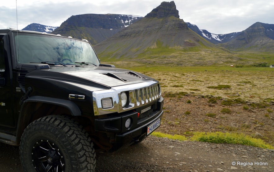
We made some stops on the way to take photos - Keldudalur valley
The people living in the Westfjords are used to steep, winding roads, seeing that this part of Iceland is made of mountains and fjords, as it were. The road leading from Þingeyri village to Svalvogar is such a steep gravel road, so I was constantly asking: "Are we there yet?" - as I thought the normal road was already so high up and narrow. But I was told that this was nothing, just wait and see...!!
Elís made the first part of the road in 1973 opening the road to Svalvogar. And the road from Svalvogar coves in the west towards Lokinhamradalur valley he opened in 1974 (ref. Brautryðendur fyrir vestan).
You can see Keldudalur in my photo above - and as you can see then I fell in love with this huge Hummer - it was my first time ever to drive in a Hummer and this particular Hummer even had the licence plate Hummer :)
We stopped the Hummer after having driven on the narrowest part of the road at Hrafnholur
Ten years later in 1983 Elís managed to open the connection to Arnarfjörður from Hrafnabjörg to Stapadalur - making it possible to drive the whole ring around the beautiful mountains nicknamed Vestfirsku Alparnir or the Westfjords Alps. This route is also referred to as the Svalvogar circle.
All in all this masterpiece of a road, the Kjaranbraut or Svalvogar road, is 24 km long, if I am not mistaken, most of which leads through really rugged terrain and even through a lava field. And the whole circular route from Þingeyri village is around 49 km.
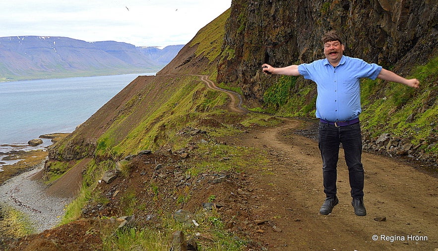
My husband found it fitting to jump on this road - I was scared of rocks falling down on the road ;)
We got out of the car after passing the narrowest part of the carved road at Hrafnholur - Raven's holes, to have a better look at it and take some photos.
This part of the road was even narrower earlier on and when Elís was asked by the Road Administration if it was not too narrow to be called a road, Elís responded that he called this an avenue ("braut" in Icelandic thus Kjaransbraut avenue).
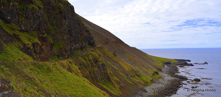
Kjaransbraut avenue
I was the first one to get out of the car and as I stood there on the sheer cliff edge, the passenger in the back seat got out and the door hit me in the back making me stumble right there on the very edge!!
I was quite startled... this, of course, had to happen on the most dangerous part of the most dangerous road in the Westfjords, eh ;)
In 2008 a huge rock fell from the cliff onto the road at Hrafnholur closing it completely. It was lucky that nobody was around at that time as the rock weighed some tonnes!
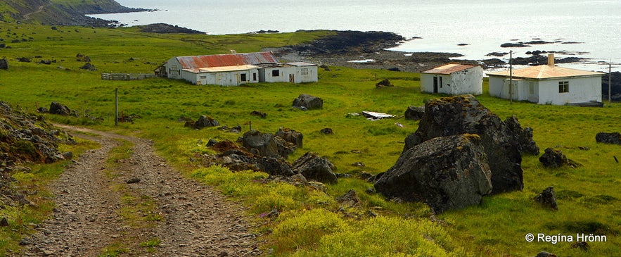
The first abandoned farm we encountered in a lava field at Hafnarskarð.
Just before we drove on this road in July 2017 another rock had fallen from the cliff and onto the road, but it was cleared the day after.
This is partly why the Icelandic Road Administration didn't want to build a road here as screes and rocks fall from the steep cliff onto the road.
A guided tour is preferable here as you never know the condition of the road or if you will have to drive back in reverse, which cannot be a hoot on this narrow and steep road with the vertical cliff beside you.
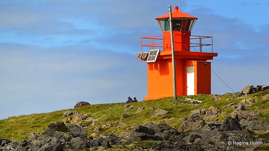
Svalvogaviti lighthouse - built in 1920
Kjaranbraut passes Svalvogar to the west, where you will see the most amazing mountains, hidden from view to most but birds and ships and now jeeps for 3 months a year. Along the very scenic route, you will see trolls in abundance, hidden coves, abandoned farms and Svalvogaviti lighthouse (1920).
It wasn't until I was uploading the photo of the lighthouse for my travel-blog that I noticed these two people sitting in front of it! We had passed a family cycling on Kjaransbraut and were wondering what had happened to them, as we never saw them again. I am glad they were just enjoying the view from the lighthouse.
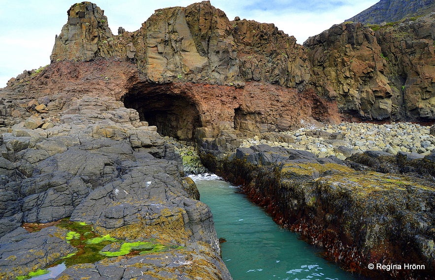
Kögurvík cove - isn't this amazing!
Our guide, María, told us that she would be showing us her favourite secret place along this scenic route - I love secret places so I was thrilled. We stopped in one spot and she told us to follow her down a rocky trail.
I am awful with stepping on big rocks so I was sliding down to the sea on my behind - but, hey, whatever works ;)
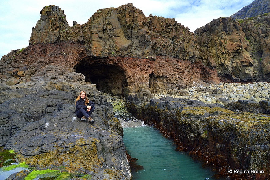
At Kögurvík cove - this is a fairytale location
A fantastic sight awaited us as we got down to the sea, such beautiful rock formations and caves. The colours were amazing, multicoloured cliffs and aquamarine sea in a secret cove! Isn't this beautiful?
Can you spot all the trolls in this beautiful place?
Vestfirsku alparnir - the Westfjord Alps
From Svalvogar the road leads to Lokinhamradalur valley and finishes in Stapadalur in Arnarfjörður fjord. You will see two farms beneath the road when driving along this way, Lokinhamrar and Hrafnabjörg.
Just imagine how remote and inaccessible these farms were before this road was opened, all transport was by boat, on horses and on foot. What a great gift Elís Kjaran gave to these farmers - a road straight to their doorstep!
Next on my agenda is to read an account on what the life of these farmers in this remote area was like, but the poet Guðmundur Hagalín (1898-1985) wrote several stories about life in this remote area - I know you will be able to relate when you see these farms.
Vestfirsku alparnir - the Westfjord Alps
My grandmother was born and raised in a remote valley on the other side of Dýrafjörður fjord, Ingjaldssandur, where there is now only one inhabited farm. But earlier there were more farms in these secluded areas and many people on each farm.
My grandmother had told me about the beauty of the majestic mountains in the Westfjords, but I had no idea that these mountains were so extraordinarily beautiful. Little did I know until I joined this tour. She must have come here by boat and known the people living in this area.
Vestfirsku alparnir - the Westfjord Alps
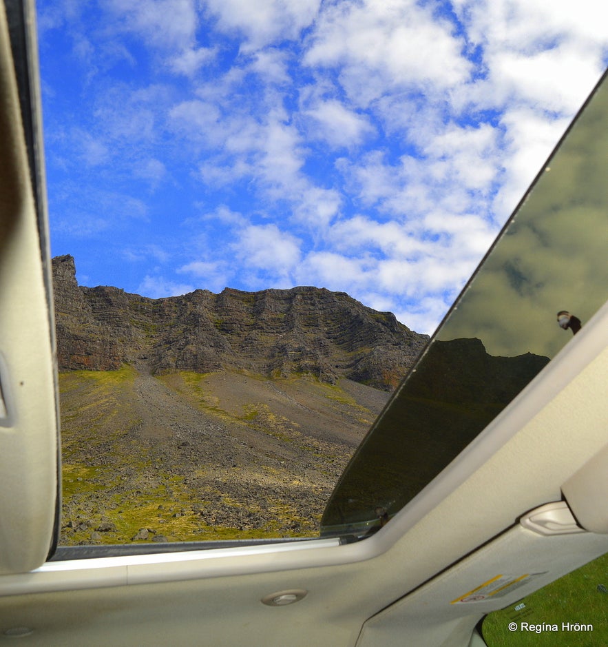
I asked the guide to open the sunroof for me so that I could see the mountains better, as I couldn't believe how beautiful they are. And knowing that I cannot drive this route myself I did not want to miss a single minute of this strikingly beautiful sight.
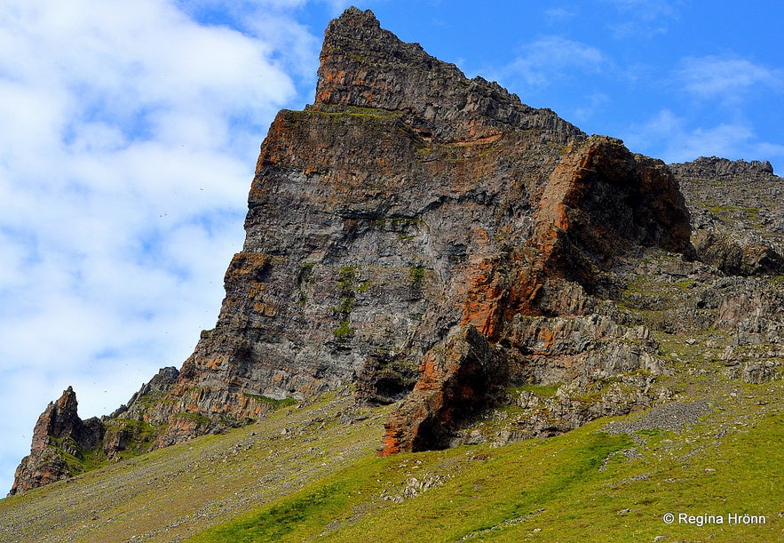
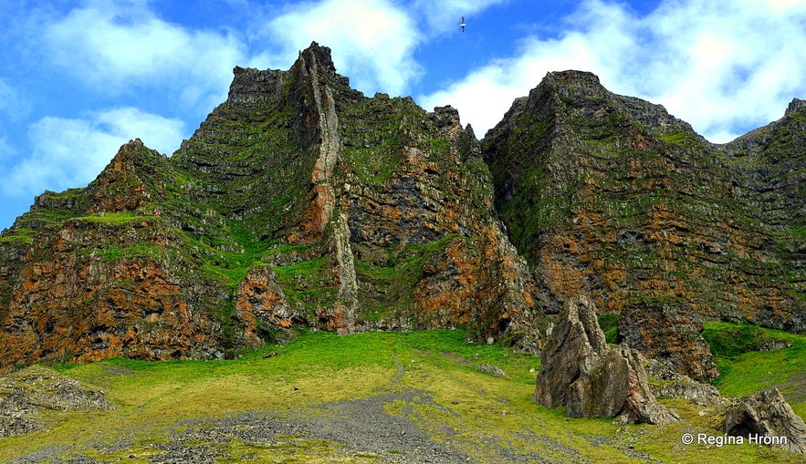
The mountains at Svalvogar are green and orange, and the colours are very vivid! The mountain in my photo above is called Mt. Tóarfjall and the dykes are old boundaries between the Þingeyri and Auðkúla rural districts.
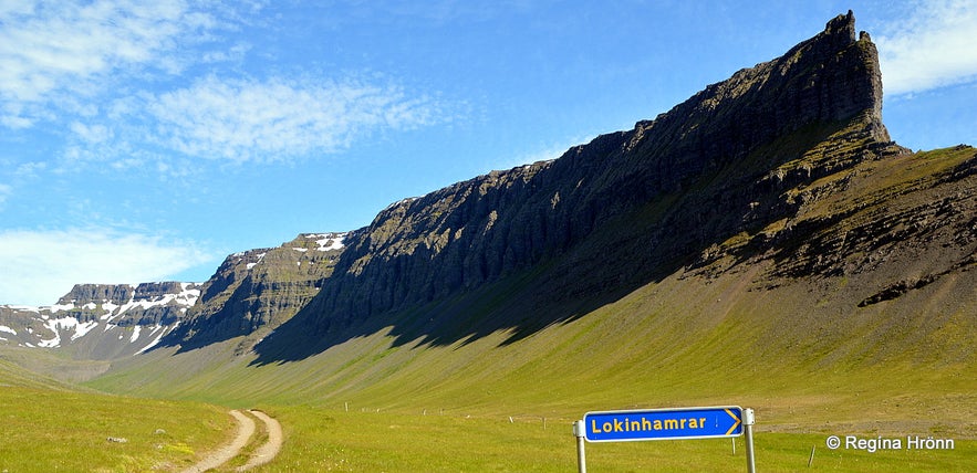
Mt. Skeggi by Lokinhamrar - it was difficult to get a decent photo of it so this one will have to do
No wonder these tall and ruggedly beautiful mountains are called the Westfjords Alps. The highest mountain in the Westfjords is in this area, Kaldbakur, which is 998 metres high.
This route is very scenic and I fell in love with the mountains on which I had never before laid my eyes - even though I have lived in Iceland for my whole life. This truly is a fairy tale landscape - given to us by the great road construction hero and trailblazer, Elís Kjaran.
Elís has written a book on his road, Svalvogavegur or the Road of Svalvogar, which must be a really interesting read.
Nowadays this road is often referred to as Vesturgatan or the Western Road and since 2006 an annual race has taken place on this steep road. Cycling is also popular here, but again I must reiterate, you must have pretty good balance and not be afraid of heights.
Fortunately, we only met one jeep further down the road, where it was easier to meet - I would not have wanted to meet it on the narrowest part of the road!
Driving by Skútabjörg cliffs
After driving through this breathtakingly scenic coastal route we reached Skútabjörg cliffs in Arnarfjörður fjord. This part of the route is at sea-level and takes you through a stony beach. When the sea tide comes in the road disappears and this is one of the reasons why you will need guidance on this route!
You will drive right by the sea beneath Skútabjörg and here the road is very narrow - it feels like you can touch the cliff while driving in the car. This is another strikingly beautiful part of the route with 3-4 small waterfalls cutting the road, creating streams which we had to pass.
By Skútabjörg cliffs
The road then led us a little bit further along the coastline at sea-level and through Stapasund, a cleft in the rock, with one freestanding rock called Stapi from which Stapadalur valley got its name. Here Svalvogavegur road ends.
This scenic route was full of surprises and didn't cease to amaze me. What an absolutely thrilling experience!
Driving through Stapasund
After the thrill of driving on this next to impossible road construction, we found ourselves in the ever so pretty Arnarfjörður, the very fjord of the Jewel of the Westfjords - the magnificent Dynjandi waterfall, my all-time favourite waterfall in Iceland. And the sea-monster fjord of Iceland.
Here we needed to let off steam so we crossed a small river on full throttle, only to realise that we had left the sunroof open for a better view of the mountains! The water came flying through the sunroof and that is why you can hear us screaming in the short video below ;)
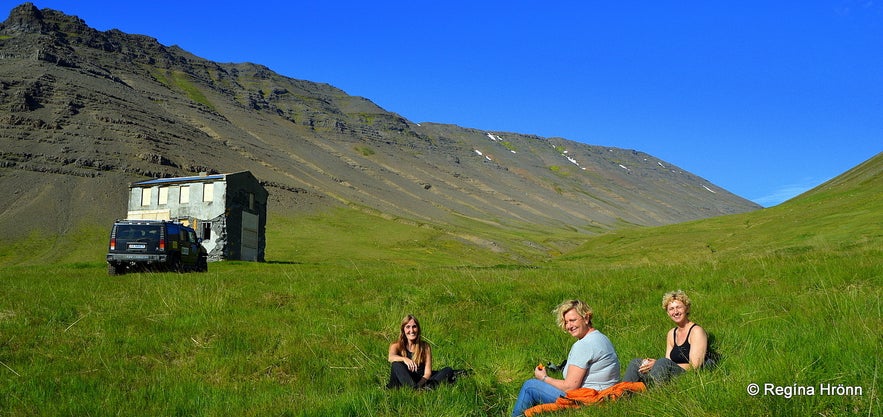
Before visiting Dynjandi waterfall we had a picnic by an abandoned house in Stapadalur valley, which marks the end of the Svalvogavegur route. The rest of the road was a "normal" gravel road in the Westfjords.
The Westfjords of Iceland together with the Eastfjords are the geologically oldest parts of my country and you can see fossilised plants in the rocks, i.e. if you are not too busy looking at the extraordinary view and standing on the imaginary break in the passenger seat like I was doing ;)
Having a picnic with the guide in Stapadalur valley
On the way to the majestic Dynjandi waterfall, we stopped at Hrafnseyri, the birth-place of our national hero Jón Sigurðsson.
In my photo below you will see the reconstructed turf house at Hrafnseyri, a replica of the farm where Jón Sigurðsson was born.
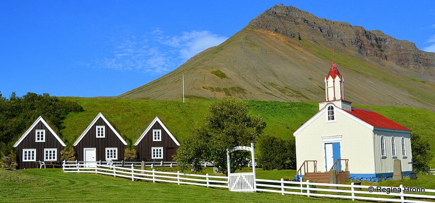
The turf house at Hrafnseyri and Hrafnseyrarkirkja church
As those of you who read my travel-blog know already then I am a big fan of turf houses and have written travel blogs on almost all of the beautiful turf houses and turf churches left in my country.
Here is also a list of turf houses I have visited in Iceland:
A List of the beautiful Icelandic Turf Houses, which I have visited on my Travels in Iceland
The majestic Dynjandi Waterfall
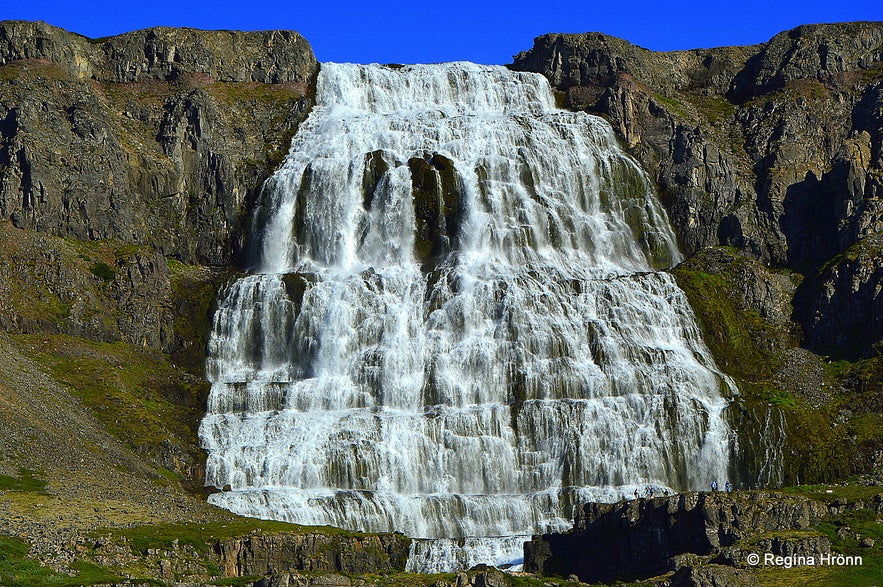
Dynjandi waterfall
The next stop on our tour was at the breathtakingly beautiful Dynjandi waterfall, the Jewel in the Crown of the Westfjords of Iceland - my favourite waterfall in the Westfjords.
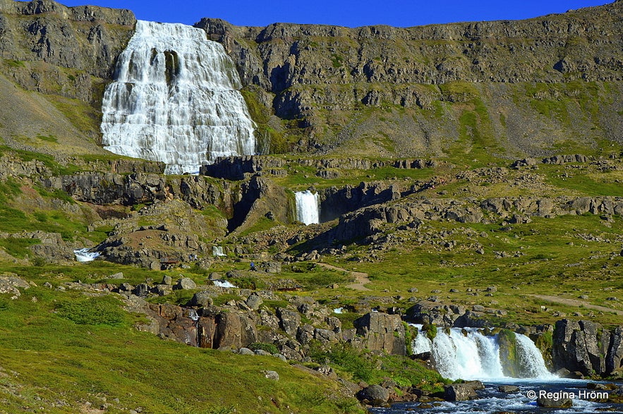
Dynjandi waterfall is the biggest waterfall in the Westfjords and in my opinion the most beautiful waterfall in Iceland. It cascades some 99 metres in a bridal-veil-like cascade - at the top, it is narrower, or 30 meters wide, and at the bottom, it doubles in size and becomes 60 metres wide!
Dynjandi waterfall
Paths and rocky steps, with an elevation of 200 meters, lead up to Dynjandi where one passes 6 other pretty waterfalls, both small and tall - it is such a lovely, very scenic path.
It is so huge and so thunderous that standing next to it is surreal - this experience will leave no man untouched, and my husband has a hard time pulling me away from here as I just want to stay, totally mesmerised by the waterfall. It is a pity that it is so far away from my home in Reykjavík, but visiting Dynjandi waterfall is one of the main reasons why we keep revisiting the Westfjords.
The roads in the Westfjords of Iceland are well known for being steep and windy gravel roads and on our way to Kjaran's Avenue we f.ex. passed both Dynjandisheiði heath and Hrafnseyrarheiði heath with their steep and windy roads. These 2 heaths are closed for about 6-8 months every year due to snow.
Hrafnsheyrarheiði heath - Mt. Sandafell in the distance
A new tunnel, the Dýrafjarðargöng tunnel, opened in 2020 from Arnarfjörður to Dýrafjörður making driving in this area much easier for the locals in the wintertime.
The combination of these two jewels in the Westfjords, the Kjaran's Avenue and the majestic Dynjandi waterfall, makes for a truly unforgettable day - highly recommended. Along the way, you will also get the local guidance of the history of the Westfjords, the geology of this oldest part of Iceland and stop at many more interesting places.
I am just showing you the highlights here, there is so much more to see :)
This extraordinary tour is run by Westfjord Adventures in Patreksfjörður village, where I stayed for one night. The friendly locals offer a free guided tour of their village on request.
See also my travel-blog about Patreksfjörður village:
The lovely Boutique Hotel Ráðagerði in Patreksfjörður, the friendly Village in the Westfjords
To visit this village you can rent a car in Reykjavík and drive up there in a couple of days.
Have a fantastic time visiting the most dangerous road construction in Iceland :)


