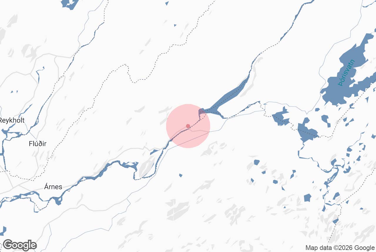
Sultartangi Power Station (Sultartangastöð) is a hydroelectric plant run by Landsvirkjun, Iceland's national power company, on the edge of the highlands above Þjórsárdalur in South Iceland.
Opened in 1999, it takes water from Sultartangalón, the reservoir where the glacial rivers Þjórsá and Tungnaá meet, runs it through a tunnel under the mountain Sandafell and returns it to the Þjórsá in a canal that feeds the older Búrfell station downstream.
Drivers and motorcyclists heading for Hrauneyjar and the Sprengisandur route pass close by it, and the power house is an unusual piece of engineering set into a cut through columnar basalt.
Key Takeaways About Sultartangastöð
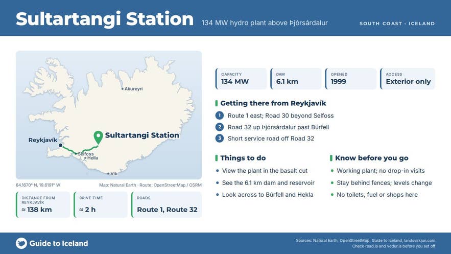
- 134 MW Landsvirkjun hydro station opened November 1999 on the Þjórsá/Tungnaá cascade
- Fed from Sultartangalón behind a 6.1 km dam, the longest in Iceland, via a 3.4 km tunnel under Sandafell
- Off Road 32 about 5 km before its junction with Road 26; about 138 km and 2 hours from Reykjavík on paved roads
- Working plant, not open to walk-in visitors; the exterior and dam can be viewed from public roads
- Gateway to Sprengisandur (F26) and the Hrauneyjar/Landmannalaugar roads
Why visit Sultartangi Power Station
Sultartangi is one of seven Landsvirkjun stations on the Þjórsá and Tungnaá, the most heavily developed river system in Iceland, and it shows how the whole cascade is strung together.
Its reservoir came first: a 6.1 km earth-fill dam, the longest in Iceland, was built across the Sultartangi spit between the two rivers in 1982-84 to steady the flow to Búrfell and keep ice out of its intakes.
The lake sits at about 297 m above sea level; raising the dam crest by a metre for the power project enlarged it from 18 to 20 square km. The power house followed in November 1999, with two Francis turbines fed from a headrace tunnel about 3.4 km long bored through Sandafell.
Water drops 44 m to the turbines, then runs just over 7 km down a tailrace canal to the Búrfell intake. Landsvirkjun gives the station's capacity as 134 MW and its output as about 1,040 GWh a year, roughly 5 percent of Iceland's electricity.
What makes it worth a stop rather than a glance is the setting. The power house sits at the foot of a vertical cut through basalt columns, with the intake house above it on the skyline and the grey-green outflow churning from the draft tubes below.
The complex is largely hidden from the plateau until the service road drops into the cut. From the rim you look south-west over the Þjórsá and across to Búrfell, the flat-topped mountain that gives the older station its name, with Hekla on the horizon beyond.
The station and reservoir also mark the start of the real highlands. Road 26 leads on to Hrauneyjar, Þórisvatn and the turn-offs for Landmannalaugar and the Fjallabak nature reserve, and from Þórisvatn the Sprengisandsleið (F26) runs roughly 200 km across the interior to Bárðardalur.
How to get to Sultartangi Power Station
From Reykjavík, take Route 1 east to the Road 30 junction beyond Selfoss, then Road 32 (Þjórsárdalsvegur) up Þjórsárdalur past Hjálparfoss and the Búrfell station.
Road 32 climbs out of the valley past the turn-offs for Gjáin and Háifoss and runs along the foot of Sandafell; the station lies at the end of a short service road (about 300 m) off Road 32, roughly 5 km before Road 32 meets Road 26.
The drive is about 138 km and 2 hours from Reykjavík, 70 km (just over an hour) from Hella via Road 26, and about 78 km from Hvolsvöllur.
Roads 32 and 26 are paved here, so an ordinary car can reach the station in summer, and Road 26 is kept open in winter as far as Hrauneyjar, though conditions can be poor. Beyond, F26 is a 4x4-only F-road. There is informal gravel parking beside the service road; do not block gates.
The power house is a working industrial site and is not open for drop-in visits. Landsvirkjun's public exhibitions are elsewhere, at the Ljósafoss station on the Sog river and at Krafla in North Iceland, and both close for the winter. The exterior, the cut and the dam are freely visible from public roads.
Best time to visit
June to September is best: the roads are clear, the rivers are high with glacial melt, and evening light falls straight into the cut. The station is a convenient stop on the way to Landmannalaugar or Sprengisandur. In winter the plateau is exposed, Road 26 can be icy or closed, and the cut is in shadow most of the day.
Safety and practical tips
- Stay behind fences and off the dam crest, canal banks and intake structures. Water levels change without warning when turbines start or stop.
- The edges of the cut are unfenced and the basalt is loose. Keep children and dogs close.
- There are no toilets, shops or fuel at the station. The nearest services are at Hrauneyjar Highland Center (about 19 km north-east by road) and in Árnes, back down Road 32, which has a swimming pool, campsite and the Þjórsárstofa visitor centre.
- Weather on the plateau is often much windier than in Þjórsárdalur. Wind strong enough to damage car doors is common.
- Drones: this is critical infrastructure; check Landsvirkjun's rules before flying.
- No entrance fee.
Nearby attractions
- Hólaskógur - 3 km, highland hut
- Háifoss waterfall - about 5 km in a straight line, a 122 m waterfall (longer by road)
- Gjáin - 6 km, waterfalls and basalt in a green cleft
- Stöng, Viking-era longhouse - 7 km
- Sultartangalón reservoir - 10 km, the reservoir and dam
- Búrfell Hydropower Station - 13 km, the older station downstream
Tours that visit Sultartangi Power Station
- Extreme 6 Day Motorcycle Adventure Tour in the Icelandic Highlands with Waterfalls & Glaciers - on day 3 the route crosses Sprengisandur to Þórisvatn and the Veiðivötn lava field, takes in Hekla and explores the Sultartangi plant.
- Challenging 4 Day Motorcycle Adventure Tour in Iceland with Waterfalls & Black Beaches - day 1 rides from Selfoss via the Golden Circle and checks out the Sultartangi hydroelectric plant on the way to Hekla.
