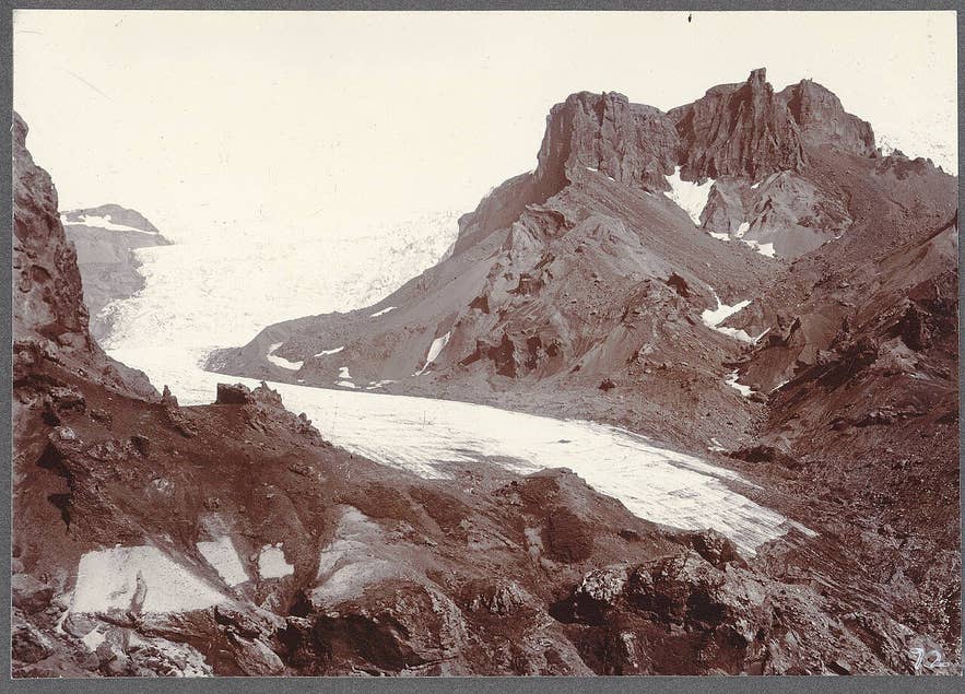
Krossárjökull in Þórsmörk, c. 1900. Photo: Frederick W. W. Howell, public domain
Krossárjökull is a small outlet glacier on the western side of Mýrdalsjökull, descending steeply into the inner end of the Þórsmörk valley system in South Iceland. It is the source of Krossá ("cross river"), the glacial river that divides Þórsmörk from Goðaland and that every traveller to Þórsmörk has to cross.
The glacier takes its name from the river. Unlike the glacier tongues at Skaftafell or Sólheimajökull, Krossárjökull glacier has no road, no car park and no sign, and it is visited almost only on guided expeditions.
Key Takeaways About Krossárjökull
- Small, steep outlet glacier of Mýrdalsjökull at the head of the Krossá valley, inner Þórsmörk; source of the river Krossá
- No road, car park or trail: reached only by super-jeep fords up the Krossá valley and a 1–1.5 hour canyon walk each way
- Þórsmörk access via Road 249/F249 from Route 1 near Seljalandsfoss; rental cars are not insured for the river crossings
- Retreated fast since the 1990s; the guided tour includes a citizen science element mapping the ice margin for Katla Geopark
- Guided 10-hour private tour from Hvolsvöllur runs April–November; minimum age 10; no services beyond the Þórsmörk huts

Why visit Krossárjökull
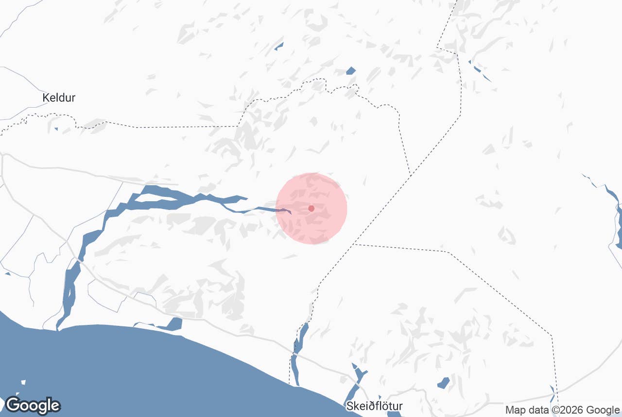
Krossárjökull drops from the Mýrdalsjökull plateau at around 1,400 m to about 400 m in a short, steep descent. Its snout once wrapped around the mountain Eggjar; after decades of retreat the ice is now confined to the northern side of the mountain.
Since the 1990s the glacier has shrunk rapidly, leaving hundreds of metres of stagnant "dead ice" buried under gravel on the valley floor, together with fresh moraines, meltwater channels and crevasse fields.
Recent surveys suggest the lower glacier has thickened slightly in the last few years and is building small new moraines on its southern side, though a real advance is unlikely because the dead ice blocks its path.
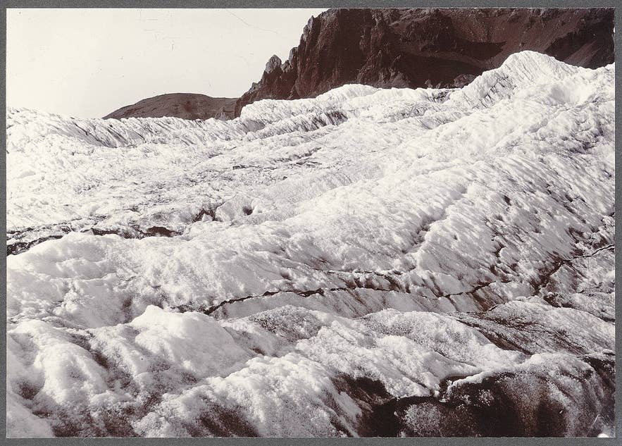
Crevasses on Krossárjökull, around 1900. Photo: Frederick W. W. Howell, public domain
The glacier lies within Katla UNESCO Global Geopark, which covers 9,542 km² of South Iceland from Hvolsvöllur to Skeiðarársandur. Aerial surveys of the glacier exist for 1994 and 2022, and the guided expedition now includes a citizen science element in which visitors help map the ice margin and collect data that is passed on to the geopark.
Photographs by Frederick W. W. Howell from around 1900, now held by Cornell University Library, show the glacier filling the head of the valley with a broad, crevassed tongue; comparing those with the view today is one of the most direct ways to see a century of climate change in Iceland.
The approach is part of the experience. The walk to the ice follows a narrow canyon of layered rock, mossy cliffs and black sand, with braided glacial streams on the floor, after a drive in through Þórsmörk's birch woods and rhyolite hills.
How to get to Krossárjökull
Krossárjökull is at the far eastern end of Þórsmörk. Access to Þórsmörk is by Road 249/F249, which leaves Route 1 near Seljalandsfoss, about 22 km east of Hvolsvöllur (itself about 108 km from Reykjavík, roughly 1.5 hours).
The track fords several glacial rivers, including Krossá, whose flow can change from a shallow stream to an impassable torrent within hours; only large modified 4x4s and the scheduled highland buses should attempt it, and no rental car insurance covers damage from river crossings.
From the huts at Básar or Langidalur there is still no track to the glacier.
Reaching the ice means driving further up the Krossá valley, where the river swings from one valley wall to the other, with repeated fords that are only feasible at low water (mornings and after dry spells), followed by a 1 to 1.5 hour walk each way through the canyon.
In practice this means joining a guided expedition such as the private Krossárjökull tour from Hvolsvöllur, which handles the driving, river crossings and glacier equipment. The whole day, including travel from Hvolsvöllur, takes about 10 hours.
Best time to visit
The guided expedition runs from April to November, but the Þórsmörk tracks are at their most reliable from June to September, when the summer highland buses also run.
River levels are lowest in the morning and after dry weather, and highest on warm afternoons and after rain, which is why tours start early.
Late summer offers the most stable conditions on the ice; autumn brings quieter valleys but a higher chance of snow and closures.
Safety and practical tips
- Never go onto the ice without a guide, crampons and a helmet. Dead ice hidden under gravel can collapse, and crevasses near the snout are often bridged by thin debris.
- Krossá is among the most dangerous rivers in Iceland for vehicles. Do not attempt to ford it in a rental car, and never wade it on foot.
- Mýrdalsjökull sits over the Katla volcano. Guides follow the Met Office's alerts; check vedur.is yourself before travelling.
- Bring waterproof hiking boots, layered clothing, gloves, a hat, food and water. There are no services beyond the Þórsmörk huts.
- The tour has a minimum age of 10 and is rated moderate; the canyon walk is on uneven ground with stream crossings.
- Mobile coverage in the inner valleys is poor. Leave a travel plan at safetravel.is.
Nearby attractions
- Rjúpnafell, a peak above Þórsmörk with views over Krossá and the glaciers, 3 km
- Fimmvörðuháls, the pass between Eyjafjallajökull and Mýrdalsjökull with the 2010 craters Magni and Móði, 6 km
- Básar Hut, the hut and campsite in Goðaland on the south bank of Krossá, 6 km
- Þórsmörk, the valley reserve between three glaciers, 6 km
- Valahnjúkur, the classic viewpoint above Langidalur, 8 km
- Stakkholtsgjá, the canyon with a waterfall at its end, 10 km
Tours that visit Krossárjökull
- Private Krossarjokull Glacier Tour and Citizen Science Expedition from Hvolsvollur: a 10-hour private day from Hvolsvöllur with a 4x4 drive through Þórsmörk, a canyon hike to the glacier, a guided walk on the ice and a Citizen Scientist certificate from Katla Geopark for helping map the glacier.
