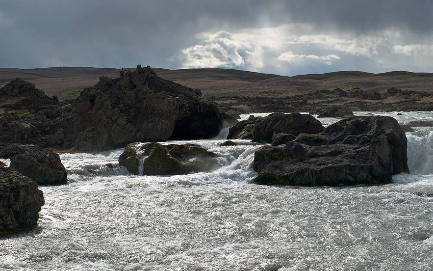
Skjálfandafljót at Ingvararfoss. Photo: Axel Kristinsson, CC BY 2.0
Ingvararfoss (Icelandic: Ingvararfoss, "Ingvar's waterfall") is a small, little-visited waterfall on the glacial river Skjálfandafljót in Bárðardalur, North Iceland.
It sits a short walk upstream from the far better known Aldeyjarfoss, and downstream of Hrafnabjargafoss, so it is the middle of three waterfalls that can be visited on the same outing at the top of the valley.
The river splits around rocks here and drops in several strands rather than one curtain.
Key Takeaways About Ingvararfoss
- Low but powerful waterfall on the glacial river Skjálfandafljót, about 700 m upstream of Aldeyjarfoss and 3 km downstream of Hrafnabjargafoss
- Reached only on foot from the Aldeyjarfoss car park: 10–15 minutes each way over unmarked lava
- Drive Route 842 up Bárðardalur (gravel, about 40 km from the Ring Road near Goðafoss); car park where the road becomes F26
- Season late June to September; F26 beyond the car park usually opens in early July and closes in October
- No fee, no facilities; about 1.5 hours from Akureyri, 6.5 hours (roughly 465 km) from Reykjavík
Why visit Ingvararfoss
Ingvararfoss waterfall is not tall. The waterfall survey site European Waterfalls puts the drop at only 1 to 2 metres, in two steps, and describes it as more a rapid than a true waterfall; photographs show a wide ledge of white water at the main step.
What makes it worth the walk is the setting. Skjálfandafljót here forces its milky grey-blue water through a maze of dark basalt, splitting into channels, pouring over ledges and boiling back together below.
The rock around it is the same dark basalt that forms the famous hexagonal columns at Aldeyjarfoss, so the ground is rough, dark and almost bare of plants, with the flat-topped mountains of the central highlands on the horizon.
Skjálfandafljót itself is about 180 km long, the fourth-longest river in Iceland. It rises in Vonarskarð, between Vatnajökull and Tungnafellsjökull, runs north along the Sprengisandur highland plateau and runs north through Bárðardalur to the sea at Skjálfandi bay, passing Goðafoss on the way.
Because it is glacier-fed, the flow and the colour change through the day and through the season, and the fall looks very different in bright June sunshine, in autumn when the water drops and clears, and in winter when spray freezes onto the basalt.
The other reason to visit Ingvararfoss is solitude. Aldeyjarfoss now draws steady traffic in summer, but very few people walk the extra stretch upstream.
The guide site Iceland the Beautiful repeats a tale about a frog that waited so long for the right moment to jump the river here that it turned to stone; look for a frog-shaped rock by the water.
How to get to Ingvararfoss
Ingvararfoss waterfall is reached on foot from the Aldeyjarfoss car park; there is no road to the fall itself.
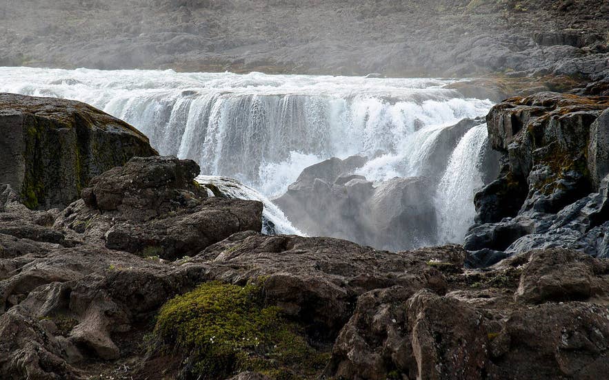
Ingvararfoss on Skjálfandafljót. Photo: Axel Kristinsson, CC BY 2.0
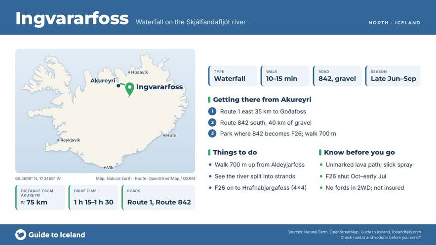
- From Reykjavík, take the Ring Road (Route 1) north to Akureyri and on past Goðafoss, then turn south onto Route 842 (Bárðardalsvegur vestri) up the west side of Bárðardalur. Total driving is roughly 465 km, about 6.5 hours without stops.
- From Akureyri the drive is about 1 hour 15 minutes to 1 hour 30 minutes: Route 1 east for about 35 km to the Route 842 junction near Goðafoss/Fosshóll, then around 40 km of gravel up the valley, past the farm Mýri and through a gate.
- Route 842 is gravel but passable for normal cars in dry summer conditions. Near the top of the valley it becomes F26, the Sprengisandur highland road. The signed turn-off and short track to the Aldeyjarfoss car park is at the start of the F-road section, and a 4x4 is recommended for the last stretch; F26 itself is open only to 4x4 vehicles.
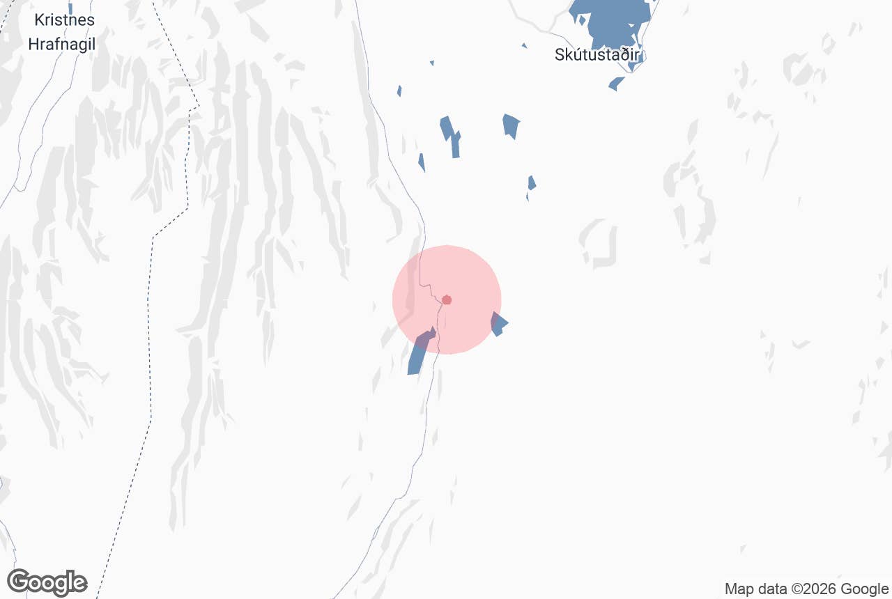
- From the Aldeyjarfoss car park, walk upstream (south) along the river for well under a kilometre on an informal path over lava to reach Ingvararfoss. Sources give the distance as roughly 700 metres to just under 1 km, which matches the map (the falls are about 700 m apart); allow 10 to 15 minutes each way. Hrafnabjargafoss is a further 2 to 3 km upstream and is normally reached by driving on along F26 rather than walking.
F26 is closed from about October until it is opened again, usually in early July (late June at the earliest), and the top of Route 842 is snowbound for much of the winter, so Ingvararfoss is effectively a summer and early-autumn destination unless you join a guided super-jeep tour.
Best time to visit
Late June to September is the practical window, when the roads are open and the path over the lava is snow-free.
Early summer brings the highest glacial flow and the most dramatic white water; late August and September give lower, clearer water, autumn colours on the moss and far fewer people.
Winter visits are possible only with a guided operator running modified 4x4 vehicles, and the hike can be icy.
Safety and practical tips
- There are no facilities at Ingvararfoss and none at Aldeyjarfoss beyond the car park. The nearest services are at Fosshóll by Goðafoss and in the lower valley.
- There is no entrance fee.
- The path is unmarked lava rock with uneven footing; wear proper boots. Stay well back from the edge: the rock is slick where spray lands, and Skjálfandafljót is cold, fast and unforgiving.
- Weather in upper Bárðardalur is highland weather. Expect wind, rapid changes and noticeably cooler temperatures than in Akureyri. Bring windproof layers even in July.
- Check road.is for the status of Route 842 and F26 before setting out, and safetravel.is for conditions. Phone coverage is patchy at the top of the valley.
- Do not attempt to drive F26 or ford any river in a two-wheel-drive car; rental insurance does not cover F-roads in a 2WD.
How high is Ingvararfoss waterfall?
How far is Ingvararfoss from Aldeyjarfoss?
Do I need a 4x4 to reach Ingvararfoss?
Can I visit in winter?
Is there a fee or any facilities?
Nearby attractions
- Aldeyjarfoss – the basalt-column waterfall with the car park, about 0.7 km downstream
- Hrafnabjargafoss – the next waterfall upstream, about 3 km away
- Goðafoss – the famous fall at the bottom of the valley, about 37 km away
- Bárðardalur – the valley itself, about 20 km to its page pin
- Svartárkot – the innermost farm in the valley, on the edge of Ódáðahraun, about 4.5 km away
Tours that visit Ingvararfoss
- Private 4-Hour Tour of Aldeyjarfoss and Godafoss Waterfalls with Transfer from Akureyri – a private half-day from Akureyri that stops at Goðafoss and then continues up Bárðardalur to Aldeyjarfoss, Ingvararfoss and Hrafnabjargafoss, with the walk upstream to Ingvararfoss included.