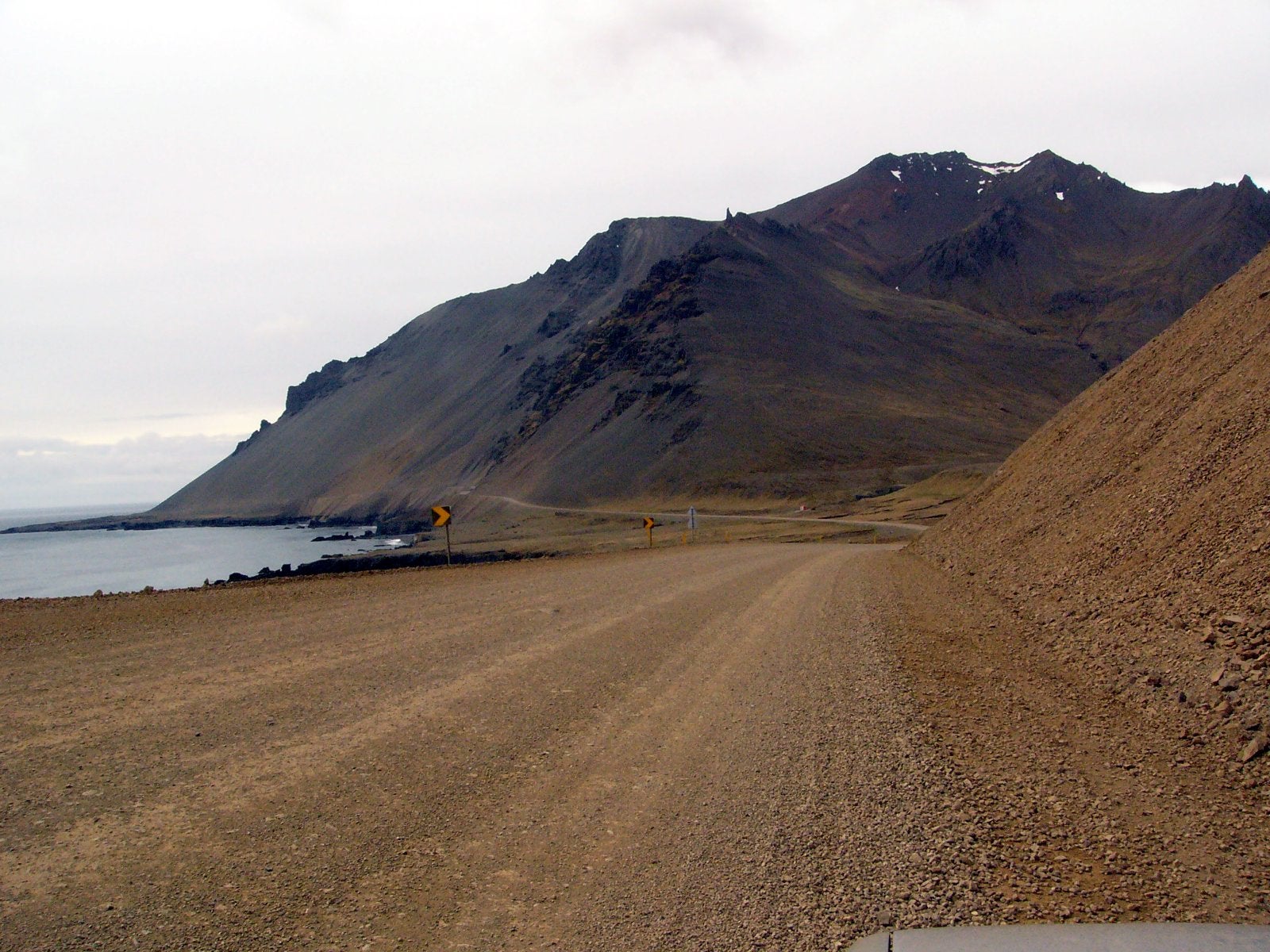
Ring Road on the Hvalnesskriður scree. Photo: Christian Bickel, CC BY-SA 2.0 DE
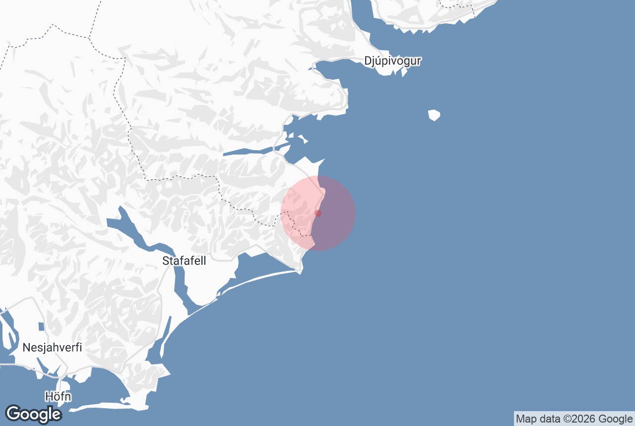
Thvottarskridur (Þvottárskriður, "the Þvottá screes") is a stretch of steep scree slope on the Ring Road in East Iceland, between Álftafjörður and the Hvalnes headland, roughly 45 km south of Djúpivogur by road.
Here Route 1 runs on a narrow shelf between loose, rock-strewn mountainsides and the open Atlantic, and together with the neighbouring Hvalnesskriður it forms one of the most exposed sections of the whole Ring Road.
The name comes from the farm Þvottá, the southernmost farm in Álftafjörður, where, according to the sagas, the missionary Þangbrandur baptised the chieftain Síðu-Hallur and his household shortly before Iceland's conversion to Christianity in the year 1000.
Key Takeaways About Þvottárskriður
- A paved Ring Road section, not a stop: scree slopes above, black beaches and skerries below
- Mudslides, rockfall and snow avalanches close the road about 3–4 times a year (Vegagerðin); steel barriers now line the worst parts
- The coastal road opened in 1981, replacing the inland Lónsheiði route
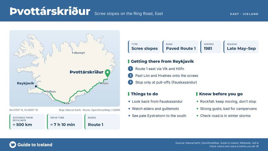
- Stop only at the widened pull-offs; the Fauskasandur pull-off near Hvalnes has a good view back
- Internationally important bird area: about 10,000 moulting eiders and 120 pairs of black guillemots
Why visit Thvottarskridur
Þvottárskriður is not a stop in the usual sense. It is a piece of road that most people remember long after they have driven it. The slopes are made of old basalt lava flows, the layered rock that characterises East Iceland, broken down into grey and rust-coloured scree that spills towards the sea.
Below the road are black beaches and skerries; above it the slopes rise steeply. To the south the scree meets the pale gabbro and rhyolite of Eystrahorn, the 756 m mountain at the tip of the Hvalnes headland.
The screes are in constant, slow motion. Mudslides and rockfall after heavy rain, and snow avalanches in winter, close the road regularly: the Icelandic Road Administration (Vegagerðin) puts it at about 3.5 closures and 22 hours a year on average.
A snow avalanche crossed the road at Hvalnesskriður in February 2019, a mudslide closed Route 1 at Þvottárskriður in August 2020, and heavy rockfall came down during a storm in March 2023. Steel barriers along the roadside now catch most of the falling stone.
Vegagerðin has studied alternatives, including tunnels under Lónsheiði of various lengths and protective road shelters, but in its 2023 tunnel plan the Lónsheiði option was left for a later review, so no decision or construction date has been set.
The coastline from Hvalnes to Álftafjörður is an internationally important bird area of about 550 hectares, with roughly 10,000 moulting common eiders and some 120 pairs of nesting black guillemots. Álftafjörður itself means "swan fjord" (álft is the Icelandic word for a swan); it is a shallow lagoon-like fjord closed off by a gravel spit.
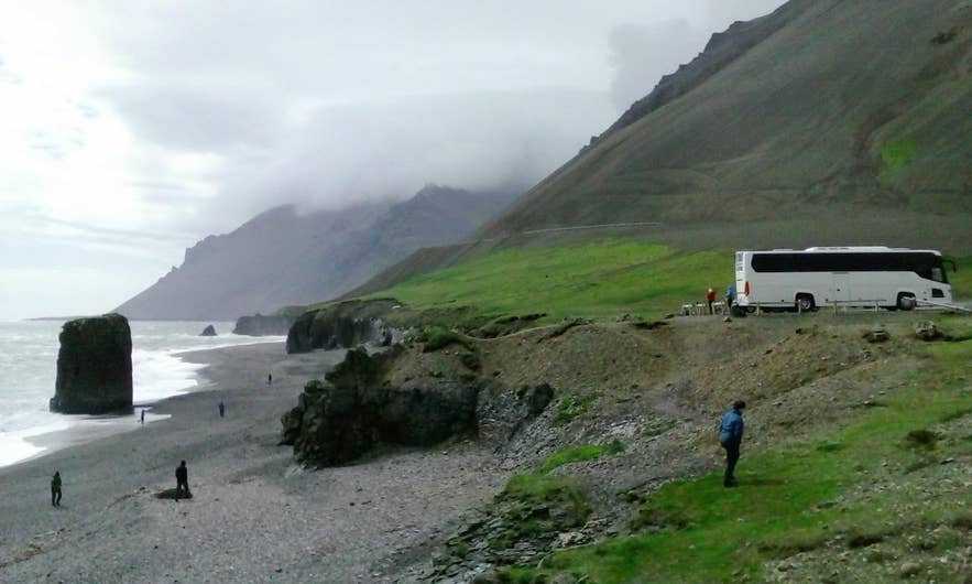
Fauskasandur beach below Þvottárskriður. Photo: Reykholt, CC BY-SA 4.0
How to get to Thvottarskridur
Þvottárskriður is on Route 1 (the Ring Road) on the boundary between the Múlaþing and Hornafjörður municipalities, where the East Fjords meet Southeast Iceland.
Driving clockwise from Reykjavík along the south coast, you pass Höfn and then Lón; after the Hvalnes headland the road climbs onto the scree slopes of Hvalnesskriður and, after a short section with black beaches below, continues onto Þvottárskriður before descending to Þvottá and the shore of Álftafjörður.
Reykjavík to Djúpivogur via the south coast is roughly 540 km, about 7.5 to 8 hours of driving without stops, and Þvottárskriður is about 45 km before Djúpivogur. From Höfn it is about 60 km, roughly an hour's drive northeast.
The current coastal road through the screes was opened in 1981. Before that, Route 1 went inland over the Lónsheiði pass (398 m).
There is no F-road and no 4x4 requirement; this is paved, two-lane Ring Road. The road is open year round, but it is closed several times a year in bad weather. Check road.is (Vegagerðin) before setting out between October and April.
There is no formal car park on the screes themselves; a few widened pull-offs allow a stop with views along the coast, and the Fauskasandur beach pull-off north of Hvalnes is a good place to leave the car and look back at the slopes. Do not stop on the road itself.
Best time to visit
Summer, from late May to September, when the road is dry, the slopes are free of snow and the light lasts late into the evening.
In winter the section is driveable in good weather, but rockfall, snow avalanches and wind are real hazards, and the road can close at short notice. Heavy rain at any time of year can bring down mudslides.
Safety and practical tips
- Rockfall is the main risk. Keep moving through the steepest parts and do not linger below the slopes, especially after heavy rain or during thaw.
- Steel barriers catch most stones, but small rocks can still reach the road. Watch the surface ahead.
- Strong gusts hit the road here; this is a bad place to be in a high-sided vehicle in a storm.
- Check road.is for closures and the weather forecast at vedur.is. Yellow warnings for East Iceland often mean this section will be affected.
- There are no facilities, fees, toilets or opening hours. The nearest services are at Djúpivogur to the north (about 45 km) and at Höfn to the south (about 60 km).
- If you stop at a pull-off, stay on the road side of the barrier. The slope below drops steeply to the sea.
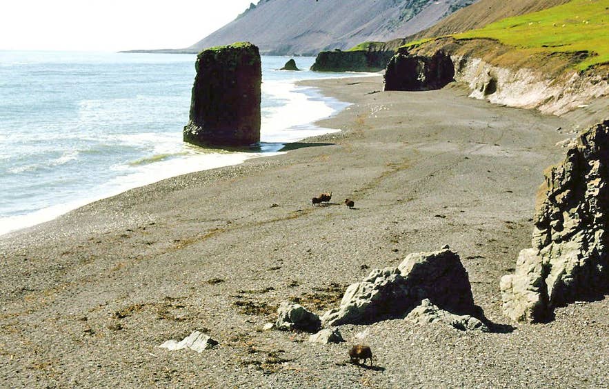
Fauskasandur beach and Hvalnesskriður, 1981. Photo: LBM1948, CC BY-SA 4.0
Is Þvottárskriður dangerous to drive?
Can I stop and take photos at Þvottárskriður?
Why is it called Þvottárskriður?
Will the road through the screes be moved?
Nearby attractions
- Stapavík / Stapinn – a sea stack and cove right below the screes, about 0.3 km.
- Fauskasandur Black Sand Beach – black beach with a pull-off and views of the scree slopes, about 1 km.
- Eystrahorn – the 756 m gabbro and rhyolite mountain at Hvalnes, about 4 km.
- Krossanesfjall – the mountain above the Krossanes headland south of the screes, about 4 km.
- Hvalnes Lighthouse – orange lighthouse on the gravel spit at Hvalnes, about 8 km.
- Stafafell Nature Park – farm and hiking area in Lón, about 18 km.
- Djúpivogur – fishing village with the Eggin í Gleðivík sculptures, about 22 km.
Tours that visit Thvottarskridur
- Fantastic 8-Day Northern Lights Ring Road Tour with Glacier Hiking & Whale Watching from Reykjavik – on day 4 the itinerary drives from Höfn through Lón, over the Þvottárskriður screes and along Álftafjörður on the way to the East Fjords and Egilsstaðir.