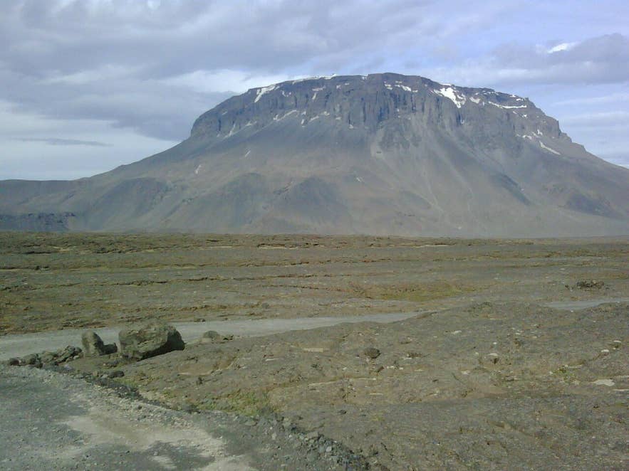
Herðubreið from the F88 track. Photo: Pietro, CC BY-SA 3.0
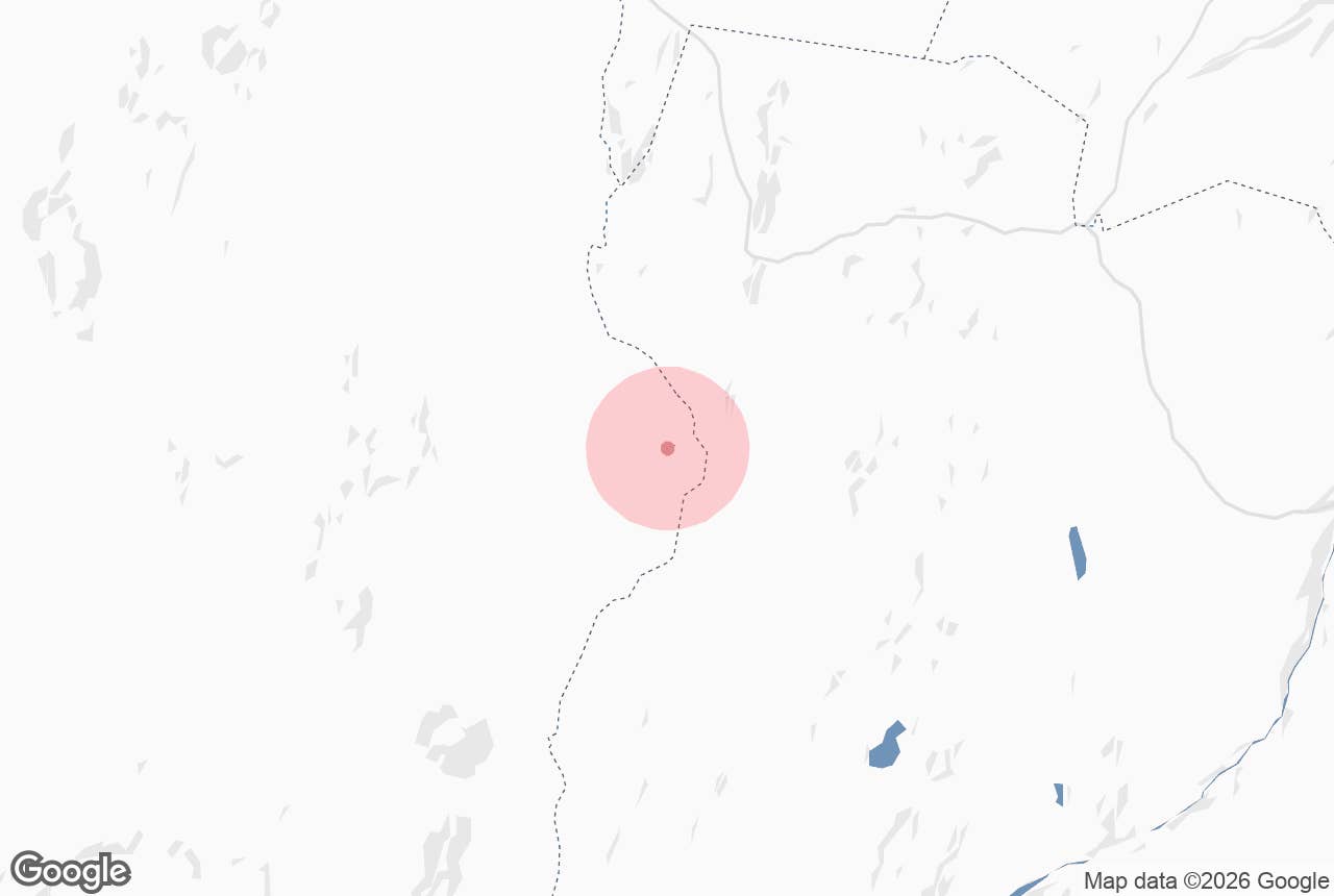
Grafarlönd is a strip of spring-fed green along the Grafarlandaá river in the eastern Ódáðahraun lava field, on the Highland track F88 between the Ring Road and Herðubreiðarlindir. The river that drains it, Grafarlandaá, simply means "Grafarlönd's river".
For most travellers it is the first river ford and the first clear spring water on the long gravel run south towards Herðubreið and Askja.
Key Takeaways About Grafarlönd
- Grafarlönd is a strip of spring-fed green along the Grafarlandaá in the Ódáðahraun lava desert, about 40 km south of the Ring Road on F88.
- The river is spring-fed and runs clear through the lava; tour guides make a stop here on the way to Askja.
- F88 is for large 4x4s only: unbridged fords of Grafarlandaá and Lindaá, open roughly late June to September.
- The area lies in the Herðubreiðarlindir nature reserve (1974) within Vatnajökull National Park; stay on the track.
- Herðubreiðarlindir, with hut, campsite and rangers, is about 20 km further south.
Why visit Grafarlönd
Ódáðahraun is the largest lava desert in Iceland, a plain of black sand and broken lava north of Vatnajökull where almost nothing grows. Rain and meltwater sink straight into the porous rock and travel underground for tens of kilometres before emerging as cold, clear springs along the west bank of Jökulsá á Fjöllum.
Grafarlönd is one of these spring oases, together with the better-known Herðubreiðarlindir about 15 to 20 km further south. The water comes out filtered by the lava, and the spring-fed river forms a small waterfall where the track fords it, which is why tours stop here on the way south.
Where the springs surface, strips of moss, willow scrub and angelica follow the river to its mouth in the grey, silt-laden Jökulsá á Fjöllum, Iceland's second-longest river. A small waterfall drops over a lava ledge on the way.
The contrast is the point: clear blue water and green banks in a black desert, with the 1,682 m table mountain Herðubreið filling the horizon to the south.
Grafarlönd lies inside the Herðubreiðarlindir nature reserve, protected since 1974 and part of Vatnajökull National Park since the park was enlarged in 2019. The reserve covers 163 square kilometres of heath, wetland and spring habitat.
Its many springs are often very deep and hold populations of dwarf Arctic char and both of Iceland's groundwater amphipod species, tiny crustaceans found only in Iceland. Pink-footed geese breed in numbers at Herðubreiðarlindir and Grafarlönd, and harlequin ducks, long-tailed ducks and red-necked phalaropes also use the area.
The track has history too. The F88 follows the old Öskjuleið route to Askja: south from Hrossaborg past Ferjuás and Miðfell, across Grafarlandaá at Grafarlönd, then west of Ferjufjall to the huts at Herðubreiðarlindir.
How to get to Grafarlönd
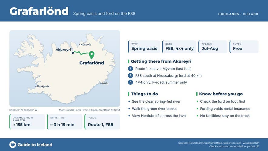
- Road: Grafarlönd is on the F88 (Öskjuleið), a Highland track that leaves Route 1 near the Hrossaborg crater, east of Mývatn and west of the Jökulsá á Fjöllum bridge. The Grafarlandaá ford is about 40 km south of the Ring Road; Herðubreiðarlindir is about 20 km further and Askja about 80 km from the turn-off.
- Vehicle: F88 is only for large, high-clearance 4x4 vehicles. There are no bridges. Grafarlandaá and, further south, Lindaá have to be forded, and water levels change by the hour with rain and glacier melt. Small 4x4s and all rental cars without F-road permission are unsuitable, and crossing rivers voids most rental insurance. Travelling in two or more cars is strongly advised.
- From Reykjahlíð (Mývatn): the F88 turn-off is about 35 km east on Route 1, roughly 35 minutes. Reykjahlíð is the last fuel; fill up there.
- From Reykjavík: Mývatn is roughly 470 km by Route 1, so Grafarlönd is realistically a two-day trip or a guided tour from the north.
- Parking and walking: there is no car park; vehicles stop on the track beside the ford. The springs and the river banks are a few minutes' walk from the crossing.
- Alternative route to Askja: F905 and F910 from Möðrudalur have fewer serious fords but do not pass Grafarlönd.
Best time to visit
The F88 opens when the ground has dried and the rivers are passable, typically between mid and late June, and closes with the first autumn snow, usually in September. July and August are the safest months, with the lowest river levels early in the morning (glacier melt raises them through the day).
Late August and September add autumn colour and the first northern lights, but the track can close at short notice. Check road.is for the F88 status and safetravel.is for conditions before leaving the Ring Road.
Safety and practical tips
- Never cross Grafarlandaá without checking it on foot first if you are unsure of the depth, and never cross alone. Water above knee height is too deep for most vehicles.
- There are no facilities at Grafarlönd and no phone signal to rely on. The nearest services are the hut, campsite and rangers at Herðubreiðarlindir.
- Weather in Ódáðahraun changes fast and sandstorms are common in dry spells. Bring warm layers, a windproof shell and eye protection.
- Camp only at the designated campsites inside the national park (Herðubreiðarlindir and Drekagil). Stay on the track; the vegetated strips take decades to recover from tyre marks, and the spring pools are protected habitat.
Nearby attractions
- Herðubreiðarlindir (17.6 km): the larger spring oasis to the south, with the Þorsteinsskáli hut, campsite and Fjalla-Eyvindur's shelter.
- Herðubreið (21.9 km): the 1,682 m table mountain that dominates every view from Grafarlönd.
- Öskjuleið (2.7 km): the F88 track itself, from Hrossaborg to Askja.
- Hrossaborg (32.1 km): the horseshoe-shaped tuff crater at the F88 junction, used as a film set.
- Jokulsa a Fjollum (32.6 km): the glacial river that Grafarlandaá joins, source of Dettifoss further north.
- Askja Caldera (41.2 km): the great caldera at the end of the F88, with Víti crater and Öskjuvatn.
Tours that visit Grafarlönd
- Super Jeep Tour to Askja Caldera & Holuhraun Lava Field with Transfer from Mývatn: a 12-hour day tour from Mývatn (June to September, minimum age 6) that visits the Grafarlönd spring, Herðubreiðarlindir, Hrossaborg crater and the ruins of Fjalla-Eyvindur's hut, then Askja caldera, Víti crater and the Holuhraun lava field.
