Information about Hjörleifshöfði
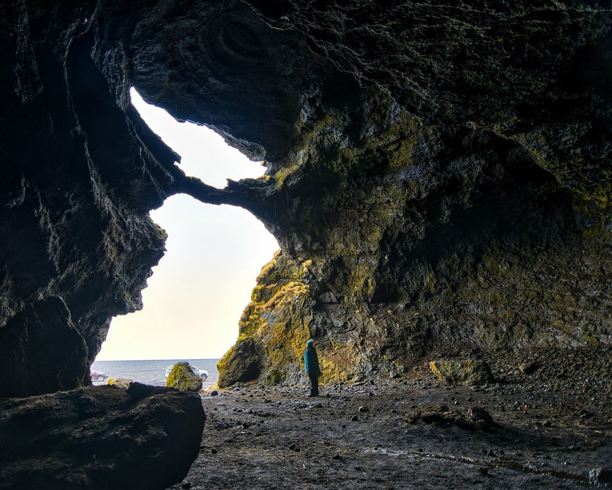
Credit: Wikimedia, Creative Commons. Photo by, Axel Krisinsson.
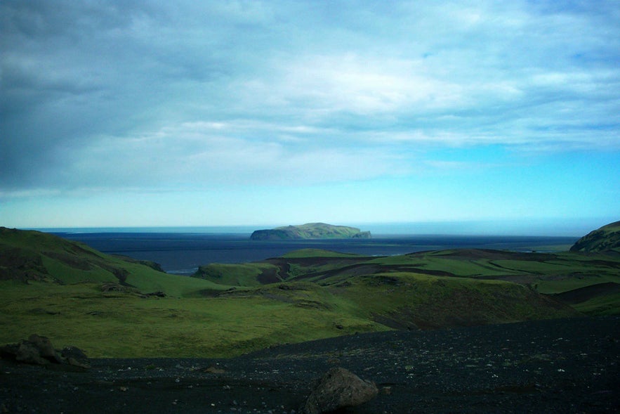
Hjörleifshöfði is a 221 m (725 ft) high mountain in South Iceland, located on the Mýrdalssandur sand plain, 15 km (9.3 mi) east of the village Vík í Mýrdal.
Like most mountains in Iceland, Hjörleifshöfði is volcanic but was submerged in seawater during the time of its formation. Originally, therefore, the mountain was an island, but by the time of Iceland's settlement, it had connected to the mainland. Later, black sand, brought forth by glacial flooding, surrounded Hjörleifshöfði completely.
Services near Hjörleifshöfði
Attractions nearby Hjörleifshöfði
Myrdalssandur
Mýrdalssandur is an outwash plain located between the rivers of Kúðafljót, in the east, and Múlakvísl, in the w...
South Coast
The South Coast of Iceland is the country's most visited sightseeing route, along with the Golden Circle. The famed South Coast shoreline...
Vík í Mýrdal
Vik in Myrdalur valley is the southernmost village on the Icelandic mainland, located 186 km from the capital Reykjavik. Vik is important as a ...
Reynisdrangar
Reynisdrangar are rock formations situated near the shore of Reynisfjara beach by the coastal village Vík í Mýrdalur on the Sou...
Reynisfjall
Reynisfjall is a tuff mountain on the South Coast of Iceland, which is 5 kilometres long, 800 metres (2625 ft) wide and 340 metres (1115 ft) tall at i...
Reynisfjara Black Sand Beach
Reynisfjara is a world-famous black-sand beach found on the South Coast of Iceland, just beside the small fishing village of Vík í M&y...
Þakgil
Photo from: Þakgil and Remundargil Canyons - Beautiful Hidden Gems in South-Iceland. Þakgil ('Roof Canyon') is a hidden cany...
Iceland's coasts
Almost everywhere where there is old lava by the Icelandic shores, there are also spectacular waves, particularly in the southwest parts of the countr...
Dyrhólaey
Dyrhólaey Peninsula is a 120-metre promenade famed for its staggering views of Iceland’s South Coast, as well as its historic lighthous...
Katla
Katla is an active volcano situated under the glacier Myrdalsjokull in South Iceland. It is one of Iceland's most well known volcanoes. Katla...
DC3 Plane Wreck
The DC Plane Wreck is a famous site located within the black sand desert of Solheimasandur, South Iceland. The wreckage is a particularly beloved sp...
Sólheimasandur
Solheimasandur is a vast area of sand and gravel along the south coast of Iceland, between the cliffs of the interior and the modern shoreline. It was...
Katla volcano
Katla (meaning “Kettle”) is one of Iceland's largest and most active volcanos. Situated in south Iceland, Katla is partially buried un...
Sólheimajökull
Solheimajokull is a beautiful outlet glacier of the Myrdalsjokull icecap. Solheimajokull is a rugged glacial tounge riddled with crevasses and specta...
Mýrdalsjökull
Mýrdalsjökull is a glacier in the south of the Icelandic highlands. It is the country's fourth largest ice cap, covering nearly 600 ...
Katla Geopark
Katla Global Geopark is a project of UNESCO and the European Geoparks Network, with the aims of promoting sustainable development and protecting the...
South Shore
From Reykjanesta and the next 100 km onwards, the south shore is characterized by lava formations constantly battered by the wild ocean waves (‘...
Kvernufoss
Photo by Regína Hrönn Ragnarsdóttir. Kvernufoss is a waterfall with a drop of 30 metres (98 feet) in South Iceland. Considered a h...
Skogar Museum - Skógarsafn
Photo from the Skógar Museum Skógar Museum is a cultural heritage museum in south Iceland. Located near one of the most popular waterf...
Skógar
Skogar, in South Iceland, is a popular destination for travelers. It has a population of about 20 people, features a regional museum and and is close ...
Tours near Hjörleifshöfði
The Secret Ice Cave

Join this small-group day tour to explore the hidden ice caves of Mýrdalsjökull glacier. On this......
Under The Volcano | Super Jeep Tour from Vik

Explore the incredible world of Iceland's glaciers and volcanoes. On this tour, you'll have an......