Kayaking on Langadæl at Stokkseyri
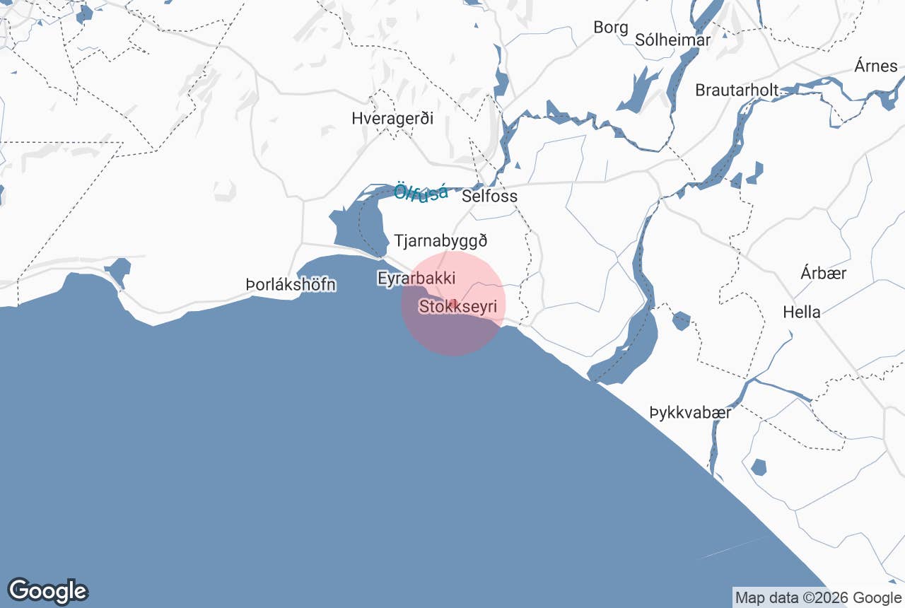
Langadæl (in Icelandic usually heard in its inflected form Löngudæl, "the long hollow") is a small, shallow lake on the northern edge of the village of Stokkseyri on Iceland's south coast, about 65 km from Reykjavík.
It is the start and centrepiece of the kayaking routes run from Stokkseyri: a sheltered pond that opens into a maze of narrow natural channels and irrigation canals winding through the wetlands between the village and the Þjórsárhraun lava. Visitors meet it on the tour pages as "Lake Löngudæl" or "Longudael Lake".
Key Takeaways About Langadæl / Löngudæl
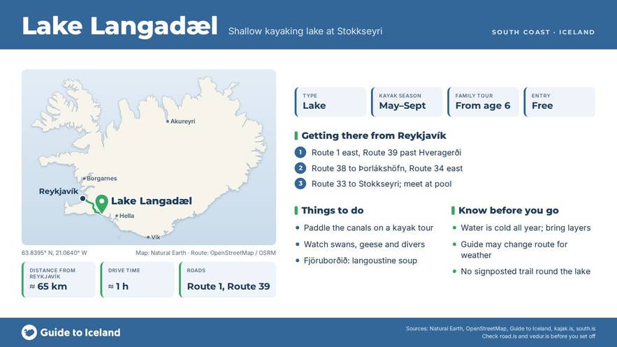
- Small shallow lake on the north-west edge of Stokkseyri, about 65 km (1 hour) from Reykjavík on paved roads
- Start point of the Stokkseyri kayak tours; the canals link a string of hollows in the Flói wetland at the edge of the Þjórsárhraun lava
- Kayak season May–September; family tour from age 6, Power Challenge from 14
- Operator based at Heiðarbrún 12a; tours meet at the Stokkseyri swimming pool, which has parking; no signposted trail around the lake
Why visit Langadæl
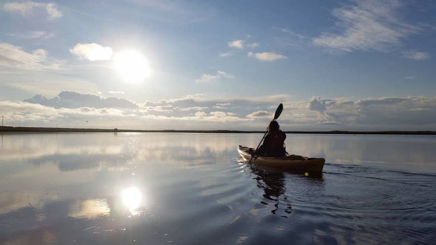
Stokkseyri's shoreline is famous for its breakers; Langadæl lake is the opposite. The lake and its channels lie behind the village, out of the surf, shallow enough for children and beginners, and quiet enough that the loudest thing is usually birdlife.
Wetland birds such as whooper swans, greylag geese, snipe and redshank use the surrounding Flói marshes, and the red-throated diver is the signature bird of the nearby Flói reserve; and the long flat horizon takes in the farms of Flói, the mountains of the Hreppar to the north and, in clear weather, Hekla and the glaciers to the east.
The landscape is unusual. Stokkseyri stands on the seaward edge of the Þjórsárhraun, the lava that flowed roughly 130 km from the highlands to the sea around 8,600 years ago and is counted as the largest single lava flow on Earth since the last ice age.
Where the lava meets the coastal wetland, water collects in a string of hollows, locally called dælar, that drain towards the sea; Langadæl is one of them, and hollows like it were traditionally cut for hay.
The canals linking them belong to the Flóaáveita, the irrigation scheme dug across the Flói lowland in 1918 to 1927, which ends here at the coast, and today they form a network of narrow, reed-lined passages that kayaks fit through but little else does.
For most people the appeal is simple: an easy, flat paddle in open country, with real wildlife and no boat traffic, an hour from the capital.
How to get to Langadæl
From Reykjavík take Route 1 east over Hellisheiði to Selfoss (57 km), then Route 34 south towards Eyrarbakki and Route 33 east along the coast to Stokkseyri, a total of about 65 km and roughly one hour. From Selfoss it is about 15 km.
A coastal alternative from Reykjavík is Route 39 past Hveragerði and Route 38 to Þorlákshöfn, then Route 34 across the Ölfusá bridge at Óseyrarbrú to Eyrarbakki and on to Stokkseyri.
The lake lies immediately north-west of the village streets, a few hundred metres from the main road.
The operator, Kayakferðir, is based at Heiðarbrún 12a, but its stated meeting point is the Stokkseyri swimming pool (Stjörnusteinar 1a), where there is parking; the water is a short walk away.
There is no need for a 4x4, and the road is open all year.
Best time to visit
The kayak tours sold on Guide to Iceland run from May to September, with departure times shown at booking; the operator keeps no fixed opening hours and also runs trips outside the season when conditions allow.
June and July give the most birdlife and near-endless daylight; late August and September are calmer in the village and still mild. An evening tour is also offered, and the operator notes that the lake can freeze when temperatures drop below zero.
Safety and practical tips
- The water is shallow but cold all year. Life vests, waterproof overalls, boots and gloves are provided; bring a change of clothes and warm layers.
- Wind is the limiting factor on this open coast. The guide may change the route or timing because of the weather.
- The family tour has a minimum age of 6; the Power Challenge tour is for ages 14 and up.
- Toilets and a swimming pool with two hot tubs are in the village. Fjöruborðið restaurant by the shore is known for its langoustine soup.
- Give nesting birds space in May and June, and keep to the water and the marked paths.
Is Langadæl a sea kayaking trip?
Do I need experience to kayak on Langadæl?
Can I visit the lake without kayaking?
Why is it spelled both Langadæl and Löngudæl?
Nearby attractions
- Stokkseyri, 0.5 km: the village, with Þuríðarbúð fishing hut, the swimming pool and the sea wall.
- Draugasetrið, the Ghost Centre, 0.5 km.
- Þjórsárhraun Lava Flow, 2.4 km: the lava that shapes this whole coast.
- Eyrarbakki, 4.9 km, and the Merchants House heritage museum, 4.9 km.
- Knarrarós Lighthouse, 5 km: Iceland's first reinforced-concrete lighthouse, built 1938 to 1939.
- Flói bird reserve, 9 km: wetland reserve on the east side of the Ölfusá estuary, north of Eyrarbakki.
Tours that visit Langadæl
- 2-Hour Kayaking Power Challenge Circle Tour in South Iceland from Stokkseyri: a guided route that starts on Langadæl, threads the narrow canals, follows the Hraunsá river out to the skerries and ends in Stokkseyri harbour.
- Family-Friendly Kayaking Tour in Stokkseyri in South Iceland: a self-guided paddle on the shallow inland canals at the edge of Langadæl, suitable for families.
