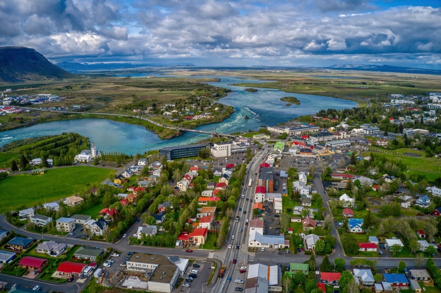
Selfoss is a lively town in South Iceland, set along the banks of the Olfusa River. Located about 31 miles (50 kilometers) southeast of Reykjavik, it’s one of the country’s largest towns outside the capital area. Known for its blend of modern design and local heritage, Selfoss has become a notable stop for travelers exploring the region.
Selfoss is featured on many South Coast tours and is easy to include in self-drive tours thanks to its location and road access. With a range of Selfoss accommodations, it works well as a base or overnight stop before heading deeper into South Iceland.
Why You Can Trust Our Content
Guide to Iceland is the most trusted travel platform in Iceland, helping millions of visitors each year. All our content is written and reviewed by local experts who are deeply familiar with Iceland. You can count on us for accurate, up-to-date, and trustworthy travel advice.
Although the name often causes confusion with Selfoss Waterfall in the north, the town itself does not have a waterfall. Instead, it offers cultural attractions, river views, and easy access to surrounding geothermal valleys and volcanic landscapes.
There are many things to do in and around town. You can explore the New Old Town to see restored buildings and local shops, or check out the Skyrland Exhibition to learn about Iceland’s dairy heritage. Keep reading to find out what else Selfoss has to offer.
Key Takeaways
-
The historic town of Selfoss offers visitors a glimpse into Iceland’s past while providing a modern experience that includes fine dining, shopping, and sightseeing.
-
Selfoss isn’t lacking in activities for visitors on the hunt for cultural education, adventure, and relaxation.
-
The surrounding natural attractions make it easy for visitors to plan hiking adventures and take in the region’s outrageous landscapes.
-
Selfoss offers a wide range of accommodations, from luxury hotels to affordable hostels and guest houses.
The Rich History of Selfoss
Records of the area near Selfoss date back to the 9th century. It’s said that Ingólfur Arnarson, the first permanent settler of Iceland, spent A.D. 873 to 874 under the roots of Ingolfsfjall Mountain, one of the natural landmarks of Selfoss. However, Selfoss wasn’t permanently settled until just after A.D. 1000.
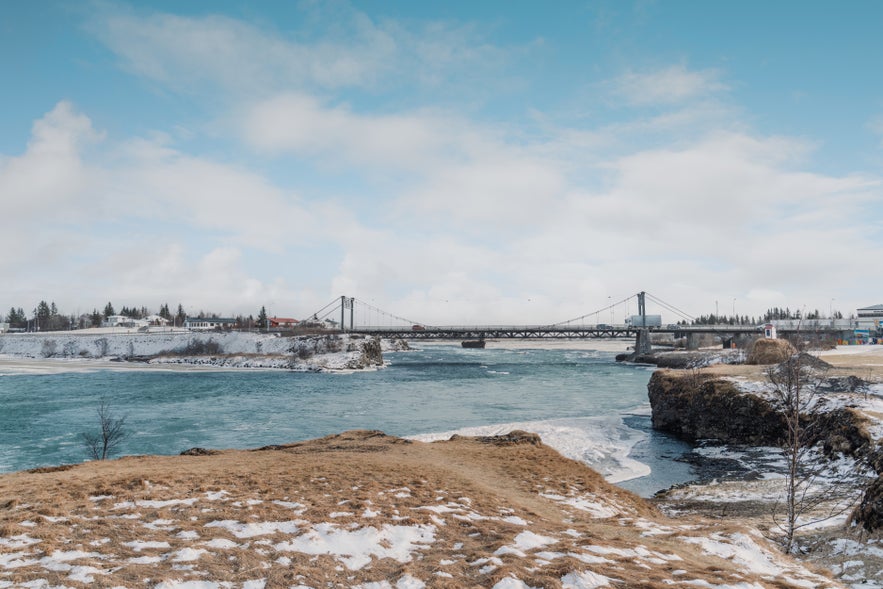
The town remained a typical farming community until the late 19th century. In 1891, the Olfusarbru Suspension Bridge was built over the Olfusa River, connecting the agricultural region of South Iceland to Reykjavik. Soon after, Selfoss began to develop into a town.
The bridge was critical to Iceland’s infrastructure and economy. It was so important that British troops guarded it during World War II.
Selfoss had approximately 40 inhabitants at the beginning of the 20th century. The rise in trade due to the bridge and the establishment of a large dairy farm and local store triggered exponential growth.
Today, Selfoss has a population of over 9,000 people. It’s considered the gateway to the South Coast and is a popular stop for tourists exploring the region.
Things To Do in Selfoss
Selfoss is a cultural hub with plenty of exciting things to do. Recent renovations to the town center make it perfect for shopping, eating, and sightseeing. It’s also an ideal home base if you want to take day trips to explore the landscape and partake in fun, exciting nature activities outside the town.
Visit Selfoss New Old Town
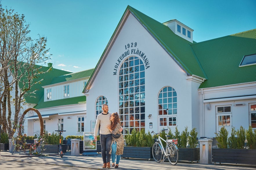
A huge renovation of the Selfoss Town Center began in 2018, creating the Selfoss New Old Town. Over thirty buildings that had been damaged or fallen into disrepair were reconstructed, while others were built from the ground up. Many buildings were rebuilt in Iceland’s traditional architectural style.
The renovations also added shops, restaurants, cafes, and hotels, including the Old Dairy Food Hall. This ongoing project will continue to expand the town center in the coming years.
Explore Cultural and Historical Attractions
 Selfoss offers many interesting activities — especially if learning about local history is your thing. It’s the ideal town for families or solo travelers looking for an enriching cultural experience.
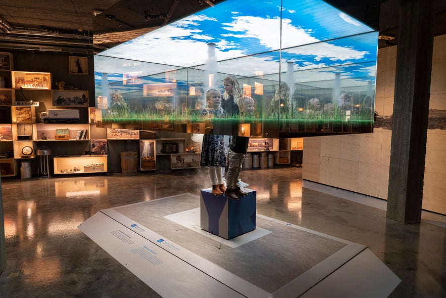
The Old Dairy, once a large industrial hub for the town, now features a food court with a slew of modern restaurants. In the cellar of the Old Dairy, you can find the Skyrland Exhibition, where you’ll learn about the all-Icelandic superfood — skyr — in a fun and interactive way.
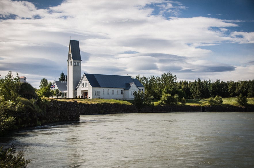
The town also has many other interesting sites. Visit the Icelandic Turf House, a museum village that showcases traditional Icelandic architecture and heritage. You can also see Selfosskirkja, the town’s church, another stunning example of Icelandic architecture.
Discover Nearby Natural Attractions
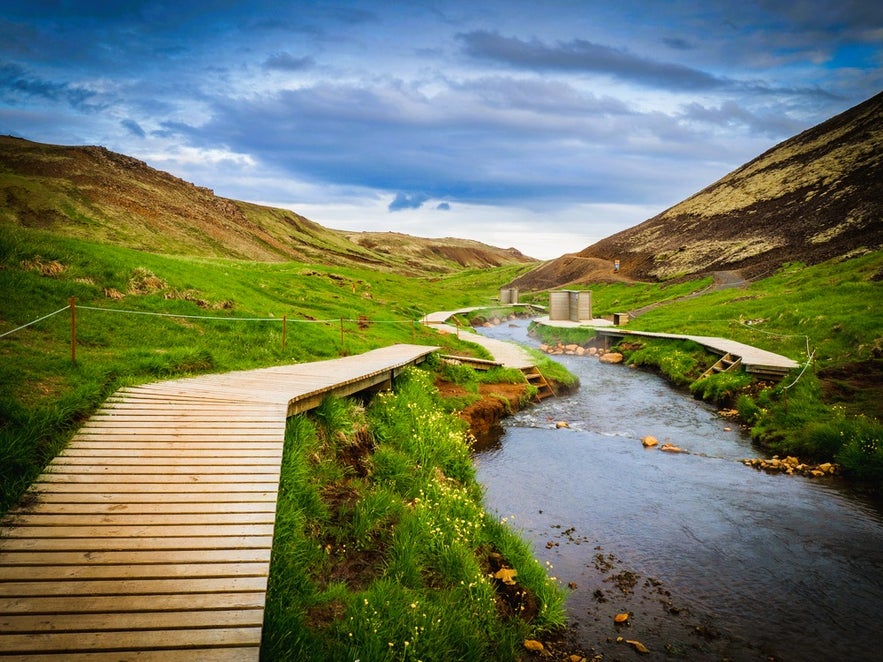 Selfoss is conveniently located near many natural wonders, so you won’t have to travel far to enjoy top-notch hiking.
Reykjadalur Valley is 15.5 miles (25 kilometers) northeast of Selfoss, in the town of Hveragerdi. This geothermal area features natural hot springs and hiking trails.
You can also visit nearby attractions along the Golden Circle. Just 9 miles (15 kilometers) north of Selfoss, you’ll find Kerid Crater. It’s known for stunning blue water and volcanic rock. This is a great spot to hike and explore the unique landscape.
Finally, a visit to Thingvellir National Park won’t disappoint. It’s about 31 miles (50 kilometers) northwest of Selfoss. Take a day trip and enjoy gorgeous scenery, hiking, or snorkeling tours in the Silfra Fissure.
Accommodations in Selfoss
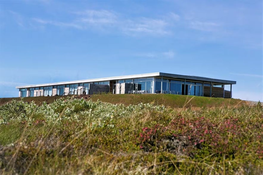
Selfoss is worth an overnight stay (or two). There are plenty of great accommodations available, including quaint cottages and guest houses.
Selfoss Hostel is a good budget option. The hostel offers rooms of different sizes with well-maintained communal areas — a perfect place to relax after a long day of traveling.
Hotel Selfoss is a comfortable 4-star hotel located in the town center on the banks of the Olfusa River. It features a geothermal spa, a restaurant, and other amenities.
Another notable 4-star hotel in the heart of Selfoss is Hotel South Coast. It boasts spacious, cozy rooms and a spa. It serves as an ideal launching point for those exploring South Iceland.
Another option is 360 Hotel, which is just under 10 miles (16 kilometers) east of Selfoss. It offers a high-end experience in a more rural setting. True to its name, the 360 Hotel presents breathtaking 360-degree views of the surrounding landscape.
Plan Your Stay in Selfoss, Iceland
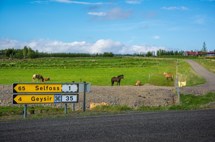 Selfoss is close to Ring Road (Route 1), which circles the island. This makes it a perfect stop if you're planning to rent a car and head out for self-drive tours. Some guided tours depart from Selfoss to explore the surrounding natural attractions or include a stop there:
-
8-Hour Glacier Hike and Sky Lagoon Tour — Embark on an unforgettable combination tour that takes you hiking on the Solheimajokull Glacier and relaxing in the Sky Lagoon Spa.
-
Small-Group 11.5-Hour Hiking Tour at Landmannalaugar — Take an adventure in the Icelandic Highlands and conquer the trailhead of the beautiful Laugavegur Trail with an expert guide.
-
9-Hour Private Golden Circle Tour — Discover the wonders of the famous Golden Circle in this private tour from Selfoss with stops at Thingvellir National Park, Haukadalur Geothermal Area, and Gullfoss Waterfall.
Choose your adventure and enjoy everything Selfoss and the surrounding region have to offer.
FAQs About Visiting Selfoss
 Still curious about a trip to Selfoss Town? Learn more in these commonly asked questions.
What’s the best time to visit?
Selfoss is a year-round destination. Summer offers milder weather and extended daylight, ideal for outdoor activities. Winter offers opportunities to witness the northern lights, though temperatures are colder and daylight hours are shorter.
How do I get to Selfoss from Reykjavik?
Selfoss is accessible via a straightforward drive along the Ring Road, approximately 37 miles (60 kilometers) southeast of Reykjavik.
Are there any notable events or festivals?
The town hosts the “Summer in Selfoss” festival every August, celebrating local culture with music, arts, and family-friendly activities.
Is there a local tourist information center?
Yes, visitors can obtain information about local attractions, accommodations, and events at the tourist information center located in the town center.
What recreational facilities are available?
The town offers various recreational facilities, including sports centers, swimming pools, and opportunities for outdoor activities such as hiking and horseback riding.
What is the significance of the Olfusa River?
The Olfusa River, one of Iceland’s largest rivers by volume, flows through Selfoss. It has historically been vital for transportation and fishing and continues to influence the town’s development and landscape.
Are there any notable personalities associated with Selfoss?
Selfoss is the final resting place of former World Chess Champion Bobby Fischer, who is buried at the Laugardaelakirkjugardur Cemetery near the town. The Bobby Fischer Center honors the chess master's life.
What transportation options are available?
Selfoss is easily accessible by car and bus. The town’s infrastructure supports both local and long-distance travel.
Is Selfoss part of the Golden Circle route?
Selfoss is not typically considered one of the main stops on the Golden Circle route, which traditionally includes Thingvellir National Park, the Geysir Geothermal Area, and Gullfoss Waterfall. However, it's easy to include Selfoss in a self-driving itinerary, as the town lies along the route. It can serve as a convenient base if you're planning an overnight stay in the area.
Discover the Quiet Charm of Selfoss
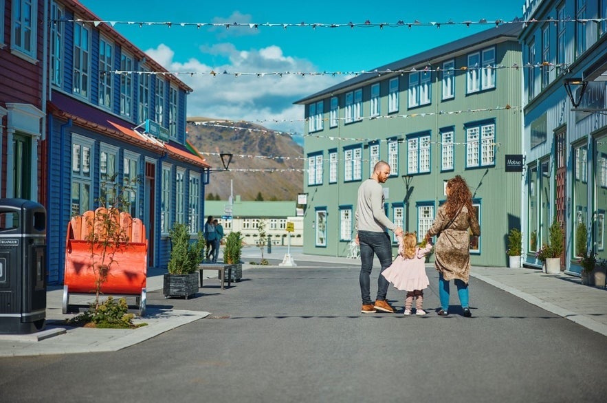
Selfoss may not shout for your attention, but it rewards those who visit. The New Old Town mixes tradition with fresh design, and the Skyrland Museum turns a simple staple into something memorable. Together, they give the town its sense of identity.
With its easy access and calm atmosphere, Selfoss adds variety to any travel plan. It’s a comfortable base, a quiet detour, or a quick stop that stays with you — worth visiting not just because it’s on the way, but because it offers something of its own.


