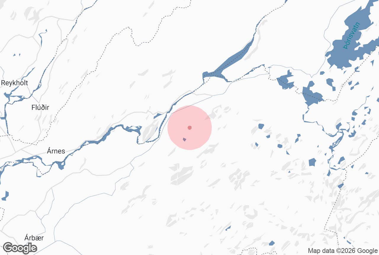
Sölvahraun is a lava field on the northern side of Hekla in South Iceland, lying east of the mountain Búrfell and the Þjórsá river at the point where the highland road to Landmannalaugar leaves the farmland behind.
Hraun means lava field; according to the national placename register, Sölvahraun is said to have once been called Salvararhraun after a woman named Salvör who was supposed to have lived as an outlaw here, and the name changed over time.
For most travellers it is the first stretch of true highland on the Landmannaleið route: a plain of black volcanic sand, lava knolls and tussocks of lyme grass, with the long back of Hekla filling the view to the south.
Key Takeaways About Sölvahraun
- Hekla lava plain east of Búrfell on the first stretch of the F225 Landmannaleið (Dómadalsleið) route
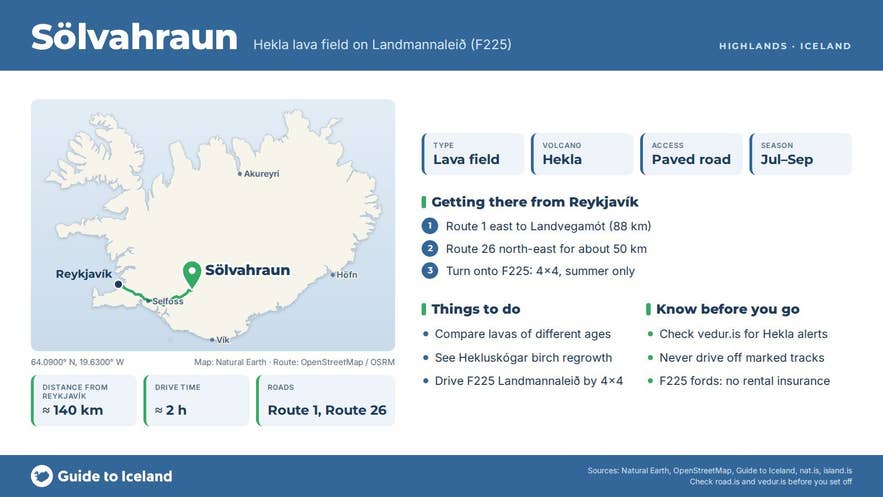
- Visible from paved Route 26 in any car, about 140 km / 2 hours from Reykjavík; F225 beyond needs a 4x4
- Showcase of the Hekluskógar reclamation: lyme grass on bare pumice in 2003, young birch cover by 2024
- Neighbouring Hekla lavas: Klofningar (1878), Skjólkvíahraun (1970), Lambafitjarhraun (1913)
- Nearest services at Hrauneyjar Highland Center (about 25 km) and Leirubakki; check vedur.is for Hekla alerts
Why visit Sölvahraun
Sölvahraun is part of the lava and pumice apron on Hekla's northern side.
The volcano has erupted more than 20 times since the 13th century (its first recorded eruption was in 1104), and repeated eruptions have sent lava and pumice north over this plain, so the surface here is a layered record of the mountain's history.
Beyond Sölvahraun the Landmannaleið track passes between the hills Sauðafell and Valafell through Klofningar, a younger Hekla lava dated to the 1878 eruption in the nat.is route guide; a side track leads south to Skjólkvíahraun from the 1970 eruption, and further east the main route crosses the southern edge of Lambafitjarhraun from 1913.
Walking a few hundred metres off the road you can compare lava of different ages by how much moss and grass has taken hold.
The field is also a showcase for land reclamation. Centuries of Hekla ash, grazing and wind had stripped the area to bare pumice, and it became part of Hekluskógar, the Hekla Forests project that aims to restore birch woodland around the volcano as a buffer against ash storms.
Land and Forest Iceland (Land og skógur) has published photographs of the same spot in Sölvahraun in 2003 and 2024: in 2003 it was lyme grass on exposed pumice; by 2024 young birch had grown well, the ground cover was almost continuous and new plant species had appeared that were absent two decades earlier.
The method was fertiliser and bonemeal, birch planting over twenty years, and trials with beach pea, a native nitrogen-fixing plant. The results are visible from the road.
Sölvahraun is where the historic Landmannaleið begins. The route, signed today as F225 Landmannaleið (also called Dómadalsleið, and historically counted as the western leg of the Fjallabak north route), was for centuries the inland way between the farms of Land and Rangárvellir and the grazing lands at Landmannaafréttur.
From Sölvahraun it heads east between the hills Sauðafell and Valafell through the Klofningar lava, past the Landmannahellir huts and through the Dómadalur valley to the lake Frostastaðavatn, where it meets F208; Landmannalaugar is about 45 kilometres from Route 26 in all. Hekla stands close on the right for the first part of the drive.
How to get to Sölvahraun
From Reykjavík take Route 1 east to Landvegamót, the Route 26 junction about 7 kilometres west of Hella (roughly 88 kilometres from the city), then follow Route 26 (Landvegur) north-east for about 50 kilometres. Route 26 is paved past the Búrfell hydropower area and continues toward Hrauneyjar.
About 3 kilometres beyond the Búrfell turn-off, east of the mountain, the road sign for F225 Landmannaleið (Dómadalsleið) points right; Sölvahraun begins about 3 kilometres along F225 and also comes close to Route 26 just north of the junction.
Driving time from Reykjavík is about two hours (about 140 kilometres); from Hella about 50 minutes. The Hrauneyjar Highland Center, the starting point for buggy tours, is about 25 kilometres further along Route 26.
You can see the field from Route 26 near the junction in any car and pull off on the gravel at the start of F225.
F225 is a mountain road for 4x4 vehicles only, with unbridged streams further on; it usually opens in the second half of June (Vegagerðin's average opening date is 16 June) and closes in September or October. Check road.is before driving it.
Best time to visit
July and August are the safest months, when F225 is open and the lyme grass is green against the black sand. Late August and September add autumn colour to the birch and heath and fewer vehicles on the track. In winter the plain is exposed and drifts badly; visits are only practical with a guided super jeep tour.
Safety and practical tips
- Hekla is an active volcano that has historically given very little warning before erupting (seismic activity typically starts only 30 to 80 minutes before an eruption). Check the Icelandic Met Office (vedur.is) for alerts before travelling and heed any closures.
- Do not drive off marked tracks. The lava and the newly established vegetation are fragile, and off-road driving is illegal in Iceland.
- F225 requires a 4x4; rental insurance does not cover river crossings. In dry conditions the first section to Landmannahellir is usually straightforward, but conditions change after rain.
- Wind-blown pumice and ash can reduce visibility; bring eye protection on windy days.
- There are no services at Sölvahraun. The nearest fuel, food and accommodation are at Hrauneyjar Highland Center and Leirubakki.
- Mobile coverage is patchy once you leave Route 26.
Nearby attractions
- Landmannaleið, 1.1 km, the highland route that starts here
- Sauðafellsvatn, 3 km, a small lake beside the track
- Skjólkvíar, 6 km, the 1970 Hekla lava and craters
- Fossabrekkur Waterfalls, 6 km
- Gjáin, 9 km, the green canyon in Þjórsárdalur
- Búrfell, 9 km, the mountain to the west
- Hekla, 12 km to the summit
- Hrauneyjar Highland Center, about 20 km
Tours that visit Sölvahraun
- Half-Day Landmannalaugar Buggy Adventure from Hrauneyjar Highland Center: a five-hour buggy drive that follows the old Sigalda track past Sölvahraun with Hekla in view, crosses Skjólkvíahraun and a shallow stream into the steaming Pokahryggir area and continues to Landmannalaugar.
