Tectonic Plates in Iceland and Where to Find Them

Stunning volcanic landscapes are one of Iceland's most defining features, explaining half of the country's nickname as "the Land of Ice and Fire." From rugged lava fields and craters to beaches of black sand - there is no shortage of dramatic scenery in Iceland! But what is the reason for the country's volcanic activity?
The answer lies in Iceland's relationship with the tectonic plates. The massive pieces of the Earth's crust comprise the planet's uppermost mantle. As the tectonic plates drift, they dramatically alter the earth's landscapes. The effects of these natural forces are especially apparent, sometimes right from the window of your hotel or guesthouse in Iceland!
Many travelers visit Iceland to explore these natural formations, which are unlike anything else you'll see on the planet. Whether you choose to drive the Ring Road after renting a car or see these wonders as a part of a self-drive tour, the effects of the tectonic plates on the landscape are sure to make their mark on you.
In this article, we'll be going over why Iceland's landscape is so affected by the tectonic plates and where to find the best locations that showcase the aftermath of these natural forces.
- See also: Volcanic Eruptions in Iceland: A History of Fire
- See also: Iceland's Volcanoes: A Complete Guide
The Mid-Atlantic Ridge
 The Earth's uppermost mantle, known as the lithosphere, is divided into several tectonic plates that are constantly moving and interacting. There are seven major tectonic plates and many smaller plates constantly moving towards or apart from each other.
- See also: Where is Iceland?
Two of Earth's major plates are the North American and Eurasian plates. The boundary between these plates is called the Mid-Atlantic Ridge, a massive underwater mountain range extending along the floor of the North and South Atlantic Oceans. As these plates move apart, magma (molten rock deep inside the Earth) fills the gap. When this magma cools down, it becomes a new oceanic crust, basically creating a new ocean floor.
Photo from Wikimedia, Creative Commons, by M. Bitton.
So, what does all of this have to do with Iceland? Well, Iceland is uniquely positioned on the globe as it is the only landmass on the Mid-Atlantic ridge! In fact, the country began forming around 60 million years ago by a series of volcanic eruptions as the two plates moved apart.
The ridge cuts through Iceland, meaning some regions are on the North American tectonic plate and others are on the Eurasian plate. This means some parts of Iceland are technically in America, while others are in Europe!
Effects of Tectonic Plates on Iceland
The shifting of tectonic plates beneath Iceland has several significant effects, both geologically and environmentally. As Iceland sits astride the Mid-Atlantic Ridge, this tectonic activity is a key factor in shaping the island's unique landscape and geological phenomena.
Volcanic Eruptions and Earthquakes
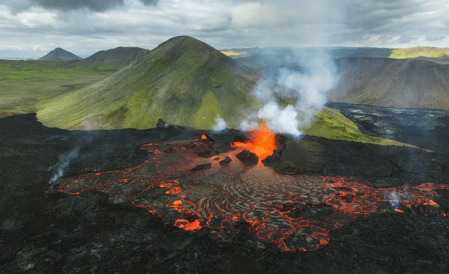
One of the most noticeable effects is the high level of volcanic activity. The movement of the tectonic plates leads to magma rising from the mantle, resulting in frequent volcanic eruptions. This activity has created and continues to shape Iceland's dramatic volcanic landscape, including its numerous volcanoes, lava fields, and volcanic islands.
When conditions allow, going on volcano tours can be an amazing opportunity, even if it is just to see the aftermath of these natural powers. If you're ever exploring the South of Iceland, consider stopping by the town of Hvolsvollur and taking a 1-hour Lava Centre exhibition and cinema tour. It is a great way to learn all about Iceland's volcanic powers in a fun and interactive way.
The movement of tectonic plates also causes earthquakes in Iceland. Most of these earthquakes are small and often unnoticed by the people of Iceland, although larger seismic events are not uncommon. Larger earthquakes can cause structural damage, but Iceland has strict building codes to mitigate earthquake damage, which helps reduce the impact of these events.
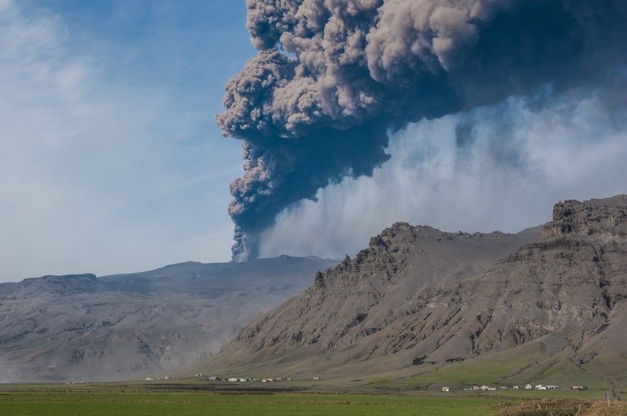
Iceland is home to approximately 130 active and inactive volcanic mountains. Some of these volcanoes are particularly well-known, such as Eyjafjallajokull, which gained international attention following its 2010 eruption when it blocked air traffic all over Europe.
Unfortunately, some of these volcanic eruptions have had devastating effects on the inhabitants of Iceland. An eruption in the Westman Islands in 1973 came out of nowhere and caused a major crisis on the island. Although the island's inhabitants were evacuated in time, hundreds of homes were lost in the eruption.
Recently, there have been several eruptions in the Reykjanes peninsula on the southwestern edge of Iceland. While the eruptions in Fagradalsfjall and Litli-Hrutur were tourist-friendly spectacles, the recent activity by the town of Grindavik is far more concerning.
The inhabitants of Grindavik were forced to evacuate the town as magma was discovered flowing only a few hundred feet below the surface. Although it is not yet certain whether an eruption will happen in the area, the seismic activity in the town caused massive damage to infrastructure, as seen in the video above.
Formation of New Land
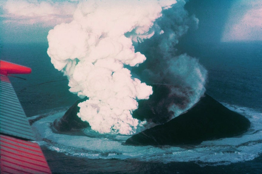
Photo from Wikimedia, Creative Commons, by Howell Williams.
The diverging tectonic plates contribute to the formation of new land. As the plates move apart, magma rises to fill the gap, which, upon cooling, forms a new crust. This was the case with Surtsey, a volcanic island that began emerging off the southern coast of Iceland in the last century.
Surtsey is a volcanic island that was formed in a series of volcanic eruptions that began beneath the ocean surface in 1963 and lasted until 1967. As the lava from the eruptions continued to spew and harden, it formed a new island.
The island is not open to visitors, but it is the perfect location for many fields of science, such as geology and biology, to see how a new landmass develops with minimal human impact. Scientists have closely monitored how life colonizes new land, making it an invaluable natural laboratory.
While you can't step onto the island itself, you can see it from a distance on many of the great tours available in the Westman Islands.
Geothermal Activity
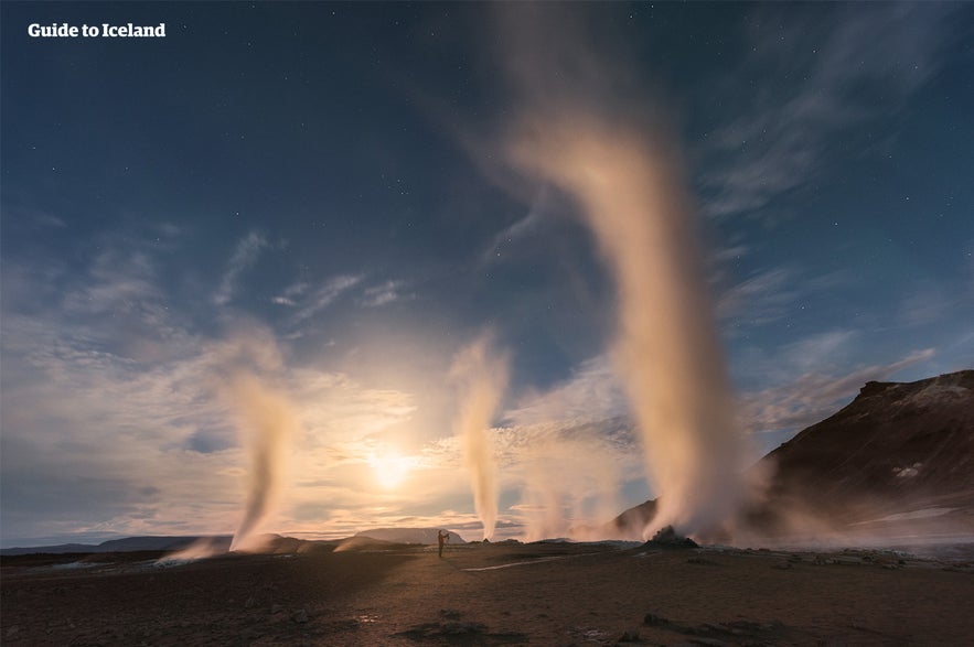
The tectonic movements contribute to Iceland's extensive geothermal activity. The heat from the Earth's interior powers numerous hot springs, geysers, and geothermal fields, which are not only tourist attractions but also significant sources of renewable energy for the country. In fact, over 90 percent of housing in Iceland is heated by geothermal energy!
There are many locations in Iceland where visitors can enjoy the effects of geothermal power. The Geysir geothermal area is part of the Golden Circle - Iceland's most popular sightseeing route. This area is home to the titular geyser Geysir as well as the iconic Strokkur that erupts every few minutes, shooting water far up into the air.
The town of Hveragerdi in South Iceland is renowned for its geothermal energy, which locals use for heating and creating greenhouses. The nearby Reykjadalur Valley, the Valley of Steam, is a popular place for hiking and hot spring bathing.
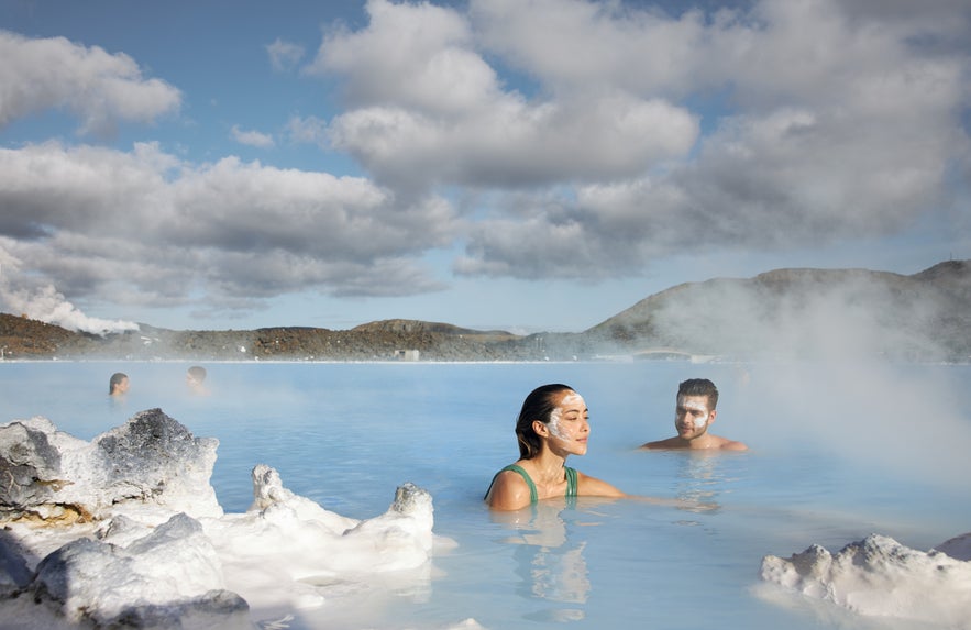 Speaking of bathing, Iceland is famous for its many great geothermal hot springs that attract visitors worldwide. The Blue Lagoon is Iceland's most popular attraction, famous for its blue mineral-rich waters.
Situated in the southern highlands, Landmannalaugar is not only famous for its hiking trails through colorful rhyolite mountains but also for its natural geothermal hot springs, where visitors can bathe surrounded by stunning landscapes.
A trip to Iceland isn't complete without taking a dip in geothermally heated water, so make sure to check out the best hot spring tours in Iceland.
Where to See the Tectonic Plates in Iceland
As most of the Mid-Atlantic Ridge lies underwater, it's understandably rather hard to see most of the rift for yourself. However, as Iceland is luckily located atop this rift, there are several locations where you can see this fantastical geological phenomenon and its effects quite clearly!
Thingvellir National Park
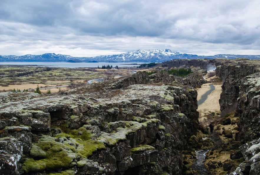 Thingvellir National Park is a beautiful Iceland site renowned for its geological features and historical significance. As one of the three stops of the Golden Circle, it is one of the most popular places to visit Iceland for both visitors and locals.
- See also: Top 11 Amazing Canyons in Iceland
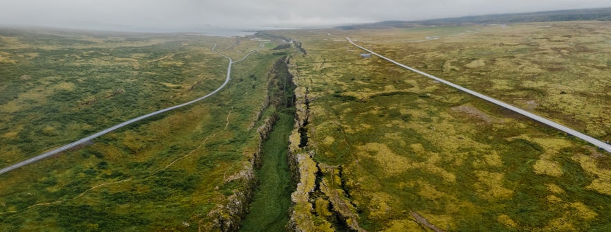
Upon entering this area, the stunning geological features are likely the first thing visitors notice. Thingvellir is located on top of the Mid-Atlantic Ridge, and the rift can be seen clearly in the gorge of Almannagja, which was formed by the tension of the North American and Eurasian plates separating. Walking through Almannagja means you're walking right between the continents of North America and Europe!
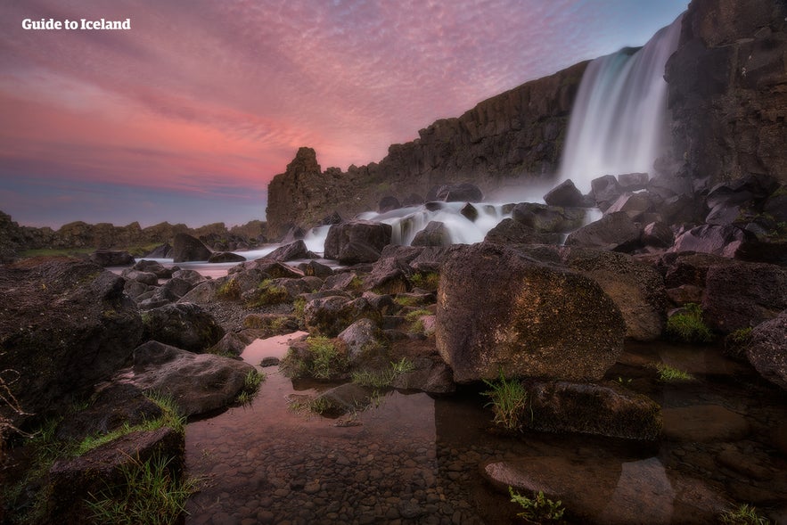 In addition to its geological importance, Thingvellir is full of historical significance for the people of Iceland. It was the site of Iceland's historic parliament, Althingi, established around 930 AD. This open-air assembly, where the country's most important leaders met to make laws and settle disputes, is considered one of the oldest parliamentary institutions in the world. Iceland's parliament is still called Althingi today, showcasing the Icelandic people's respect for the country's historical roots.
Today, Thingvellir is a UNESCO World Heritage Site recognized for its cultural and geological values. A great way to visit this location is on a Golden Circle small group minibus tour, where a local expert will give further insight into Thingvellir.
Silfra Fissure
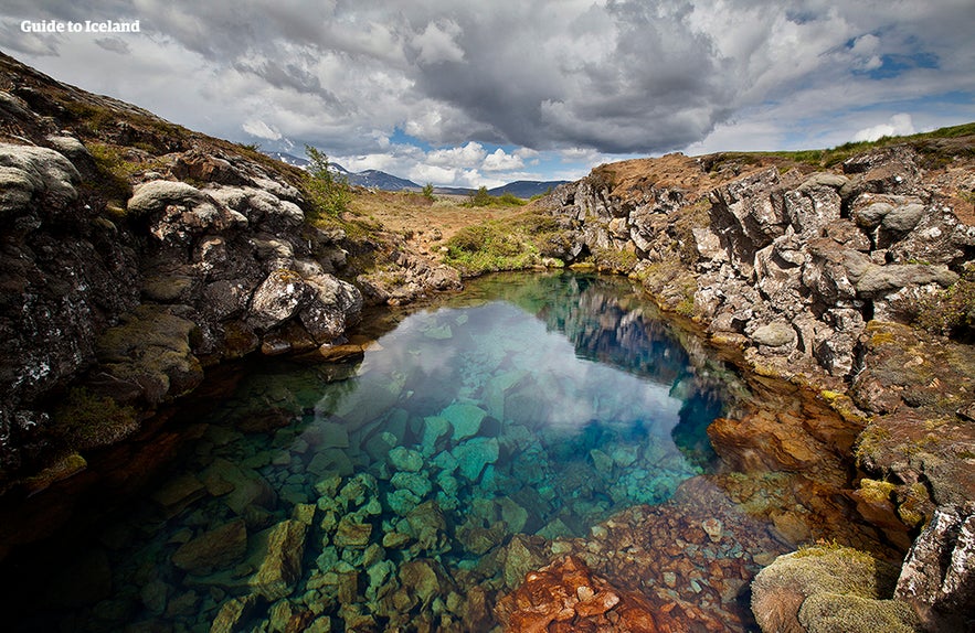
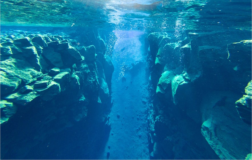
The fissure of Silfra is a natural pearl located within Thingvellir National Park. Full of crystal clear spring water, it is considered a diver's paradise and is the only place in the world where you can go snorkeling or diving between two tectonic plates.
- See also: Scuba Diving and Snorkeling in Iceland
The water in Silfra is glacial meltwater that has been naturally filtered through volcanic rock over decades. This makes the water in Silfra among the clearest water you'll find anywhere on Earth. Divers and snorkelers who brave the chilly waters, hovering around 35 to 39° Fahrenheit (2 to 4 degrees Celsius), are rewarded with visibility that's out of this world – often over 330 feet 100 meters!
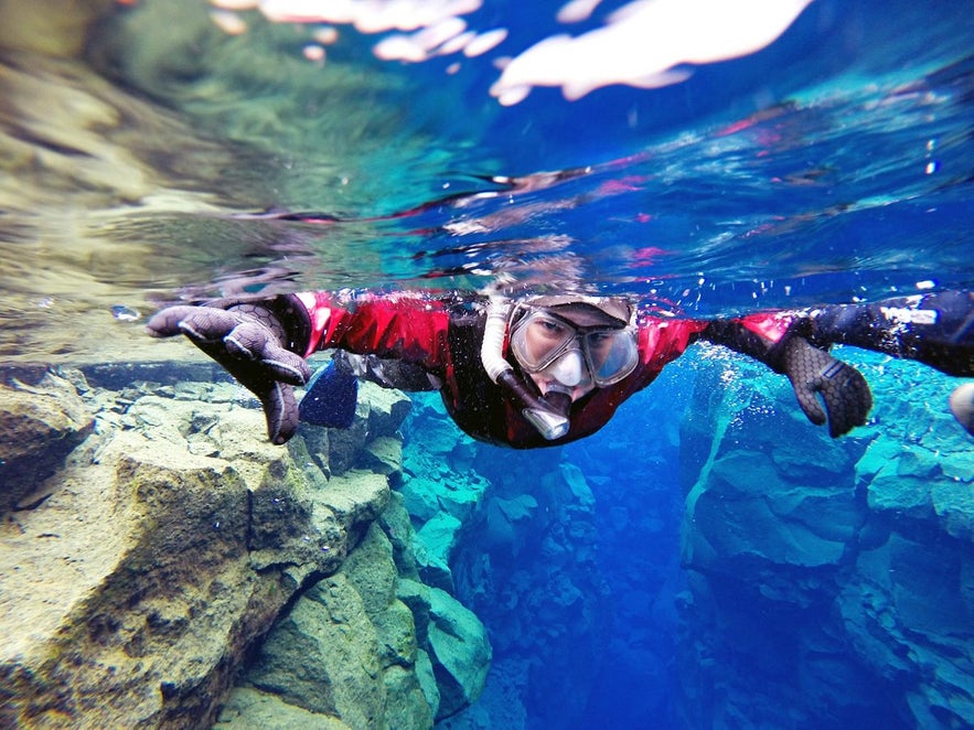
Photo from Unforgettable Drysuit Snorkeling in Silfra.
As visitors brave the waters of Silfra, they get struck by the awe-inspiring realization that they're floating between two continents. Every dive or snorkel here is a unique experience as the fissure is continuously reshaped by the Earth's restlessness.
While Silfra's cold waters might seem offputting, there are many accessible ways of experiencing this natural wonder. Taking a snorkeling tour of Silfra will allow you to gaze float through the waters of the fissure in a drysuit, keeping you comfortably warm in the frigid waters.
Bridge Between Continents
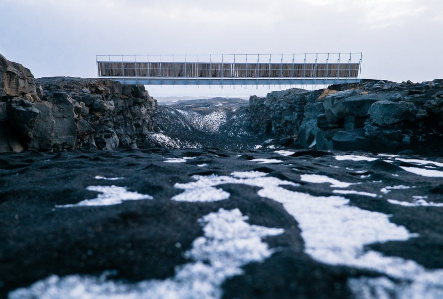 The Reykjanes Peninsula in southwestern Iceland lies on the Mid-Atlantic Ridge, offering a dramatic and vivid showcase of volcanic landscapes. The region is filled with several volcanic craters and intense geothermal activity, making Reykjanes a testament to the power of the shifting tectonic plates below it.
- See also: 22 Things to Do in Reykjanes Peninsula
The Bridge Between Continents is an iconic structure that represents the meeting point of the North American and Eurasian tectonic plates. This simple bridge offers a physical and symbolic connection between two major tectonic plates.
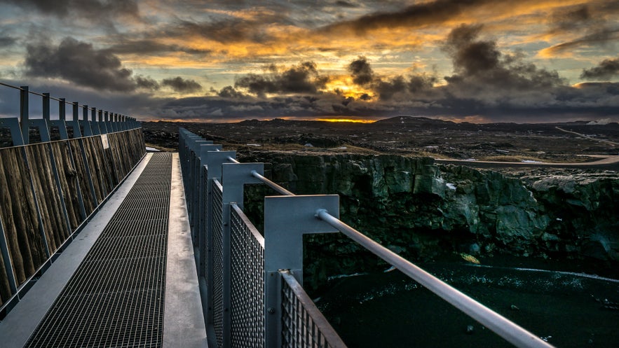
Photo from Wikimedia, Creative Commons, by Giuseppe Milo.
The bridge spans a small fissure, which has been widening as the plates slowly move apart. This movement is gradual, averaging around an inch (2.5 centimeters) per year, but over time, it has created noticeable geological features across the country.
While the Bridge Between Continents is more symbolic than a precise marker of the plate boundary, it offers visitors a tangible experience of standing atop the Mid-Atlantic Ridge. It allows for a unique perspective on the dynamic nature of the Earth's crust, where the boundary between the plates is not just a concept but a physical reality.
That's it for tectonic plates in Iceland for now. Did we leave any of your questions unanswered? Have you seen any of these locations when visiting Iceland? Let us know in the comments below!
Other interesting articles
De 30 bästa varma källorna och geotermala poolerna på Island
Här finner du en komplett lista över alla de bästa varma källorna och geotermala poolerna på Island. Ta reda på var de allra härligaste naturliga varma poolerna finns på Island, samt alla spa oc...Läs mer
Guide to Iceland:s VIP klubb - en komplett guide
Om du är kund hos Guide to Iceland har du inte bara tillgång till det största urvalet av turer, boende och hyrbilar på Island ... du kan också få fantastiska rabatter och specialerbjudanden på olika...Läs mer
Komplett guide till vulkanutbrottet i Sundhnukagigar 2024
Lär dig allt du behöver veta om vulkanutbrottet 2024 i Sundhnukagigar, Island. Vad innebar det för ortsborna i Grindavik? Hur kraftfullt var utbrottet jämfört med andra nyligen inträffade utbrott? I d...Läs mer

Ladda ner Islands största resemarknad till din telefon och hantera hela resan på ett och samma ställe
Skanna QR-koden med telefonkameran och tryck på länken som visas så får du tillgång till Islands största resemarknad. Ange ditt telefonnummer eller din e-postadress om du vill få ett SMS eller e-postmeddelande med nedladdningslänken.
