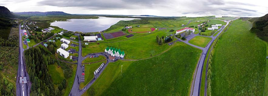
Lake Laugarvatn, source of the Hólaá. Photo: Bob T, CC BY-SA 4.0
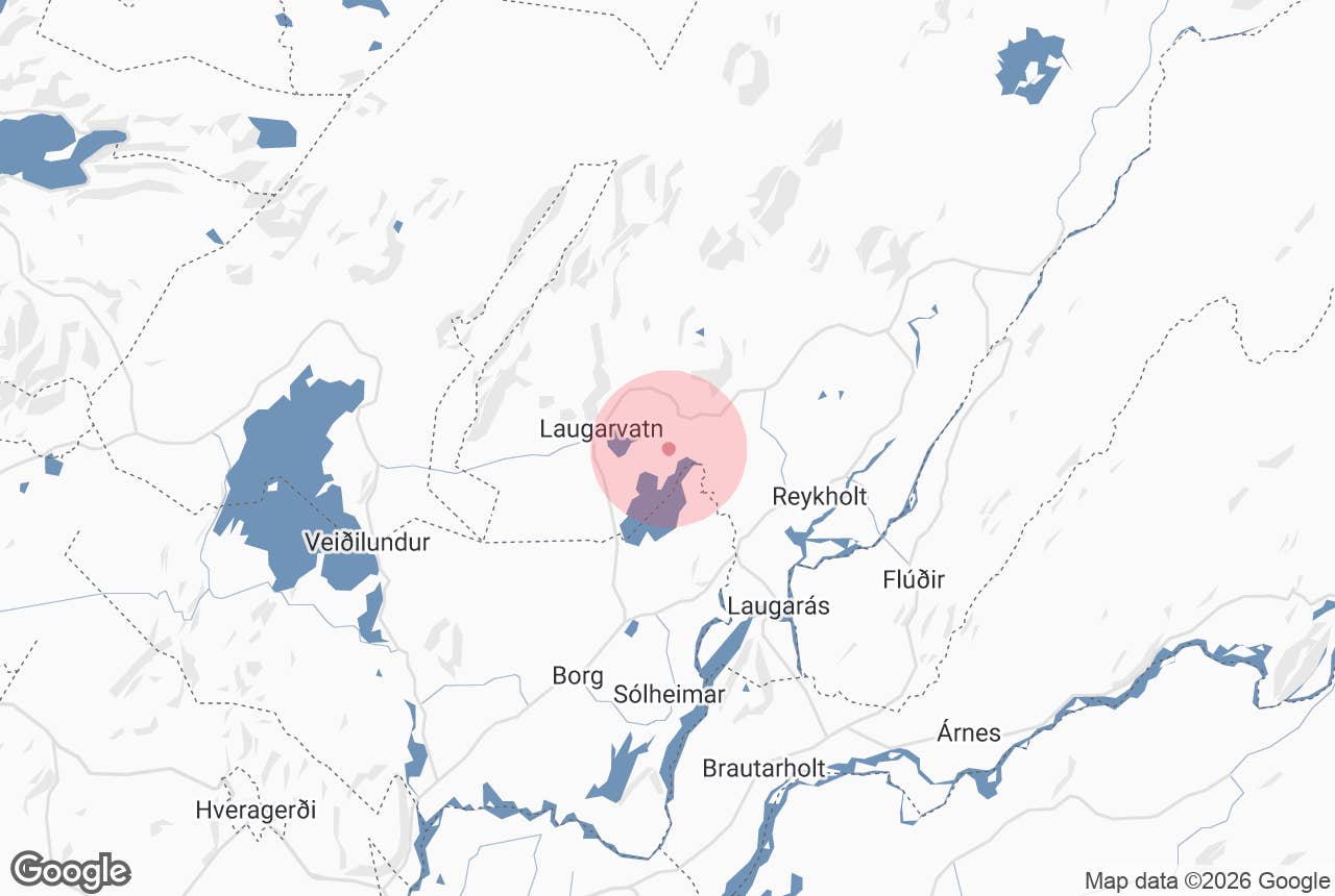
Hólaá (also written Hólá, "the river of the hills" or "Hólar river") is a short, slow lowland river in Laugardalur in Bláskógabyggð, South Iceland, inside the Golden Circle.
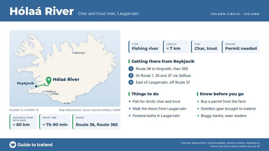
It leaves the east end of Lake Laugarvatn and winds for about 7 km through flat meadows and birch scrub to the north-east corner of Apavatn, the larger lake to the south-east, which it enters beside the lake's outlet, Hagaós.
The river, the two lakes and the streams that join them form one connected fishing system known for Arctic char (bleikja) and brown trout (urriði).
Key Takeaways About Hólaá
- About 7 km long, from the east end of Laugarvatn to the north-east corner of Apavatn in Bláskógabyggð (IS 50V name: Hólá).
- Arctic char and brown trout; one connected system with the two lakes.
- Permits are sold by the individual farms along the banks; guided tours include them.
- Paved roads to Laugarvatn (about 78 km, 75-90 minutes from Reykjavík); no public car park on the river.
- Season April to September.
The name means the river of the hills (hólar); the farm Laugardalshólar ("the hills of Laugardalur") stands just north of the river and the two names most likely share the same hills.
The name is also the clue to telling it apart from namesakes: there is another Hólaá in Húnavatnssýsla in the north and a Hólá in Öræfi in the south-east. This one is the river between Laugarvatn and Apavatn, about 80 km (50 miles) by road east of Reykjavík.
Why visit Hólaá
Hólaá is a fishing river first and a sightseeing stop second.
It is one of the closest places to Reykjavík where you can fish for wild Arctic char and brown trout in a river that is easy to reach, easy to wade and set in open farmland with views to the mountains of Laugarvatnsfjall and Efstadalsfjall.
Because the river connects Laugarvatn and Apavatn, fish move between the lakes through it, and the slow bends and pools hold both species through the summer.
The surrounding lakes are part of the attraction. Laugarvatn is shallow, at most about 2 m deep, with hot springs flowing into it along the village shore, and the Icelandic fishing guide Veiðistaðavefurinn recommends fishing where the warm water enters the lake in spring, because char hold along the temperature boundary.
Apavatn, downstream, is known for both char and sizeable trout. Several farms own the banks of the river and the lakes, and each sells fishing permits for its own stretch, so the river is fished in small sections rather than from a single beat.
For non-anglers, the river is a quiet place for a walk from Laugarvatn village, with birdlife on the lakeshore and the geothermal steam of Laugarvatn rising behind you.
How to get to Hólaá
- From Reykjavík: take Route 36 to Þingvellir and Route 365 over Lyngdalsheiði to Laugarvatn, or Route 1 to Selfoss, Route 35 north and Route 37 (Laugarvatnsvegur). The drive to Laugarvatn village is about 78 km (48 miles) and takes 75 to 90 minutes.
- From Laugarvatn village: Route 37 runs along the lake towards Laugardalur and Geysir. The river leaves the lake at its eastern end, a few kilometres east of the village, and flows south-east to Apavatn past the farm Laugardalshólar. Route 37 is the nearest paved road; farm tracks reach the banks.
- Parking: there is no public car park on the river. Anglers park where the permit seller directs them. For a look at the lake outlet, park in Laugarvatn village and walk east along the shore.
- Vehicle: paved roads all the way to Laugarvatn; no 4x4 needed.
- On a tour: the Golden Circle & Fishing tour from Reykjavík brings you here with permits and gear included, which settles the permit question.
Best time to visit
The rod-fishing season on Apavatn runs from 1 April to the end of September (check the exact dates for Laugarvatn and the river with the permit seller), and the Golden Circle & Fishing tour operates from April to September.
Spring (May to June) is good for char near the warm inflows at Laugarvatn; July and August are the most comfortable months for wading and the longest days; September brings larger trout and autumn colour on the birch. The season closes at the end of September.
Safety and practical tips
- Permits: fishing without a permit is illegal in Iceland. Each landowner along Hólaá, Laugarvatn and Apavatn sells permits for their own land, so buy from the farm whose bank you intend to fish, or go with a guided tour that includes permits.
- Gear: fishing equipment brought into Iceland must be disinfected and certified to protect native fish from disease. Guided tours supply local gear.
- Wading: Laugarvatn has a soft, muddy bottom and the river's banks can be boggy. Wade carefully and wear waders or waterproof boots.
- Weather: Laugardalur is relatively sheltered but can be cold and windy even in summer. Bring layers and a waterproof.
- Facilities: Laugarvatn village, about 4 km away, has the Fontana geothermal baths and pool, a campsite, shops and restaurants. There are no facilities at the river.
- Fees and hours: no entrance fee to the area; fishing permit prices are set by each farm.
Where exactly is Hólaá?
What fish are in Hólaá?
Do I need a fishing permit?
Is this the Hólaá in North Iceland?
Can I swim in Laugarvatn after fishing?
Nearby attractions
- Austurey, the farm area at the east end of Laugarvatn beside the river's source, about 2 km.
- Apavatn, the lake Hólaá flows into, about 4 km.
- Laugarvatn, the lake and village, about 4.5 km.
- Vígðalaug Hot Pot, the historic "consecrated pool" by the lakeshore, about 4 km.
- Fontana Spa, geothermal baths on the Laugarvatn shore, about 4 km.
- Bruarfoss Waterfall, the blue waterfall on the Brúará river, about 9 km.
Tours that visit Hólaá
- Affordable Golden Circle & Fishing Tour with Transfer from Reykjavik: a 9 to 9.5 hour day tour combining Þingvellir, Geysir and Gullfoss with angling for Arctic char and brown trout at Lake Laugarvatn and the Hólaá river. Fishing permits and all equipment are included; minimum age 10; runs April to September.
