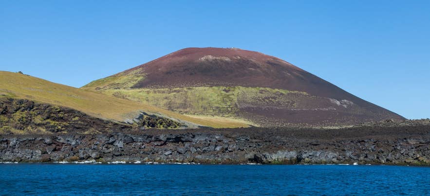
Eldfell above the Heimaey lava shore. Photo: Diego Delso, CC BY-SA 4.0
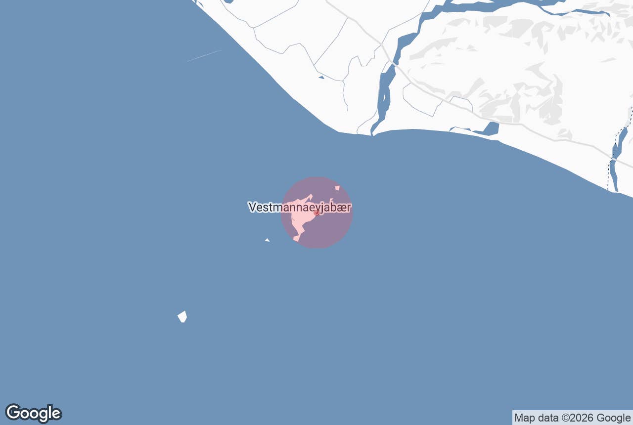
Prestavík (also written Prestvík, "Priests' Cove") is a small cove and boulder beach on the east coast of Heimaey, the only inhabited island in the Westman Islands (Vestmannaeyjar) off Iceland's south coast.
It sits on the "new lava" that poured into the sea during the Eldfell eruption of 1973, below the slopes of the volcano and a short distance south of the Urðaviti lighthouse, next to two other registered place names, the Prestar rock pinnacles and the Prestafjara beach. The origin of the "priests" in these names is not recorded.
Tour operators on the island usually call it Prestvík beach.
Key Takeaways About Prestavík
- Lava cove on the east coast of Heimaey, on land created by the 1973 Eldfell eruption, 2 km from town
- Site of the 1982 Pelagus wreck (four dead, memorial raised in 2022) and the coast where Guðlaugur Friðþórsson came ashore in 1984
- Reached on foot or by car on gravel tracks across the lava, or on the island's ATV tours; no facilities
- Not a swimming beach: sharp lava boulders and heavy Atlantic surf
Why visit Prestavík
Prestavík is not a swimming beach. It is a place to stand on land that did not exist before 1973, look out over the open Atlantic east of Heimaey, and hear two of the most dramatic stories in Icelandic maritime history.
On 21 January 1982 the Belgian trawler Pelagus (O 202) ran aground in a winter storm just off this shore, in the surf below the lava cliffs. Rescuers from the island got six of the crew ashore.
One crewman had already drowned when the crew's rubber dinghy capsized in the surf, and three more were sheltering under the hull; two of them were pulled out, but when rescuers went back for the third, a wave swept the wreck and everything beside it away.
Four people died that night: two Icelandic rescuers, Hannes Kr. Óskarsson and Kristján Víkingsson, and two Belgian crewmen, Gilbert Stevelinck and Patrick Maes. A memorial ceremony was held at the shore in September 2021, and in 2022 a memorial stone to the four was raised there, at what islanders also call Pelagusfjara (Pelagus beach).
The second story is the one the island is best known for. On the night of 11 March 1984 the fishing boat Hellisey VE 503 capsized and sank about three nautical miles east of Stórhöfði, the southern tip of Heimaey. Four of the five crew died in the cold water.
The fifth, Guðlaugur Friðþórsson, then 22 years old, swam roughly 6 km through 5°C seawater for five to six hours, steering by the lights on the island, and came ashore on this rough new-lava coast, the most dangerous stretch of the island's shoreline.
He then walked barefoot across about 3 km of sharp lava into town and knocked on a door at around 7 in the morning. The story became the 2012 feature film The Deep (Djúpið), and a memorial from 1996 stands at Haugar on the east side of the island.
The setting itself is worth the trip. Behind the cove the red-brown cone of Eldfell rises to about 200 m, and the lava you stand on is the same flow that buried around 400 houses and extended the island by more than two square kilometres in 1973.
How to get to Prestavík
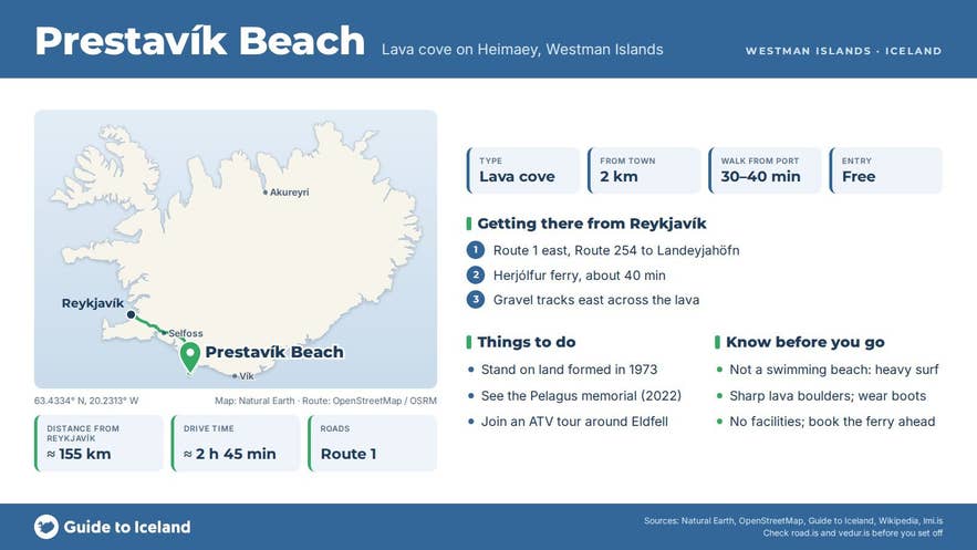
Heimaey is reached by the Herjólfur ferry from Landeyjahöfn on the south coast, about 135 km (roughly 2 hours) from Reykjavík via Route 1 and Route 254. The crossing takes about 35 to 45 minutes; in bad weather, mostly in winter, the ferry sails from Þorlákshöfn instead (about 2 hours 45 minutes). Book the ferry ahead in summer.
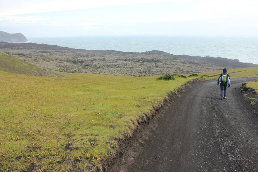
Track along Eldfellshraun, Heimaey. Photo: Julien Carnot, CC BY-SA 2.0
On the island, Prestavík is about 2 km east of the harbour and town centre. Gravel tracks run from the edge of town across the new lava towards the east coast and the Urðaviti lighthouse; the cove lies just south of the lighthouse.
On foot it is about 30 to 40 minutes from the harbour across the lava, or 10 minutes by car to the end of the track and then a short walk. Many visitors come on one of the island's ATV tours, which include Prestavík on their loop around Eldfell and the lava field.
There is no formal car park, signage or facilities at the cove itself.
Best time to visit
May to September gives the longest days, the calmest seas and the best chance of ferry sailings from Landeyjahöfn. Winter visits are possible but the east coast takes the full force of Atlantic storms, and the ferry schedule is weather-dependent.
Safety and practical tips
- The shore is loose lava boulders and sharp, uneven rock. Wear proper boots and keep well back from the waterline: the surf here is powerful, and this is where both the Pelagus and the Hellisey stories ended.
- There are no toilets, shops or shelter on the lava; everything is in town 2 km away.
- Stay on existing tracks when driving. Driving off marked tracks is illegal everywhere in Iceland.
- If you join an ATV tour the driver needs a valid driving licence; helmets, gloves and waterproof overalls are provided.
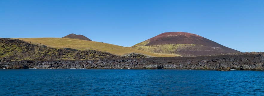
Helgafell and Eldfell above Heimaey. Photo: Diego Delso, CC BY-SA 4.0
Is Prestavík the same place as Prestabót and Pelagusfjara?
Can you see the wreck of the Pelagus?
Can I walk to Prestavík without a tour?
Is Prestavík a swimming beach?
Nearby attractions
- Eldfell Volcano, 0.8 km: the 1973 crater, a short, steep climb from the road.
- Eldheimar, 1.4 km: museum built around a house dug out of the ash.
- Skansinn Fort, 1.9 km, and the Heimaey stave church, 1.9 km, by the harbour.
- Sprangan, 2.9 km: the cliff where islanders practise rope-swinging.
- Herjólfsdalur, 3.6 km: the valley that hosts the Þjóðhátíð festival.
- Stórhöfði, 4.8 km: the southern headland and lighthouse; the Hellisey sank about three nautical miles east of it. Puffin viewing in summer.
Tours that visit Prestavík
- Exhilarating 1-Hour ATV Volcano Tour in Vestmannaeyjar stops at Prestavík, where the Pelagus was wrecked, and at the site where Guðlaugur Friðþórsson came ashore, before heading into the Eldfell lava.
- Westman Islands Volcano and Puffins ATV Tour takes the ATVs off-road toward Prestavík beach and combines it with the island's puffin colonies.
