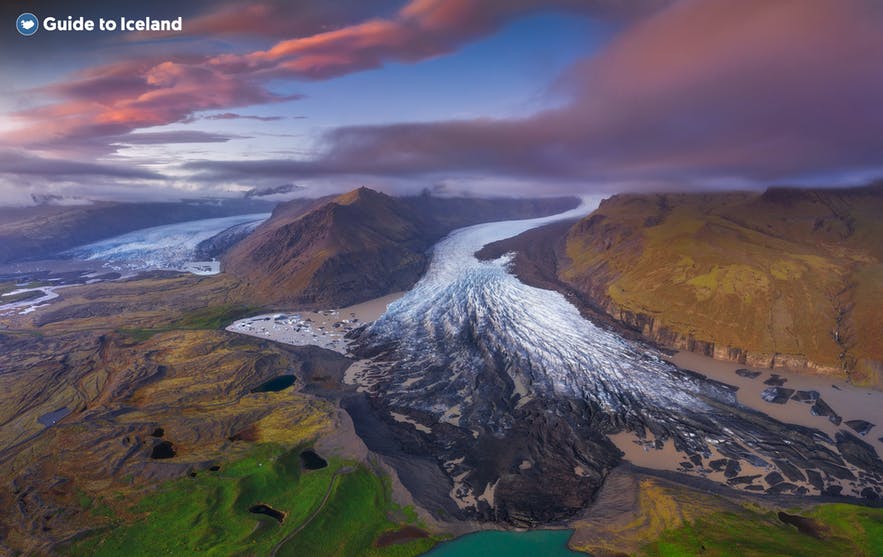
Katla Global Geopark is a project of UNESCO and the European Geoparks Network, with the aims of promoting sustainable development and protecting the natural environment within a designated space surrounding one of Iceland’s most active and known volcanoes, Katla.
Explore this area while on a self drive tour in Iceland.
Warum du unseren Inhalten vertrauen kannst
Guide to Iceland ist die vertrauenswürdigste Reiseplattform Islands und hilft jedes Jahr Millionen von Besuchern. Alle Inhalte werden von lokalen Experten erstellt und geprüft, die Island in- und auswendig kennen. So kannst du dich auf zuverlässige, aktuelle und präzise Reisetipps verlassen.
Katla Global Geopark is the first Geopark designated in Iceland. Its borders lie between the rivers Eystri Rangá and Núpsvötn in the south, and stratovolcano Bárðabunga underneath Vatnajökull glacier in the north. Within the park, you’ll find volcanoes, glaciers, black beaches, lava fields and waterfalls. With a strong emphasis on sustainable nature tourism, the park is set to introduce visitors to environmental values and local culture.
- Read more: National Parks in Iceland
Geology and Nature
The nature of Katla Global Geopark is singular on a worldwide scale, due to glacial outbursts having created vast black sand plains, while the lowlands are cut through by glacier rivers. Underneath ice-capped mountains rest powerful volcanoes, including the world's largest volcanic canyon Eldgjá and the crater row Lakagígar, both of which have created the lava fields and pseudocraters that dot the area.
Extraordinarily varied rock formations are also found everywhere within the park, as well as numerous waterfalls that have their sources in the park’s glaciers and glacial rivers. These include the famous South Coast falls of Skógafoss, Seljalandsfoss and Gljúfrabúi. Besides from Katla volcano, Iceland’s most notorious volcanic ice cap Eyjafjallajökull―that last erupted in 2010 with massive effects on European air traffic―is also within the park.
History and Culture
The Geopark is characterised by a long history of active volcanism and glacial outbursts. Since the Settlement of Iceland, this interplay has greatly affected human life and cultivation in the area. The park includes many old buildings, historic farmsteads and ancient ruins, such as the turf chapel at Núpstaður and fishing village Kirkjubæjarklaustur.


