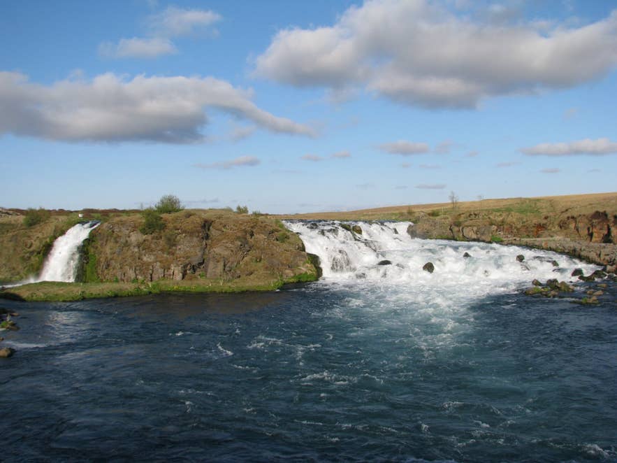
Árbæjarfoss on Ytri-Rangá. Photo: Bromr, CC BY-SA 3.0
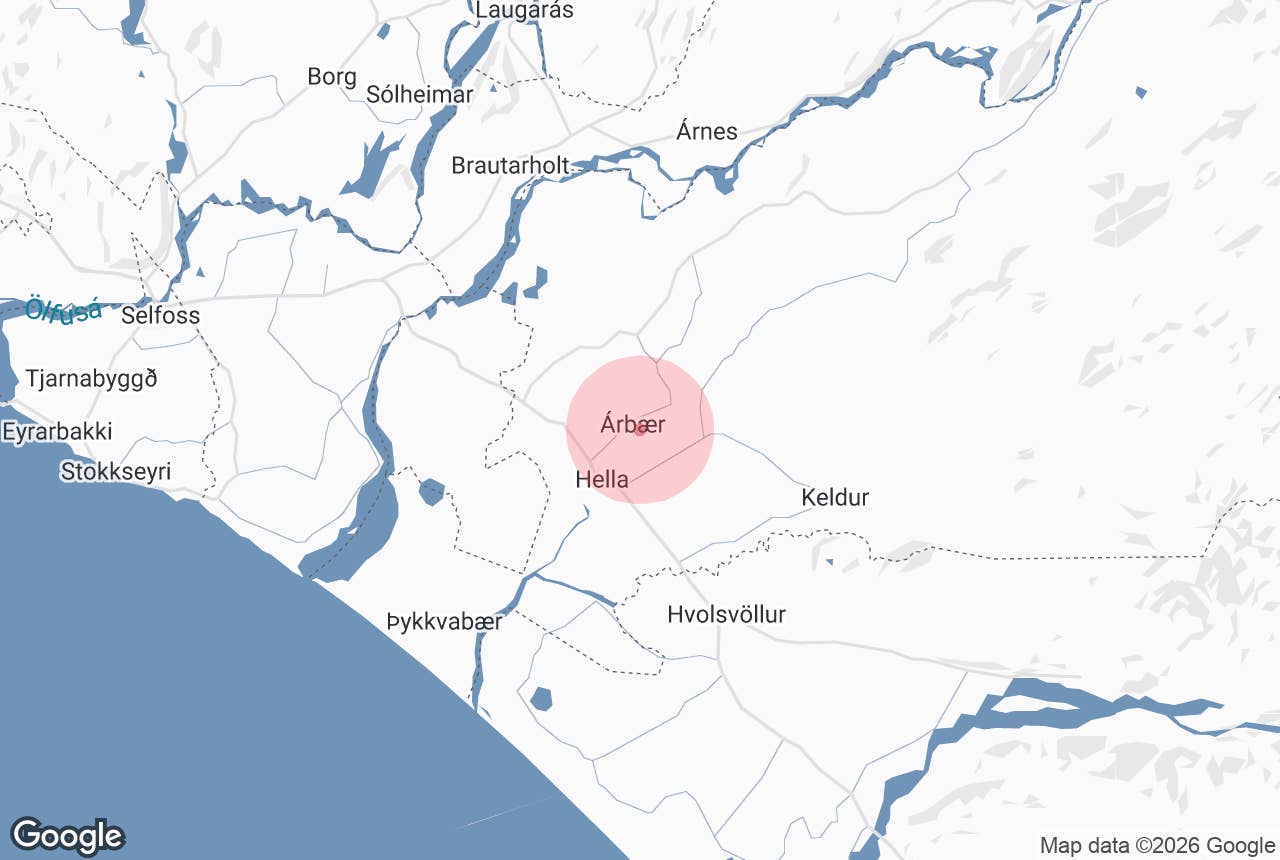
Árbæjarfoss waterfall is a wide, low fall in the Ytri-Rangá river in South Iceland, about 4 km north of the village of Hella as the crow flies and about 6 km by road. The name means "the waterfall at Árbær", after the farm it belongs to (Árbær is "river farm").
It is not a tall fall: the river drops roughly 7 to 10 metres over a lava ledge about 35 metres wide. What makes it worth the short detour is the shape. Just above the fall the Ytri-Rangá splits in two.
One arm pours over the edge as a single clean curtain into a pool; the other breaks up into a wide bed of white rapids beside it. From the bank you get both at once, with the flat Rangárvellir plain and, on a clear day, Hekla behind.
Key Takeaways About Árbæjarfoss
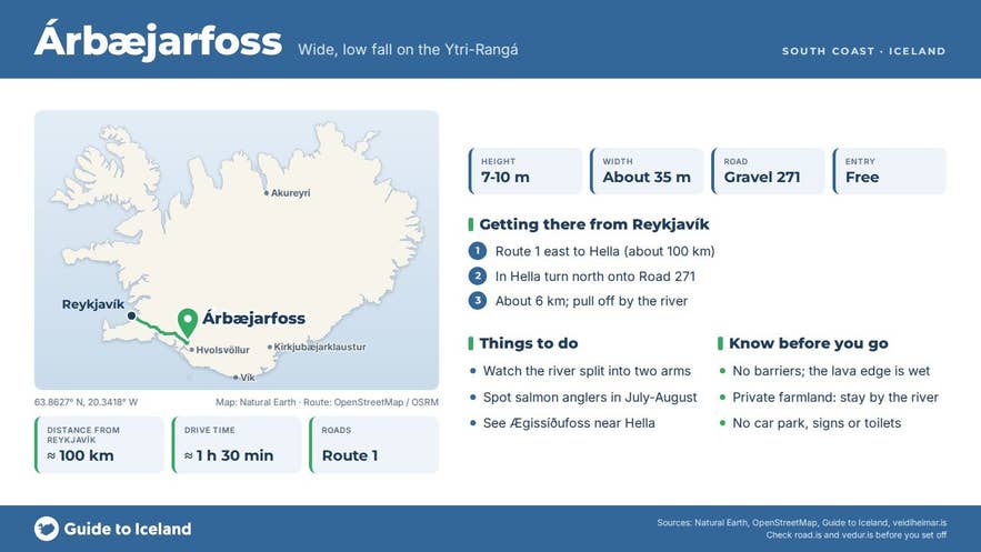
- Wide, low waterfall (7-10 m high, about 35 m across) where the spring-fed Ytri-Rangá splits into a curtain and rapids
- About 100 km / 1.5 hours from Reykjavík; about 6 km north of Hella on gravel Road 271, fine for a 2WD car in summer
- Upper limit of the Ytri-Rangá salmon beat, one of Iceland's most productive salmon rivers (record 14,315 fish in 2008)
- No car park, signs, toilets or fee; the land is private farmland, so pull off carefully and stay by the river
- Steady flow all year because the river is spring-fed
Why visit Árbæjarfoss waterfall
The Ytri-Rangá is one of Iceland's most productive salmon rivers. It is 55 km long and rises in Rangárbotnar, north of Hekla, where it comes up out of the lava at around 200 m above sea level.
Because it is spring-fed rather than glacial, its level is stable and the water is rarely discoloured even after heavy rain, which is why it stays clear and blue below the fall when nearby glacial rivers turn brown.
Several named waterfalls lie along it: Fossabrekkur and Gutlfoss upstream, then Árbæjarfoss, then Ægissíðufoss down by Hella.
Árbæjarfoss marks the upper limit of the river's main salmon beat; the fishing zone runs from here down to Djúpós near the sea.
The record season was 2008, when 14,315 salmon were landed on rod, the largest catch recorded on any Icelandic salmon river, and recent long-term averages are quoted at 5,000-7,000 fish a year. Up to 18 rods fish the river at a time.
In July and August you may see anglers working the pool below the fall.
The fall itself is a good example of how South Iceland's rivers cut through the Hekla lava flows: a hard basalt lip, a plunge pool, and a wide shallow bed where the second arm of the river skips over boulders. Birch and willow scrub grows on the islands between the two arms.
How to get to Árbæjarfoss waterfall
Árbæjarfoss is about 100 km from Reykjavík, roughly 1 hour 30 minutes by car. Drive the Ring Road (Route 1) east to Hella.
In Hella turn north onto Road 271 (Árbæjarvegur) and follow it along the Ytri-Rangá; the waterfall is below the Árbær farm, about 6 km from the village. Road 271 is a gravel road but is passable in an ordinary car in summer; no 4x4 is needed. A short walk from the road leads down to the river.
There is no official car park or signage. Pull well off the road without blocking farm gates.
The land around the fall is private farmland with a small wooden church (built 1887) at Árbær, so stay by the river and do not walk through fields or the church grounds.
The nearest town with fuel, food and shops is Hella, back down the road.
Best time to visit
Summer (June to August) gives the easiest access and the greenest banks, and the long evenings put low light across the falls.
Because the river is spring-fed, the flow is steady year-round, so the waterfall looks much the same in May as in September. In winter the gravel road can be icy and the banks slippery. Check road conditions before driving in winter.
Safety and practical tips
- There are no barriers. The lava edge above the fall is uneven and wet; keep well back and keep children close.
- The ground near the river is a mix of grass, loose rock and mud. Wear boots with grip.
- Do not wade into the river. The current below the fall is strong and the pool is deep.
- The salmon fishing is strictly licensed. Do not disturb anglers or walk through pools being fished.
- There are no facilities, no toilets and no fee. Hella has a campsite, cafés, a supermarket, a swimming pool and a fuel station.
- Weather on the Rangárvellir plain is windy and changes fast. Bring a windproof layer even in summer.
How tall is Árbæjarfoss waterfall?
Can I reach Árbæjarfoss in a normal car?
Is there a parking area and are there toilets?
Can I swim or fish at Árbæjarfoss?
Which river is Árbæjarfoss on?
Nearby attractions
- Hella - the nearest village, 4 km, with services and a campsite
- Caves of Hella - man-made caves of uncertain age by the river in Hella, about 4 km
- Ægissíðufoss waterfall - the next waterfall down the Ytri-Rangá, 6 km, just south of Hella
- LAVA Centre - volcano and earthquake exhibition in Hvolsvöllur, 13 km
- Keldur turf house - medieval turf farm at the edge of the Hekla lava, 14 km
- Urriðafoss waterfall - Iceland's most voluminous waterfall, in the Þjórsá, 18 km
Tours that visit Árbæjarfoss waterfall
- Private South Coast Tour with Glacier Walk from Reykjavik - stops at Árbæjarfoss near Hella, where the Ytri-Rangá splits before the fall, on the way along the South Coast.
- Hidden Waterfalls Exploration and Super Jeep Private Tour from Reykjavik - Árbæjarfoss is the last of the nine waterfalls on this super-jeep day.
